Berlin, Germany

July 23, 2018

This morning we docked in Warnemunde Germany, which is close to Rostock. Our tour started with a with a 3 hour bus ride to Berlin. Once in Berlin, we met the tour guide and went on the city tour of Berlin. We saw many of the main sights in the city, but most were just a stops were just few minutes to get off the bus and take a few pictures.

Berlin has changed a lot since I was there in November, 1988. In 1988 I went to Berlin just a few weeks after the fall of the Berlin Wall. Now almost 30 year later a lot has changed. In 1988 everything in East Berlin was dark and old. It seemed that everything was painted either gray or dark brown. I remember that all the building that bordered the Berlin Wall were built without windows on the west side. This was so the people could not see what was in the west. We were able to climb through the holds in the wall and see the difference between the east and west.

Holocaust Museum

Now the east looks just like the west, you can not tell much difference. They have rebuilt much of the city. While in Berlin we saw a section of the Berlin Wall, walked through the Brandenburg Gate and visited many of the historic buildings. We ate our lunch at a mall in downtown Berlin.

Berlin Wall
Brandenburg Gate
Brandenburg Gate

A Cruise through the Baltic Sea

The next few posts are a recap of our cruise through northern Europe in the summer of 2018.

July 21, 2018

This morning was the first day of our cruise to the Baltic Sea. We left home at 6 am and Hannah drove us to the airport. The cruise itinerary is to leave from Copenhagen and cruise to the following ports: Warnemunde (Berlin), Germany; Tallin, Estonia; St Petersburg, Russia (2 nights); Helsinki, Finland; Nynashamn (Stockholm), Sweden and back to Copenhagen, Denmark.

The first leg of the trip was from SLC to New York City’s JFK airport. We got there around 2 pm and did not leave until about 11 pm. We were suppose to leave at 9:30 pm, but they were delayed multiple times. Every time I have flown into JFK, there has been a delay.

We sat in the plane, on the ground for about 1 hour, until we finally took off. This leg of the trip was to Copenhagen, Denmark. It was an overnight trip and but we did not sleep much. We got to Copenhagen around 1:30 pm and took the Norwegian shuttle to the port.

We found our room and hung around on the boat that night.

The White Rim Trail in a 4×4 Van

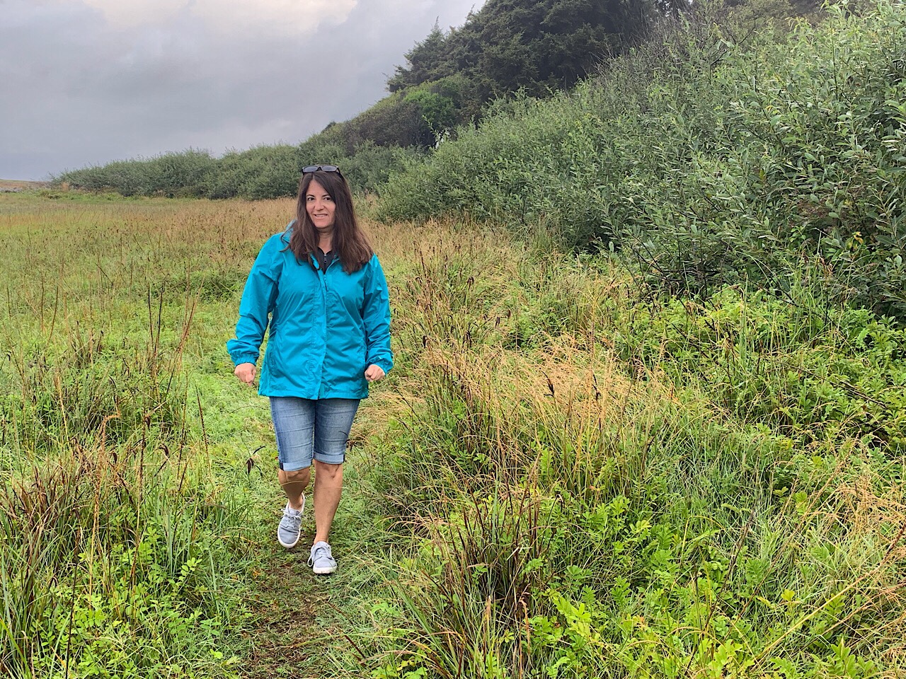
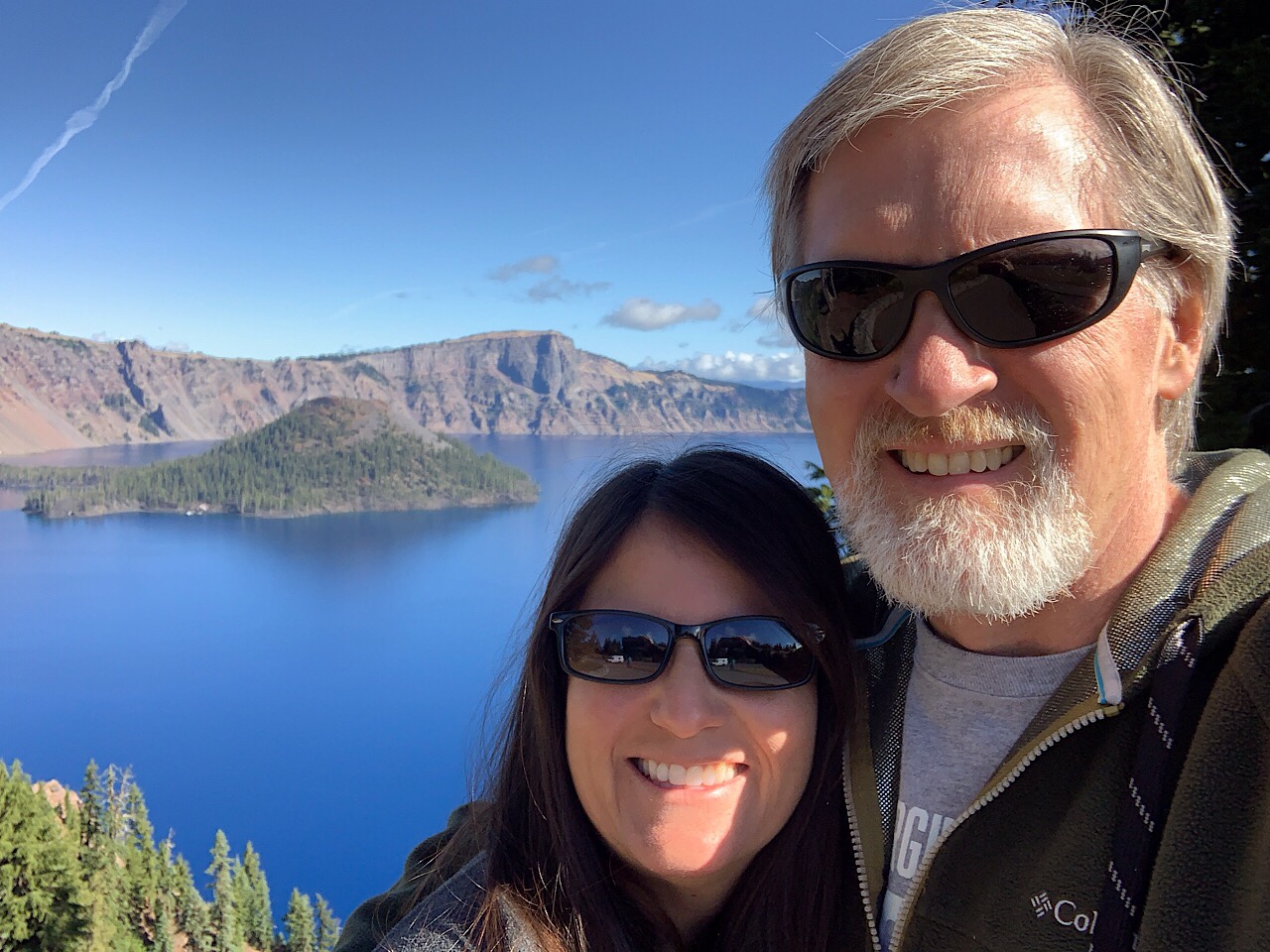
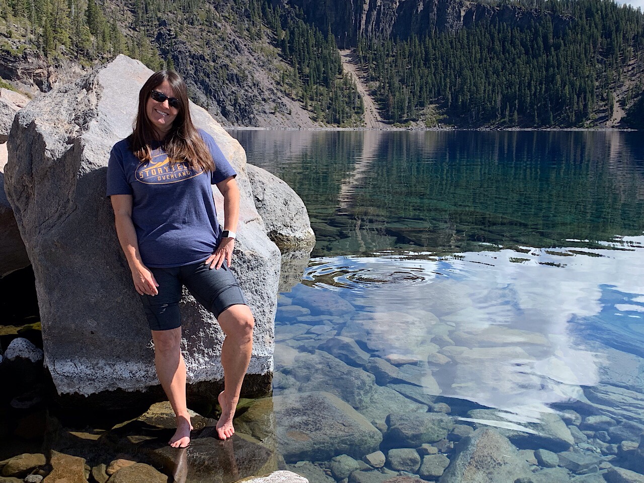
This is the story of my White Rim Trail adventure. We had planned this trip since June, when we stayed awake until mid-night for 3 nights in a row to reserve the three campsites. However, Eva hurt her back a few days before, so she stayed home and I went on my own for this trip.

The White Rim Trail is a 100 mile trail that circles the Island in the Sky section of Canyonlands National Park. The name comes from the white colored rimstone that is above the many canyons that lead down to the Colorado or Green River. It seems like 3 days is a lot for only 100 miles, but it took us that long to complete.

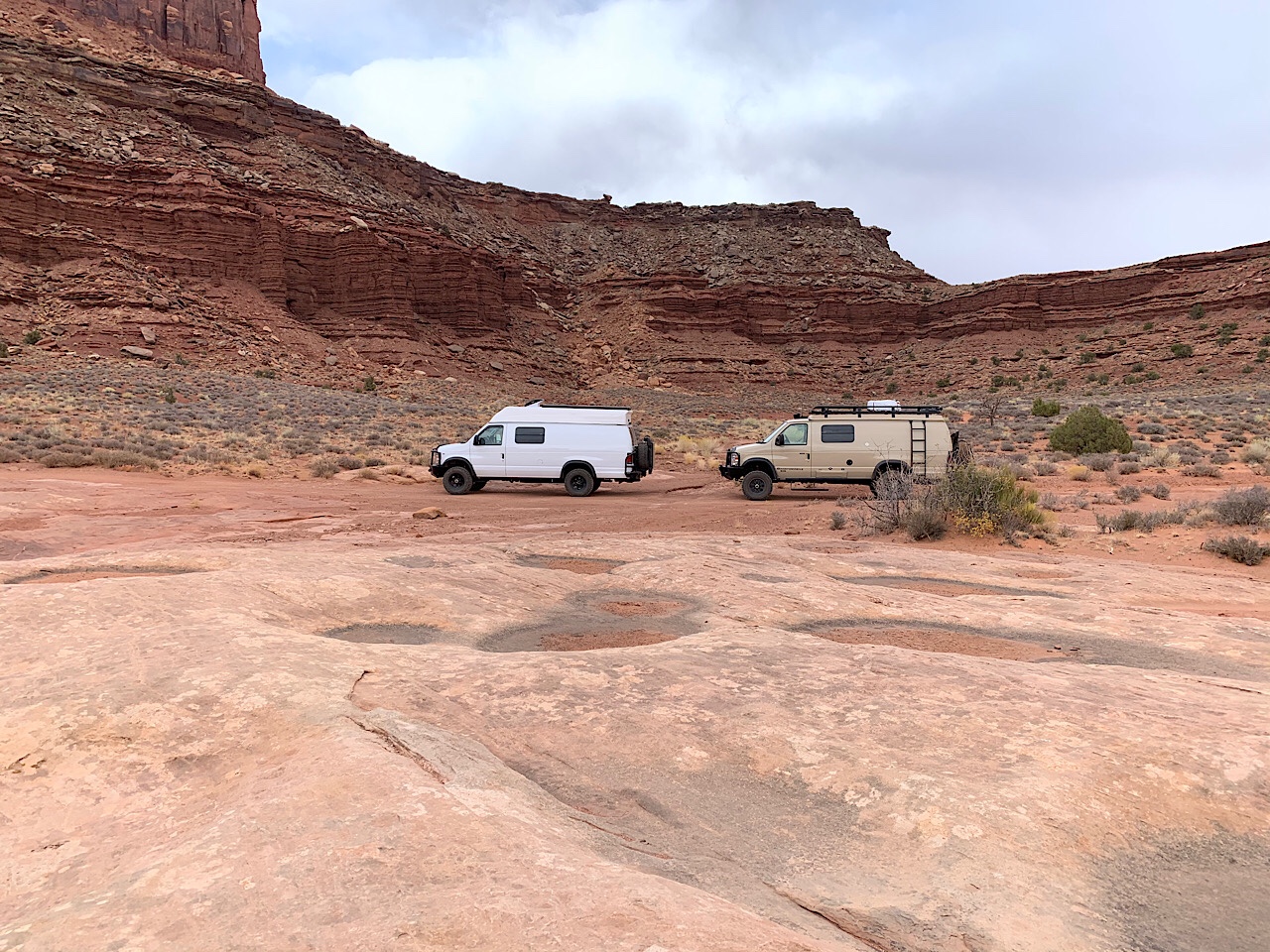
A few weeks before I put out an invite on the Sportsmobile online forum, to see if anyone was interested in traveling with us. A gentleman from Modesto, CA contacted me and wanted to come along. His name is Terry. He is a former methodist pastor, but retired as a financial planner just a few months ago. He was a real nice guy and it was good to talk to and hear of his experiences.

I left home at 7 am, but stopped in Price to buy a couple of cans of beef stew. I stopped for gas in Green River and arrived at the Canyonlands Visitor Center around 11:30 am. Terry was waiting at the visitor center.

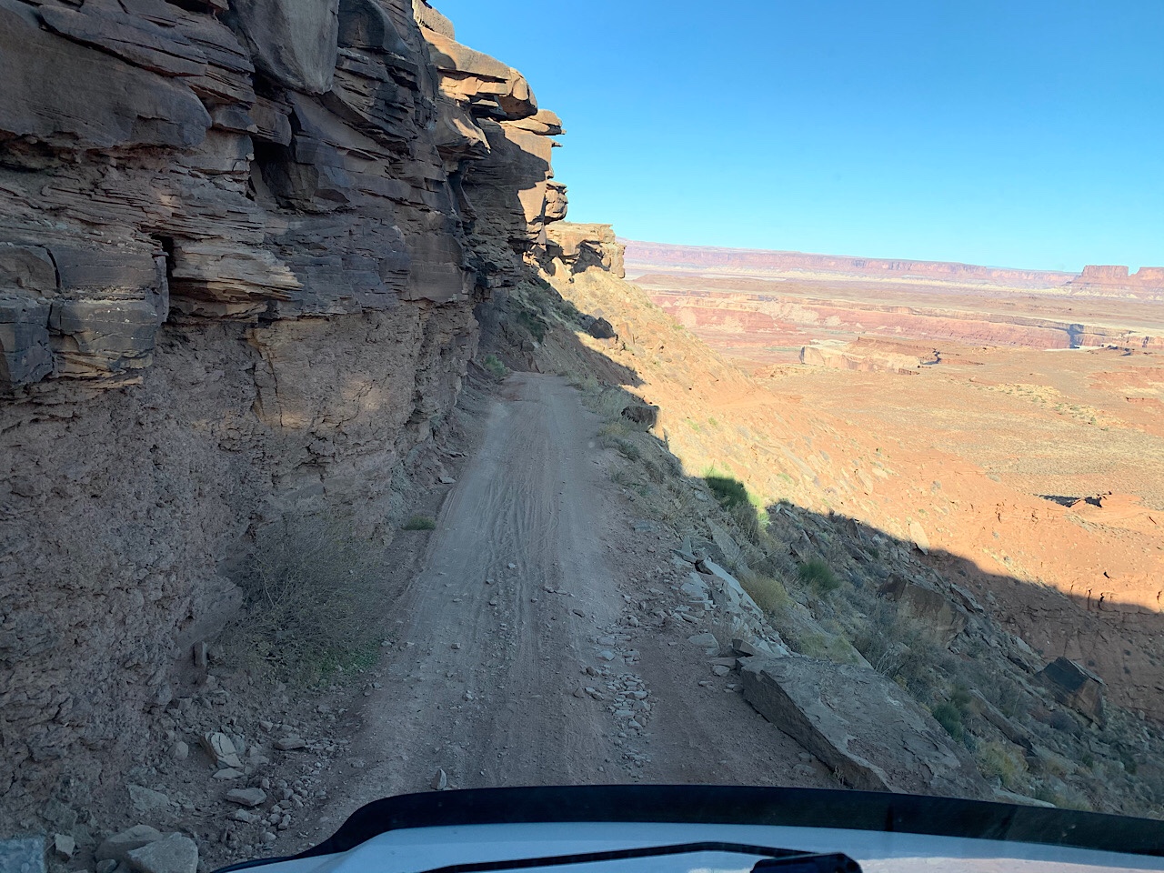
We hit the trail around 12:30 pm. The first step was down the Shaffer Switchbacks.

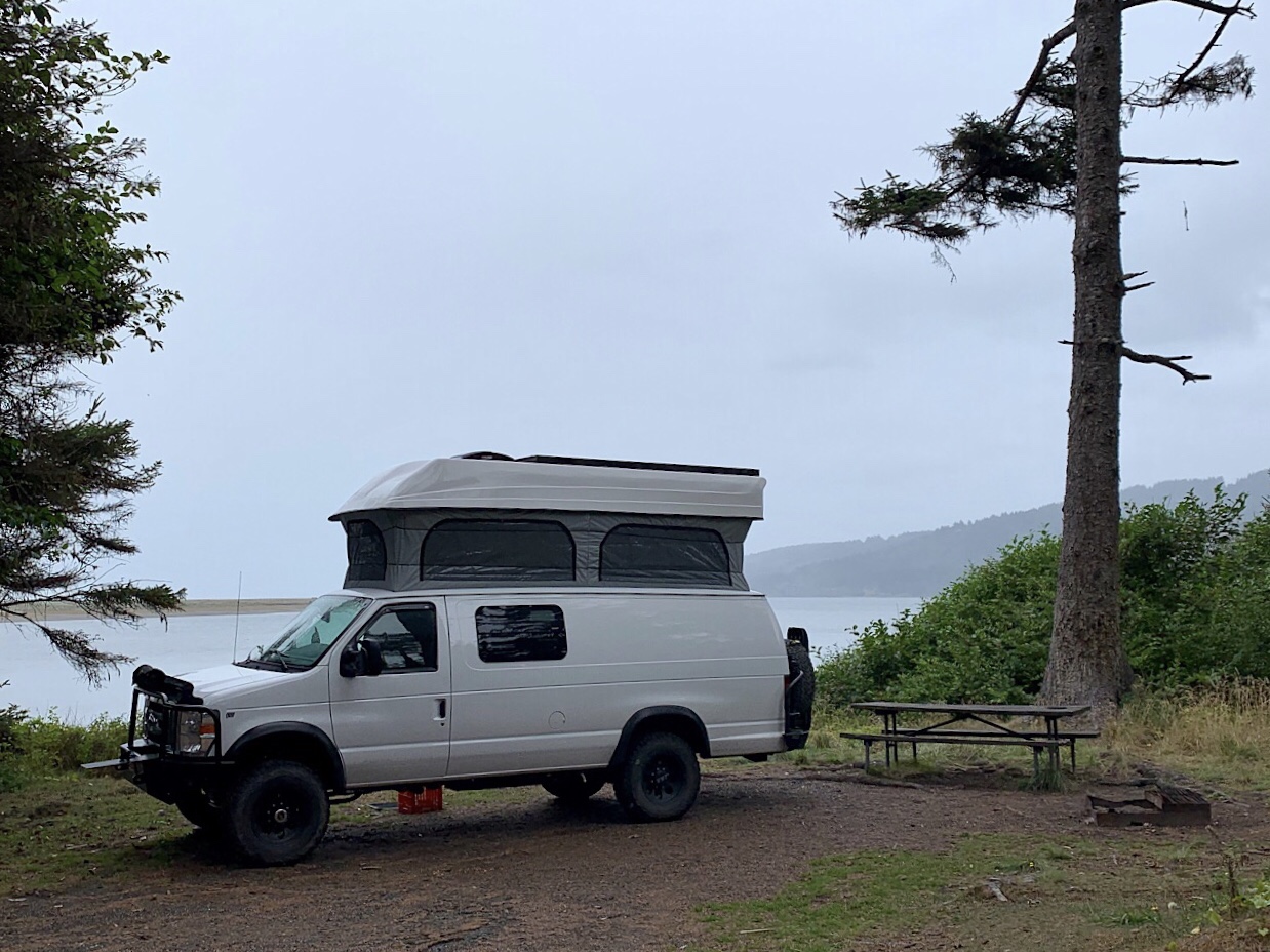
The next stops were at the Gooseneck Overlook and Mussleman Arch. We made it to our first night’s camp at the Airport B site around 4 pm. It was a nice site, just below the Airport Tower formation. It was nice and flat with plenty of space to park the vans.

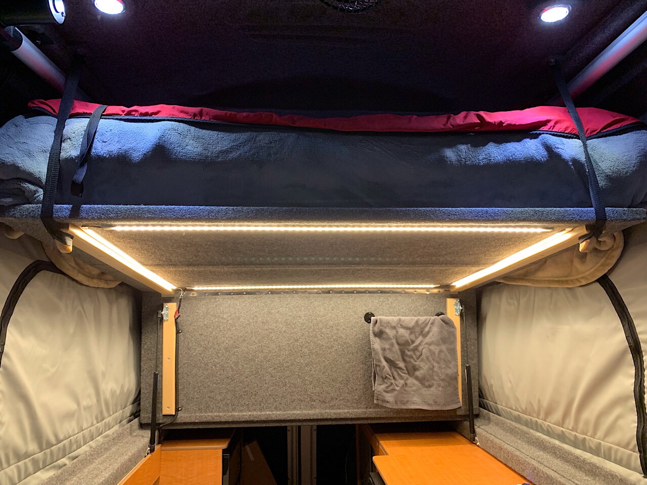
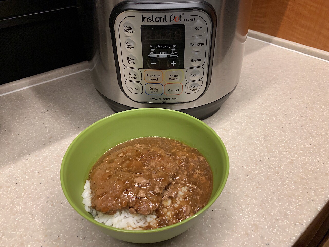
The weather was pretty good, but once the sun went down it got cold fast. Once it got cold, we went to our vans for the evening. I had beef stew for dinner and read the rest of the evening. The low that night was around 35 deg, but the forecast was for an arctic cold front coming for the next few days.

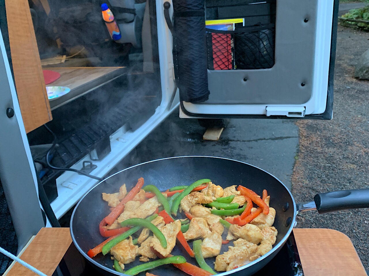
I was up around 7:30 and started the heater to warm the van. I ate oatmeal for breakfast. After breakfast, Terry came over and we sat in our van and talked for while. We left camp at 10:30 am and continued down the trail.

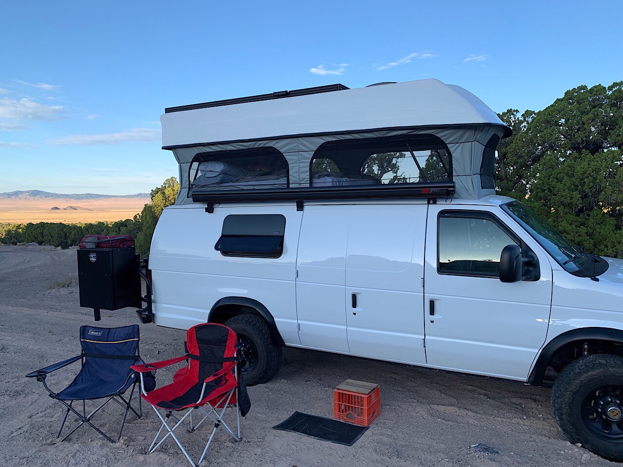
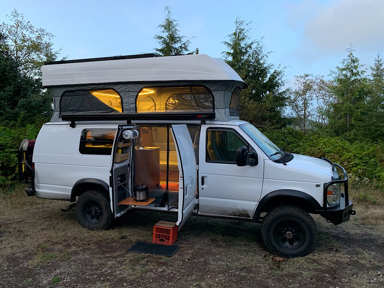
We planned ~25 miles of driving to the next camp. Most of the trail was pretty easy, but very rough. This kept us from going more that 5-10 mph. Every so often, there was a more difficult obstacle that require a little more care on getting through it. I finally put the van into 4WD for a few spots and also lowered the air pressure in the tires (45 front, 60 rear).

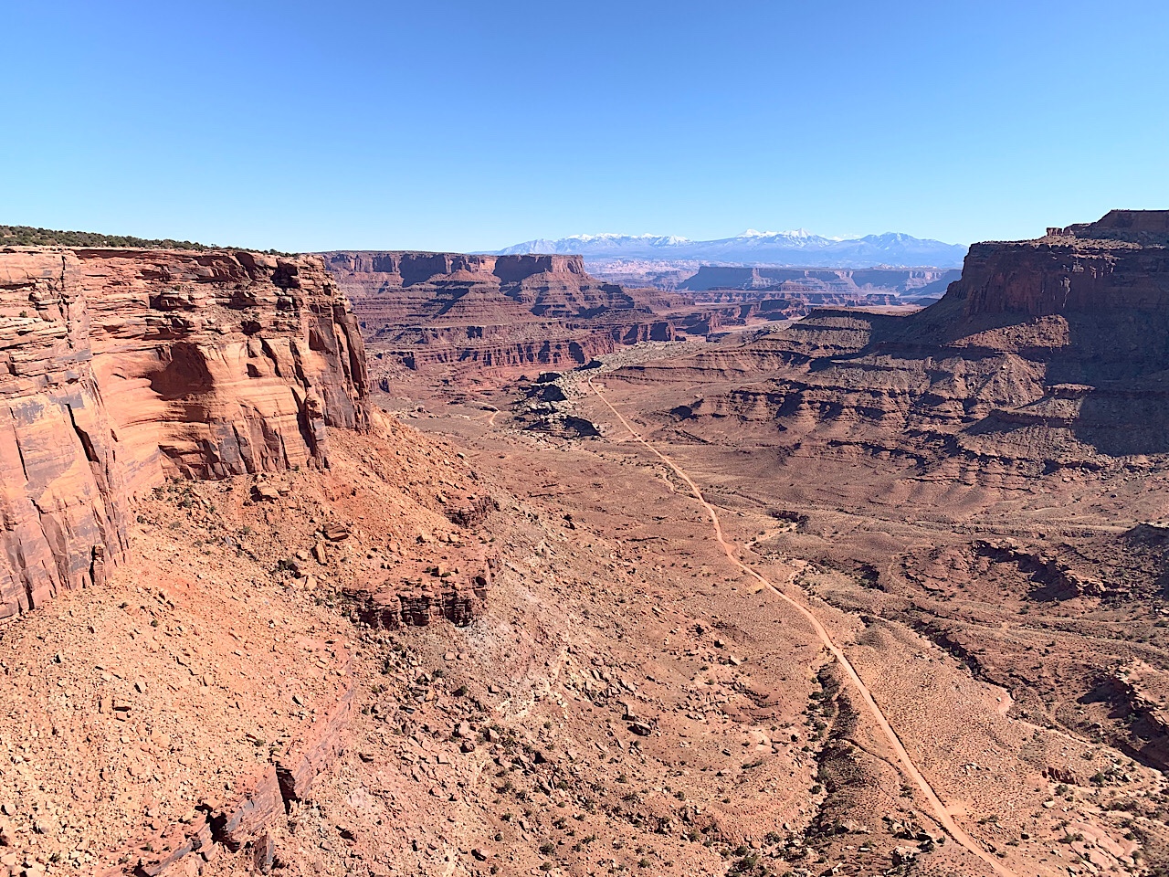
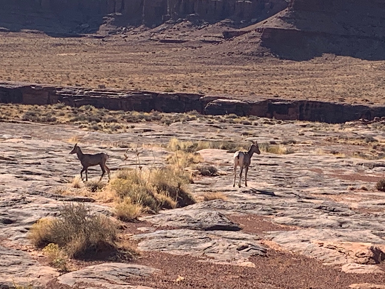
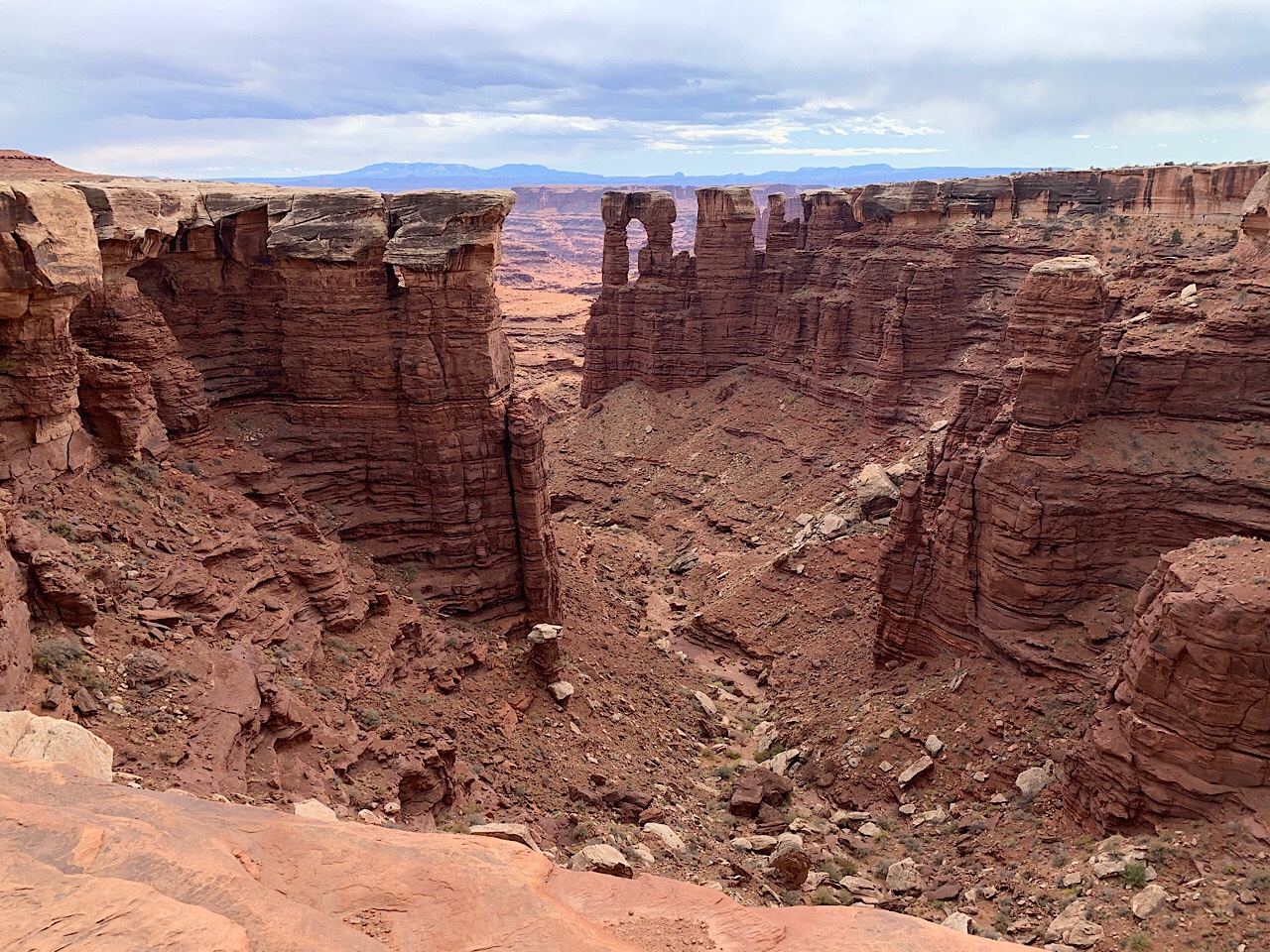
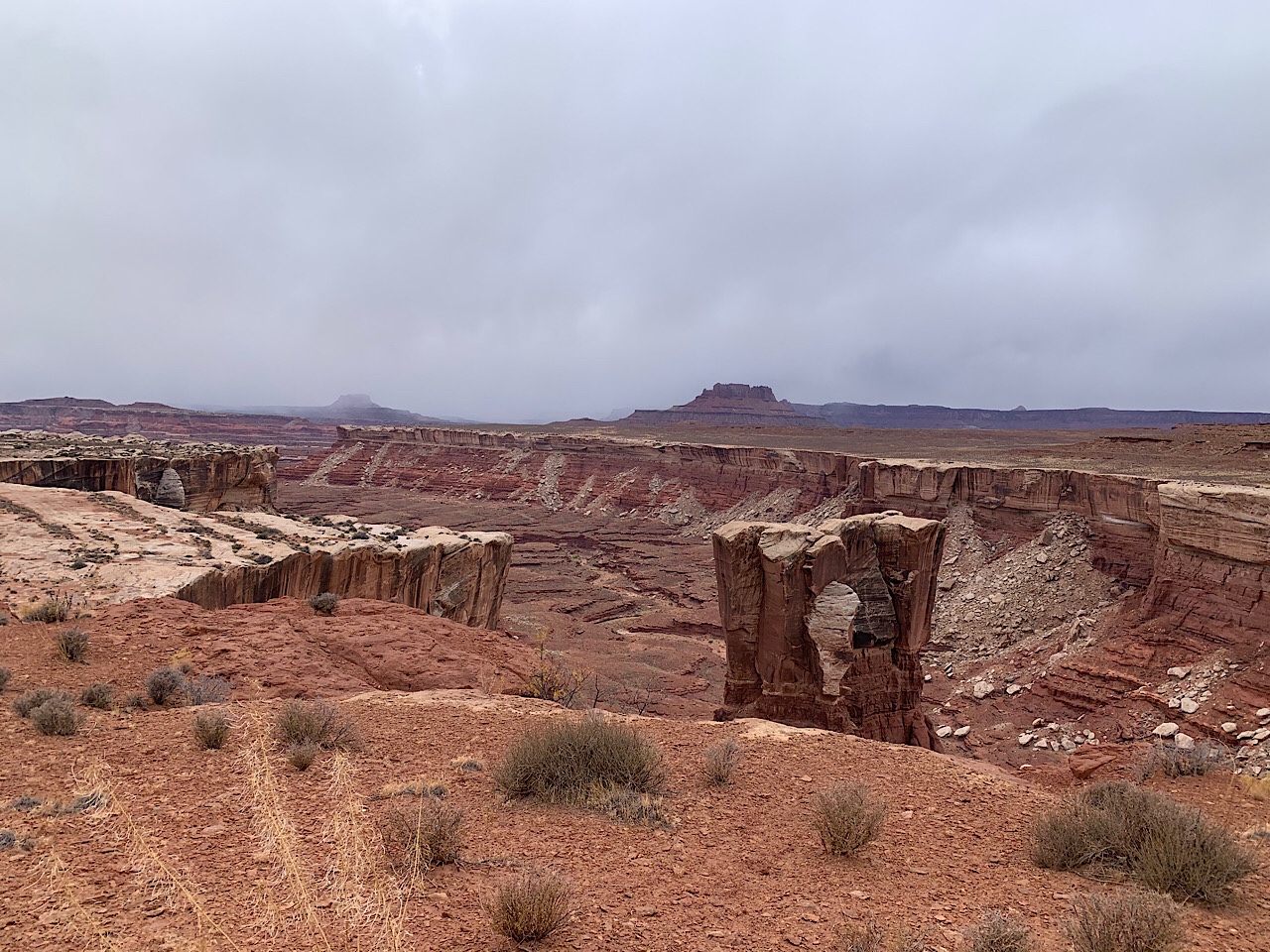
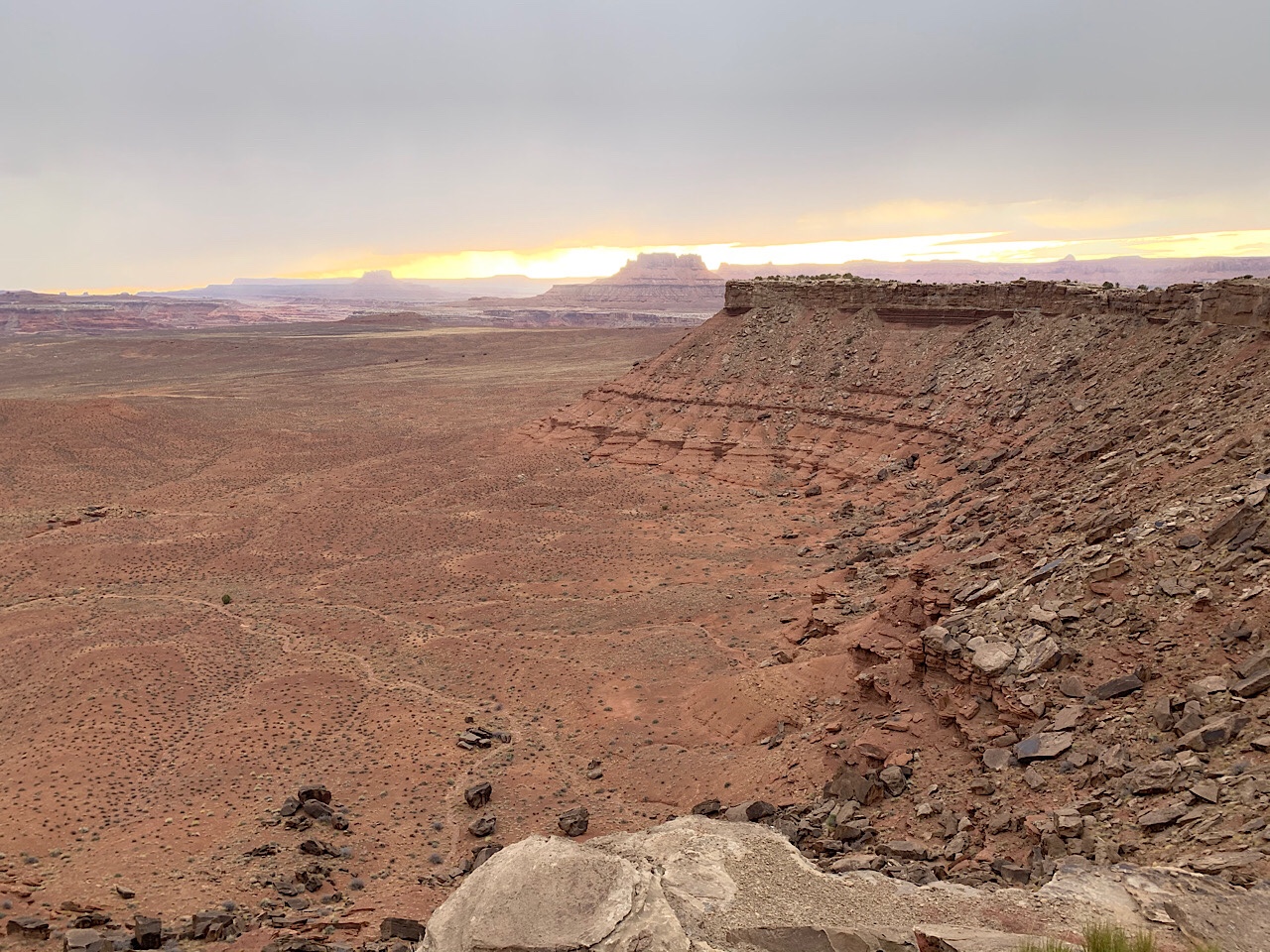
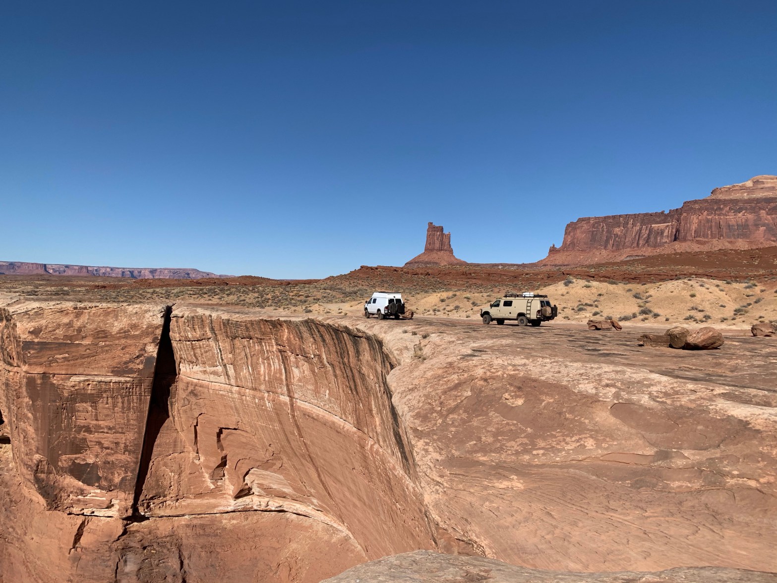
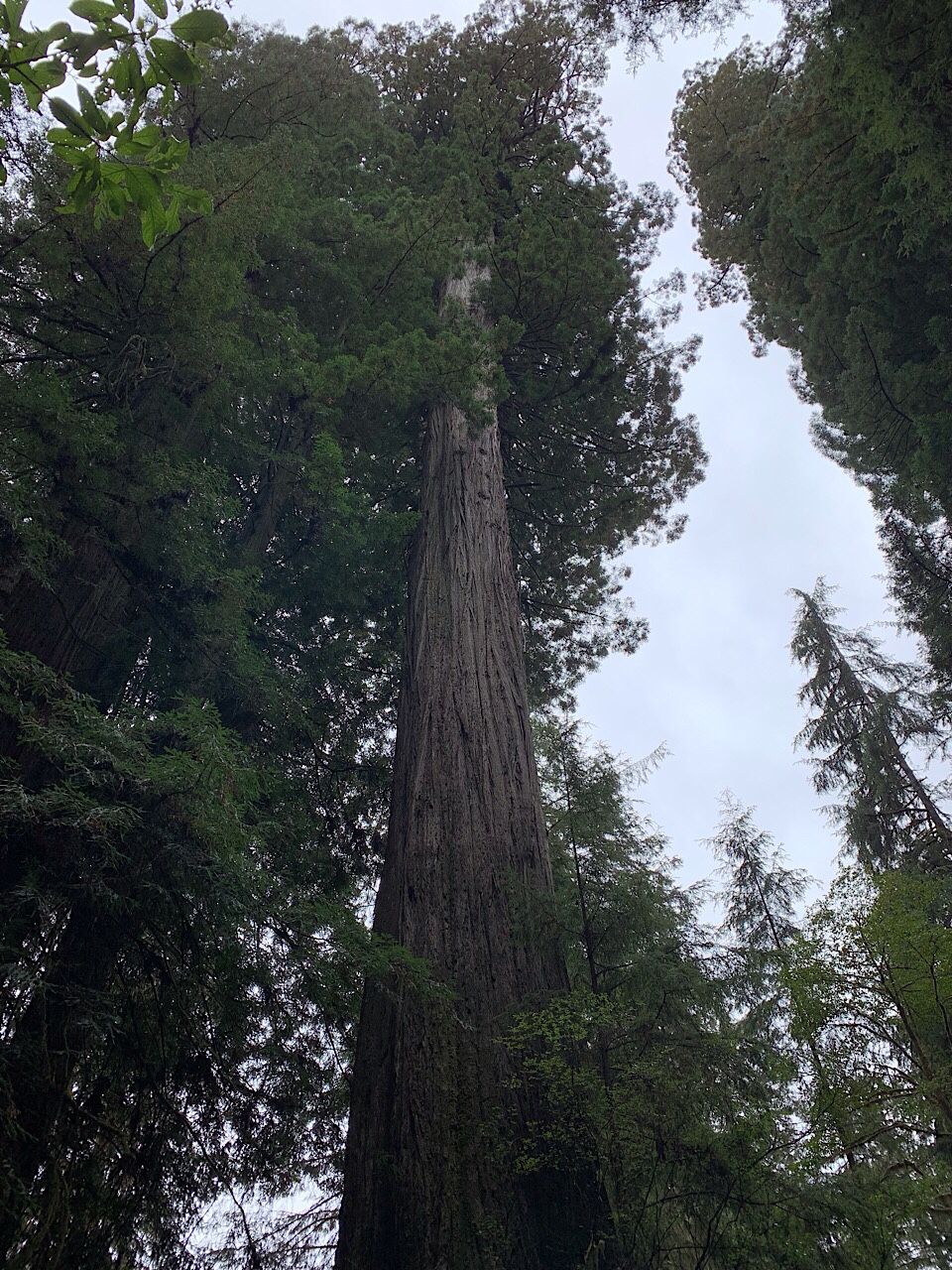
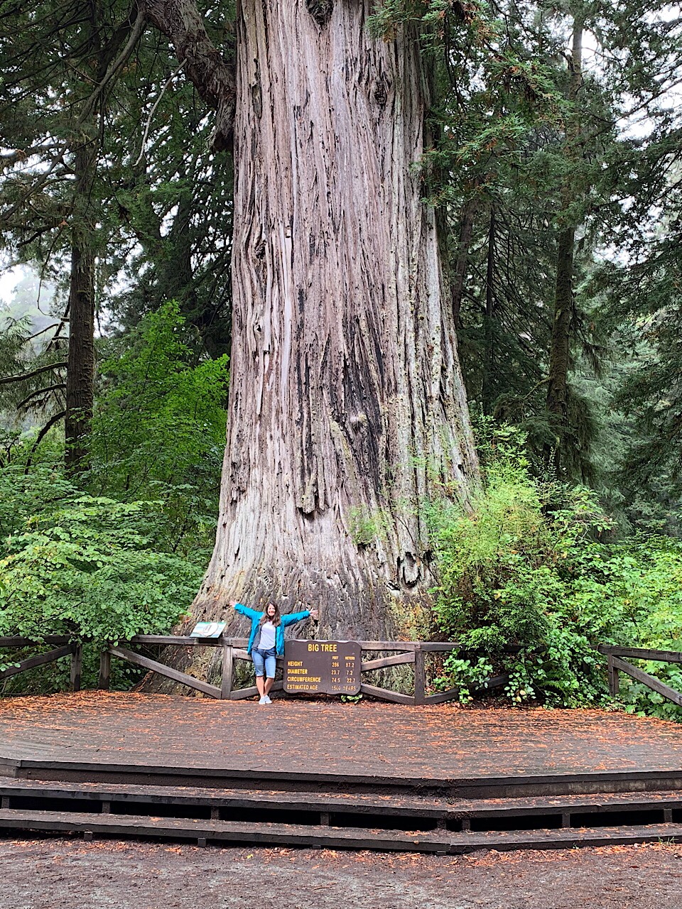
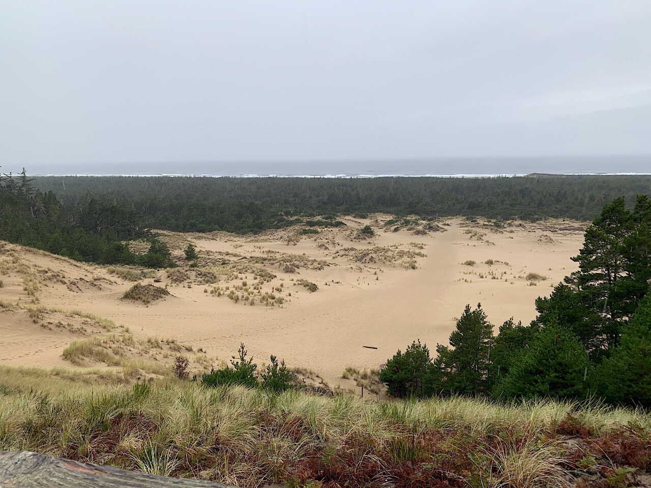
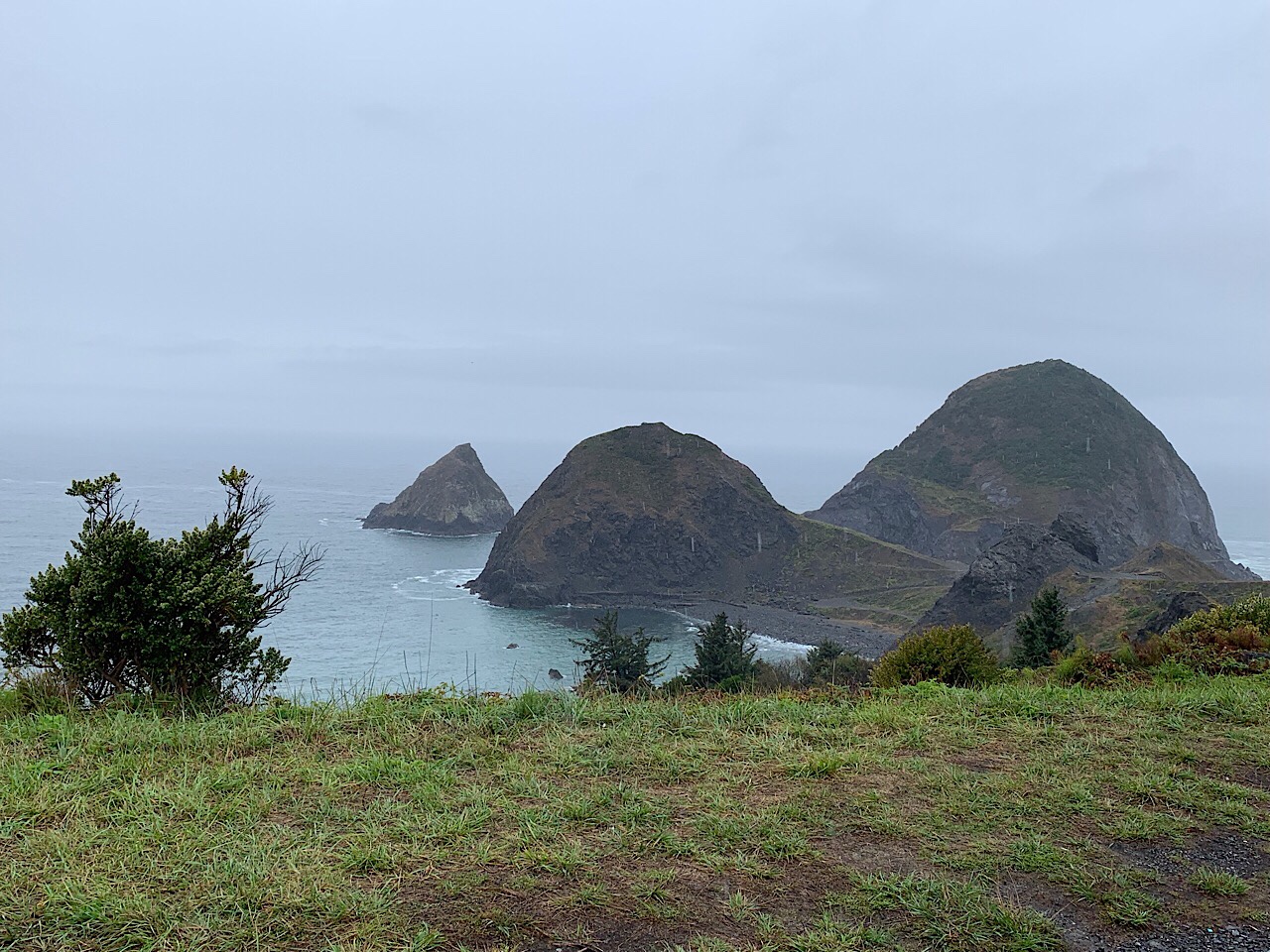
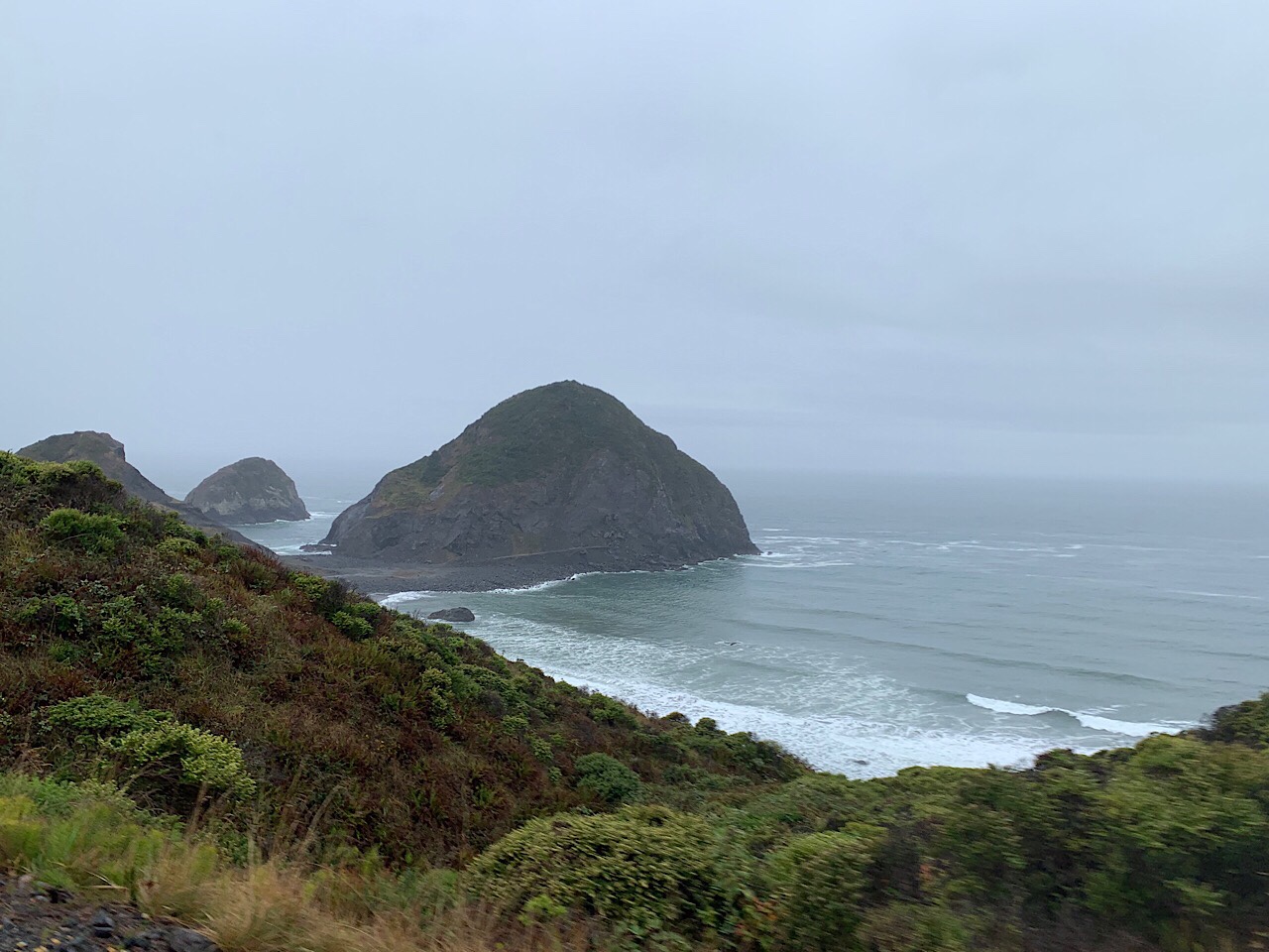
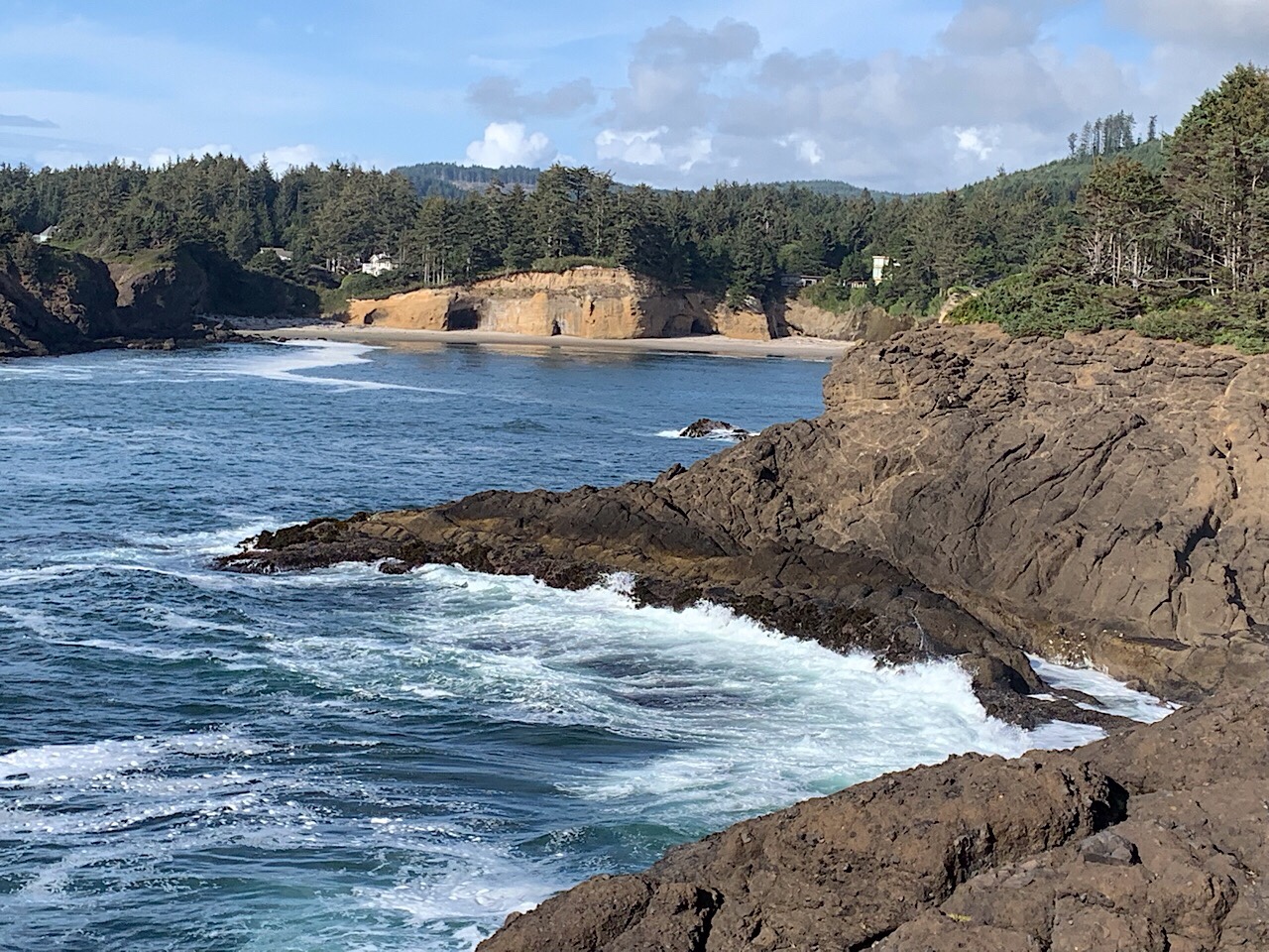
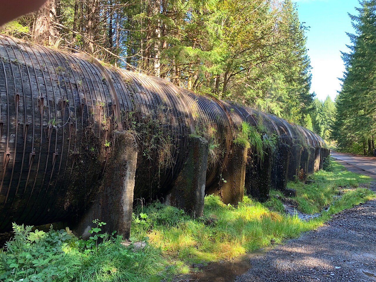
We passed by several canyons and stopped for pictures. Monument Basin was particularly beautiful, with many interesting formations. Each canyon was enough different that I wanted to stop at all of them, but there was not enough time.

We went down the side trail to the White Crack campground. This campground is approximately 1/2 way through the trail from the top of the Shaffer switchbacks to the top of the Mineral Bottom switchback. The campground had a nice view and was near the historic road that was blasted through the White Rim capstone. There is only a hiking trail now, but this is what gives the campground its name. By that time the cold front had arrived and it was overcast, windy and cold.

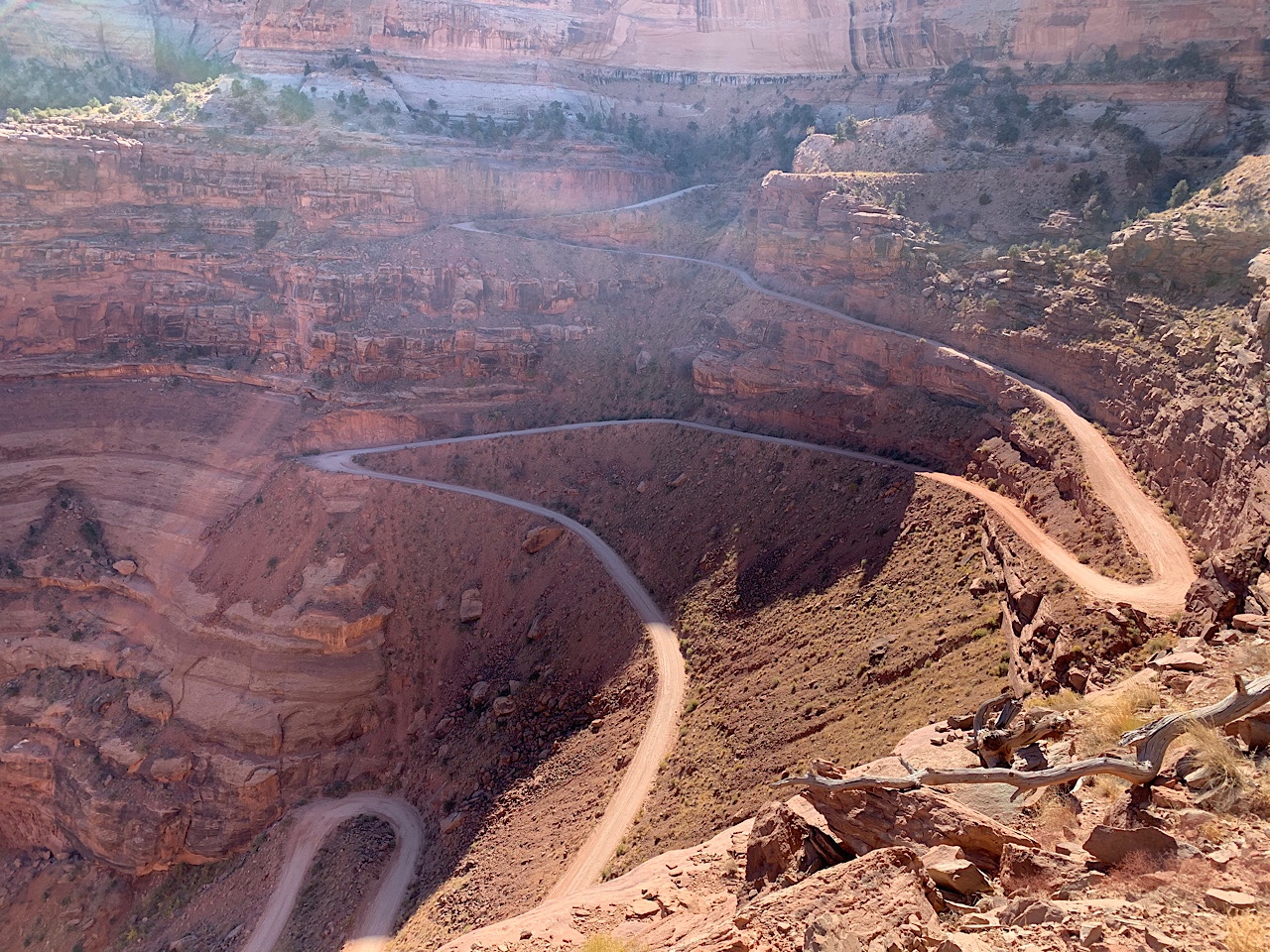
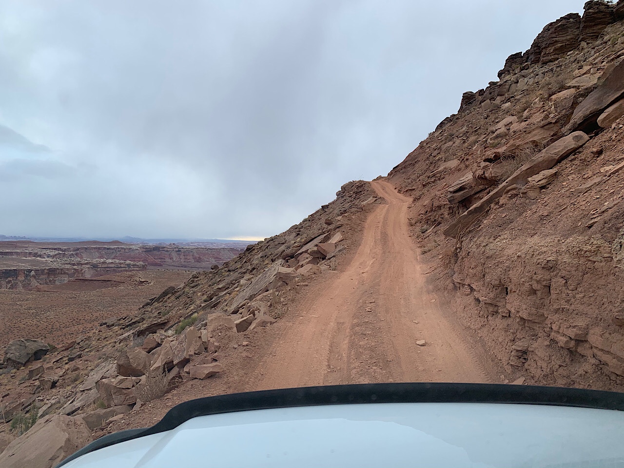
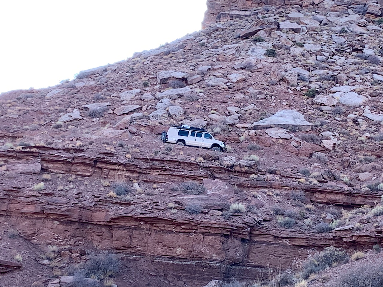
We continued north west on the trail, but it was pretty windy and cold. We made a few more stops and finally arrived at Murphy’s Hogback. This is one of the two major climbs on the trail. The first “S” turn was a little challenging, but we made it through okay. After a short flat section, the main climb began. It was steep with a couple of large rocks to climb. There were a few narrow spots, but nothing that had me worried. With the van in 4WD Low, I just climbed the hill. Coming over the top was a bit of a worry as you could not see the road in front of you. My biggest worry was someone coming down while we were going up.

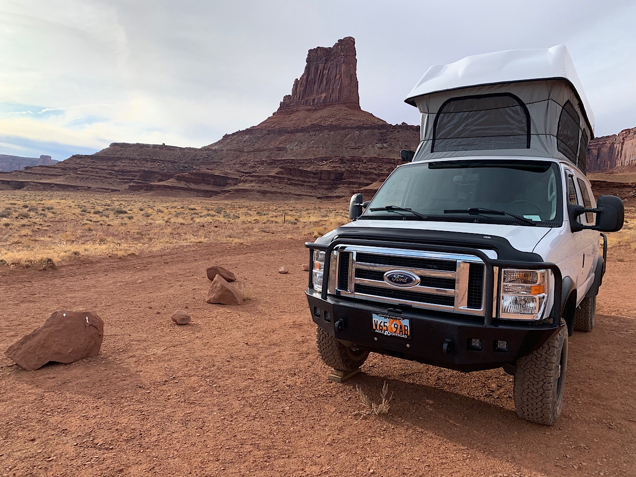
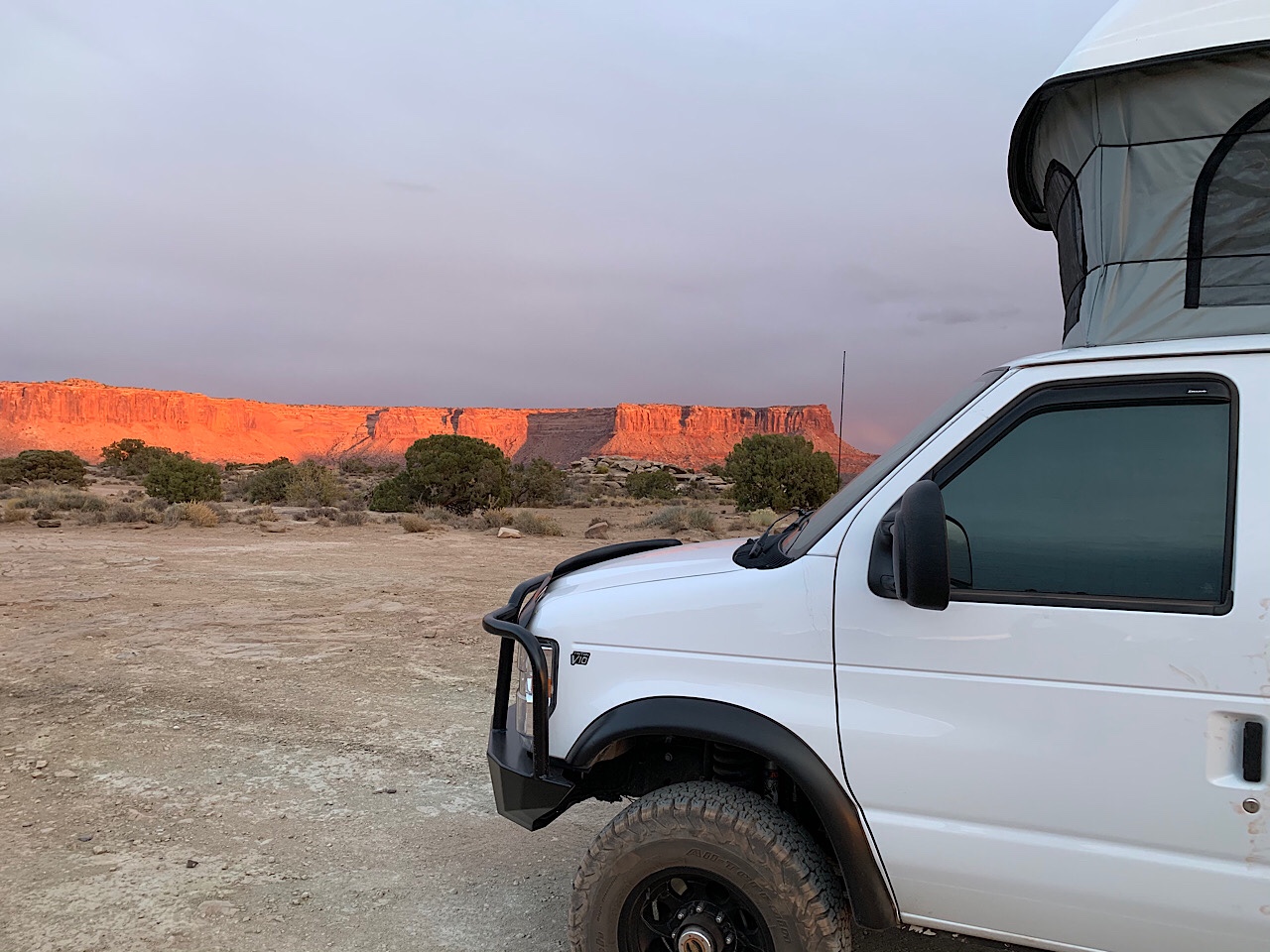
At the top of the butte was the Murphy campground. We had the A campground, which was on the edge of the cliff and had nice views. It was the best site we saw. However, it was still overcast, and the wind was really blowing. We walked around and took a few pictures, but we were in our vans by 6 pm. I had beef stew again and read until I went to sleep. That night it got pretty cold and was windy most of the night. I was cold, but mostly just my head, because I forgot to wear my beanie to bed. At 7:30 am it was 12 degree outside and 30 degrees in. But the wind wasn’t blowing and the sun was out, so it was not too bad.

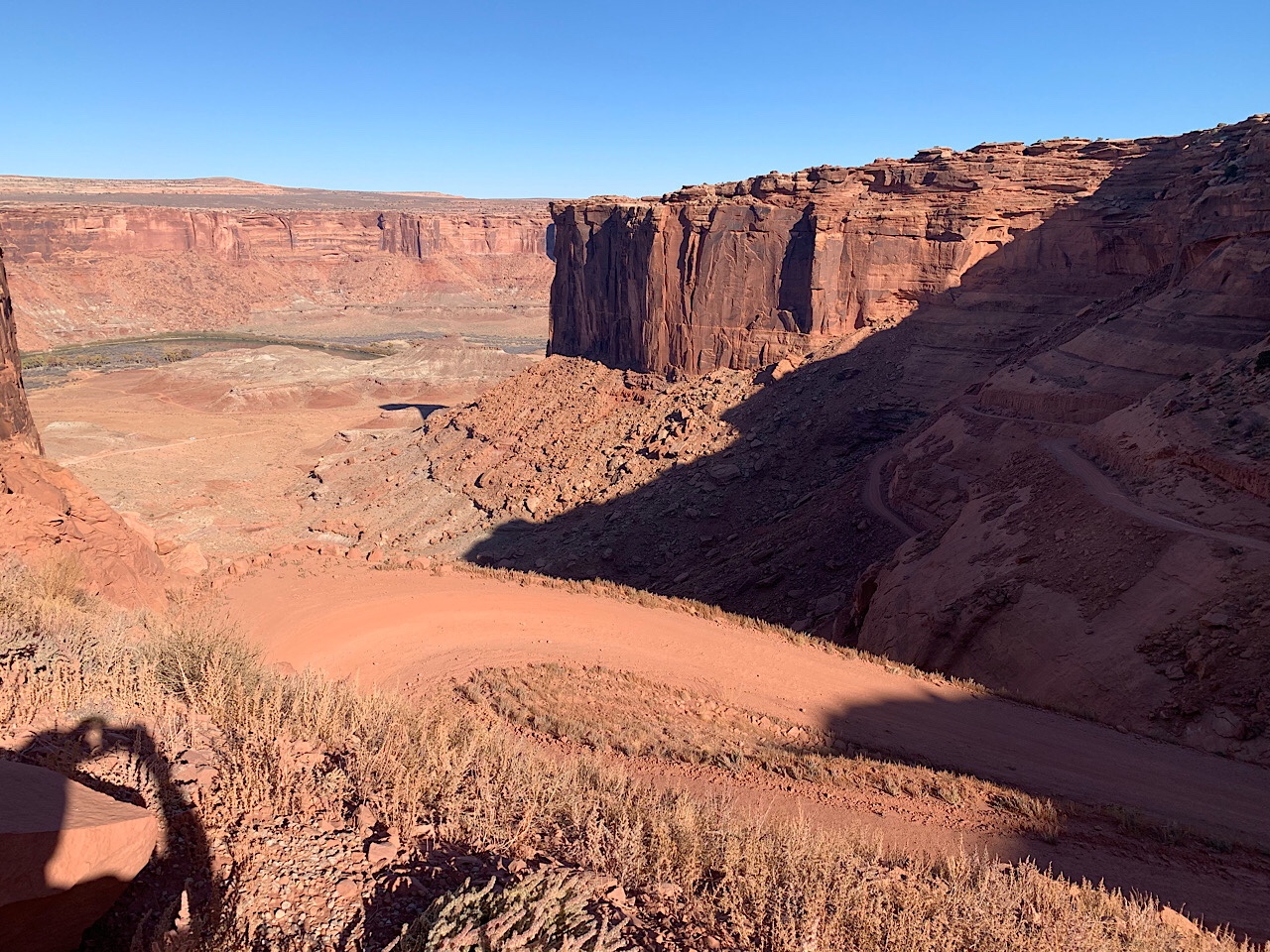
We left camp at 9 am and the first challenge was driving down Murphy’s Hogback. This was about as steep as the uphill, but had more turns and switch backs. I just put in 4WD Low and crawled down.

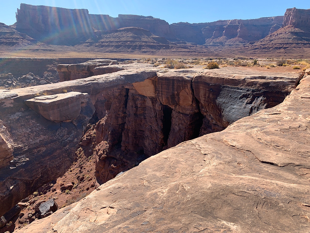
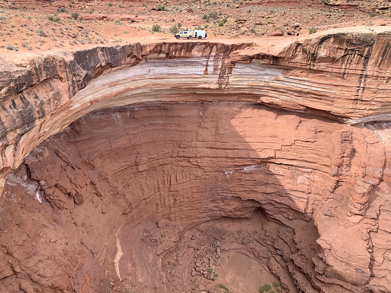
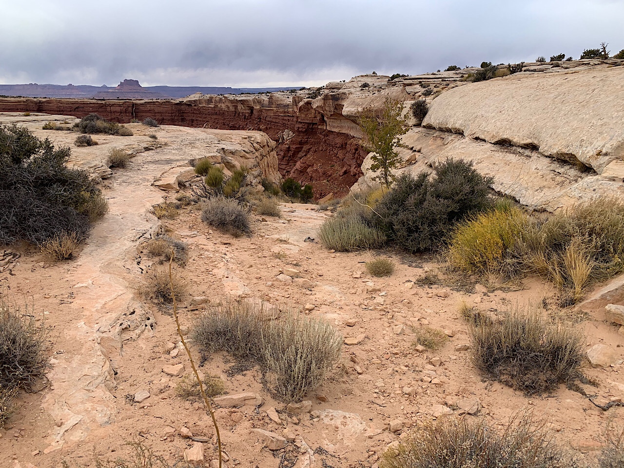
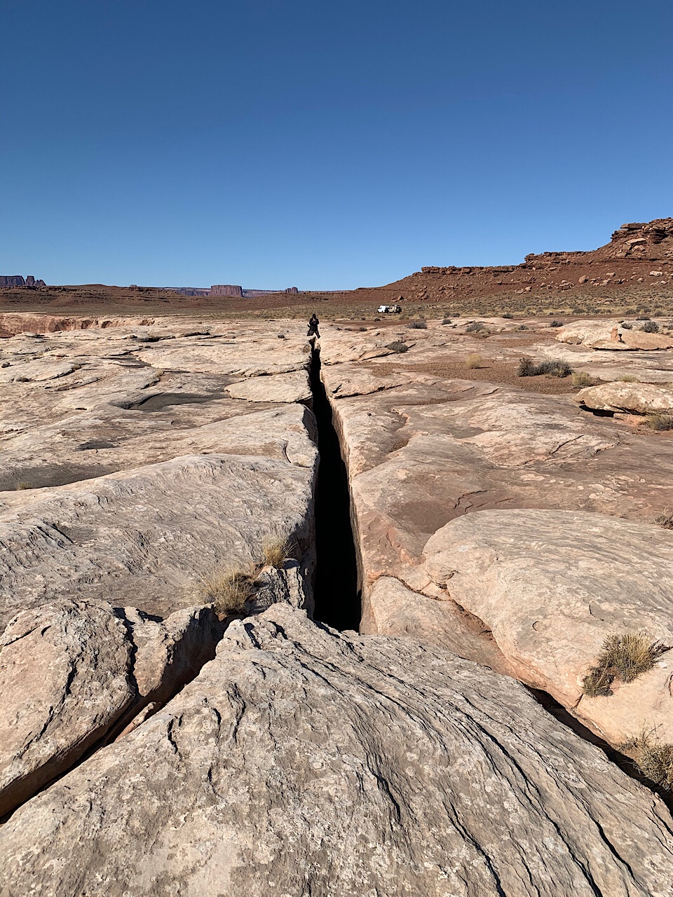
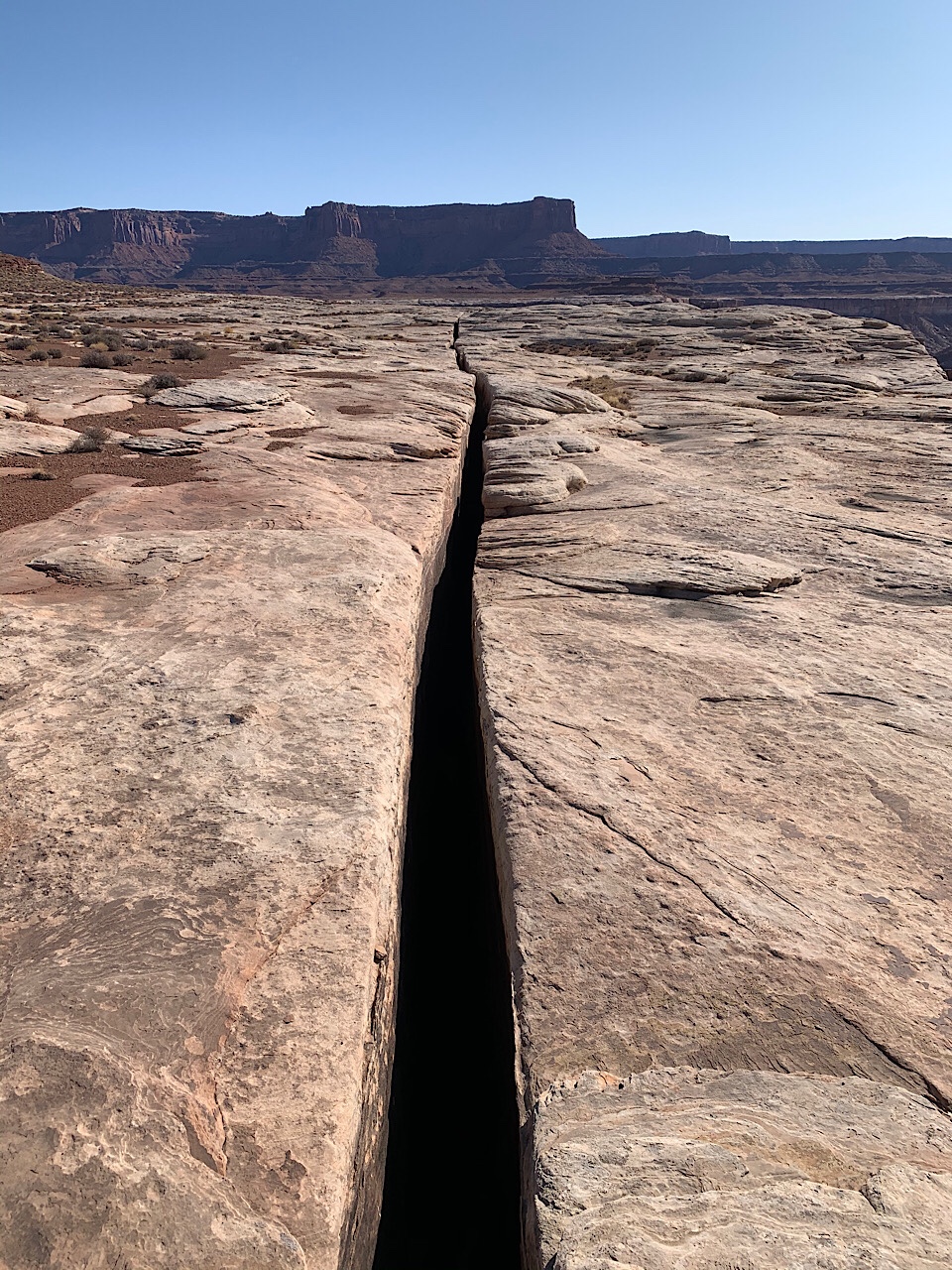
We stopped at the Black Crack. This was on a cliff overlooking the Green River. The crack was 1700 feet long and only 1-2 feet wide. It was deep enough that you couldn’t see the bottom, after dropping a rock, I would guess 50-75 feet deep.

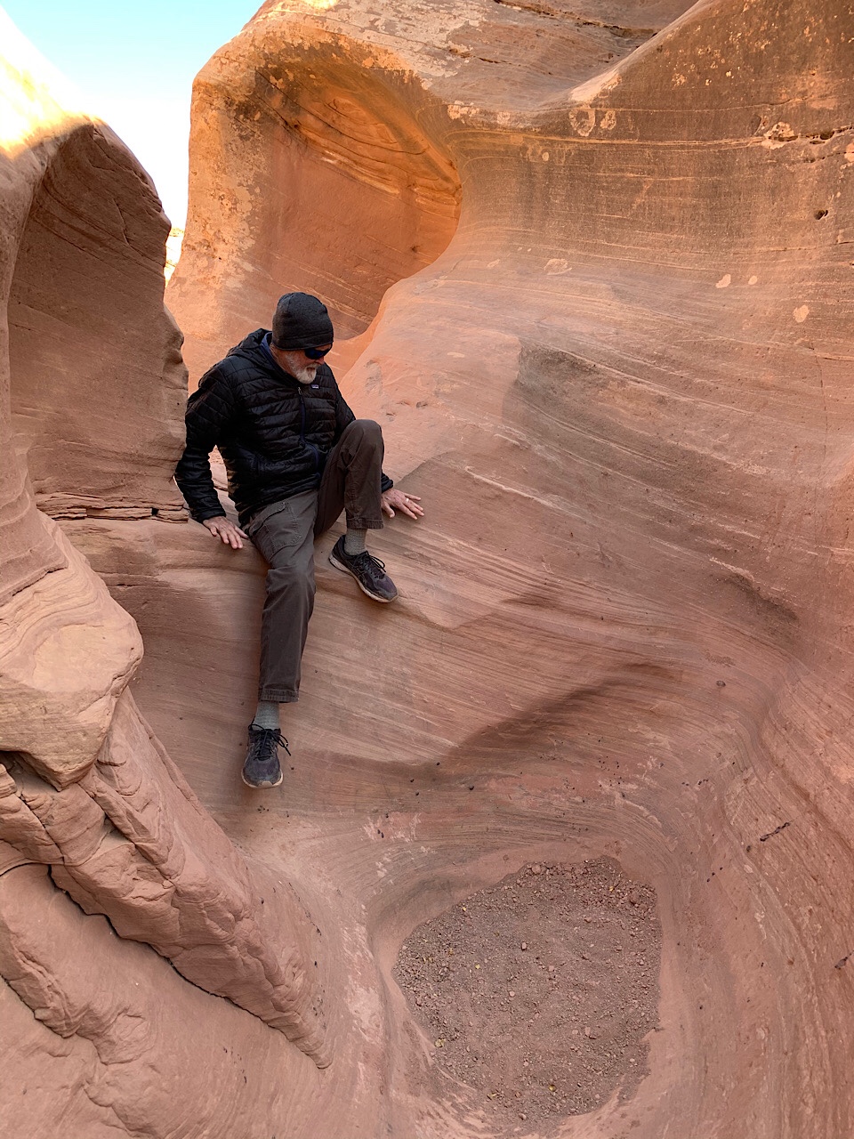
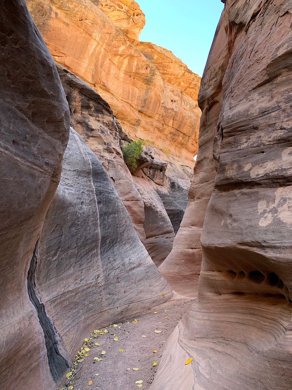
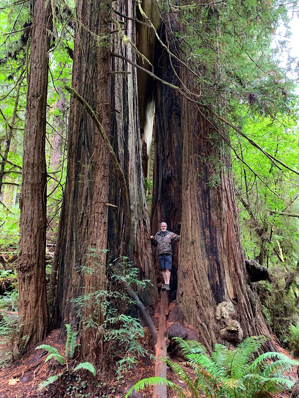
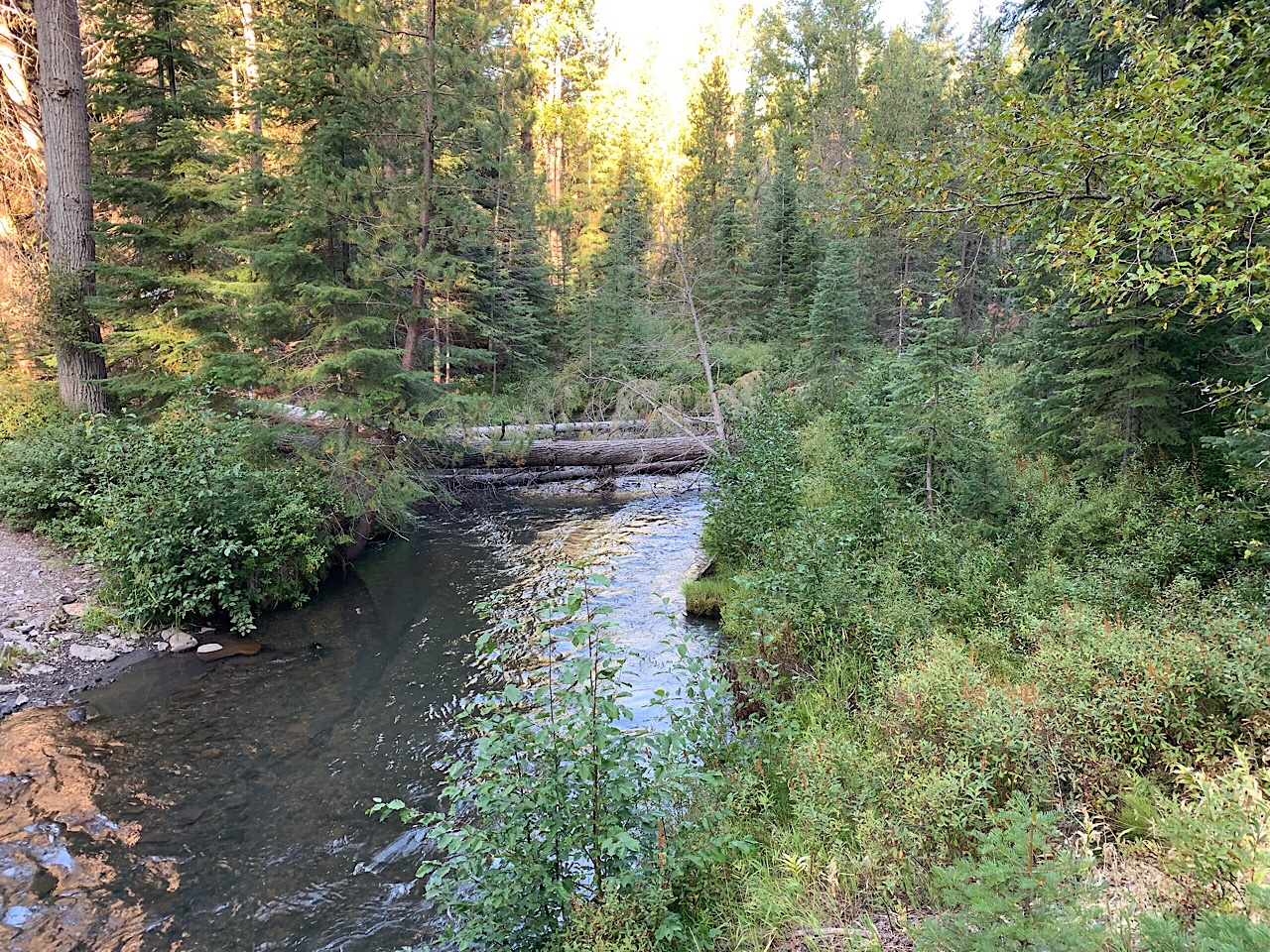
The next stop was Holman slot canyon. The canyon is short, but we climbed down a ways.

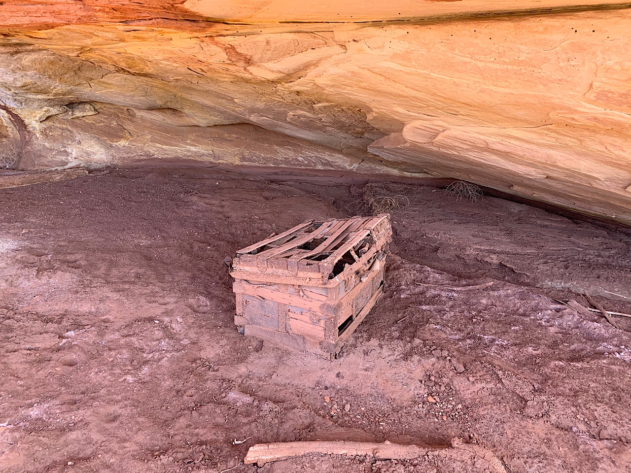
At this point we were down to just above the Green River. We stopped at the Beaver Bottom Cowboy camp, but could not find the inscriptions. A mile more down the road was the Potato Bottom Cowboy camp. In an alcove just above the river was an old wooden chest that is over 100 years old. All that remains are some pieces of wood and the metal straps, hinges and clasp.

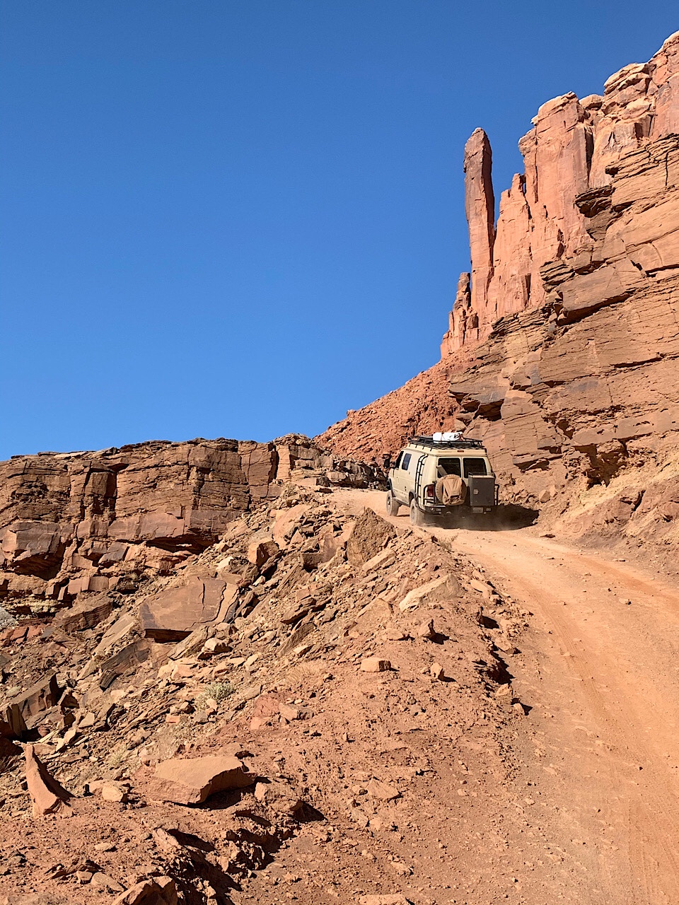
The final big obstacle was Hard Scrabble. This was a climb over a ridge. It was steep with a few tight corners, but overall, not too bad. We climbed up with no problems.

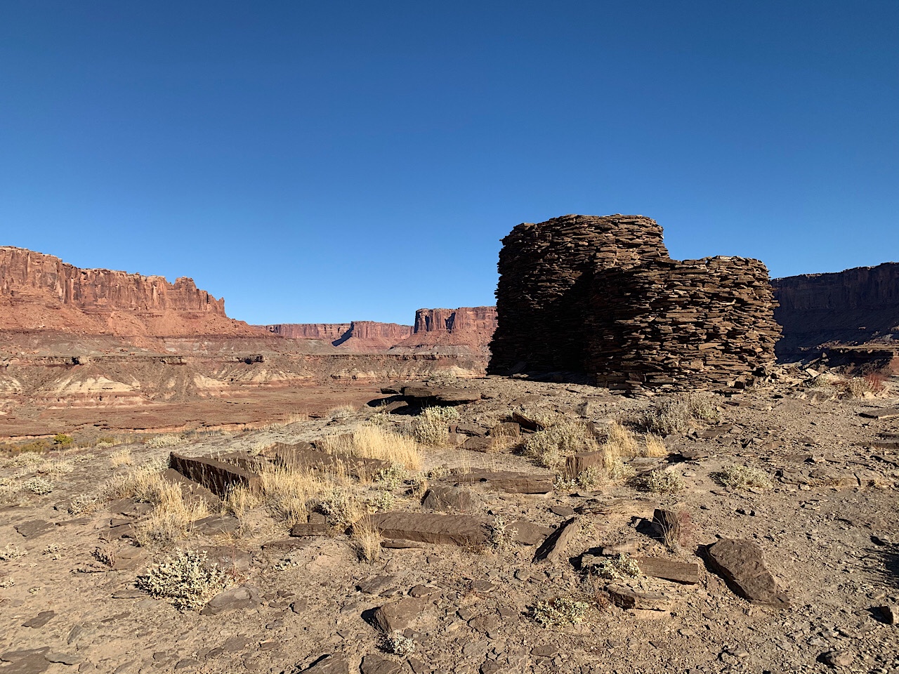
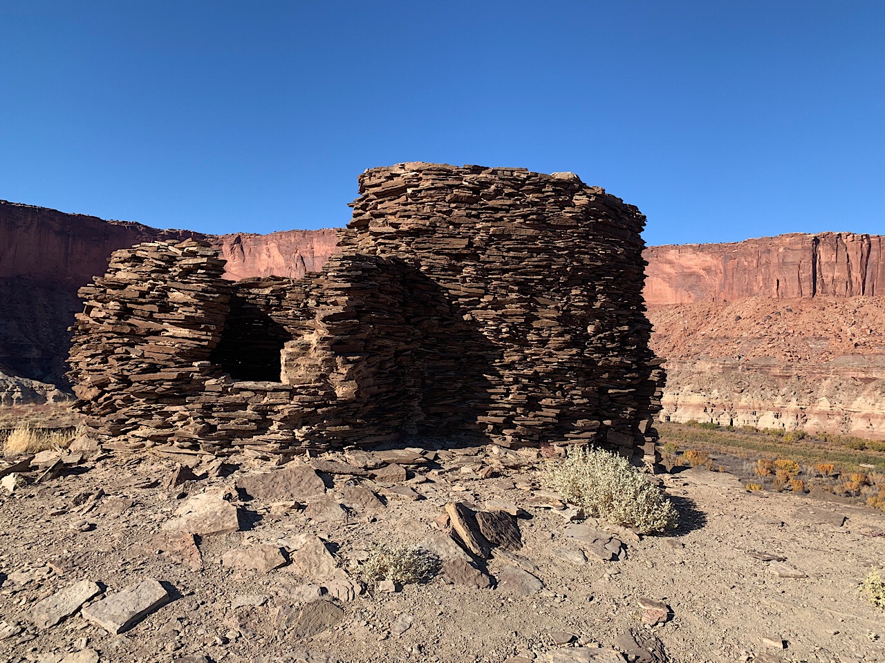
Just past the top of Hard Scrabble we stopped at the Fort Bottoms Ruin hike. This was a 2 mile hike out and back to a 700 year old stone tower, built on a peninsula above a sweeping curve of the Green River. It was a good hike and and a chance to stretch our legs.

After Hard Scrabble the road was much better. However, there were still challenging spots that required 4WD low to climb or drop off a ledge or rock.

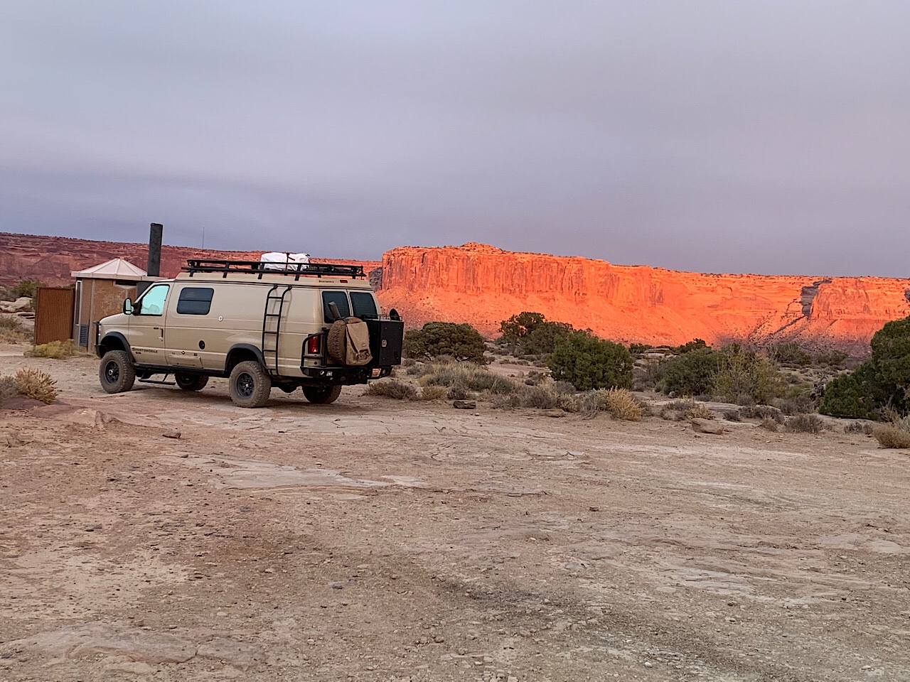
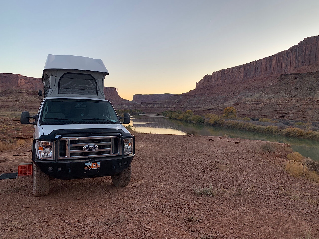
We arrive at our campsite at Labyrinth B around 5:30 pm. The sun was already behind the cliffs, so it was getting cold. The campsite is just above the Green River and a very nice site. It would be a great spot to sit on a cool summer evening and enjoy the views. However, with the sun down, it was already cold. We were back in the vans by 6:30 pm. I cooked grilled ham and cheese sandwiches.

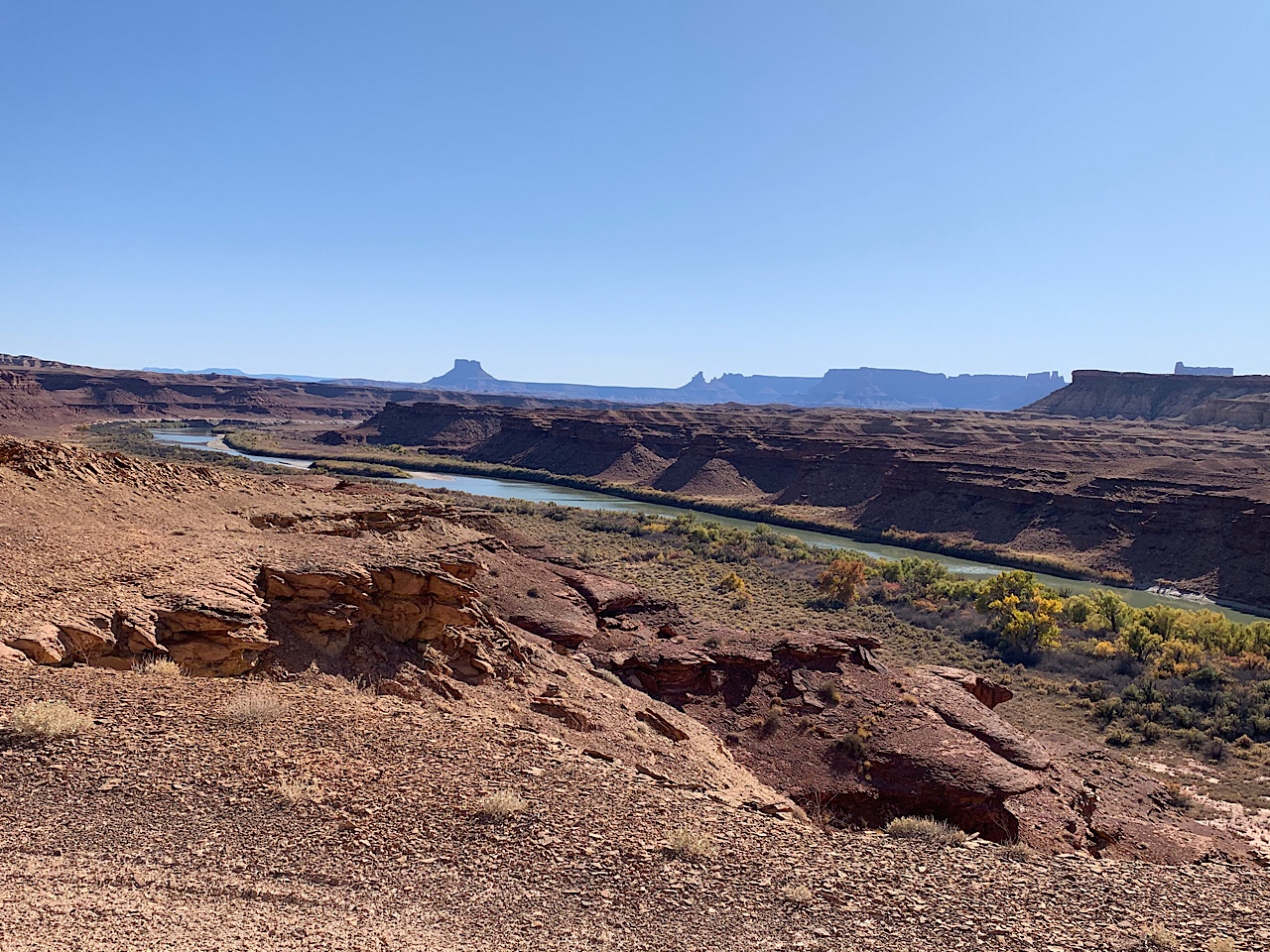
We left camp at 9 am and drove the few miles along the river to Mineral Bottoms. We stopped at the boat ramp to look at the water levels. The water was probably 6-8 feet lower than when Eva and I floated the river in June.

After the boat ramp we headed back to the switchbacks and drove to the top. From there it was ~17 miles of dirt road to the end. We aired up the tires and I headed for home.

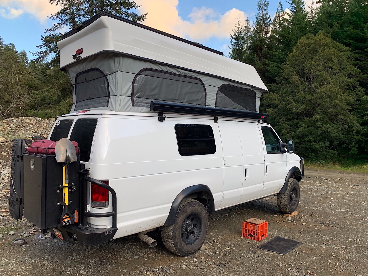
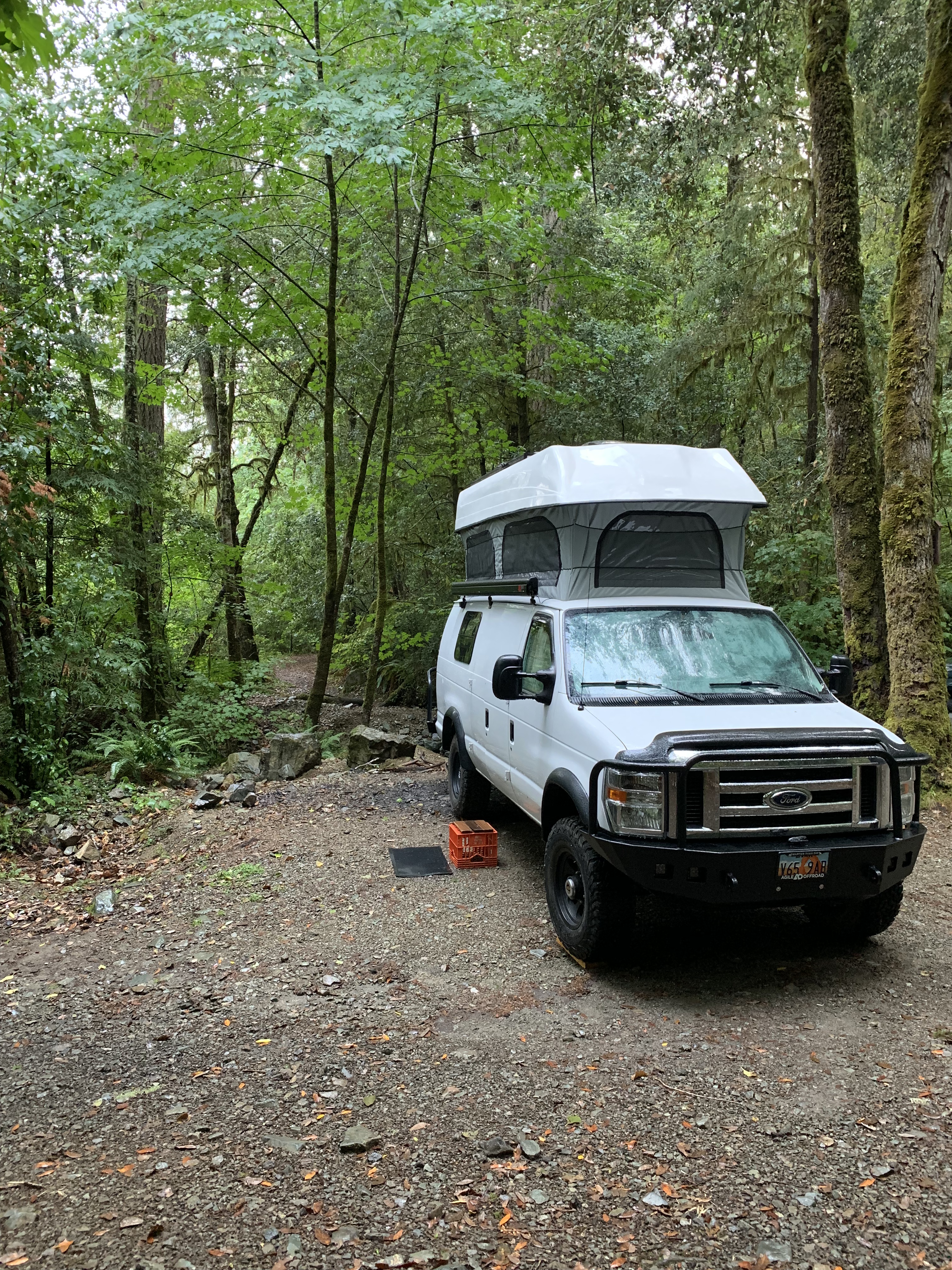
The van did great. The trail was rough, so you could never go very fast for very long. I think we averaged 4-5 miles per hour over the entire trail (counting stops for pictures). The big climbs (Murphys and Hard Scrabble) were not that bad. I had good traction at all time and the van just crawled up the trail. My biggest concerns was someone coming down the opposite direction. I think the more challenging spots were the 6-10 foot drops or climbs that dispersed through out the trail. These became a challenge where there was an off-camber drop, followed by another boulder or hole or some other obstacle. I was never concerned about not making it through the trail, but I was afraid of hitting the back end of the van on rocks. But I made it through unscathed.

It was a fun trip and nice to have Terry along. I may go again to take Eva along for the trip.

Westward to Home

After our walk we drove the van over to the restrooms and took showers and then headed east. We then started our way home, but plan on taking 3 days to get there.

We drove on highway 299, east from the coast, to Redding. The drive was through more forests and hills. The highway followed the Trinity River. It is a very beautiful area. We stopped at a river beach to eat lunch. I drove down close to the river and got the van stuck in the sand. It was not too bad, I just put it in 4WD and drove out of the sand.

We ate lunch and watched the river. It started raining again while we were eating lunch and continued to rain for most of the day. While we were driving that day through the mountains we were stopped at least 5 times for construction, and once for an accident. I think we were stopped for a total of 2 hours, waiting on the road to open up.

In Redding we gassed up the van and as we were leaving the outskirts of town, we remembered that we wanted to find somewhere to get internet. Eva pulled up the Church Tools app and it found the closest chapel, which we were 20 seconds from passing the exit. The church was only 1/4 mile from the exit. We parked outside the church and got a good WIFI signal. We even FaceTimed Rosie, Everett and Chandler.

We ended up camping near Lassen Volcanic National Park. The spot was only 1/2 mile from where we camped last week. We just wanted to try a different spot that was next to the creek. The rain continued through the night, so we were stuck in the van for the evening.

It rained throughout most of the night. We left camp around 9 am. We had planned to stop and do another hike at the Lassen National Park, but it was still raining.

We continued through the California forests, but as we got closer to Nevada, the terrain turned to more open space and sagebrush. We stopped in Reno for gas and to eat lunch at Super Burrito. I think it was an okay burrito, but not a super burrito.

Since there is nothing in Reno, but casinos, we continued east on I-80. Around 5 pm we stopped at a campsite in Water Canyon, just 4 miles south of Winnemucca. Even in Nevada it was raining off and on, so everything was wet and muddy when we set up camp. We spent the evening reading in the van.

Tonight is the last night of our trip, and I am pretty sad. It has been a lot of fun for us. This is the longest trip that we have ever been on together.

In the morning we left camp around 8:30 am. We continued to drive east on I-80. We made a stop at the California Trail Center that is outside of Elko. We were there for over an hour. I was surprised at how nice this place was and the number of exhibits about all the trails that went west.

We pulled off at a desolate off-ramp in Nevada to eat lunch and then were back on the road. Our next stop was at the Air Force Museum in Wendover, UT. This is the location where the Enola Gay was stationed when they were training for the drop of the atomic bombs in Japan.

Our final stop was at the Bonneville Salt Flats, just east of Wendover. I have never been there, so we drove a few miles out on the salt to experience the rock, hard salt surface.

From there it was about 2-1/2 hours to get home. We had no problems for the final leg of our trip.

Our trip was 18 days/17 nights. We drove 3150 miles through 4 states. We ended up paying for 4 nights at campgrounds (mostly to get access to showers), but the rest of the nights were free. We visited 5 national parks and a few monuments and state parks.

Tall, Tall, Trees (and more rain)

Late last night, after dark, another camper drove into the area and parked near our camper. The campsite was at the end of the road, so there was nowhere for them to turn around. They were pretty quiet and it looked like they were in bed within a few minutes of parking.

The next morning we talked with them. They were Lux (from Germany) and Charolette (from South Africa). They had a cool little camper on a Volkswagen 4×4 truck and were traveling the world. They have been on the road for 140 days so far. They started in Germany and traveled north to Belgium. From Belgium, they shipped their camper to Halifax, Nova Scotia. Once in Canada, they traveled across Canada and the northern US all the way to Seattle. Where they decided it would be cheaper to take a cruise to Alaska then ferrying their vehicle to Alaska. Now they are traveling down the western US into Mexico, and then all the way to the tip of South America. We talked with them for about an hour, after which we all left the camp.

From camp we went to the Redwoods visitor center in Smith River Canyon. They gave us guidance on where to go. The Redwood National and State Parks are made up of 4 separate parks they do share some borders, but are mostly spread down 50 miles of the California coast. We started in the Jedediah Smith Redwood State Park. This park has a lot of old-growth coastal Redwoods. Many are thousands of years old and are up to 300 feet tall. We went on several hikes through the redwood groves. After hiking we drove the van down a narrow dirt scenic route through the park into Crescent City.

In Crescent City we stopped at Walmart for food and internet. We then checked out the visitor center there and planned what to do tomorrow.

The best option for camping was near the area where we camped the night before, but not on the main road. We went down a side road and found an open gravel pit area to camp. It was nice to be in an open and sunny area. It allowed us to raise the camper top and dry things out.

By the time we found out campsite, it was around 5 pm. This is early compared to the other nights. We ate dinner and relaxed the rest of the night.

The night went real well. It didn’t rain at all in the night and it was very quiet. Until morning. Around 8 am, some lady and a kid parked 30 yards away from us and started target shooting. Fortunately we were almost ready to go, so we finished packing up and left. It also started to rain again. An it pretty much rained the rest of the day.

We drove back to Crescent City and continued south down the California coast. The next part was Prairie Creek Redwood Park. There was a very nice scenic drive through a lot of large redwoods. We stopped and looked at the trees and went on a few hikes. This is the location of the “Big Tree”, although they say there are a lot of bigger trees in the park. This “Big Tree” is close to the road, so it is easy to get to.

After we explored that park we started looking for a place to camp. It was still early, but it looked like rain again, and it has been difficult to find a spot. All the campgrounds in the national parks have been full, so we went to a county park that is on the coast. We wanted to spend one night on the coast where we could hear the ocean. The spot we could find was on a fresh water bay, but the ocean was just over a sand dune. We could hear the ocean waves for about 10 minutes after we parked, but then it started raining. And it rained hard for the rest of the evening and into the night. We were joking the lagoon was going to overflow and flood our campsite. That is how hard it was raining.

We stayed in the van and had spaghetti for dinner.

The next morning the rain had stopped for a while, so we walked along the lagoon and over to the ocean beach. We saw a family of otters in the lagoon and a lot of waves in the ocean.

How we live in a van (Down by the River)

I thought I would give an overview on how we live in about 72 square feet of space. This trip will only be 18 days, but next year we plan to go for 3-4 months at a time.

The van has all the conveniences of home. We have a bed, hot and cold running water, a refrigerator and furnace. There are also a lot of cabinets and drawers for storage.

Sleeping

When we raise the pop top, there is a full size bed that is in the top of the van.

This has been a very comfortable bed and we have slept well. When it’s a warm evening, we can open all the screened windows and get a good breeze through the van.

When we are not in bed, we can raise the bed to give us plenty of head room in the van.

Cooking

So far on our trip we have eaten every meal in the van. However, we did stop for ice cream in Oregon. We have a large electric refrigerator that will hold 6-7 days of food. The freezer part is small, but we have some meat and ice trays in it. There is also a pantry where we hold the rest of our food. So far, we go 4-5 days between shopping for food.

We have 4 ways to cook our food. For this trip, Eva bought a mini, 3 quart Instant Pot. That has been the favorite way to cook. It’s the fastest and easiest way to make dinner. It’s also uses the least amount of battery power. As you have seen in previous posts, Eva has made some great dinners with it.

We also have an induction cooktop, microwave and a butane gas burner. We haven’t used the butane burner yet, but we use the induction cooker and microwave almost every day.

Cleaning

The van has 10 gallons of fresh water that we use for cleaning dishes, brushing our teeth and cleaning ourselves up. The 10 gallons will last of 3-5 days, depending on how much we conserve. There has been plenty of options to fill the water tanks, so we don’t conserve very much.

For showers, there are a lot of options for campers. We have an outdoor solar shower, but it has been too cold to use it on this trip. So we use the national and state parks to shower. It usually costs a couple of dollars to get a shower. Sometimes they are timed and we have to hurry, but some of them are unlimited hot water.

Electricity

The camper part of the van gets power from the two 12 volt batteries that I installed in the rear of the van. It provides power for the lights, refrigerator, hot water and furnace. It also powers the microwave, Instant Pot and induction cooktop. The cooking appliances and the hot water heater are what use most of the power.

The batteries are charged three ways. Whenever the sun is shining, the four solar panels on the top of the van direct their power to the van. When we drive, the alternator in the van charges the batteries. Also if we can plug into an external power plug, there is a built-in battery charger to charge the battery.

On this trip we have had plenty of power. Without conserving we could go at least 2 days without charging the batteries. I have noticed in Oregon, we get a lot less solar power, but since we drive everyday, the batteries are fully charged when we get to camp for the evening.

Camping

Towards the end of the day, we start thinking about where to camp. So far, we have only paid for 3 nights in a campground. Two nights were in Lake Tahoe, where we planned to stay a few days, so we wanted a campsite close. And one night in Oregon, where we stumbled upon a very nice BLM campground. We were the only ones there and it only cost $7/night.

The rest of the nights we use the iOverlander app to find a spot. This app allows people to mark spots where they have camped for the night. Some of them are paid campgrounds, but most are free sites in the forest or desert. The app gives directions to the spot and provides a description and pictures.

iOverlander App

iOverlander App

We have used the app to find our camping spots most of the nights. Usually it is pretty accurate, but sometimes the description is not that accurate. We have passed over a few locations and went further down the road to find a better spot.

Once we find a campsite, if needed we level the van and then raise the van roof. This gives us plenty of room to cook and get ready for bed. Usually, after dinner we read or talk.

When it gets dark we cover all the windows with the window shades that Eva made. She did a really good job with these, and they look professionally done. The shades are insulated, with a black side and a foil side. They fit tight in all the windows so no light can get in or out. At night we put the black sides out and the foil side in. This provides some insulation for the night time.

One night in the mountains we left them out and it got pretty cold. The heater was very slow to warm the van. With the shades installed, the heater will easily warm the entire van.

Bathroom

Usually we try to use the public bathrooms at stores, rest stops, gas stations or the parks that we go to. However, when we absolutely have to go, or during the nights we have a porti-potty that fits into a cabinet below the closet. It will hold 5 gallons of stuff, so we could go two weeks without emptying it.

Driving

I usually drive and Eva navigates. She will drive when we are at camp and need to level the van or back into a spot.

When we are driving we listen to either an audio book or a podcast. Right now we are listening to the autobiography of Alexander Hamilton. Our favorite podcast is one called “History that doesn’t Suck”. It is about the history of America. Our neighbor is a history professor and he produces this podcast.

Rain, rain and more rain

After 12 days of excellent weather, the rain started pouring in the night and pretty much rained all day. Between the rain and the fog, it was a pretty gray day.

We woke up early and left camp. We were camped about 5 miles down a narrow steep road. I was a little worried about getting up the muddy road, but with the van in 4WD Low, there were not problems.

We were headed to an Oregon State Park, on the coast, to take showers before church. The church was about 40 miles from our campsite. We got to the state park before the office opened, so we took showers and went back, but the host was still not there so, we left our $4 in an envelope at the registration booth.

The drive from our campsite, and the showers went faster than expected, so we stopped at one of the scenic overlooks, just off the highway, and ate breakfast and got dressed for church. The church was in Florence, Oregon. They have a nice sized church and there were about 150 people there. They must not get many visitors as we had several ward members come and talk to us.

After church we drove south on the coast highway. We wanted to get close to the Redwood Parks, so we could visit them tomorrow.

We stopped at several overlooks and state parks, but it was so rainy and foggy, it was hard to get any good pictures. The Oregon Sand Dunes was interesting. They are positioned between the highway and ocean and stretch out for 30 miles. But we could not get any good pictures because of the rain.

We crossed the border into California around 5 pm and started looking for our campsite. We picked a spot on the Smith River, about 15 miles from Crescent City. It was a paved road all the way, except the last 1/2 mile. We turned off the highway and drove down a narrow steep road until we were near the river. It was still raining hard, so I put on my rain coat and leveled the van. The rest of the night we stayed in the van.

For dinner we heated up some leftovers in the microwave

Mid Oregon Coast

Last night after we set up camp, we had a couple of vans come to camp at the same spot, luckily we were here first. On the way out the next morning, we passed one van. It was parked on the side of the dirt road on a very non-level spot. I don’t know how they slept there.

We left camp just before 9 am and were parked in Cannon Beach by 9:15 am. We parked in town, but then we had about a mile walk along the beach to the Haystack Rock. I think this is the most famous rock on the Oregon coast.

It was a nice walk as the tide had just gone out, so the sand was nice a firm. It was a little foggy and breezy, but it was still a pleasant walk.

We took pictures around the rock. As we walked back to the van, we were glad we came early. We crossed a lot of people on the beach heading to the rock.

We looked around town for a little while and then we were back in the van to head further south along the coast. We stopped at a few of the overlooks and scenic points along the road.

We made it back to Tillamook around lunch time. We planned on stopping at the Tillamook Creamery, updating the blog and eating lunch, but there were no parking spots available. It was completely packed. After circling the parking lot 2 times we decided to go back to Blue Heron French Cheese Company, where we had camped a few nights ago. They have good internet and had the same Tillamook (Monster Cookie) ice cream.

After eating we needed to find a laundromat. We have been gone for 12 days and we ran out of clean clothes a few days ago. There was one in town and were able to fit everything into one load of wash and dry. It has been a long, long, long time since we had used a laundromat. It doesn’t look like anything has changed since then. There was a couple from Ohio that was also traveling. They had taken Amtrack from Ohio to Seattle, and had rented a car to see Washington, Oregon and California.

After laundry, we continued further south. We stopped at Rocky Creek State Park that overlooked the ocean. A lot of people were staring out into the ocean looking for whales. I think I may have seen one, but no one else saw it, so maybe it was a big wave.

Every night around 4-5 pm we start thinking about where to camp. We have an APP on our phones that show different campgrounds that people have stayed. It has a focus on free spots in the woods/deserts. That is how we have found most of our nightly campsites. However, sometimes the sites are either taken, or not a very good site. Other times, the description of the campsite and the path there are not very accurate.

Tonight we had some problems getting a site, but in the end we still ended up at a great spot. We followed the APP to the first two sites we thought would work for us, but at the first the road was gated and the second site was essentially a spot on the side of a hill. We kept going deeper and deeper into the forest. The road got narrower and it got darker. Finally after about 5 miles on a forest road we found a spot at the bottom of a steep hill. The trail is covered in loose shale, so we will probably need 4WD to get up and out of our spot. But it’s still a great spot and we will not have to worry about anyone bothering us.

Eva made Cubed Steak and Gravy using the Instant Pot. It was very good.

The Northern Oregon Coast

The morning was very foggy and quiet so we slept in a bit. Today was going to be a travel day, as we needed to go northwest to get closer to the Oregon coast. We were also going to be leaving the mountains and going to a lower elevation. Yesterday, at the rim of Crater Lake we were at around 8000’, by the end of today, we were at sea level. So it did get a little warmer.

We left the Mill Pond Recreation Area around 10 am and drove west until we joined the interstate at Roseburg. From there we headed north on I-5 to Eugene. We stopped in Eugene to take a shower at one of their rec centers. They will let you shower for $2. I think they allow it so the homeless can get cleaned up.

After showering we drove to the closest LDS church to eat lunch and use the WIFI. I uploaded another blog post and we planned out our next steps. After lunch we stopped at Costco for gas. It was nice to have gas back around $2.65/gal. We were in Eugene for about 3 hours.

From Eugene we drove further north to Salem. From Salem, we left the interstate and followed highway 22 north and west to Tillamook. This was another winding highway through the woods and hills. There were a lot of farms and some dairies along the road, especially as we got close to Tillamook.

We stayed the night at the Blue Heron French Cheese Company, in north Tillamook. They allow RVs to stay a night or two in their grassy field, among all their antique vehicles and farm equipment. After we cooked dinner, we went to their store and shared an ice cream cone. This is a popular place to stay, by the time it was dark, there were probably 20 vehicles parked for the night.

It was a nice place to camp. It was pretty quiet, but you could hear the highway a little bit through the night and morning. This morning the animals on the farm started making noise. They have a burro that started hee-hawing around 6:00 in the morning. It was also very foggy and wet this morning.

We left the Blue Heron French Cheese Company early in the morning. We wanted to get to the Tillamook Creamery just as it opened at 8:00 am. We went on the tour, sampled the cheese and browsed the gift shop.

From Tillamook we drove north on highway 101. This highway parallels the coast and bays of the Pacific Ocean. It’s a narrow and curvy road, so you can never go very fast.

Our first stop was Ecola State Park. This had a high cliff overlook above the beach. We took some pictures and walked a few of the trails.

The next stop was Fort Stevens State Park. The first stop was at the black sand beach with the remains of an old shipwreck. We walked the beach and ate lunch. I had to raise the top of the van so the fabric could dry out from the rain the night before.

After lunch we went to the historic fort site of the state park. There were several old fort structures to walk through, and a visitor’s center with a movie about the history of the fort. It is the oldest military structure on the west coast of the US. It was built during the Civil War.

After stopping at Costco for gas we went to the Lewis and Clark Historical National Park. They had a movie about the Lewis and Clark Discovery Expedition and a re-creation of the fort that they spent the winter in.

The next stop was Astoria Oregon. We went to the Astoria Column and climbed the steps to the top to admire the view and take pictures of the Columbia River and the surrounding sites.

Our last stop for the night was the Astoria shoreline boardwalk. Not much was open, but we walked along docks and looked at the ships.

Our next goal was to find a place to camp for the night. The first two spots we had identified were fenced off by the lumber companies. But we found a spot in the forest about 10 miles east of Cannon Beach. It was another dark and quiet spot. We slept well and had another good night.

The Deep Blue Lake

The drive from Lassen National Park to Crater Lake National Park took most of the day. As we woke it was raining a bit, but stopped by the time we left our campsite. Again, we drove on the forested lined highways that are through much of northern California. It was a very beautiful with the thick trees and ferns. However, we are tired of the California gas prices. The price jumped to $3.77/gal in Lake Tahoe, compared to $2.63 in Nevada. While driving north to Crater Lake, we went 5 miles out of our way to save $0.70/gal in a town called Burney, CA. Once we got to Oregon, the prices dropped down to around $2.70/gal again.

We drove north past Mount Shasta, but it was covered in clouds, so we could not see much, but we did get a picture for Zac.

Mount Shasta was covered with clouds, but we did see the tip (we think).

As we got close to Oregon, the forests went away and there were a lot of farms and ranches. We passed huge grain and hay farms, along with some vegetable farms. Closer to Crater Lake we saw a lot of large cattle ranches with huge flat pastures full of grass. The valleys between the hills were very flat and very green.

We stopped for lunch in Klamath Falls, Oregon. We ate lunch at a river front park and then went to Walmart to get more food and WIFI. We were expecting to find a nice park next to the Klamath Falls, but apparently the falls aren’t much to see.

From Klamath Falls it was about an hour drive to Crater LakeNational Park. It was around 5:30 when we got to the park, so the visitor center was closed. But we stopped at the campground store and took showers. They have a very nice set of showers at this park.

After showering we went back out of the park, about a mile, and found another great campsite in the woods next to Annie’s Creek. The creeks and rivers in Northern California and Oregon are very clear. Even at the deepest spots you can see the bottom. I think its because the soils have a lot of sand, not silt. Also the ground is covered by plants and pine needles. When it rains, the water doesn’t pick up a lot of silt or dirt that would cloud up the water.

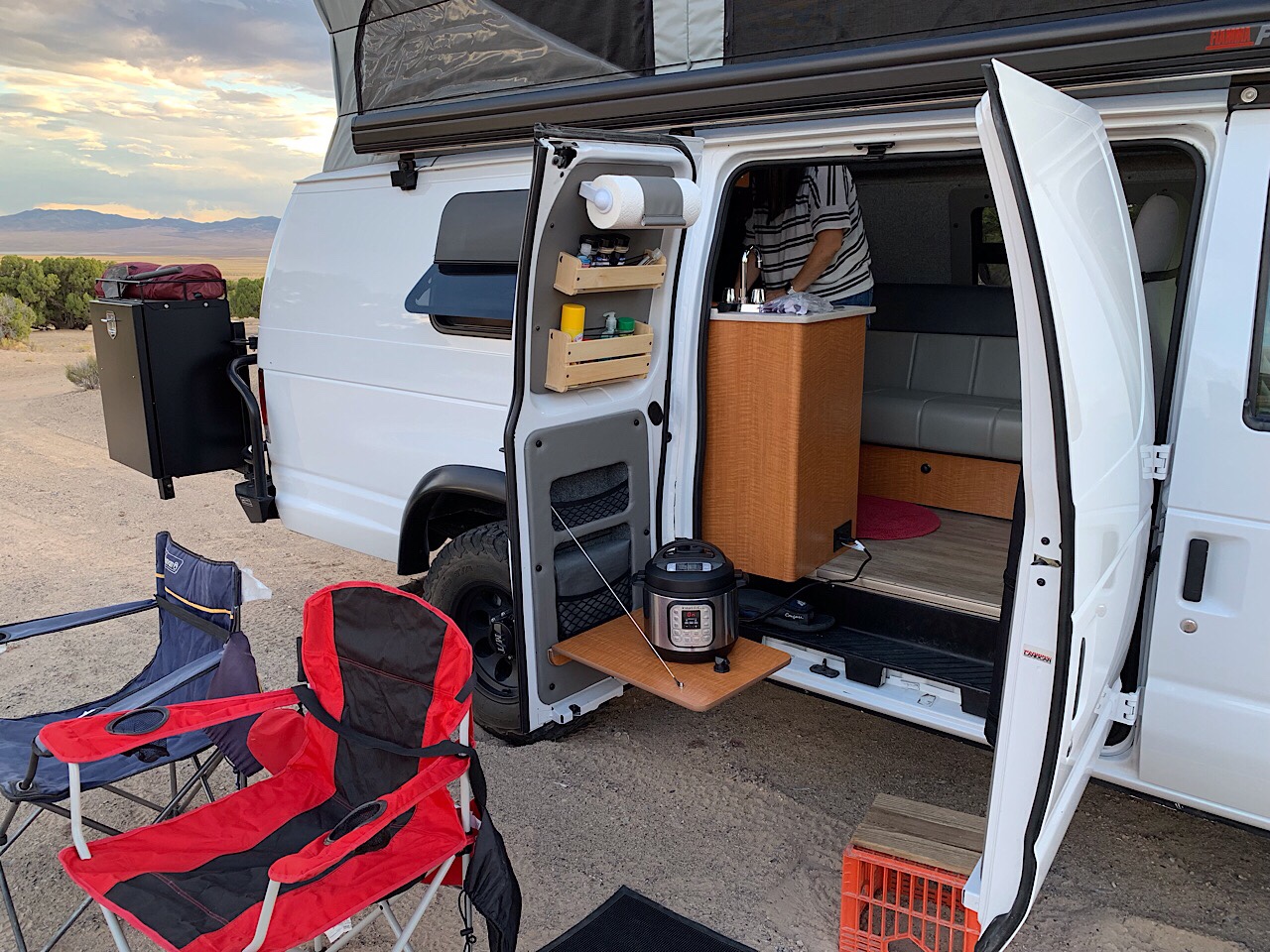
Eva made Bacon Ranch Chicken in the Instant Pot for dinner. It gets dark and cold around 7:30 pm, so after dinner we stayed in the van and talked and read the rest of the evening.

It was another great night. It wasn’t too cold when we went to bed, but it was cold in the morning. A few nights ago we started using the furnace that I installed in the van. It runs with fuel from the van gas tank. It also has a timer, so I can program it to start in the morning. That helps keeps it from being too cold when we get up. It has worked pretty good.

We stopped at the main visitors center when we got to the park in the morning. Crater Lake National Park is the fifth oldest US national park. It was founded in 1902. The crater was formed 7,700 years ago, after the volcanic magma flowed out of the caldera beneath the volcanic peak. With no magma, the peak collapsed and created the crater. The crater was filled by rain and snow melt to create the lake. There are no rivers or streams that can bring silt into the lake. So the water is supposedly the cleanest lake water in the US. It is also the deepest lake in the US at 1,943 feet deep.

First we stopped at the Visitors Center and watched the movie about the park. It explained how the lake was formed. From there it is a 3 mile drive to the rim of the crater. This was our first view of the lake. We walked around the edge a bit and took pictures. We considered taking the trolley around the entire rim, but they were sold out.

So we drove Rim Road to the viewpoints. About halfway around we arrived at the Cleetwood Cove Trail. This is the only way to get from the rim, down to the water. We didn’t plan to do the hike, but just to walk down to the first or second switchback to get a better view. But at every switchback we kept going. Finally we accepted that we were going down all the way. The trail is only 1.1 miles each way, but is 700 ft of elevation change. So going down was not bad, but coming back up it was pretty steep.

At the bottom there was a boat dock for the boat rides to Wizard Island. But they ended the boat tours for the summer last week, so we could not go for a ride. We got down to the bottom and Eva soaked her feet in the water. The lake water is the clearest water in the US, with visibility at least 100 feet. There were a few people jumping in the water, but since we did not plan to hike down, so we did not bring our swimsuits.

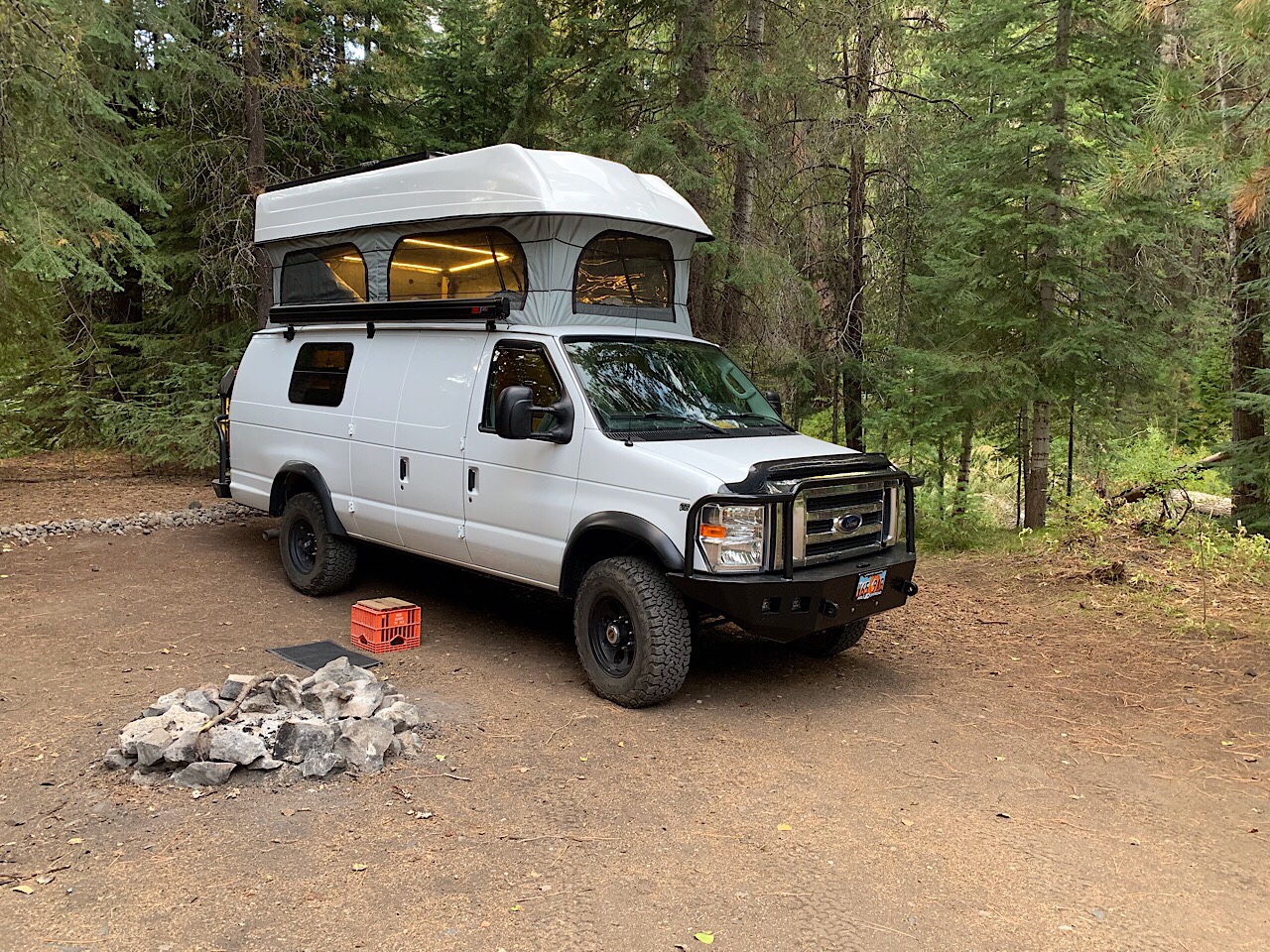
After about 45 minutes at the bottom, we hiked back up the trail. It was not too bad, but now we were in the sun, so it got a little hot.

After the hike we ate lunch and left the park using the north entrance road. This started us towards the coast of Oregon. On the way we stopped and hiked to Toketee Waterfall. This was only about a 1 mile hike, but it was through a deep, dark and wet forest. It was almost like a rainforest. There were huge trees with moss and ferns growing everywhere.

Near the parking area was a 10 ft diameter wooden flume that carried water to the power plant. It was leaking all over. I am surprised it has not fallen apart, but it has been there for a long time.

We continued down the mountain until we were close to Roseburg, Oregon. We found a campsite at Mill Pond Recreation Area. It was a very nice place with 12 campsites and we were the only ones camped there. We got a camping spot on the river and had camp set up by 4:30 pm. This is the earliest we have set up camp. Were were able to eat dinner by 6 pm, rather than 8 pm.

After dinner we walked along the river trail for about a mile. It was dark by the time we got back to the van.

Design a site like this with WordPress.com
Get started