November 2, 2020
We decided to take one last trip for the year while the weather was still good. The forecast in the south was for the highs in the low 70’s and the lows in the high 40’s. So perfect weather for the desert.
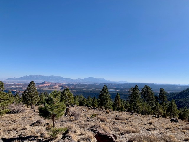
We didn’t get out of town and headed down I-15 until about 11:00 am. We took our time and stopped and drove through a few small towns along the freeway. Later we stopped in Cedar City for gas and then headed over the mountains to the east on highway 14. This is a beautiful highway as it goes through the trees, red rocks and lava flows. It started to rain at Cedar City and continued over the mountain until we were on highway 89, near Mt Carmel Junction.
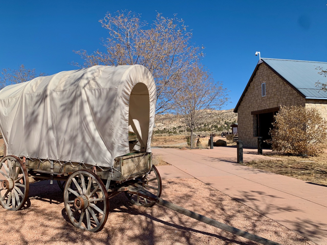
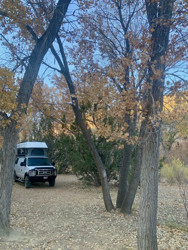
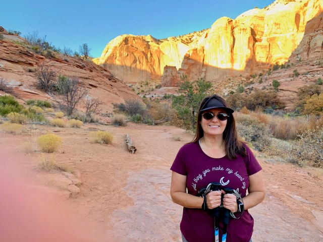
We arrived at our campsite, just outside of Kanab around 5 pm. The problem with November camping is the sun goes down early and once the sun is down, it gets cold. We were camped near Kanab Creek, just about 5 miles north of Kanab.

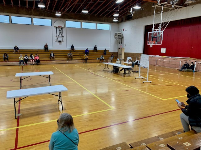
In the morning we drove into Kanab to enter the BLM lottery for one of the 10 permits to hike to the Wave Formation, just over the border in Arizona. The lottery was held in the gymnasium at the Kanab City Center. There were about 200 people for the 10 permits, so the odds were not too good, and our number wasn’t drawn so we missed out. This was the fourth time I have entered the lottery and have never won.
We were done with the lottery around 9:30 am, so after gassing up we drove east on Hwy 89 about 30 miles to the turn off to the Paria Ghost townsite. It was 5 miles up a dirt road, but we never found any of the ruins. We found the old cemetery, but there was supposed to be a few ruins and foundations, but I guess time has taken it’s toll.


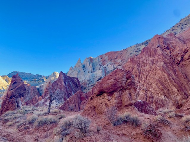
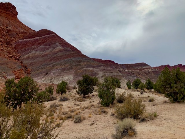
We drove back to the highway and then another 25 miles east, to the Cottonwood Canyon road. This road goes north through the canyon and is full of nice views and rock formations. Our first stop was the Paria river where there is supposed to be a hidden cache/camp that was found in 1953 by local ranchers. Some of them were convinced it was from a German spy that had hidden in the hills after WW2. In 2014, I had talked to one of the ranchers that found the camp when he was a young boy. He told me how to find it, but I could not find the right canyon and only had about an hour to look.
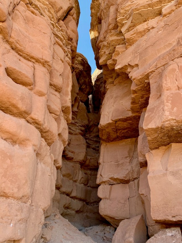
This time I planned to spend more time to try and find this camp. The directions are to go up the Paria riverbed about 3/4 of a mile and just before the Paria Box (a narrow part of the canyon), you go up a side canyon on the right side. The camp was on top of the cliffs above the canyon. The rancher originally found the camp while driving horses up the canyon to graze on the top of the cliffs.
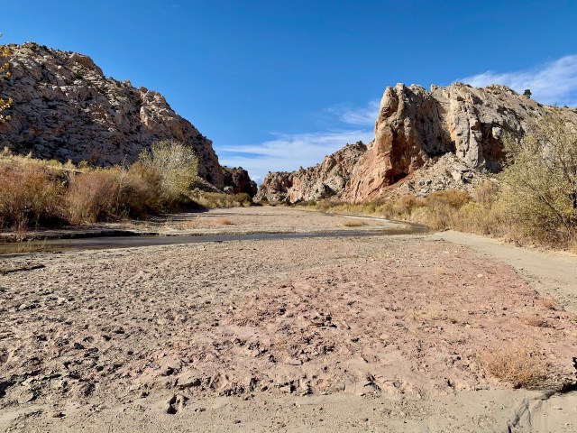

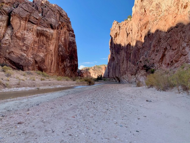
Eva and I walked up the Paria riverbed, but the water was higher than last time, so we had to wade across the river 4-5 times. When we got near the Box, Eva decided to wait for me while I hiked up the canyons. However, all of the canyons were steep, rugged and full of boulders. I could barely climb up the canyon, so I don’t know how they drove horses up the canyon. I never found the camp, and I had told Eva I would be back down by 4 pm, so I gave up and hiked back down to the river and caught up with Eva. We made it back to the van and drove north another 10 miles before finding a side road with some nice camping spots.
November 4, 2020
We woke up and had no idea if anyone had won the presidential election and if there were riots in the cities. We drove further north on Cottonwood Canyon road and finally got phone reception as we got close to Cannonville. We checked on the election and still didn’t know who won.
We drove on highway 12 from Cannonville to Escalante. In Escalente we stopped a the BLM visitor centers to review the road conditions. We had planned to hike through Zebra slot canyon, but the report was there was chest deep water in the canyon. Eva didn’t want to go because chest deep water is up to her neck.
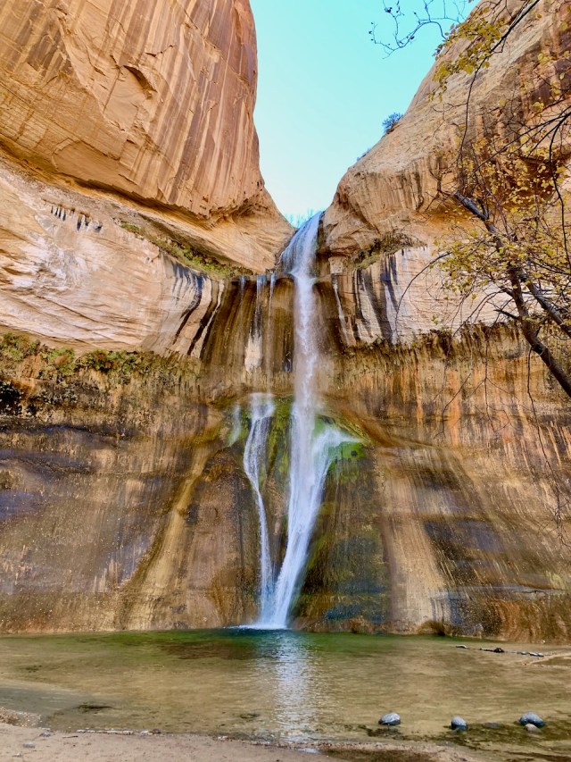
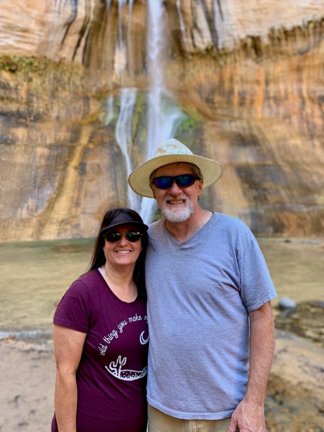
We changed plans and continued up Hwy 12 to Calf Creek Campground. We were lucky and there were several campsites available for $15/night. We snagged a site and setup camp. We ate lunch and then started the hike to the Calf Creek Waterfall. It was a 6 mile round trip, but 5-1/2 miles of the hike was deep soft sand, so it was a difficult hike. We started late in the day, so we passed a lot of people coming down the trail. It took about 1-1/2 hours for us to get to the waterfall. After taking some pictures, I tried to talk Eva into jumping into the pool of water, but she wouldn’t go for it. About 15 years ago I did this hike with the kids. It was a hot, middle of the day hike. When we got to the waterfall we all jumped into the pool of water. I dove in, head first. The water was freezing cold. So cold that it gave me a headache the minute I dove under the water.

The hike back was not too bad and we were back at camp before 5 pm. We set up the shower tent and both showered before eating chicken taco’s for dinner. We watched a movie before going to bed.
November 5, 2020
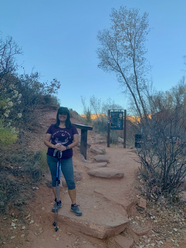
We took our time getting going in the morning because our campsite was the last one to get sun in the morning. We left camp around 10:30 am and the sun still hadn’t hit our site.
We continued on Hwy 12 to Boulder, UT. This is a very scenic drive across the knife edge of a mountain ridge, and then the highway weaves down through the white sandstone hills and canyons. We stopped at the state park in Boulder for the bathroom and WIFI to update this blog.
At Boulder we had to decide between going west on the Burr Trail to the Notom road, or continue on Hwy 12 over Boulder Mountain. We have been both ways, and both are beautiful rides. The Burr Trail is through the red rock and desert, and Hwy 12 is over a 9000 ft mountain and then down the mountain through the Capitol Reef area.
We decided on the mountain road as it was a bit faster and no dirt road. We decided to try and get home by Friday afternoon so we could unload and wash the van before the storm and snow hits home this weekend. It was a great ride over the mountain, but too late in the year for any autumn colors. After passing through Capitol Reef, our favorite National Park, we drove east to Hanksville to stop for a milkshake at Stan’s Burgers.
We decided to camp early so we could relax in probably the last warm sunshine we will see for a while. About halfway between Hanksville and the Goblin Valley turnoff, we went down a dirt road on the west side of the highway. It looked like a rancher road that wasn’t traveled on too much. There was a lot of deep sand, but we made it about 2 miles and camped under some huge sandstone formations. It was a little like Goblin Valley, but the goblins were 100 feet tall.


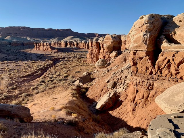
We hiked around the area and I climbed to the top of the goblins that were across from our camp to take a picture. The rest of the night we had dinner, talked and read. The next morning we plan on driving home through Price, UT and getting home after lunch time.
