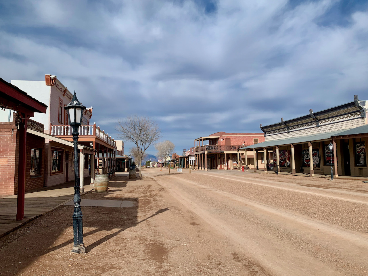
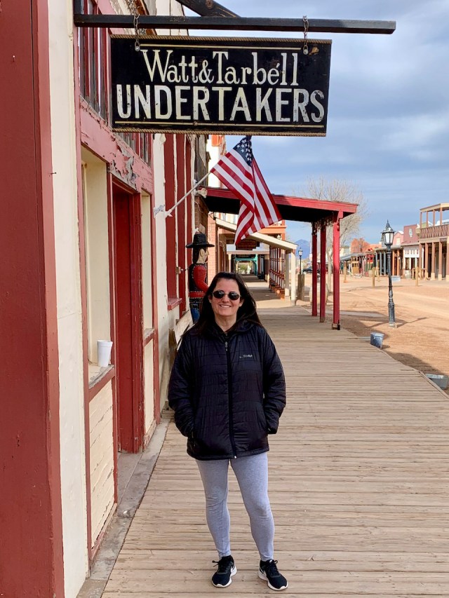
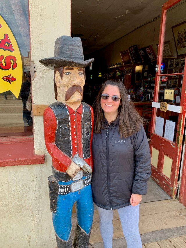
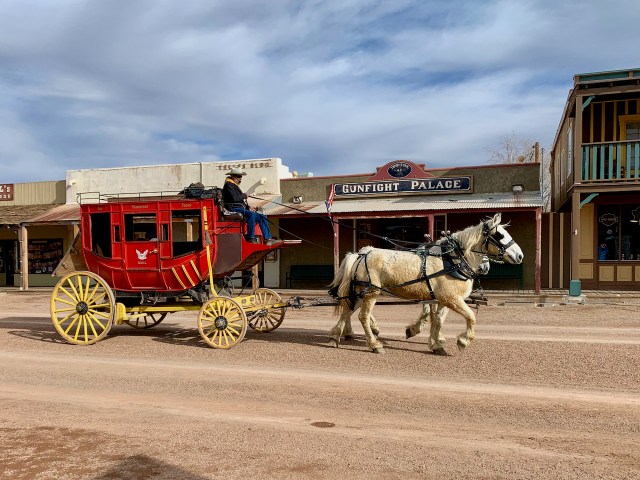
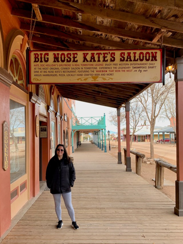
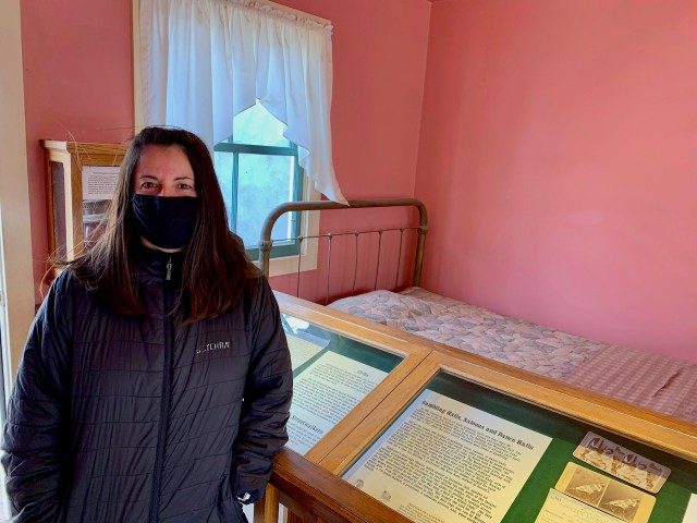
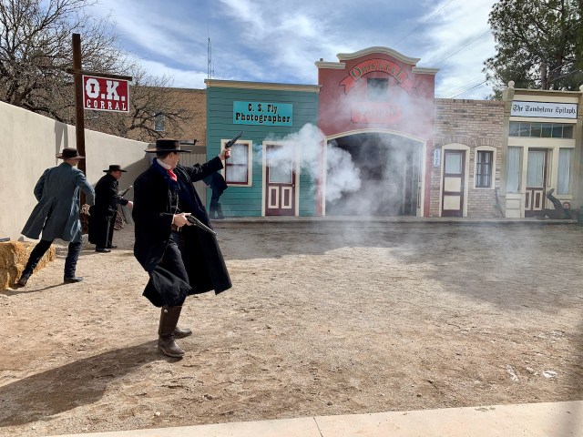
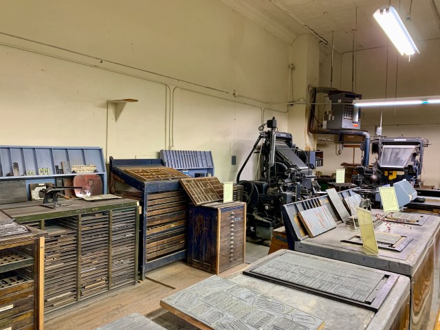
Our plan was to spend the day in Tombstone, AZ. We arrived in town just before 10 am and it was cold and windy. Mostly windy, so it was a little uncomfortable. Most of the places opened at 10 am or later, so it was pretty quiet the first hour we were there, but did pick up later in the morning. The main street from the 1880s was Allen Street and they have made it an old west street with boardwalk sidewalks and a dirt road. We walked the streets, but a lot of things were closed. Our first stop was the OK Corral and watched a “re-creation” of the “Shoot-out at the OK Coral”. It was fun and entertaining and they had several museums about the town and lift in the wild west.
We spent the rest of the morning in town and had a nice lunch at a local restaurant. But it was too cold and windy, so we left after lunch and started our long drive home.
We stopped in Costco in Tucson for gas and then camped in the Ironwood National Forest for the second time in 3 days. It was a windy evening and it rained for much of the night. The past week has not been good for enjoying the warm Arizona winters.
Jan 30, 2021
The skies were clear and it was a beautiful blue morning. We hung around camp for a while so the tent part of the popup could dry from all the rain last night.
We continued north through Phoenix and past Wickenburg to a nice camping spot out in the desert mountains near Wikieup, AZ. It was 3-4 miles down a nice dirt road and our camp spot was in a dry wash among all kinds of cacti. We stopped early and enjoyed the sun with no wind. We took a shower and had tacos for dinner.
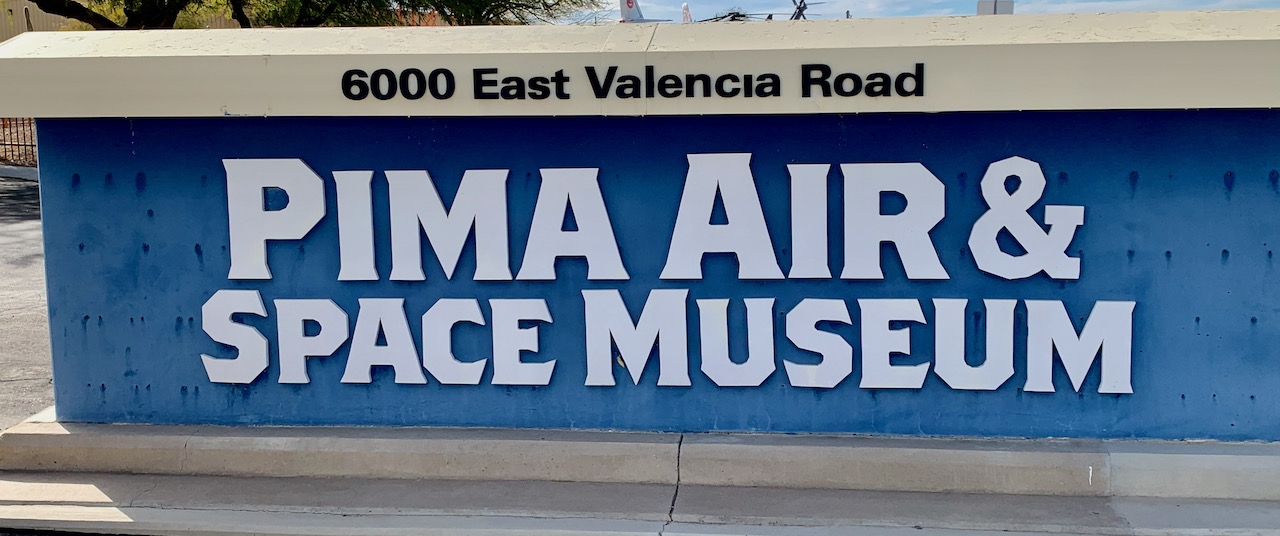
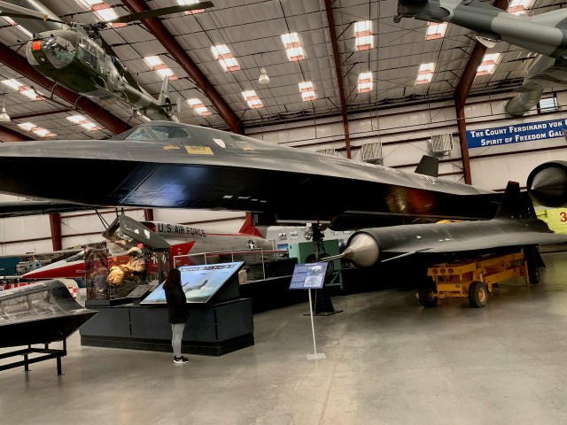
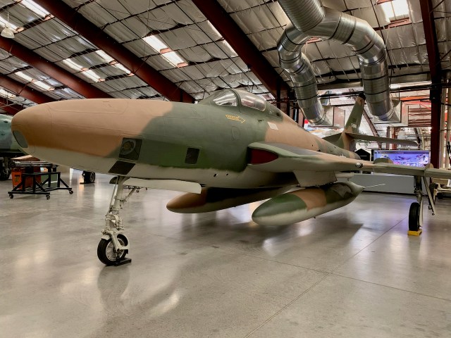
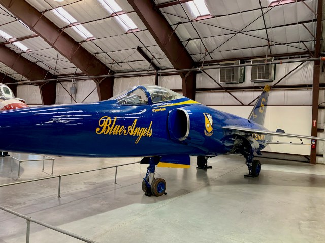
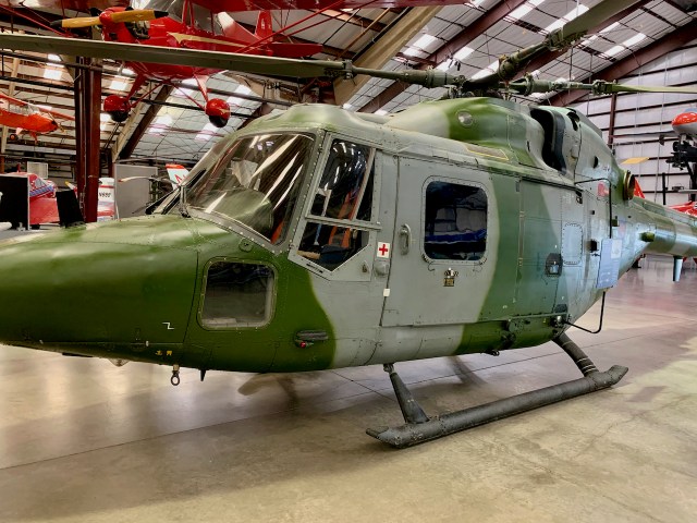
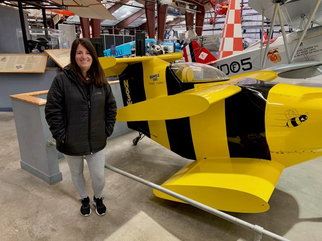
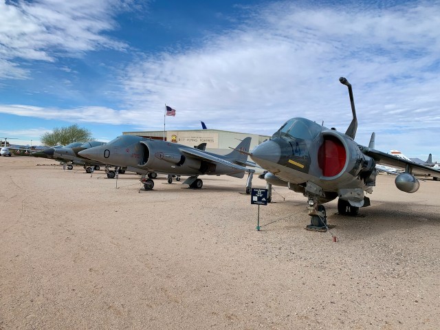
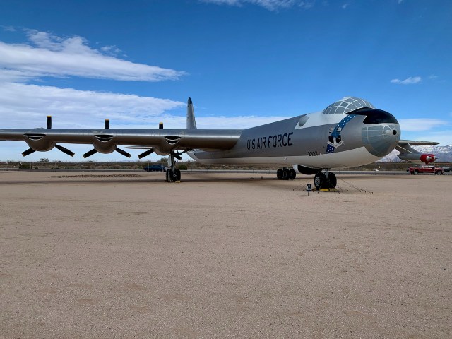
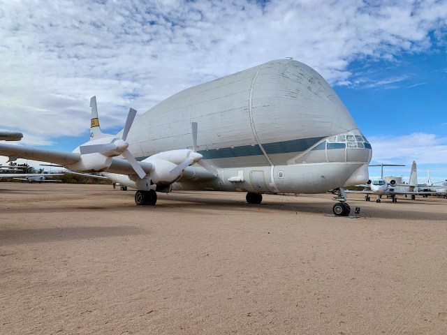
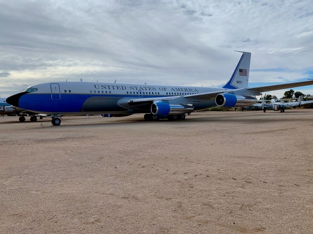
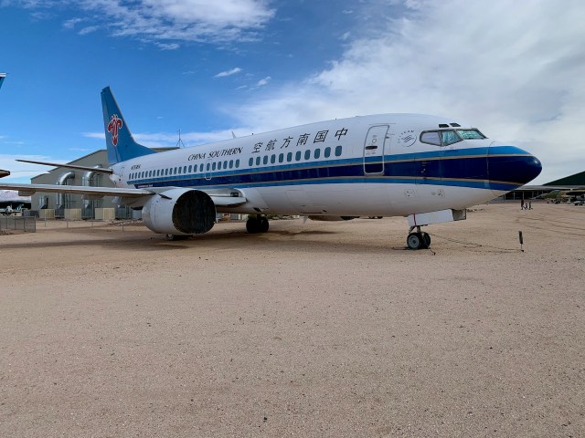
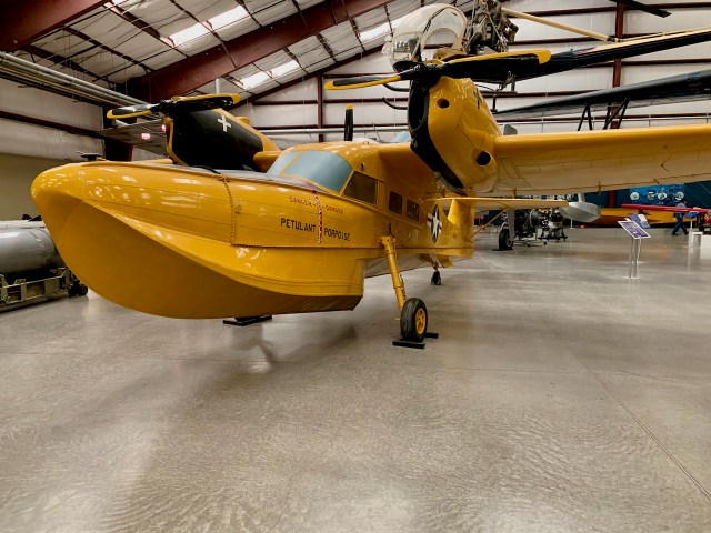
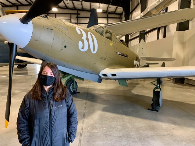
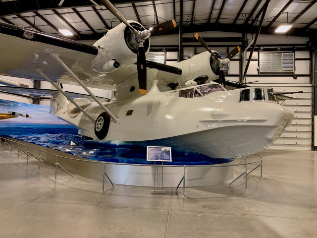
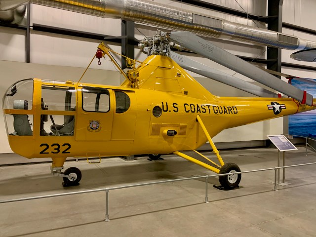
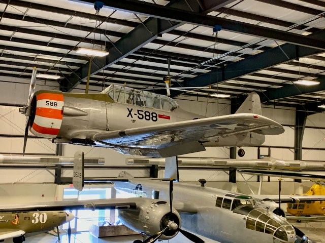
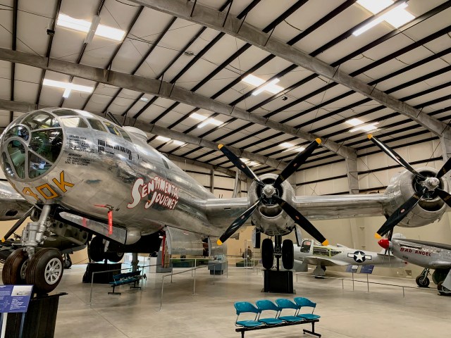
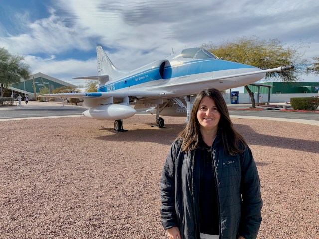
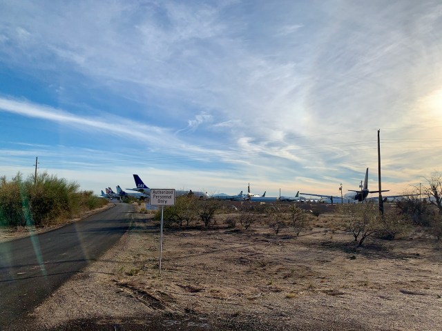
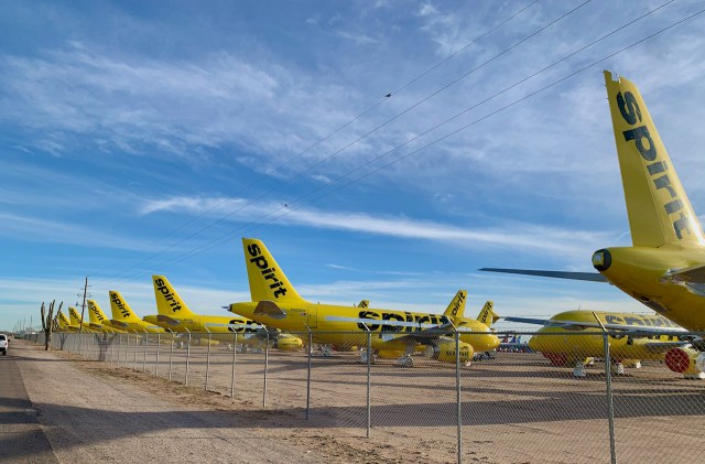
We spent the entire day at the Pima Air and Space Museum. It is on the southeast side of Tuscon and is 80 acres of planes. There are 4 huge indoor hangers, then many planes displayed on the grounds between the hangers. We were there when it opened and didn’t leave until after 4 pm.
From the museum we drove towards Tombstone, AZ, but camped outside of St. David. The campsite was a mile down a dirt road out in the desert.
We left KOFA around 10 am and drove back into Quartzite. This gave us a chance to dump the PortaPotti and drive to town. We parked in the church parking lot to access the WIFI so we could get online to watch our church service. Just as we pulled into town, the rain started coming down hard and we had a few minutes of hail/rain.
After leaving Quartzite we drove the 2 hours to Phoenix to spend a few days with Hilda. It was nice to sleep in a real bed, take a real shower. and hang around with Hilda for a few days. Another reason, for us to be glad we stayed at Hilda’s house, is the weather turned cold and wet. It rained most of the day Monday and Tuesday. There was some hard rain and hail on Monday afternoon, so we were glad to have a house to stay in.
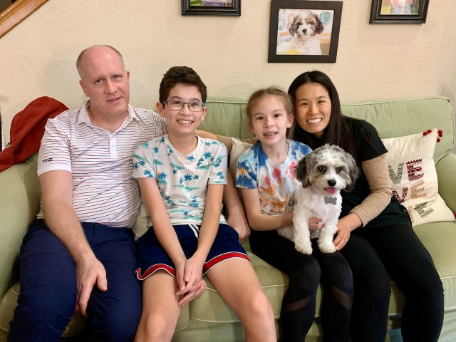
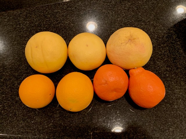
On Monday evening we did drive south about 40 miles to Chandler to visit Alan, Jinhee and the twins. They gave us some oranges and grapefruit from trees in their yard. We also took Hilda and Justin out to dinner on Tuesday night.
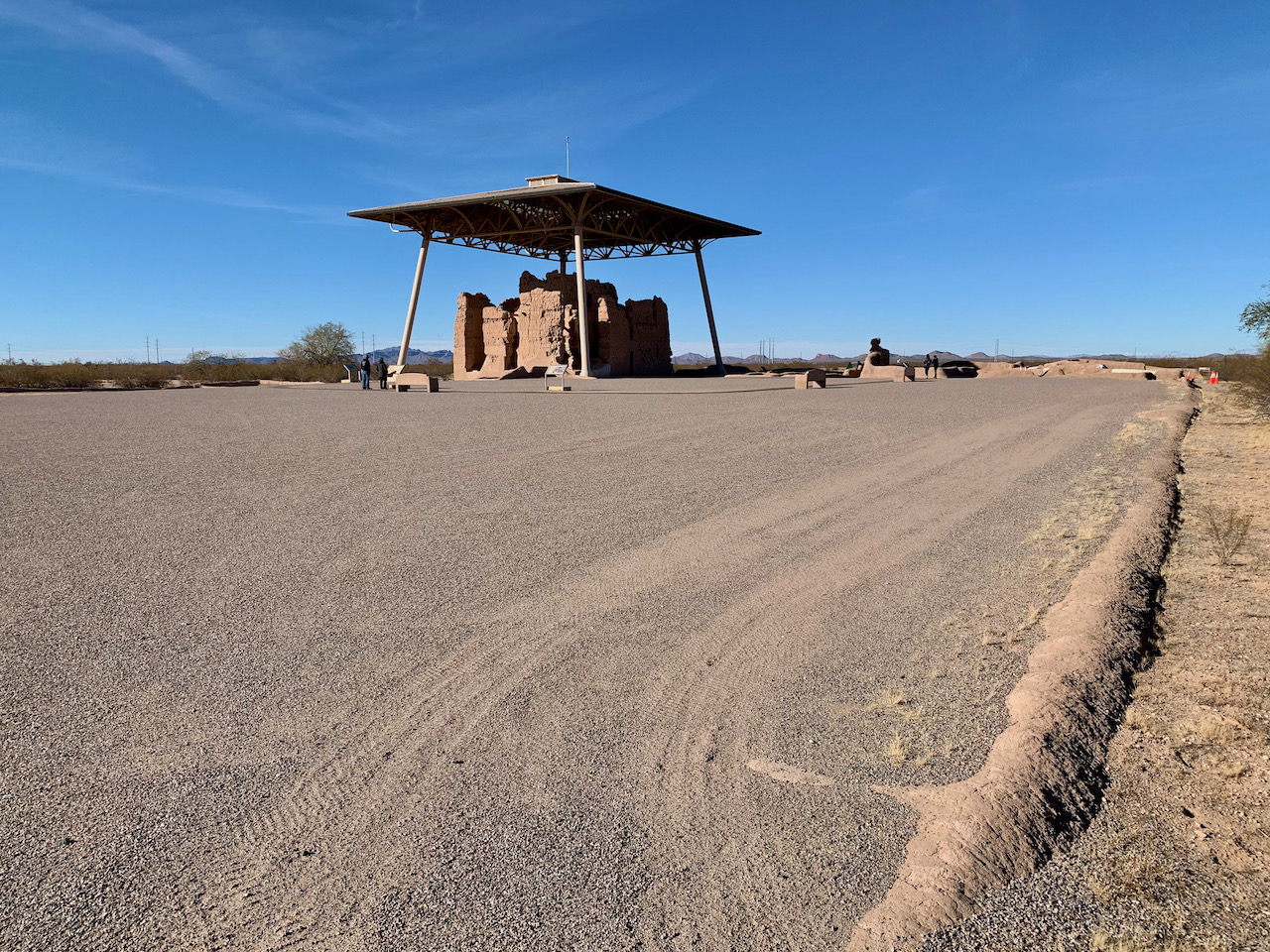
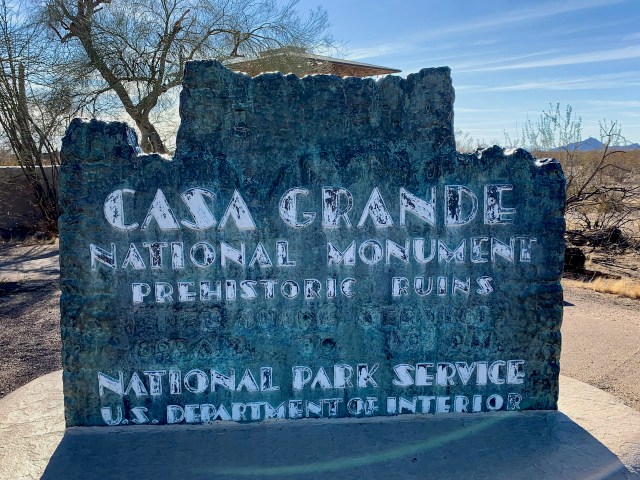
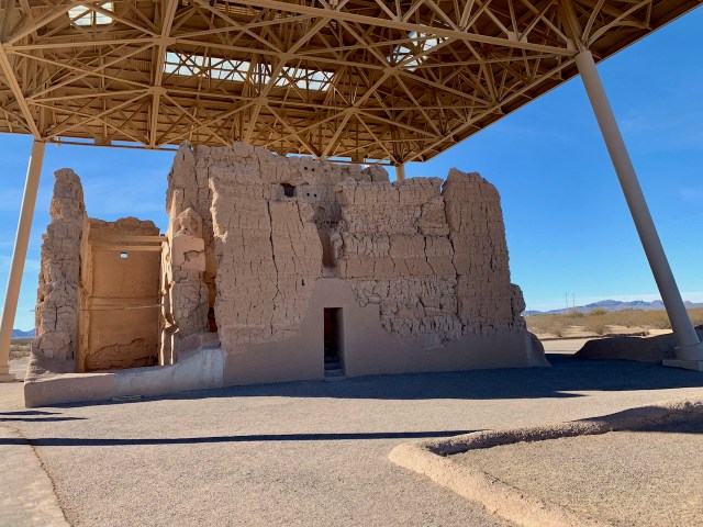
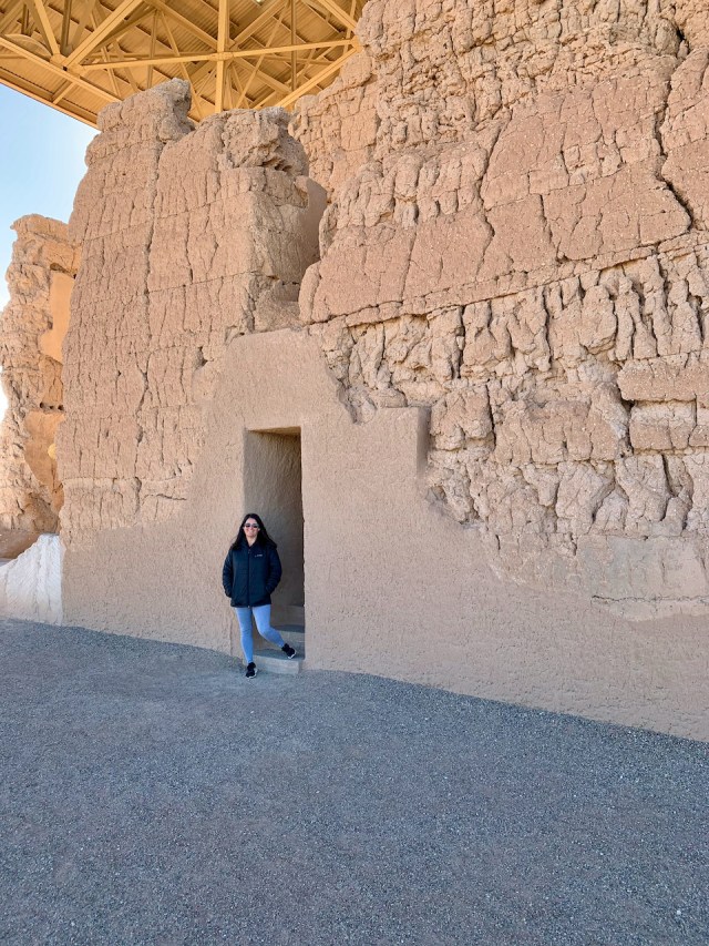
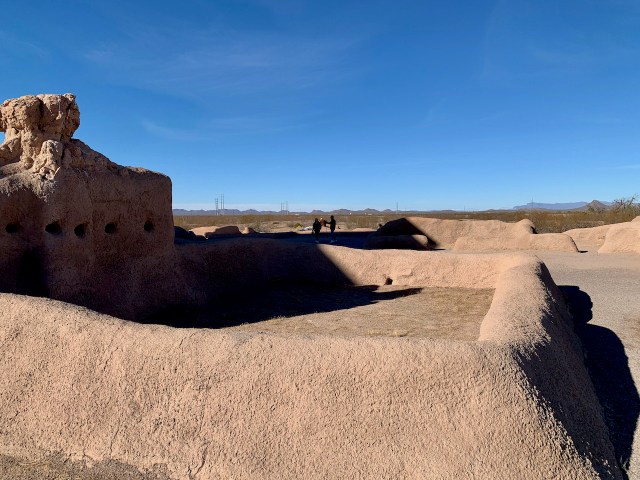
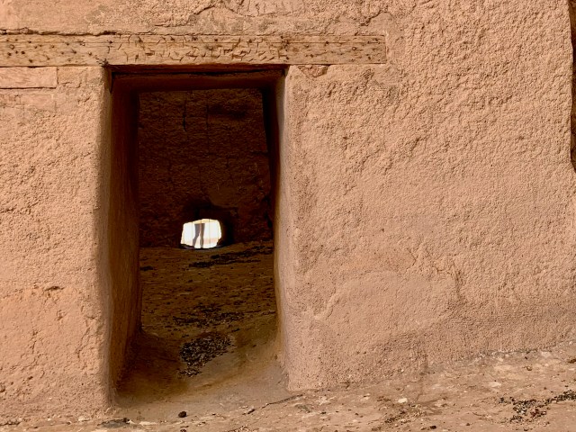
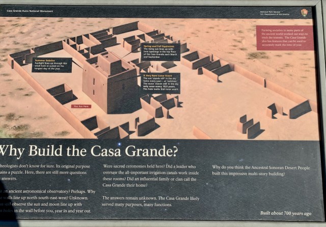
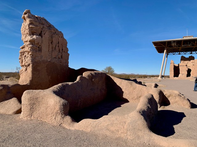
Wednesday we left Hilda’s house before noon and drove south towards Tuscon. It was a sunny day, but still cooler than we were hoping for. We stopped at the Casa Grande Ruins National Monument, in Coolidge AZ.
These are the ruins of a community that was built over 700 years ago. However, the Ancestral People had been residing in the area for 1000 years before that. The Casa Grande (Big House) was covered with a steel roof to protect it, but there were ruins of the walls and other buildings. There are even the remains of a ball stadium/court where the people recreated.
We only had about an hour to visit the monument before it closed, but it was worth the visit. We continued south towards Tuscon, but camped for the night in Ironwood National Forest. As we drove into the cactus forest, we drove past one of the airplane storage locations in the area. Visitors are not allowed, but we took a few pictures over the fence.
We had setup camp before dark and Eva made fideo for dinner.
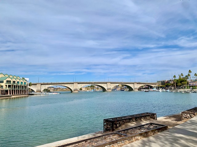
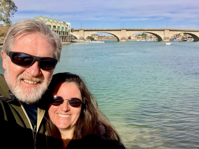
It was a windy night with lightening and thunder, but no rain at our camp. In the morning we drove into Lake Havasu City and stopped at London Bridge. We walked the waterfront and took a few pictures. It was sad to see all the closed businesses. There only a few people in the area, compared to last year when the waterfront was packed.
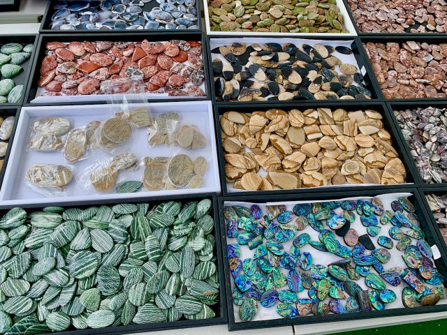
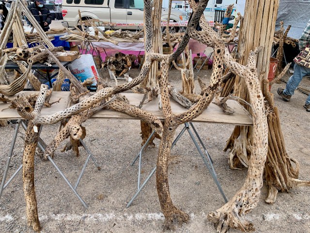
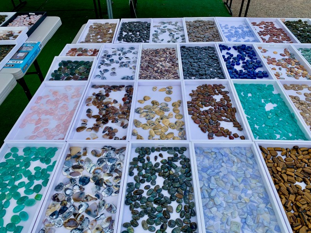
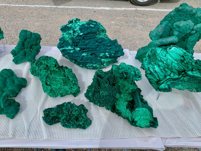
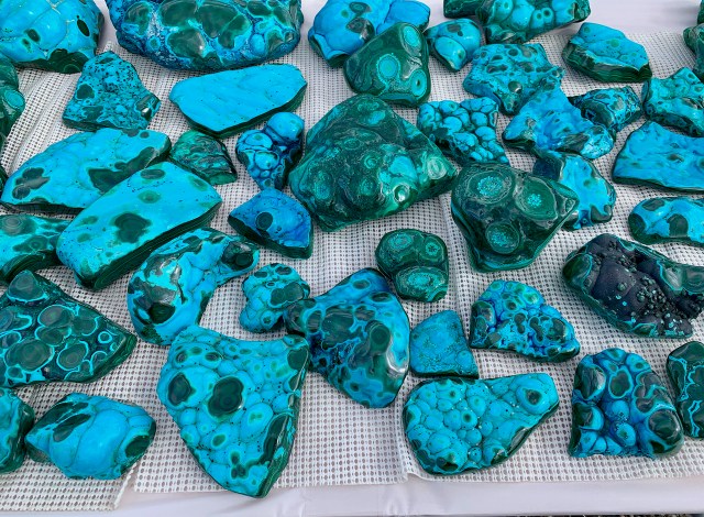
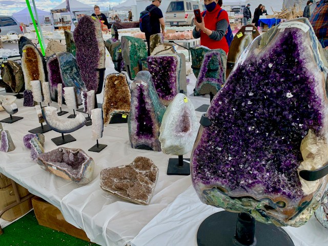
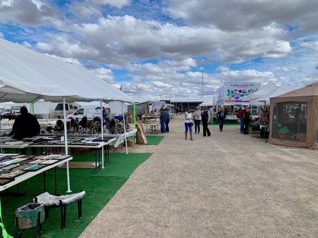
We stopped in Quartzite, AZ for gas and to eat lunch. We saw an area with tents, so we drove by and parked at the Quartzite PowWow Gem and Mineral Show. There were many booths of rocks and stones. We thought they would have other items, but it was mostly rocks.
We stayed for 10-15 minutes and at that point we had enough of the show. We loaded up and started driving out of town. Once we passed over the freeway, we saw a huge area of tents, people and cars. We realized that we had parked at the overflow area of the Gem and Mineral Show. On the south side of the freeway was the main show area. It was at least 10x the size of the area we stopped at. The road into the parking area was backed up (and we had seen enough rocks), so we didn’t stop or take pictures. There are a lot of people how like looking at rocks.
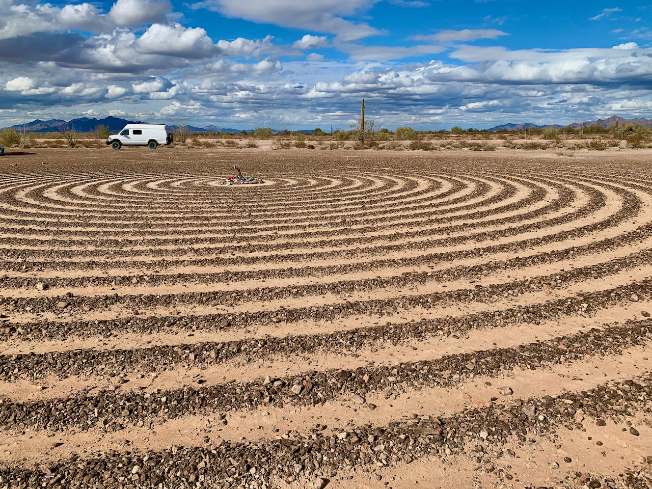
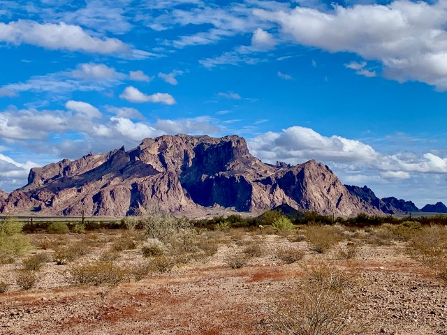
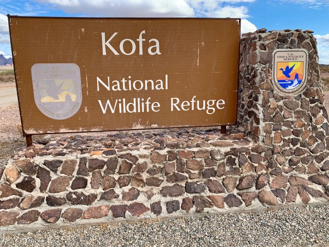
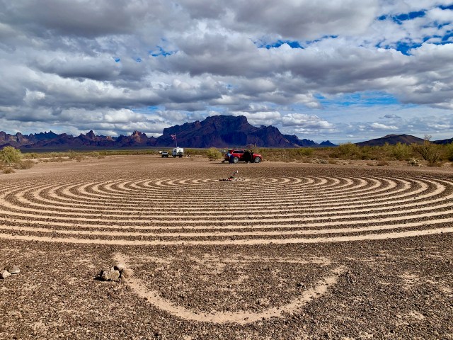
We about 25 miles south of Quartzite to KOFA National Wildlife Refuse. KOFA is named after the King OF Arizona mine which is inside the refuse. We first stopped at the Spiral Labyrinth. Someone “carved” at perfect spiral in the desert, just outside of KOFA.
It was interesting to see and good to see that no one had ruined it. We set up camp a bit off the main road and spent the rest of the day at camp. It was an overcast day and windy, so it was too cold to do much outsite.
Last night was our coldest night of the trip. We were camped at about 5,000 feet and it got down to 27 deg. With the electric blanket we were not too cold, but my head got cold.
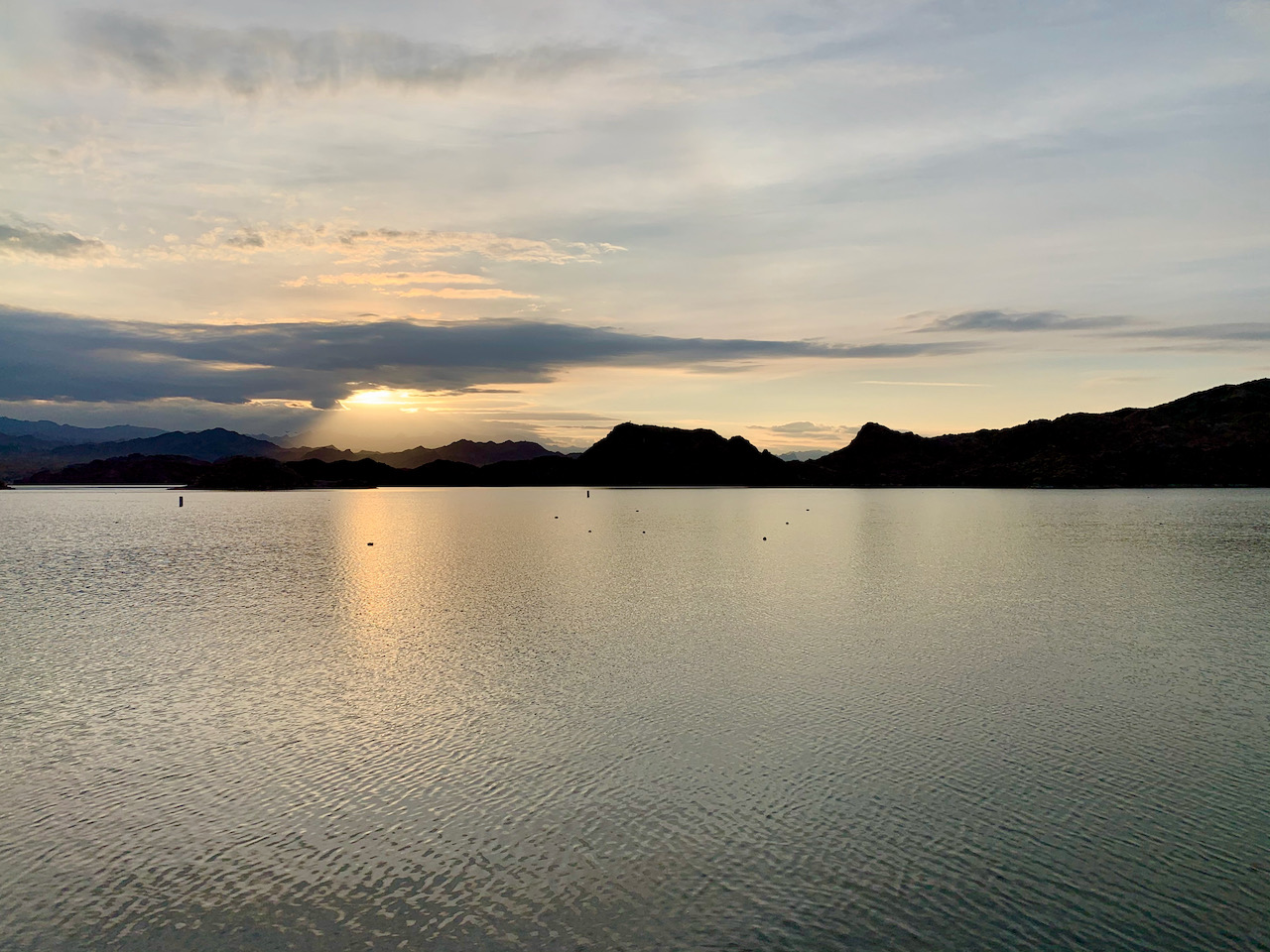
We took our time to get moving in the morning, but were back on the highway around 10:30 am. We were excited to drive further south and hopefully warmer weather. We drove through Las Vegas and Henderson and continued south on highway 95. We got to our campsite on Lake Mohave around 1 pm. Lake Mohave’s elevation is about 550 feet, so it was much warmer.
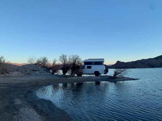
We had a great spot on the edge of a semi-circular beach. Our spot was on a small peninsula at the very end of the beach. This camp area probably fills up with 80-90 campsites in the summer, but there were only 10 other campers spaced out around the beach.
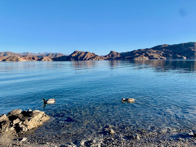
I was surprised how beautiful this lake is. The lake is fed by the Colorado River from Lake Mead. I am used to seeing the river as a muddy brown water passing through Moab, but the water in the area we camped was crystal clear. I imagine in the summer the area is packed with swimmers. We thought it would be a great spot to have the family at in the summer, but it is a little far for everyone to drive.
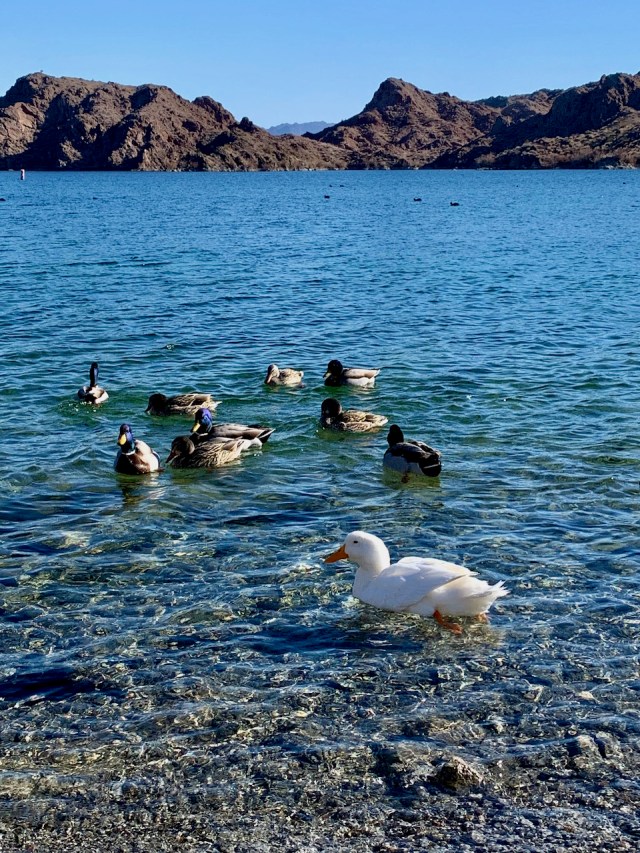
We enjoyed the perfect weather for the afternoon and evening. The cove we are camped in is full of all types of ducks that fly and swim in the area. The ducks are well trained, as soon as we parked and got up, they swam up looking for food. But we didn’t have lunch ready, so they left. They did come back several times throughout the evening.
When we parked earlier that day, we were only about 3 feet from the waterline. Late that night we heard water lapping at the shore. It sounded real close. We peeked out the window and could see the water had risen up the shore about a foot. Now we understood why the ground under our camp was all wet. We thought we may have to move camp in the middle of the night. I checked online and read that Lake Mead increases water output each night. This raises Lake Mohave about 3-4 inches, which at our site was about 1-2 feet up the shoreline. The water then recedes in the morning.
After the research we were able to go to sleep, but I did wake up a few times to check the water level. By morning the water level was back to normal.
Jan 22, 2021
We left camp and drove into Laughlin for gas and a stop at Home Depot. We continued south on highway 95 and camped in an area where we camped last year in Craggy Wash, just north of Lake Havasu.
Last night was one of the windiest night we have ever spent in the van. One problem with our van is the poptop, it’s like a big sail and really catches the wind. It kept our van rocking back and forth through the night. A couple of times the wind stopped and everything was calm and quiet, but then it would start up again.
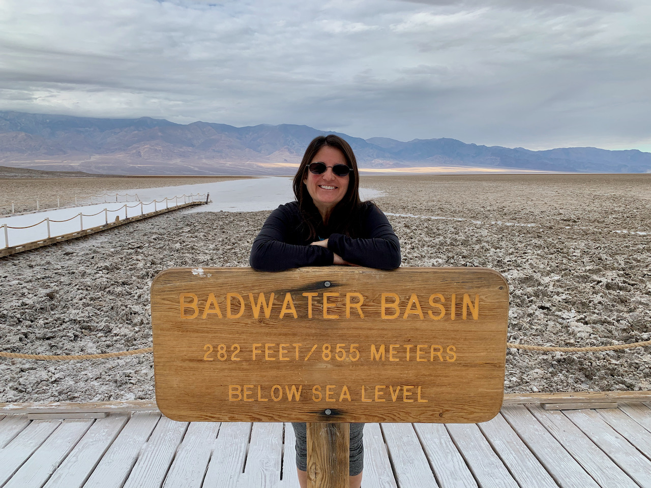
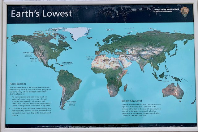
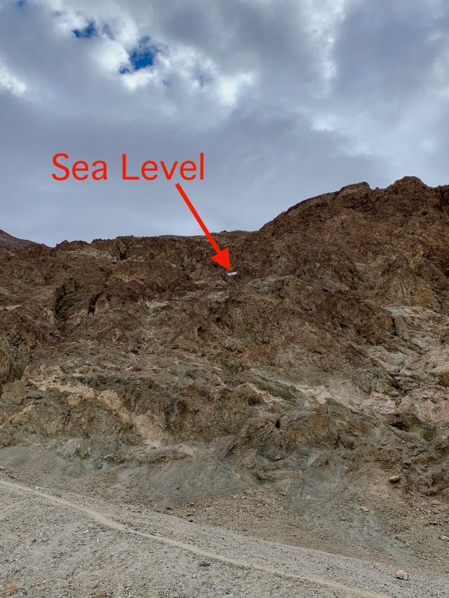
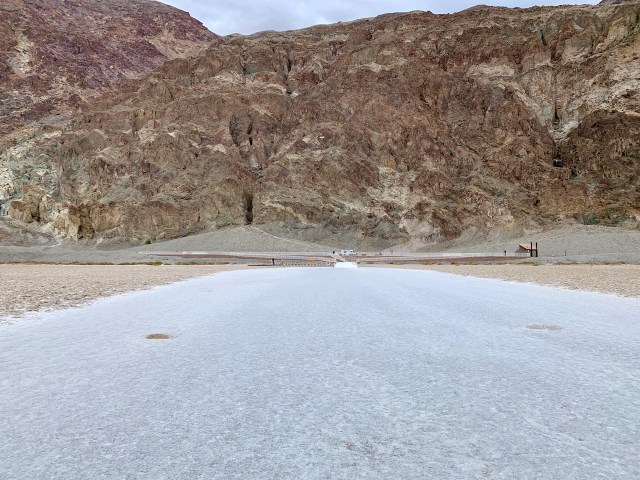
By morning the winds had calmed down to a breeze. We drove back to the Furnace Creek area and took the 17 mile drive to Badwater Basin. This is the lowest place in the western hemisphere and one of the hottest place in the world. However, the last time we were here, it was cold and rainy. Today was cool, dry and very pleasant. We were the second car in the lot, but the other guy had walked way out into the valley, so we had the place to ourselves. We took a few pictures and walked out onto the salt flats. There was a sign high on the mountain that indicated where sea level was.
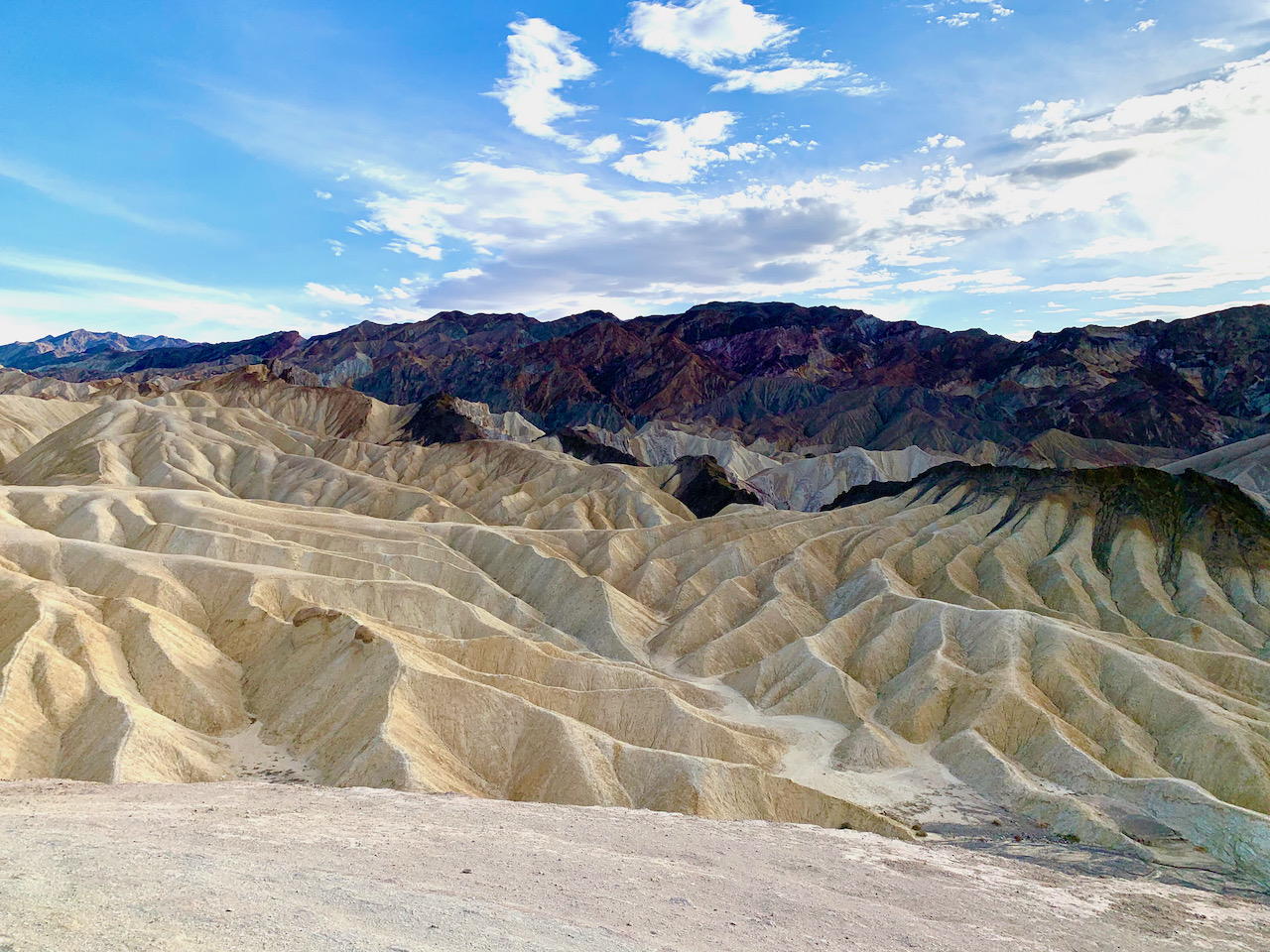
On the way back we took the Artist Drive. It is a beautiful drive with all the various formations and colors.
After that drive we were done with Death Valley for this trip. It is an immense space with some interesting locations spread through the park. Other than the vastness of the park and the appeal of Badwater Basin, I think the canyons of southern Utah are much prettier and interesting. Even the areas that are not part of national parks. But I love visiting all of them.
The rest of the day was spend driving out of the park to Pahrump, NV. Once in town we got gas, groceries and I had enough internet access to update the blog. We had planned to camp at a spot on the edge of town, but it was just a flat desert area, so we decided to continue another 30 miles and camped up Lovell Canyon, about 40 miles west of Las Vegas. We found a nice spot in the cedar trees about 3 miles up the canyon.
We made the bumpy trip from camp back to the highway. We aired the tires back up to highway pressures at the gas station and then drove into the southern part of the park.
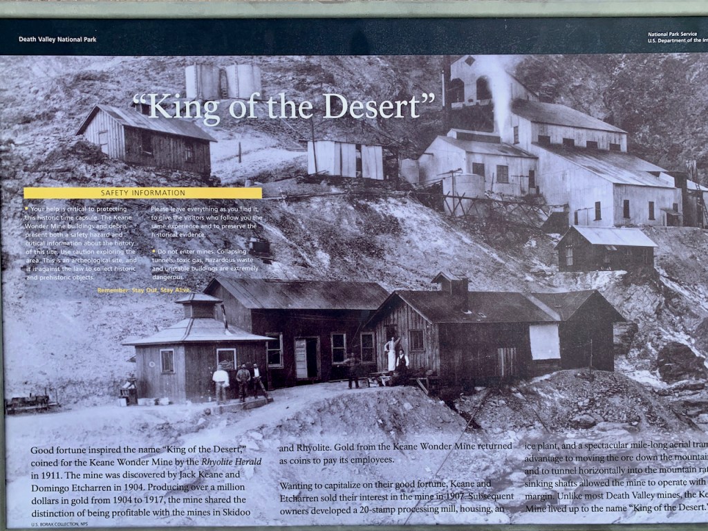
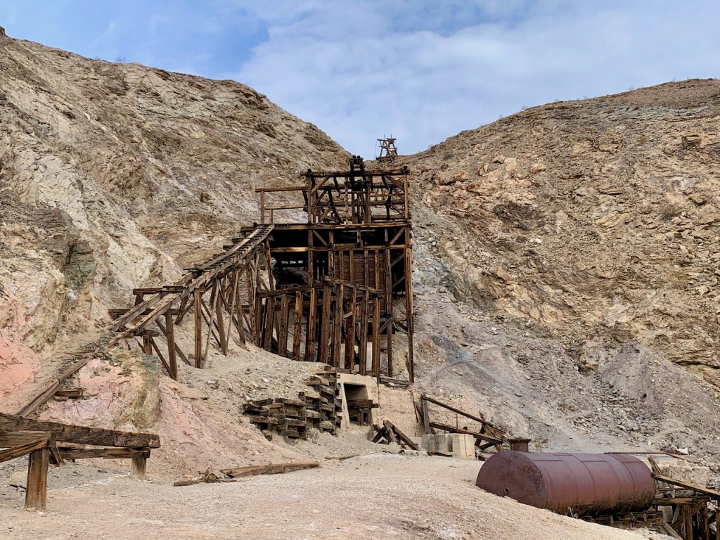
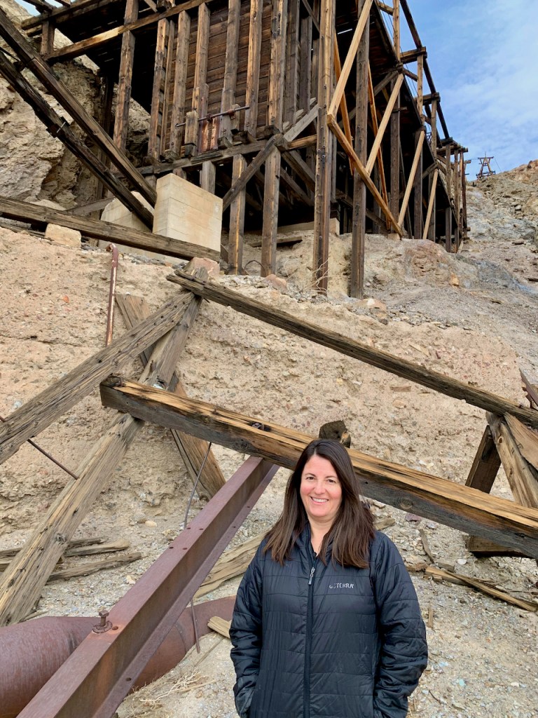
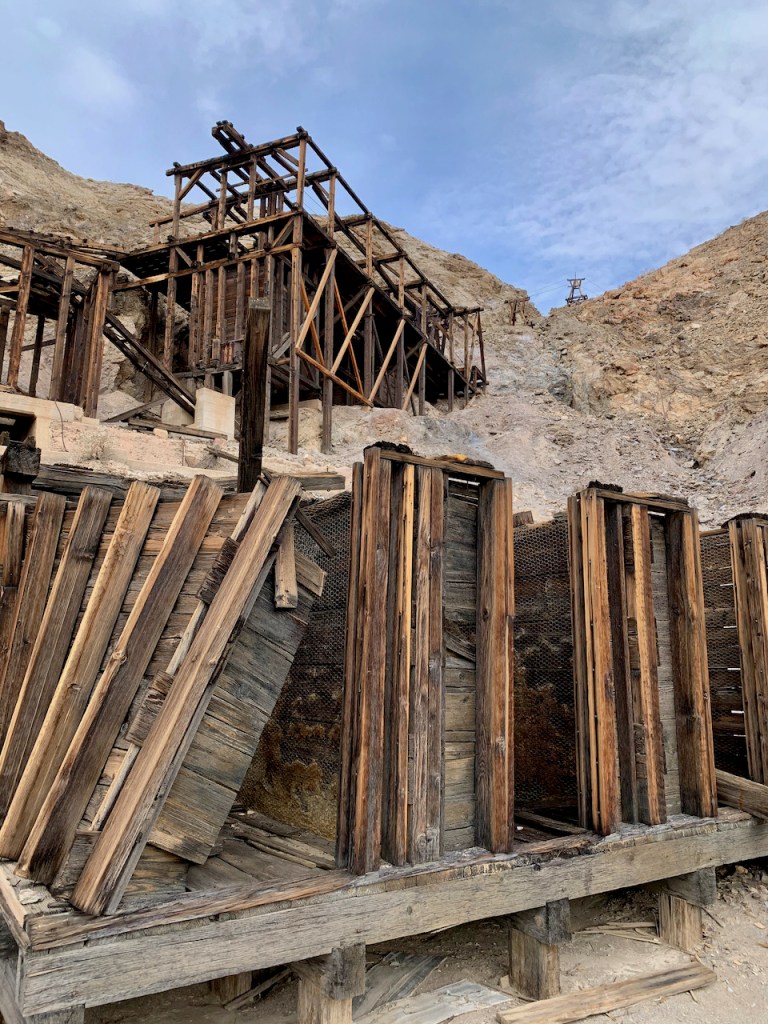
The first stop was at the Keane Wonder Mine site. Much of the old mining structures were preserved, along with an aerial tramway that carried the ore from the mine to the mill. The Keane Wonder mine was one of the more successful mines in the area and pulled more that one million dollars of gold out of the mountain. For this reason it was known as the ”King of the Desert”.
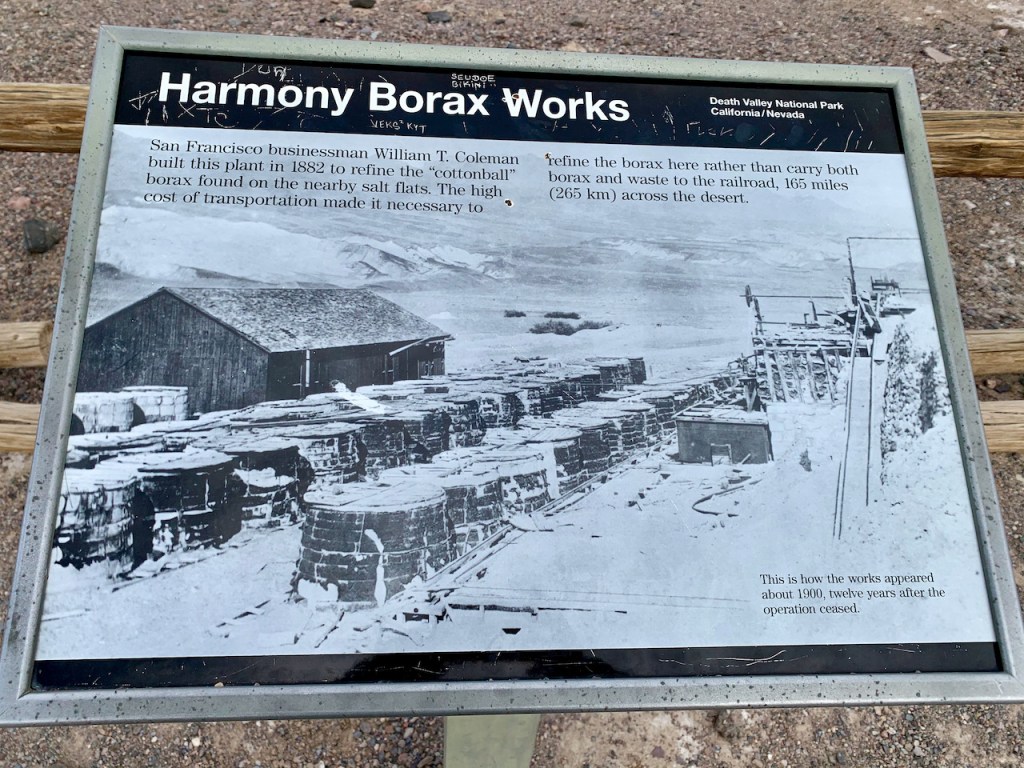
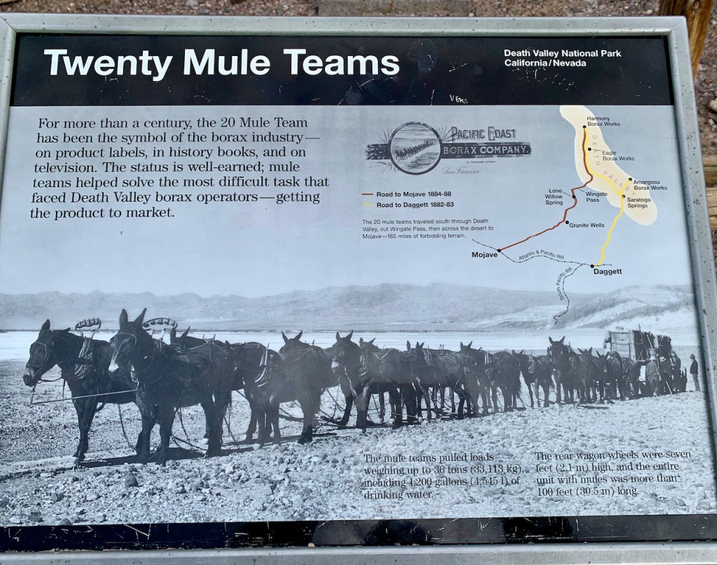
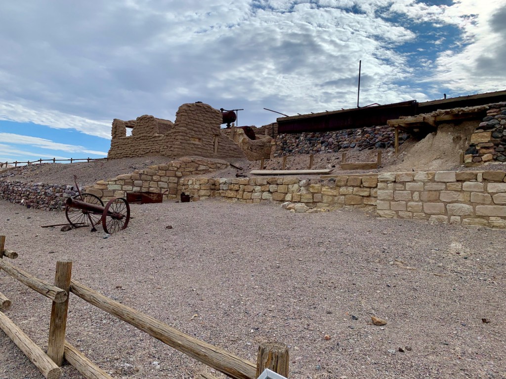
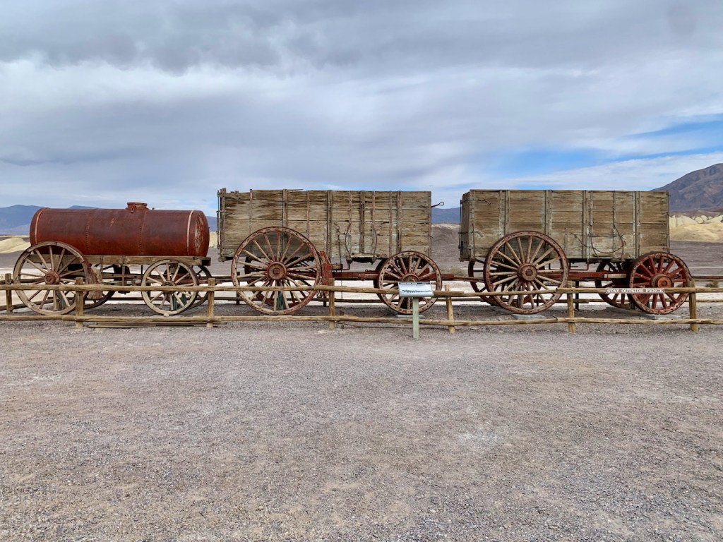
We next stopped at the historic site of a borax mine (Harmony Borax Works) before continuing to the Furnace Creek visitor center. We were able to get cell phone reception again and we spent some time taking care of business.
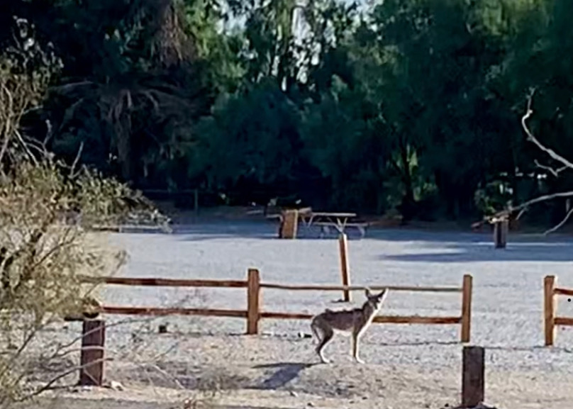
A lonely coyote walked by the visitor center’s parking lot while we ate lunch.
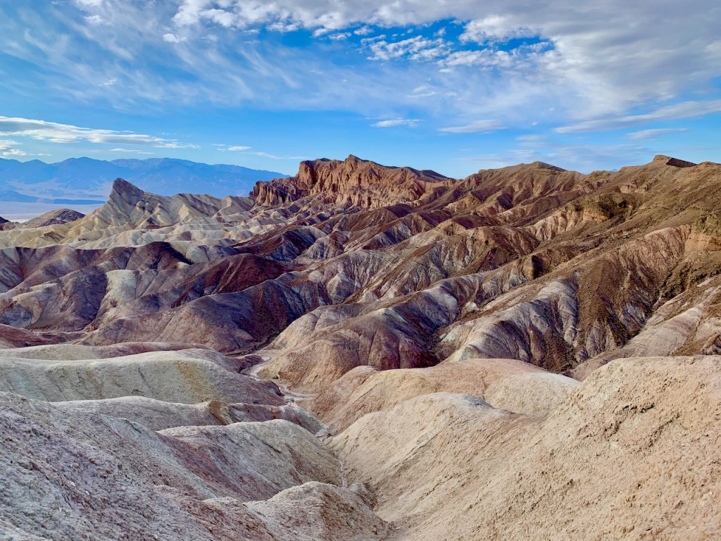
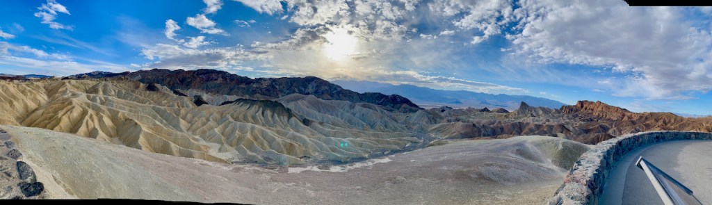
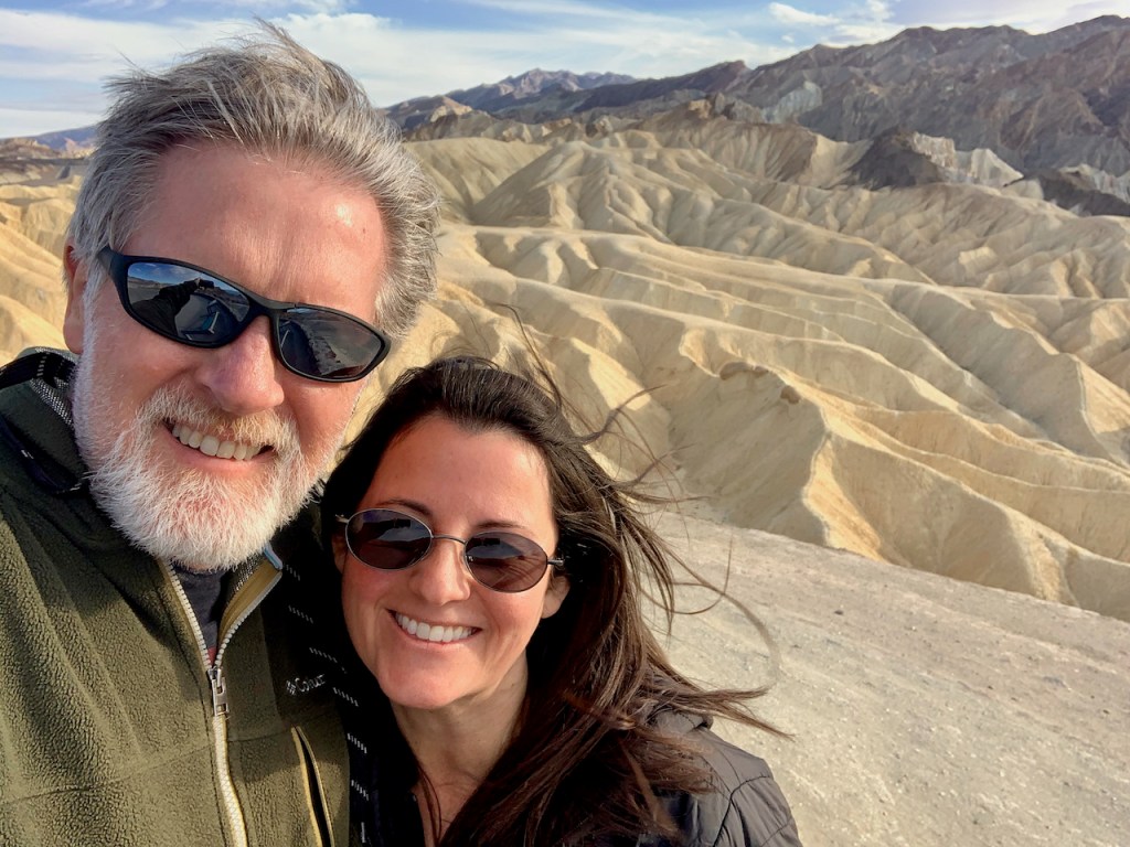
Afterwards we headed to Zabriskie Point and took some pictures. It was quite a windy day, so we then decided to find camp a little early and drove a bumpy road up Echo Canyon about 3 miles, to an okay spot in the dry wash. It ended up being 4 pm by the time we set up camp and the sun was set by 4:30 pm.
It was a warm night and morning so we got out of bed earlier than normal. As we were leaving camp a Park Ranger drove by. We stopped her and told her about the vandalism we witnessed at the Racetrack. I gave her the pictures and video and she was glad to have this evidence. She said she would keep us updated on the progress of the case.
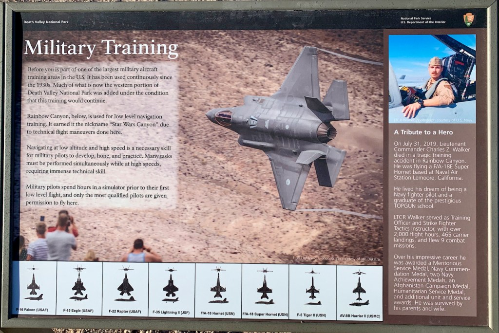
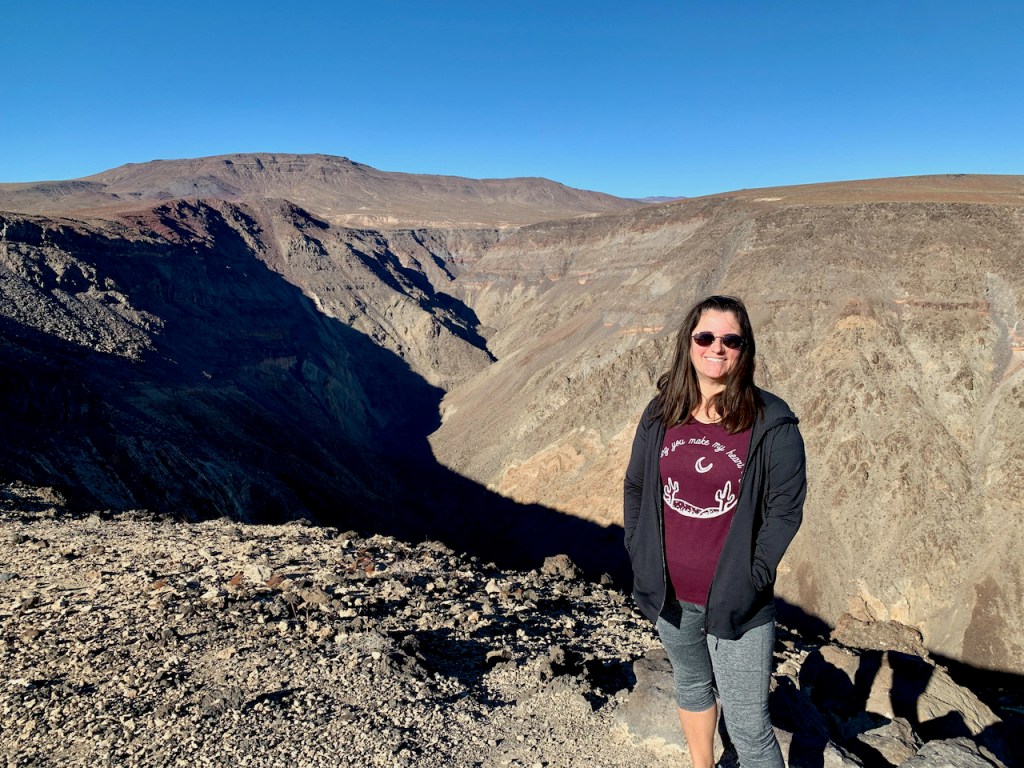
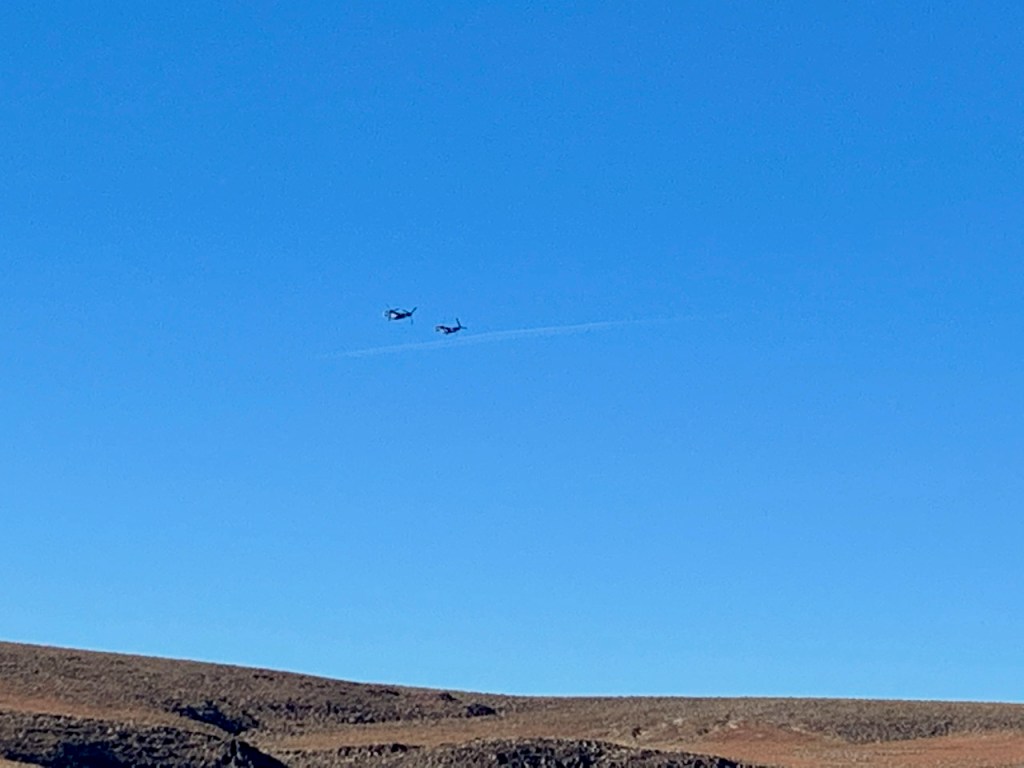
We decided to make it an easy day. We back-tracked to Father Crowley Point. This is an overview above Rainbow Canyon, also known as Star Wars Canyon. This is the canyon that military flights will do their low-level training fights. If you are lucky you can look down on the jets as they weave through the canyon.
We hung out at a private overlook for much of the day, but we were not lucky enough to see a jet. However, at around 3 pm, we were able to see a pair of Osprey aircrafts fly over the canyon wall and down the canyon. Not as good as some of the YouTube videos of “Star Wars Canyon Flights” but it was better than not seeing anything.
We came down the mountain from the overlook at 4 pm and were back in our same camp from the night before by 4:30 pm. We made dinner and watched a movie later in the evening.
Jan 18, 2021
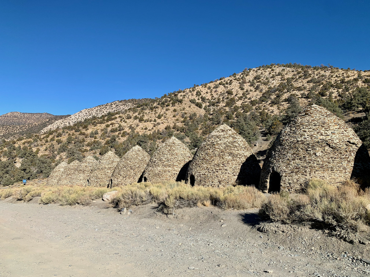
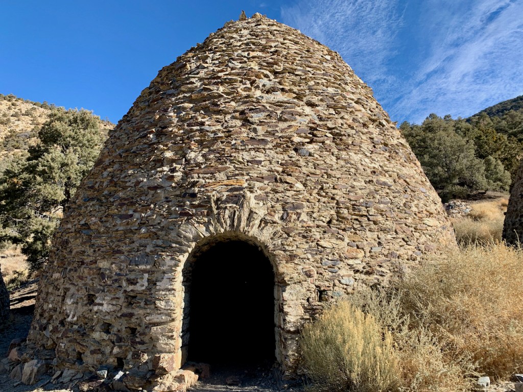
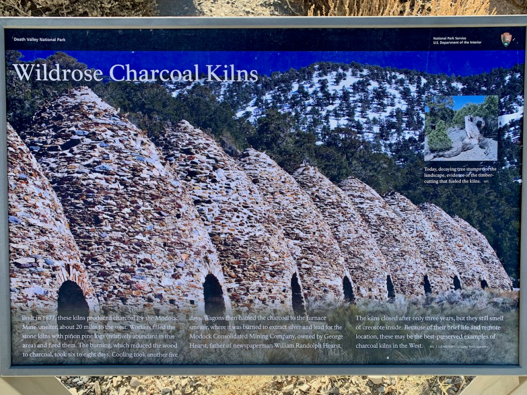
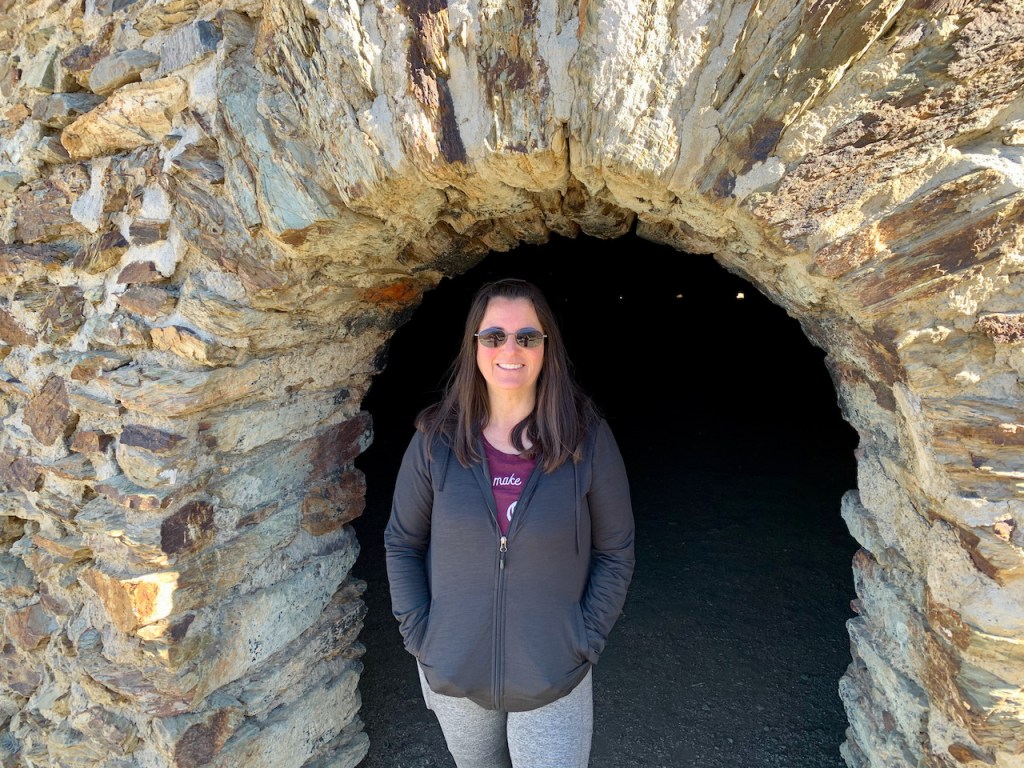
Beehive Charcoal Ovens
In the morning we drove over the mountain to the next valley. We found some water at one of the closed campgrounds and then drove up Emigrant Canyon and then up Wildrose Canyon. In Wildrose Canyon there are 10 charcoal kilns that were build in 1877. They call them beehive ovens, because of the shape. They were excellent condition and we were able to explore then, but it was pretty windy and cold, so we didn’t stay long.
It was a long drive back down the canyons and to the main road. Once on the main road it was a 20 minute drive to Stovepipe Wells Village. We filled up the gas tank with $3.81/gal gas. Most things there were closed, but we did visit the gift shop so Eva could get her national park patch for Death Valley. We stayed there for a few hours as this was the first cell phone access for we’ve had in 5 days. We called the kids, took care of a few bill payments and ate lunch.
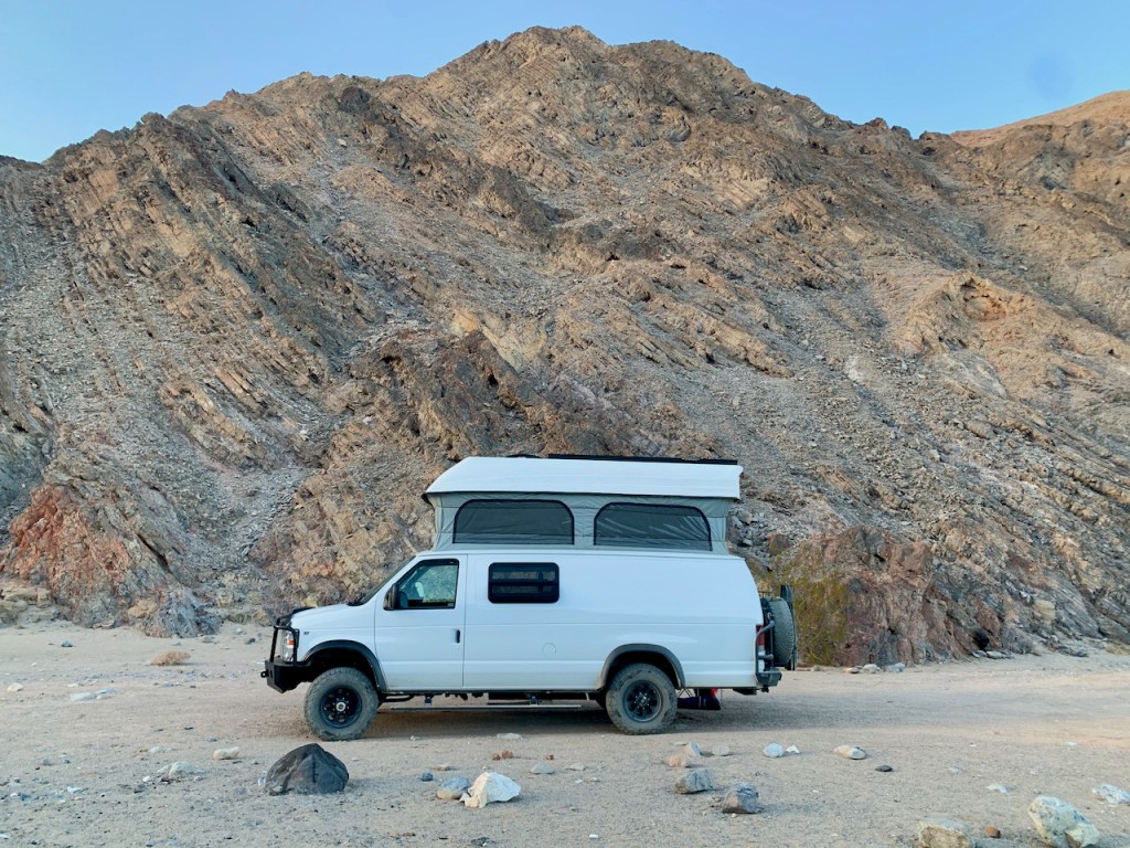
From the village area we drove 10 miles out in the desert to Cottonwood and Marble Canyons to find a camping spot. We found a nice sandy spot next to the cliffs to spend the night. We set up the shower and got cleaned up before cooking dinner. It was pretty calm until it got dark outside. Then the wind kicked up and kept blowing all night. I am glad we were in the van verses being in a tent. We stayed nice and cozy as we ate dinner, read and watched a movie.
Last night we were the only ones in the center of a 100 square mile valley and it was dead quiet. However, a car drove by about 6 am to break the silence.
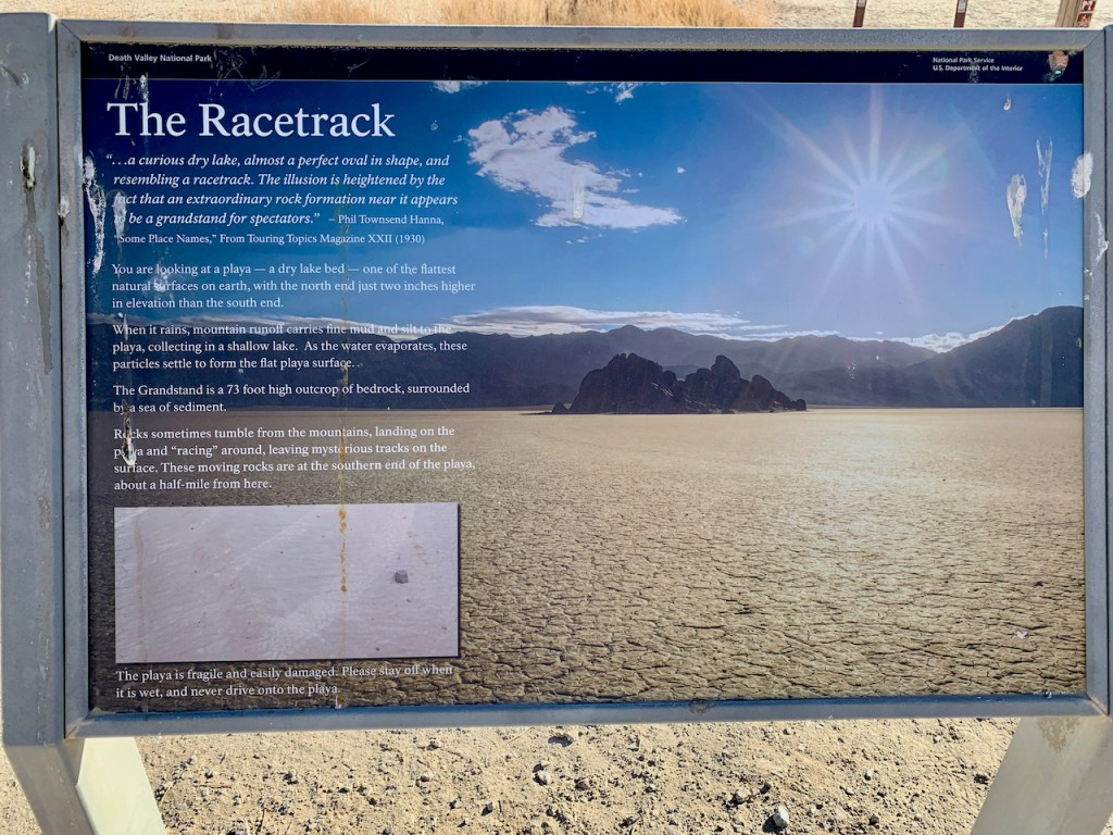
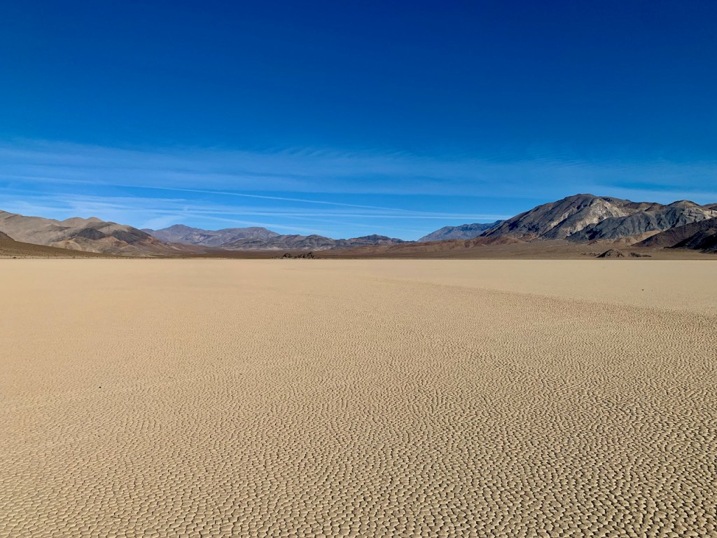
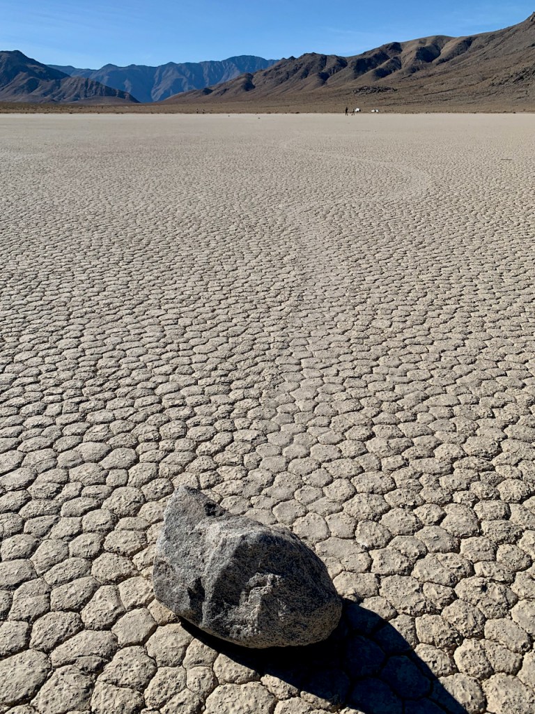
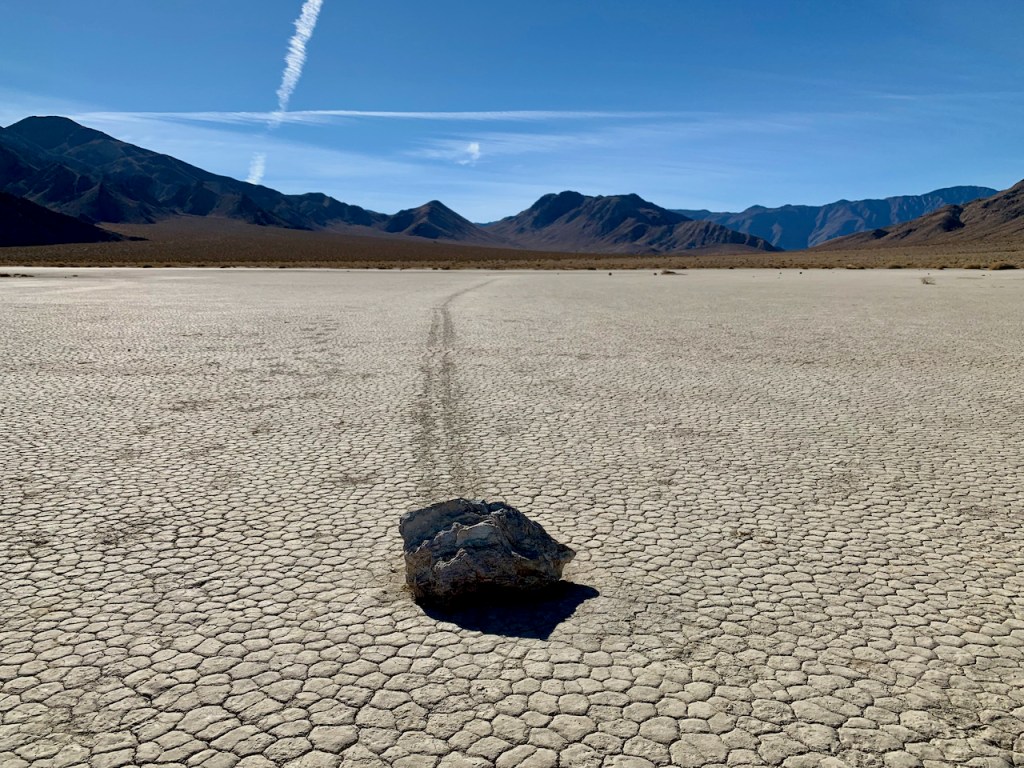
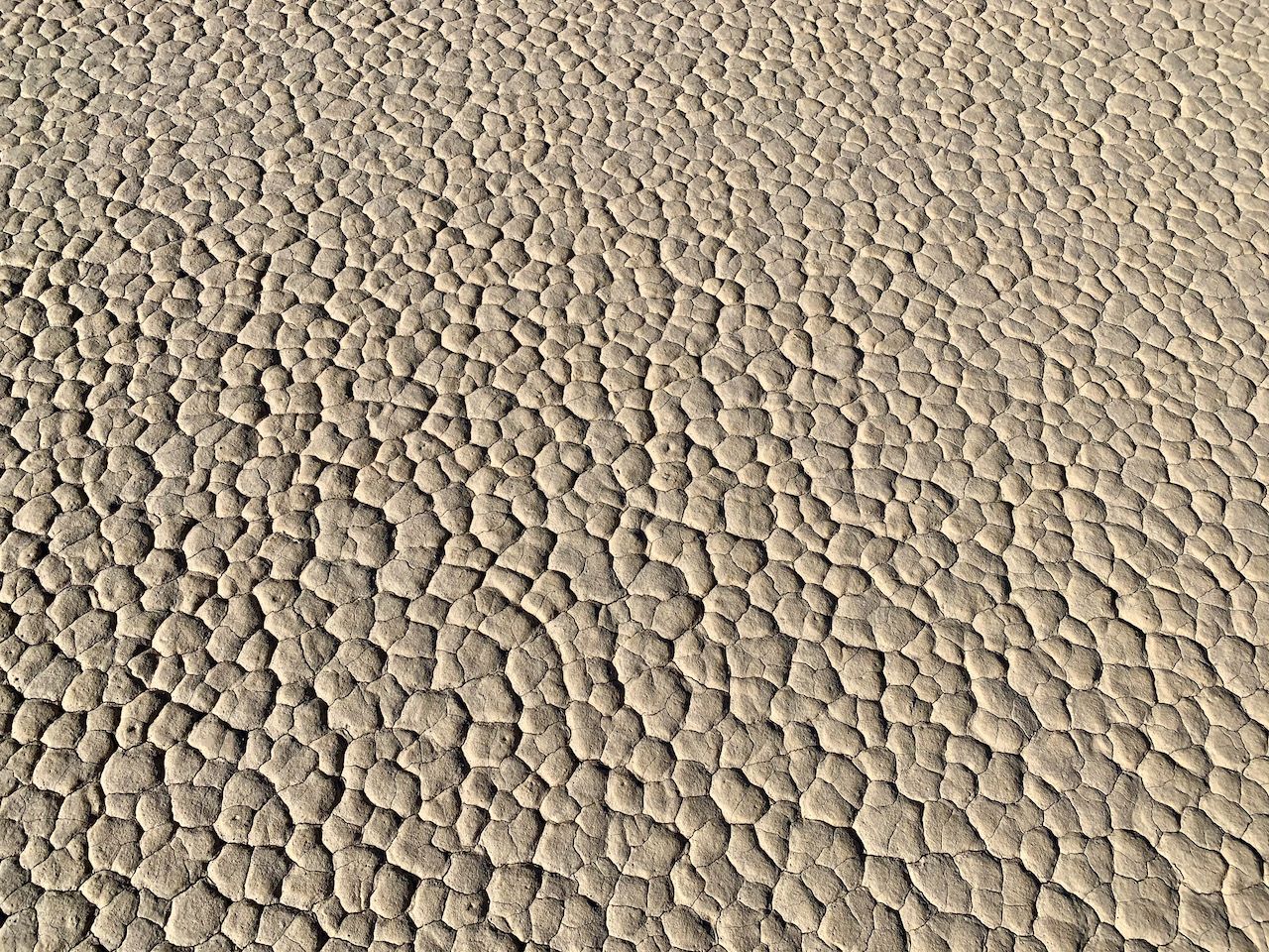
After breakfast we drove from Teakettle Junction to the Racetrack. The Racetrack Playa is an almost perfectly round dry lake bed that resembles a racetrack. It is one of the flattest natural surfaces on earth with the north end only 2 inches higher than the south end, around 3 miles away.
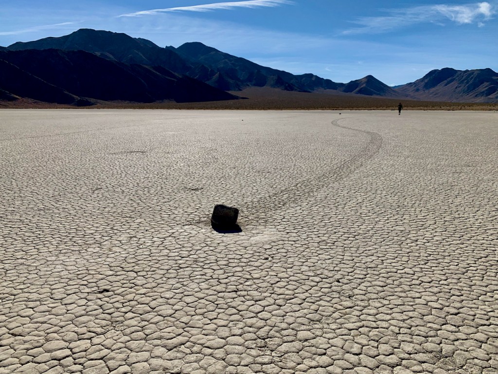
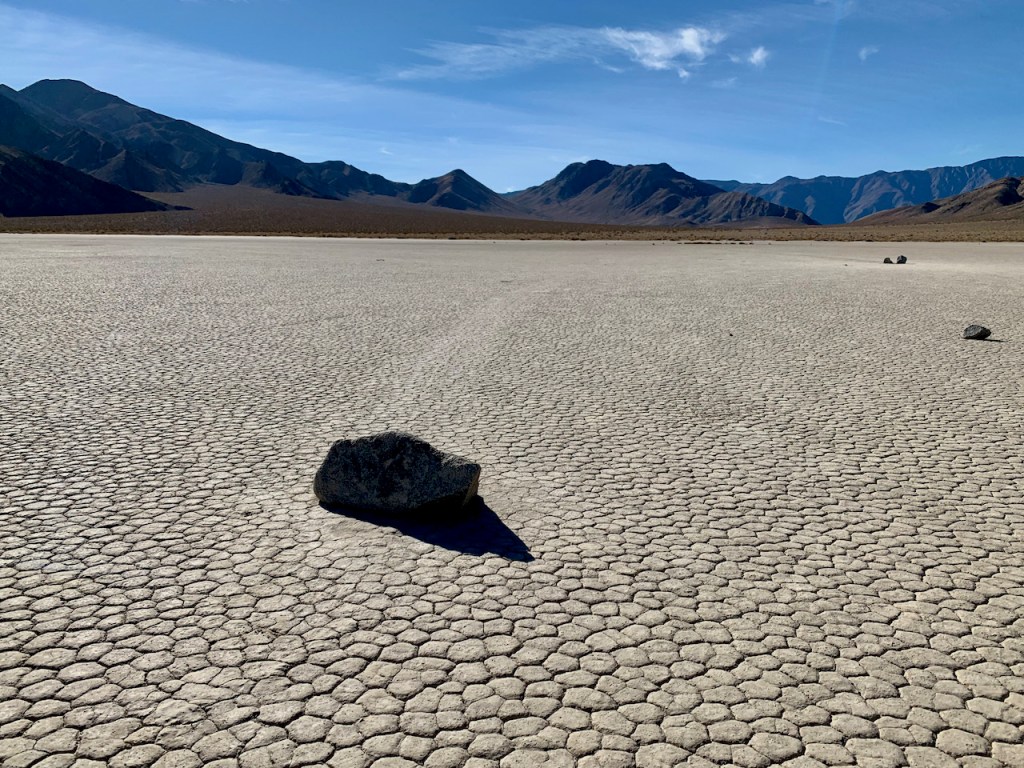
The real reason we came to the Racetrack is to see the magic sliding rocks. I had heard of this place probably 10-15 years ago and wanted to visit here ever since. The south end of the Racetrack has rocks that slide across the playa. The rocks leave distinct weaving trails across the flat lake bed.
There have been many theories on how these rocks move. From magnetic forces, to wind or even aliens. Finally in 2013 and 2014 scientist used instruments to monitor the rocks and learned the truth. At times in the winter there is water in the lake bed. At night the water freezes into a sheet of ice, embedding the rocks. In the day the sun breaks up the ice sheets and the wind will blow the ice and rocks across the flat lake bed. When the ice melts the rocks are left in their new position with the tracks left in the mud. The rocks may not move again for many years until the conditions are right again.
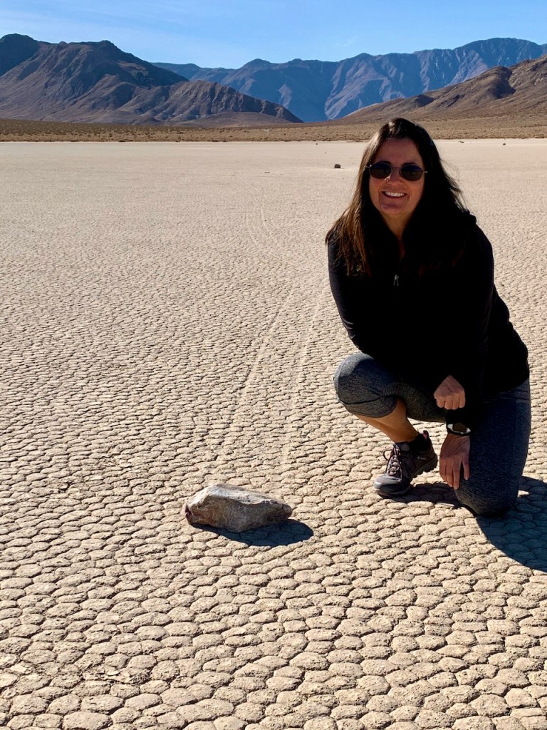
We walked around and took pictures of the magic rocks. It was amazing how flat and hard the lake bed was. It looked like a cobblestone road and the mud seemed as hard as a rock.
There was another group of people there and two of them were chipping of pieces of one of the rocks and digging up the dirt. We didn’t confront them, but I took pictures and videos to give to the Park Service rangers. I also got a picture of their license plates. We never saw any rangers or got cell service the rest of the day, so we will let them know when we get to the Furnace Creek Ranger station.
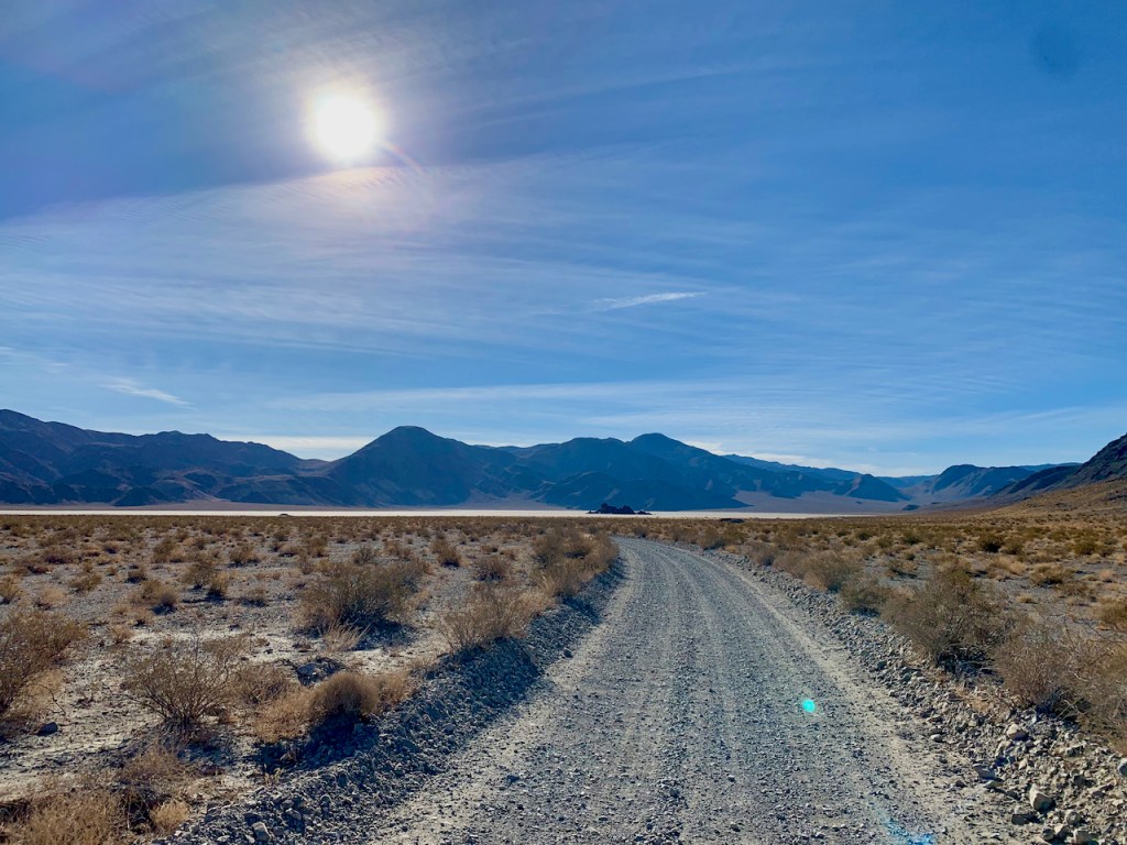
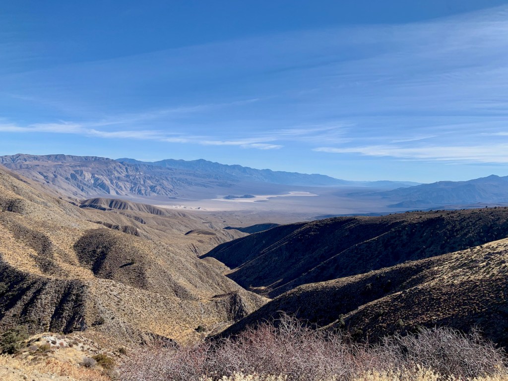
We drove back to Teakettle Junction and turned west on Hidden Valley road to find our way out of this northern part of the park. It was a beautiful ride through canyons and valleys. The trail ends with a steep narrow road across a couple of mountain ranges. There were many switchbacks and steep areas, but the road surface was pretty smooth so it was a fun ride. Once over the mountains we descended into Saline Valley and back to the paved road. Our drive across the northern part of Death Valley was two days long and ~150 miles of driving with only 24 miles that were paved. We saw very few people and we saw a lot of beautiful desert valleys and mountains.
After crossing the national park we were out of the park for a few miles before entering back in on the paved road. We drove down to Panamint Springs and payed $3.86/gal to fill up the gas tank. However, we were in Death Valley in 2012 and the gas was over $6.00/gal.
We found a campsite in the Lake Hill area, just a couple of miles past Panamint Springs. It was just a flat desert area with a few other campers, but no one too close. The sun set just after 4:30 pm, just after we parked and raised the van top. We spent the rest of the evening at camp. Later in the night, after the moon set, we went out and looked at the Milky Way and all the stars. There was no light pollution in the area so the stars were very bright.
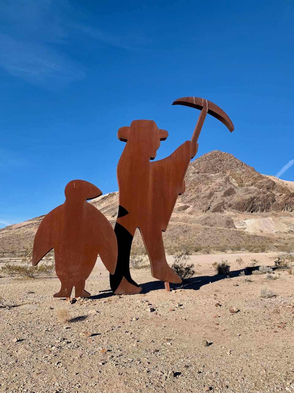
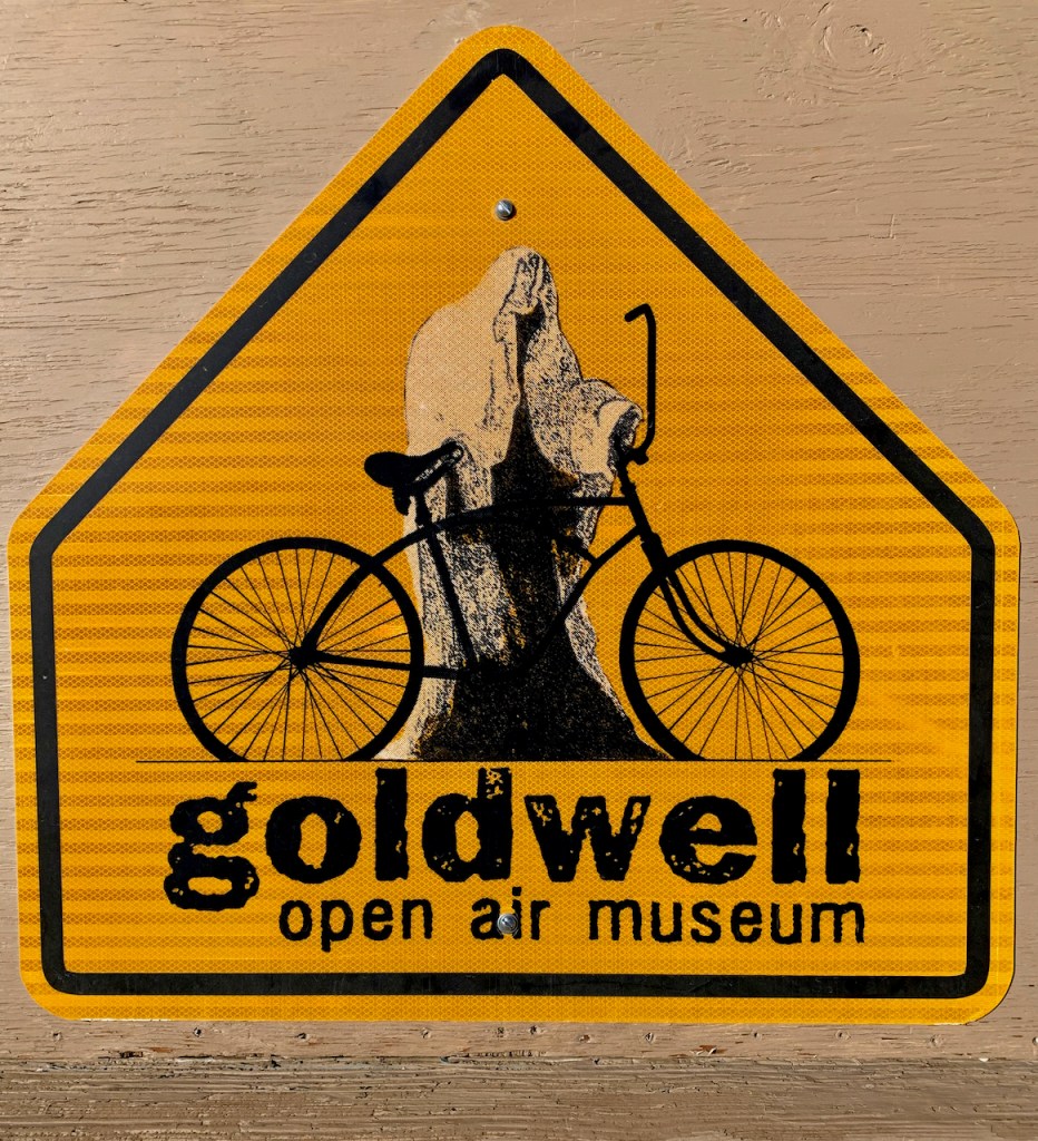
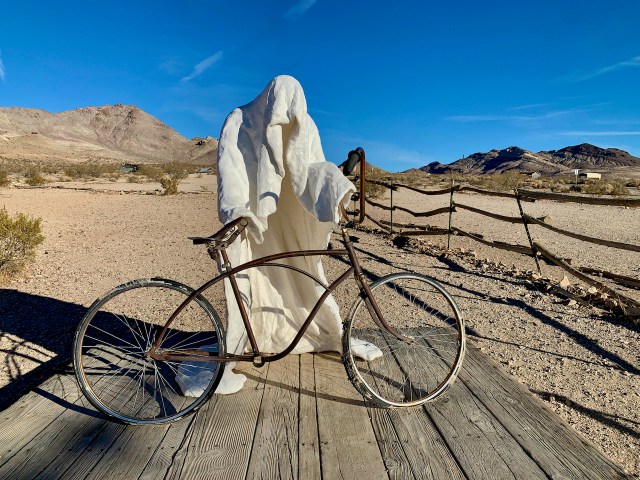
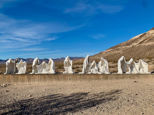
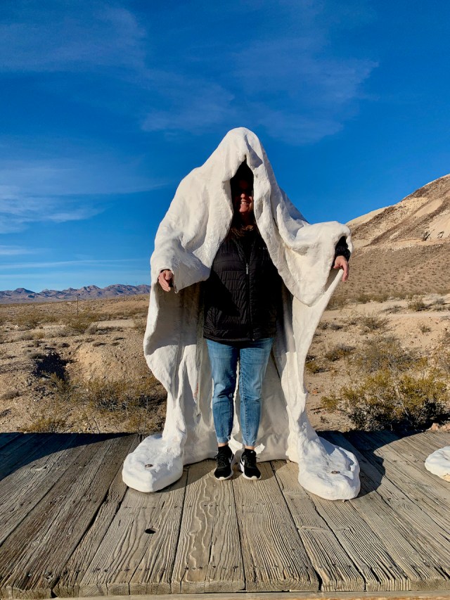
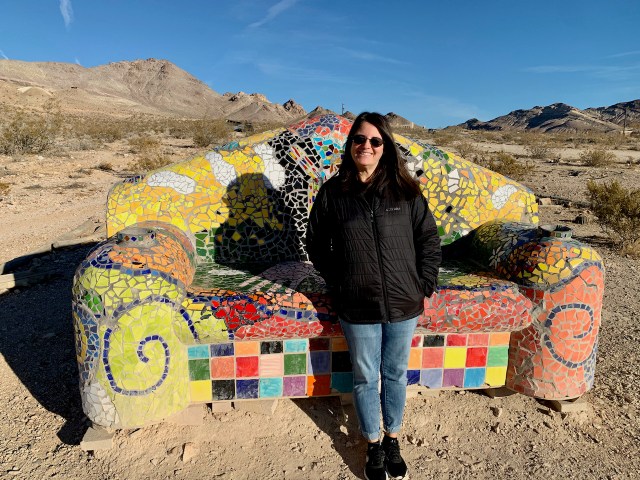
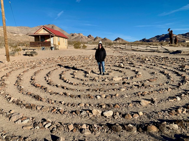
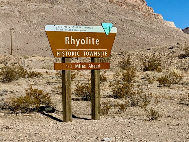
We were up pretty early and left camp a little after 8 am. About 10 miles down the road was the ghost town of Rhyolite, NV. Just before town was the Goldwell Open Air Museum. It contained some interesting displays. We walked around and took a few pictures.
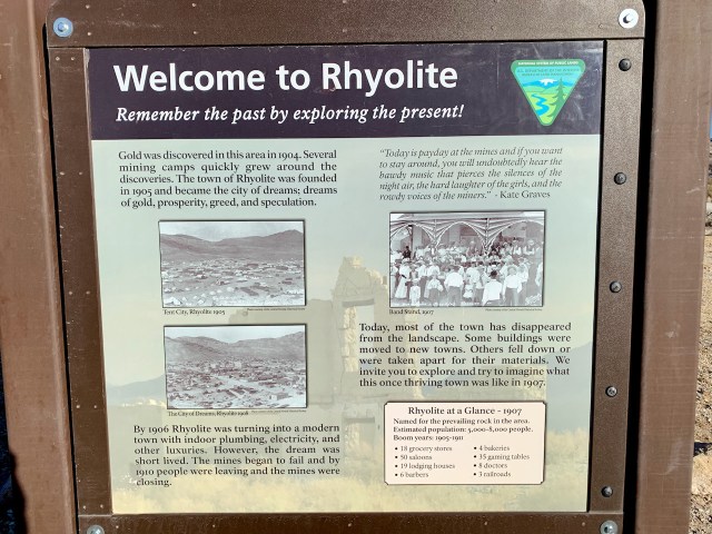
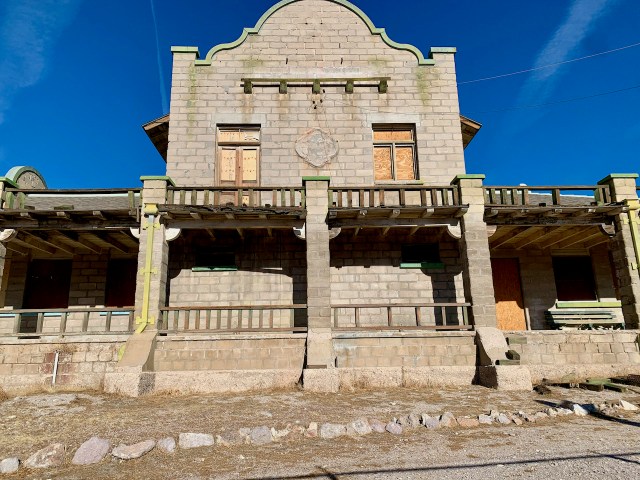
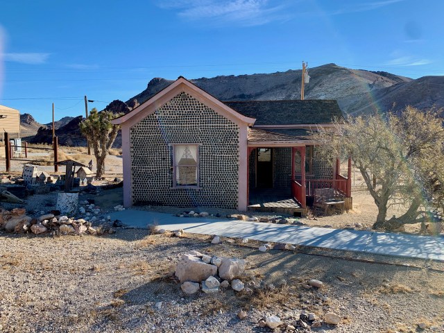
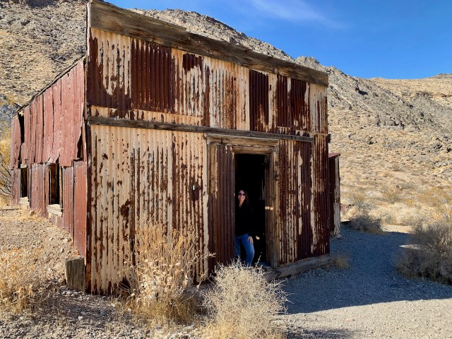
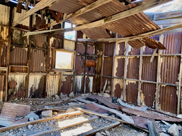
We then continued to Rhyolite. The town was founded in 1904 and by 1908 up to 8,000 people lived there. The mines ran out by 1910 and by 1920 the population was only 14. Today, there are a couple of hosts living in trailers and one house that looks like it was occupied. The government owns much of the area and it is maintained as an archaeology preservation site.
In its heyday, there were two schools, a bank, train depot, 18 grocery stores, 50 saloons, 8 doctors and 4 bakeries. Now there are only a few ruins, with the train depot being preserved the best. We walked around the remaining ruins and took a few pictures. Other than another girl taking pictures, we were alone.
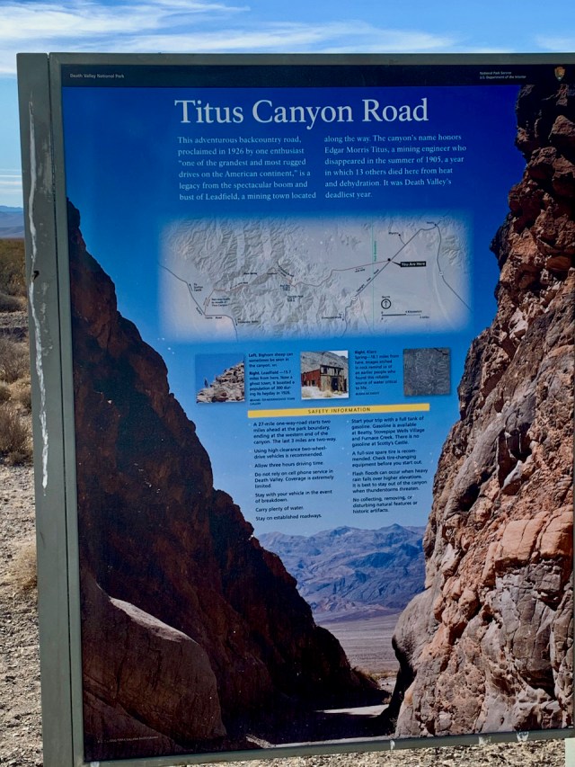
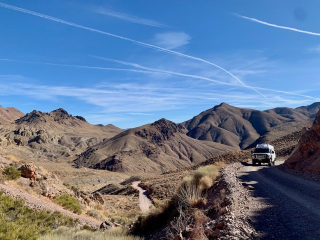
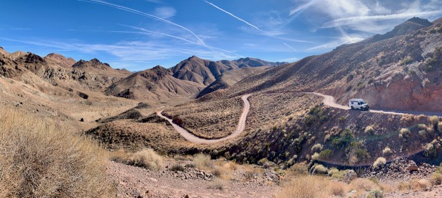
After leaving Rhyolite we started our way into Death Valley National Park. We weren’t entering on the main road, but planned on taking a back country route through Titus Canyon. Titus canyon is a 27 mile track across a mountain range. From the east you climb over one set of mountains into a mountain valley. This part of the trail was steep going up and steep going down. I put the van in 4×4 low, without locking the hubs, to creep down from the top of the mountain pass.
Once down from the mountain pass we entered the ghost town of Leadfield. The town lasted less than a year as the “Jazz Baby” mine got a lot of attention and then allegations of fraud turned it into a ghost town. The post office closed in February 1927 and the town died.
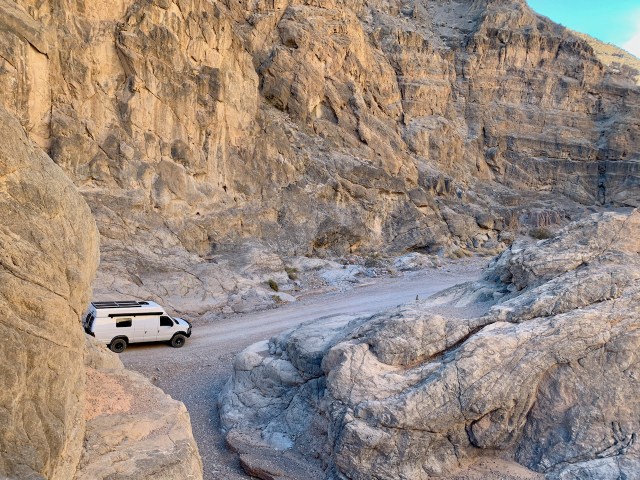
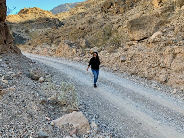
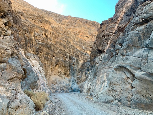
After leaving Leadfield the fun section of the road begins. The road weaves through a narrow canyon and it continued about 7-8 miles down to Death Valley. The last couple of miles is very scenic as the canyon narrows to 20 feet wide, with canyon wall rising over 100 feet.
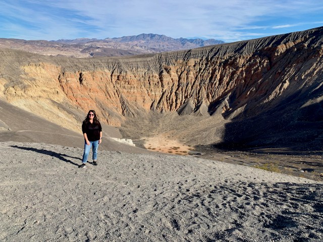
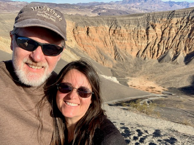
After exiting Titus Canyon we drove north to Ubehebe Crater. This is a volcanic crater that is 1/2 mile wide and 600 feet deep.
Leaving from Ubehebe Crater we were back on the dirt road to the Racetrack. We planned to camp at the only dispersed campsite on this road, about 20 miles from the crater. We had heard that this is the worst wash-boarded road around. I just about didn’t go this route because I hate driving on wash-boarded roads.
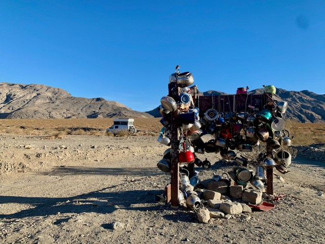
However, they must have just graded the road and it was the best gravel road we have been on. It was a easy 20 mile drive to the campsite at Teakettle Junction. Due to Covid all the campgrounds are closed, but we verified with the park rangers, before hand, that dispersed camping is allowed in the park in the approved areas. Fortunately, the campsite at Teakettle Junction was open and we set up camp for the night.
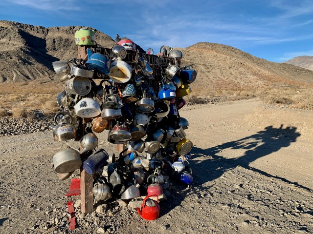
Teakettle Junction has a sign that is covered in teakettles. Apparently, in olden days, a teakettle meant that water was close by. It is now a tradition to hang teakettles on the sign. We considered it a teakettle shopping area and picked up a few free kettles. Not really, but it was interesting to see all the pots that people had left. Most of them were signed and dated. It looks like the rangers clean the sign post off every 2-3 months as no pots were older than November of 2020.
We took showers and enjoyed the beautiful sunset over the desert mountains. There were a couple of vehicles that drove down the road and stopped at the sign, but by 5 pm, the sun was setting and it was real quiet the rest of the night.


You must be logged in to post a comment.