A Trip to Batopilas

May 7, 2021

Today we drove to Batopilas, a small town at the bottom of Copper Canyon. It was 140 km, or about 88 miles, but it took almost 5 hours to make the drive. We drove through many small Tarahumara villages. These villages had a mixture of old and new. We saw farmers using a horse or mule to plow their fields. There were also women filling buckets of water and carrying it on their head up the hill to their home. However, there were some dwellings with nice vehicles parked out front, and many homes had satellite dishes on the roofs.

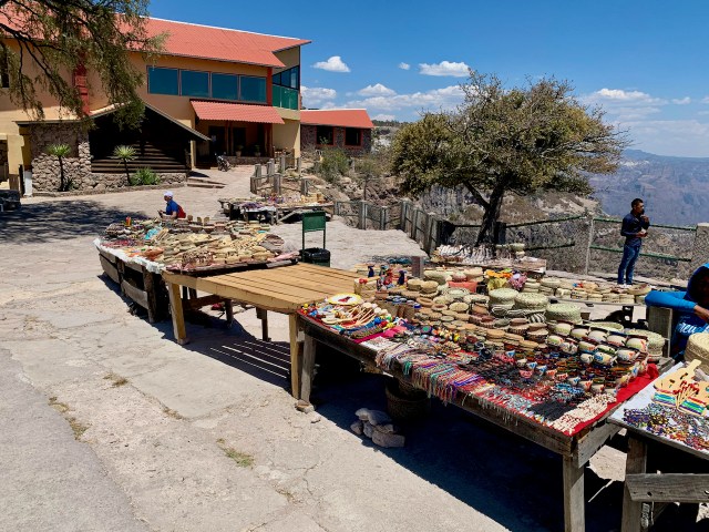
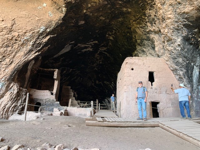
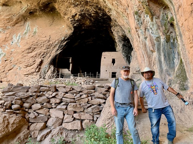
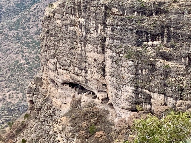
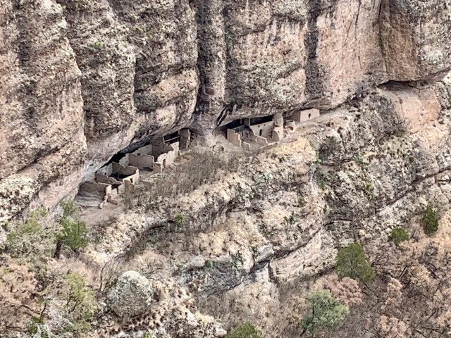
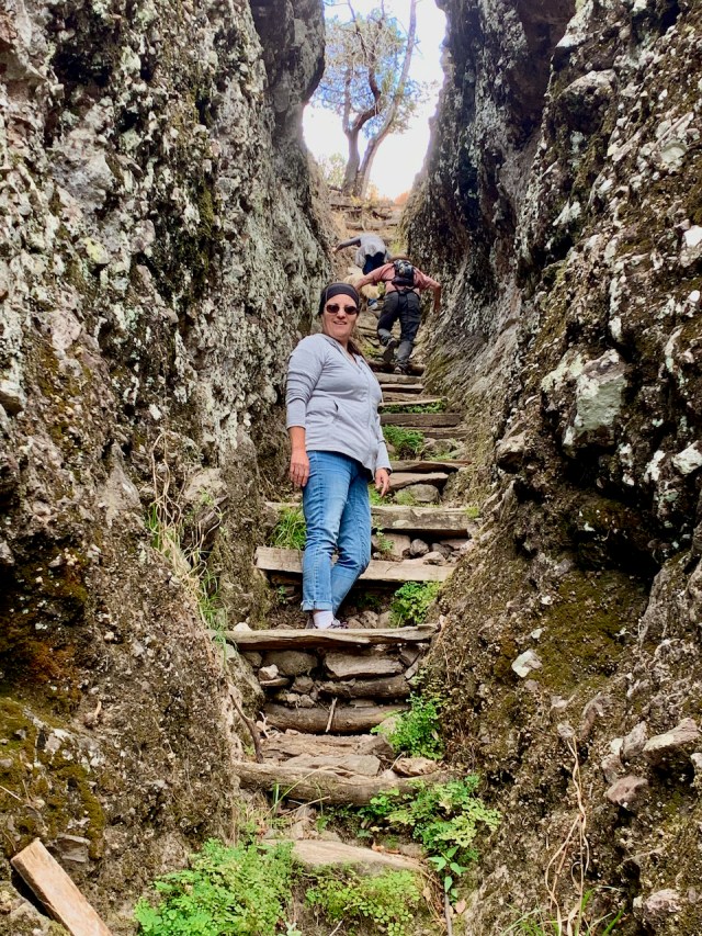
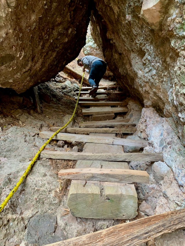
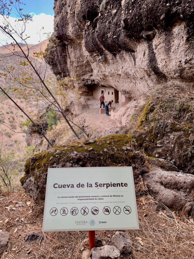
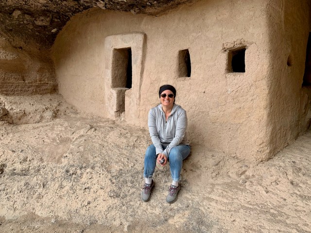
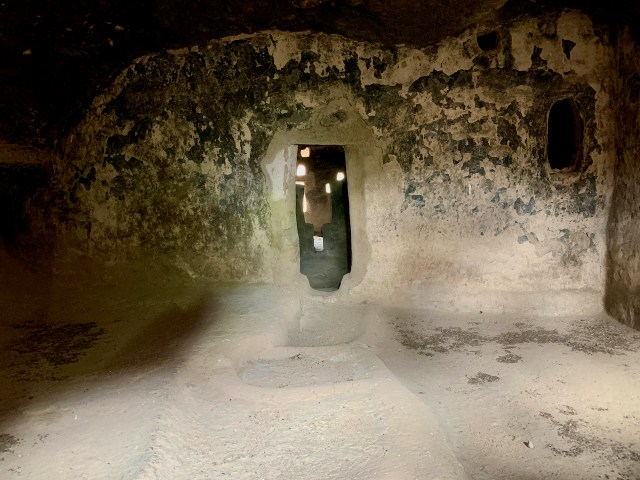
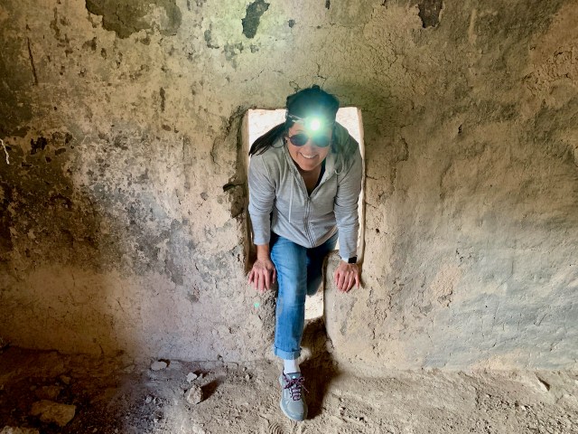
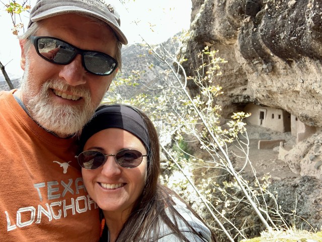
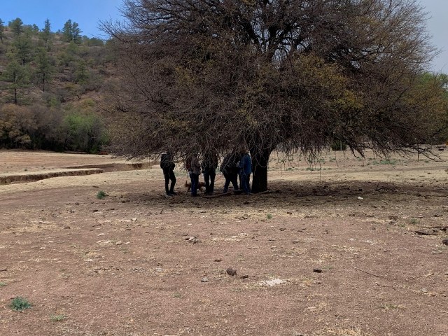
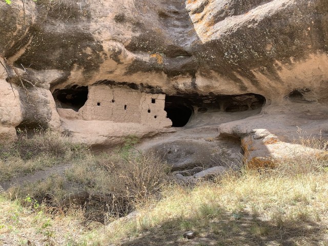
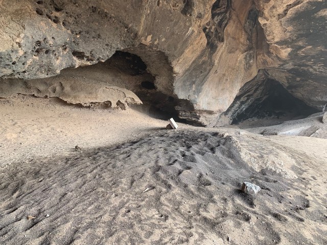
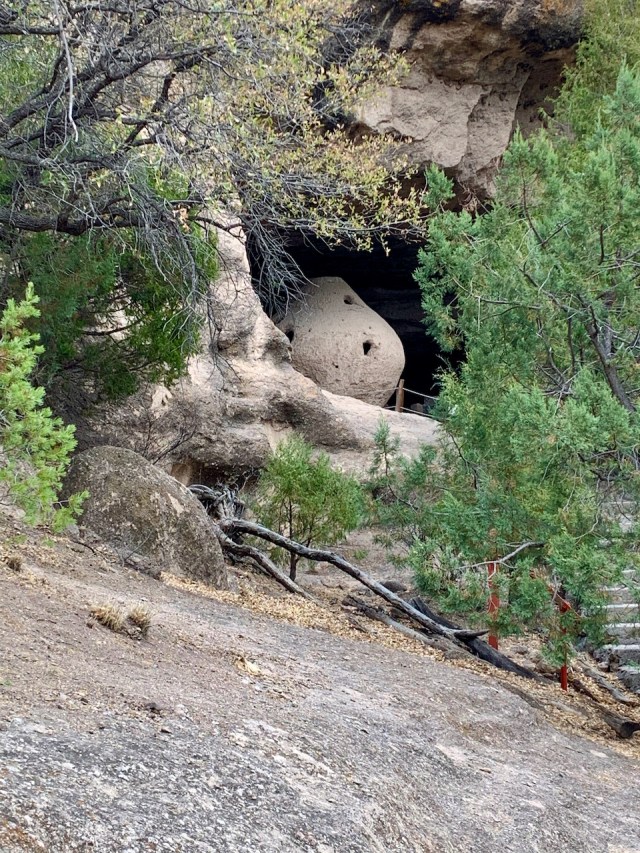
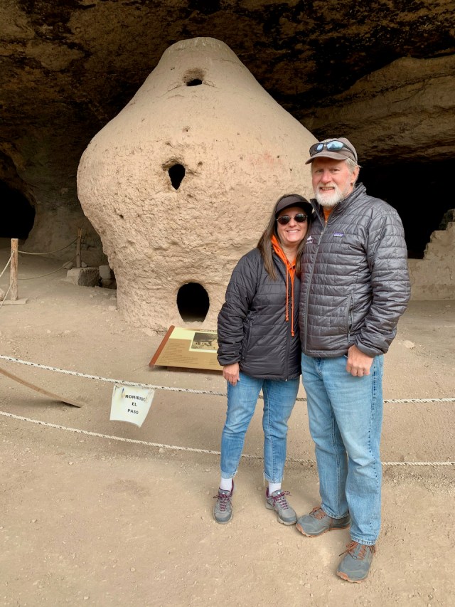
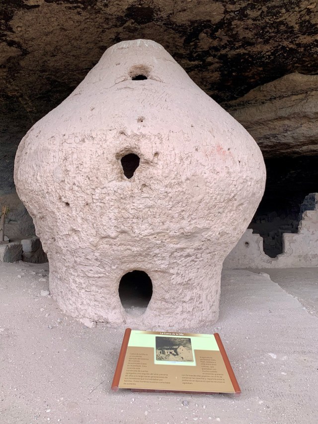
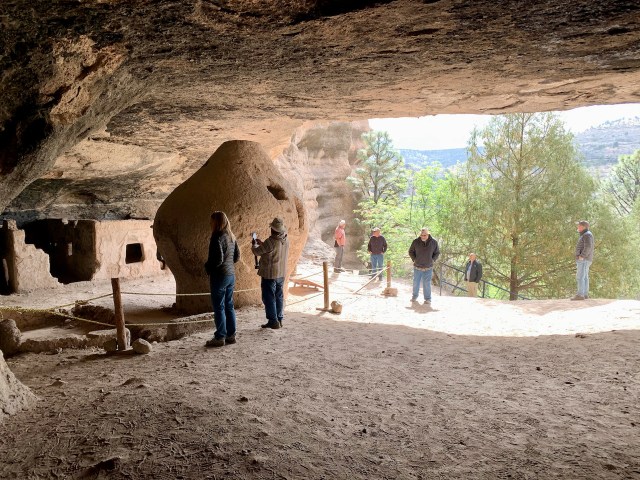
We were able to see cave dwellings, high on the cliffs, that are still used during the summer months by the Tarahumara people. We stopped at a small tiende (store), situated high on a cliff overlooking the river valley. We stopped for a view of the valley, but a young girl, maybe 12-13 years old, scrambled up and opened the store. It appeared that she lived at the store by herself. She had a small garden and an outhouse perched on the edge of the cliff that overlooked the switchbacks below. We bought a couple of baskets and snacks from her and Eva gave her a couple of fruit snacks.

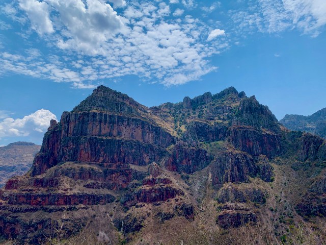
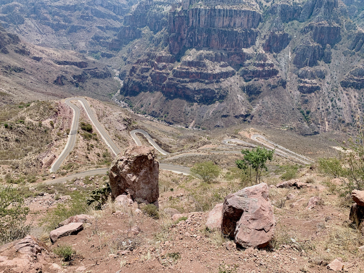
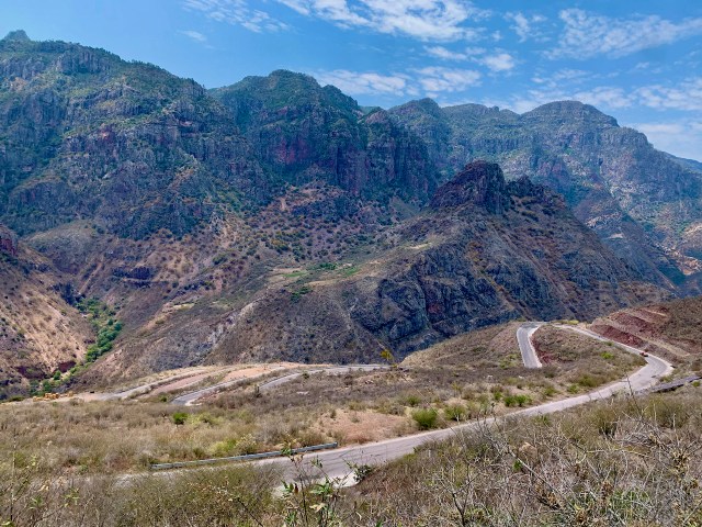
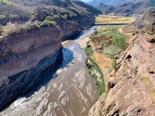
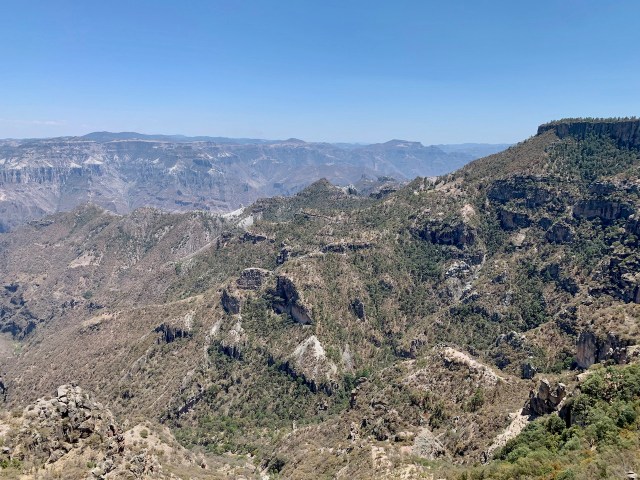
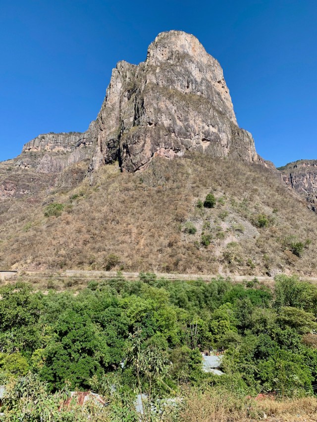
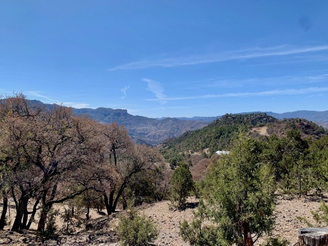
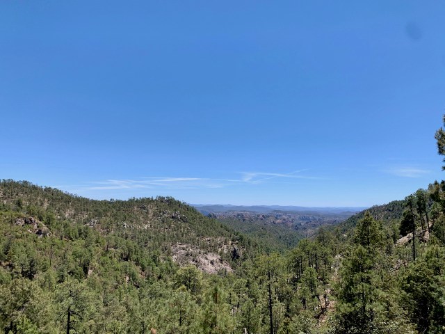
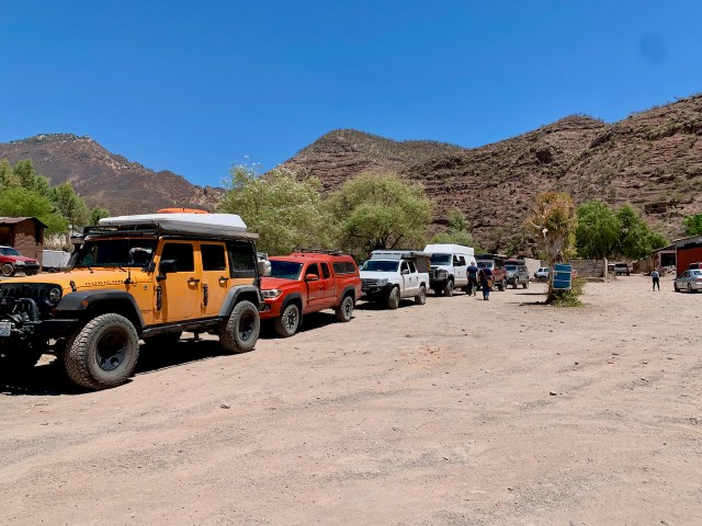
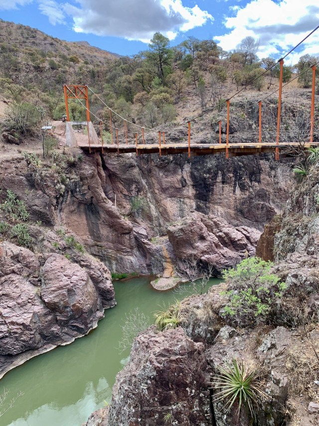
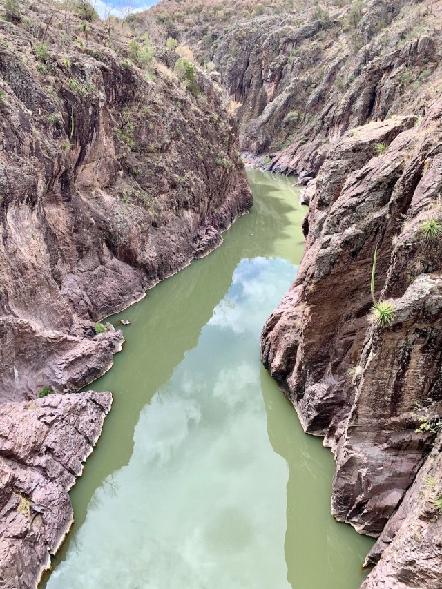
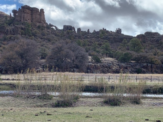
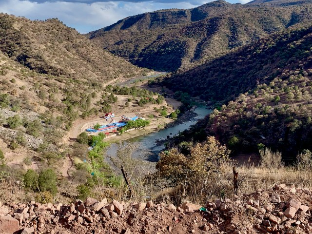
I had seen pictures of the road that descend from the top of the mountain to the river just outside of Batopilas, and was looking forward to the drive. The road was paved, but it has over 100 switchbacks to get you down the steep mountain. It was a beautiful drive that took us from over 6000’ to 3000’ in just a few miles. The views of the surrounding mountains were beautiful, but you had to keep your eyes on the road as you twisted your way down the steep cliff.

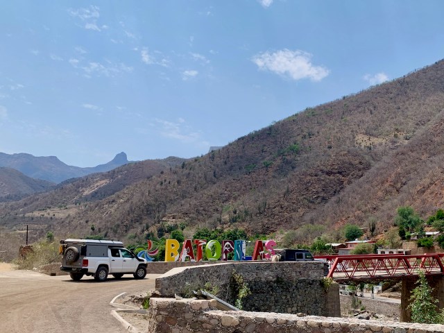
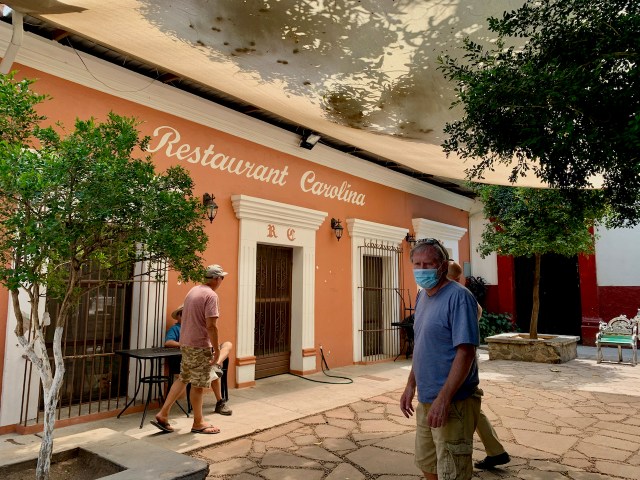
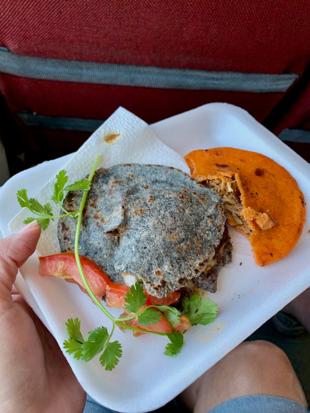
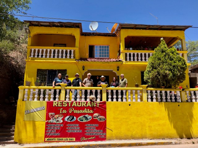
The drive into Batopilas was more challenging than the switchbacks. The roads are small and narrow, and driving a large van kept me looking in the mirrors and stretching my neck to make sure we didn’t hit anything. While coming down the switch backs, a man stopped us and told us about his restaurant in town. He was glad to see tourist and it sounded like a good place to eat. The biggest problem was finding a place to park. We circled through the small streets. Everyone else found a place to park, but with our big van, we finally ended up parking under a bridge, in the dry wash that ran through town. It was close to the restaurant, so we just had to climb our of the wash and walk down the road. Restaurant Carolina was just part of Carolina’s home, but the food was very good. 

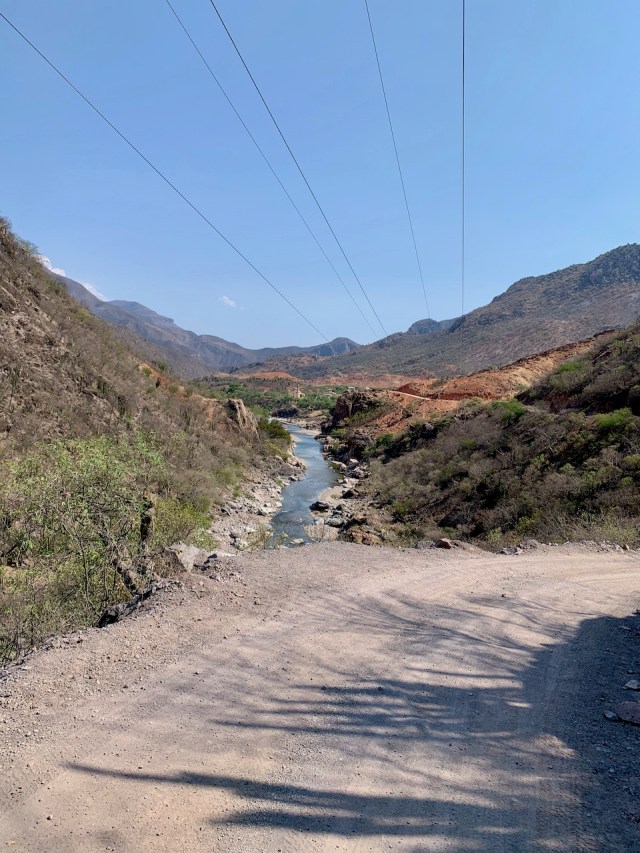
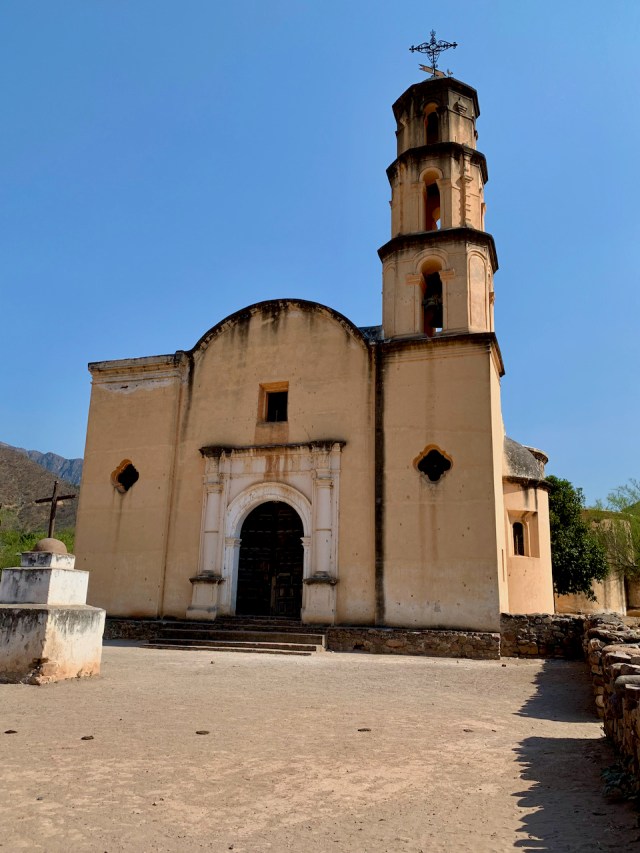
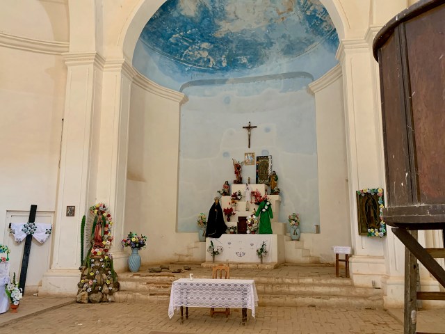
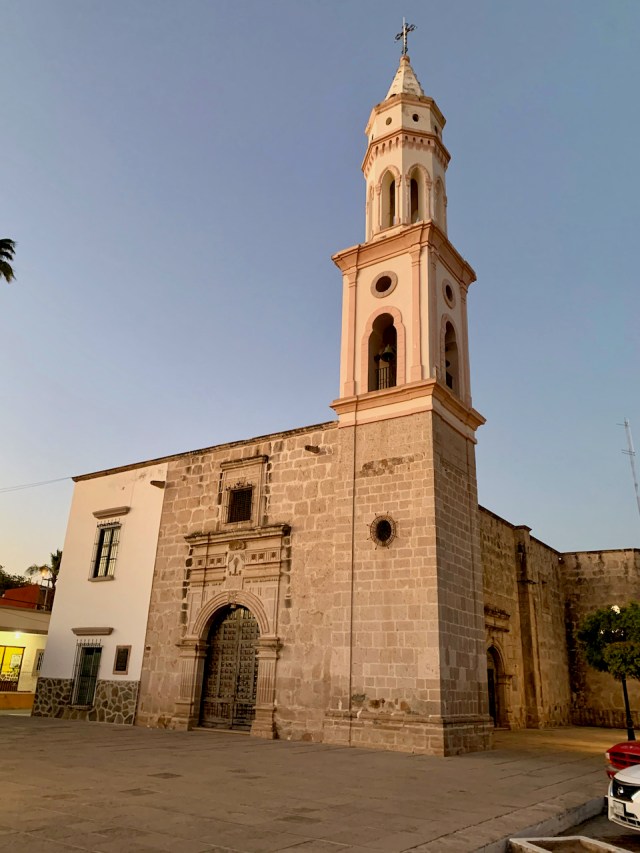
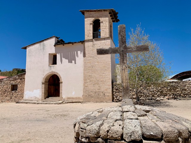
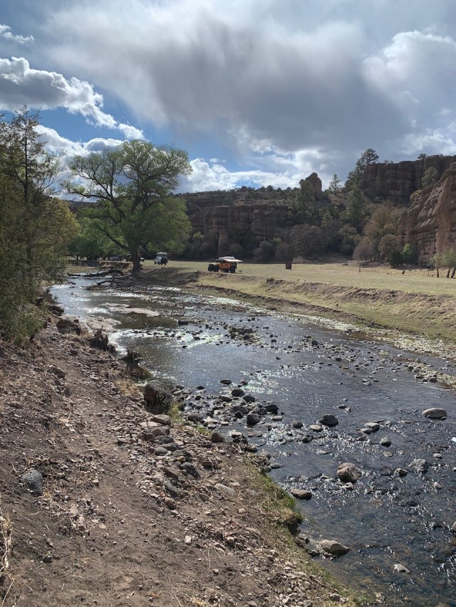
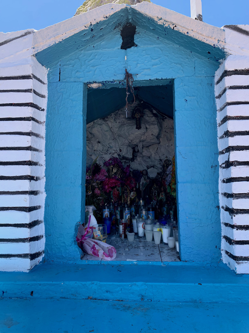
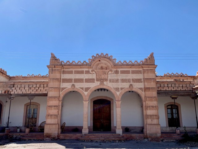
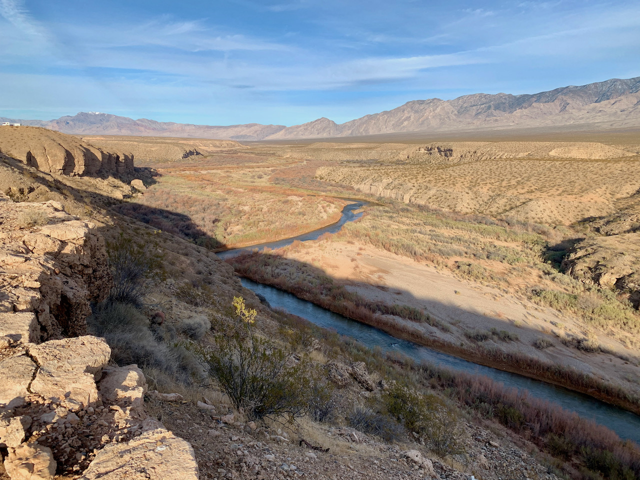
After eating we continued down the dirt road next to the river to Satevo. This was a small town of 500, but was the home to the “Lost Mission”, a catholic church built in the 1600’s. As we parked a man came up with the key and for a small fee, allowed us to enter the church for pictures. It is still an active church, even with the cows that wandered through the grounds.

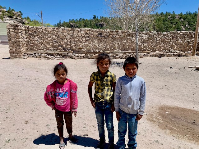
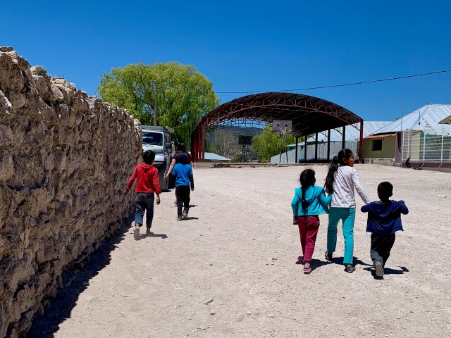
While in Satevo, we met a young lady that Frenchie has know for over 20 years. He met her when she was about 6 years old. She has epilepsy, and he has been able to help her with her medication and even gave her father a ride to get more medication a few years ago. We all donated a little money and she was very grateful. She rode with us in the van to see a potential camping spot and Eva was able to talk to her for a while.

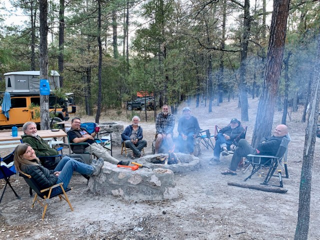
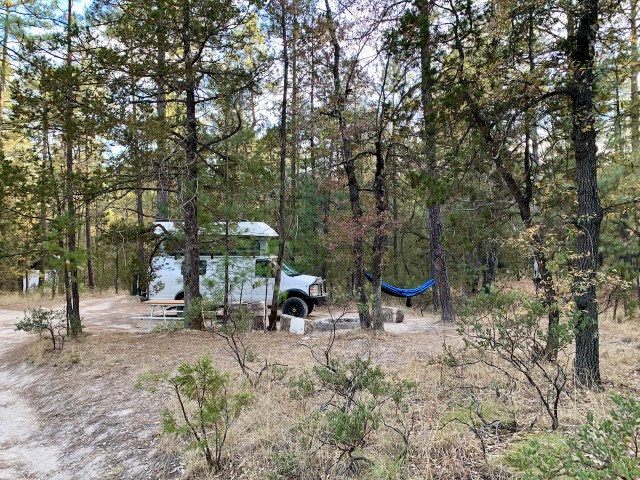
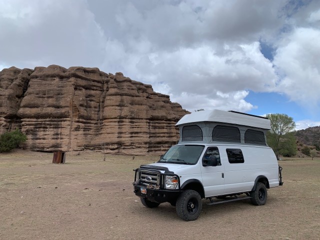
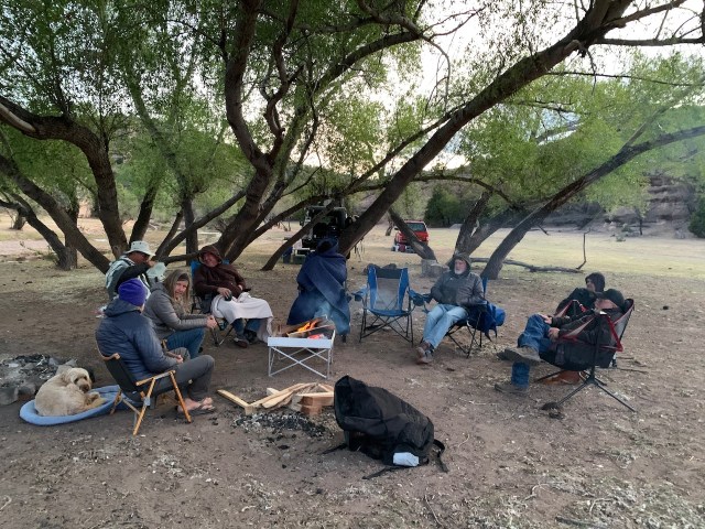
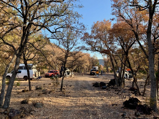
We decided to camp along the river in Batopilas. There was a nice flat sandy spot at the edge of town where the kids were swimming in the river. We all set up and enjoyed the evening. It had become very hot when we descended into the canyon, about 95 degrees, but as the sun went down, it cooled to 85 degrees.

This was the hottest night we have ever spent in the van. We opened all the windows and used the fan to blow on us throughout the night. By morning it had cooled to about 70 degrees. It was also the noisiest night we have had. All night long there were noisy cars, music, frogs, roosters, dogs, people yelling and other noises we could not identify. But once it cooled down, I was able to get some sleep.

Riding El Chepe

May 5, 2021

The adventure today was something we had been looking forward to since we heard of Copper Canyon. El Chepe is one of the most famous train rides in the world. The Chihuahua to Pacific railroad traverses some of the most rugged and scenic country in North America. The tracks run from Chihuahua to the Sea of Cortez near Los Moochis, but the most exciting and beautiful part is from Creel to El Fuerte. This section descends from 8000’ elevation at Creel to near sea level at El Fuerte. The railway clings to the sides of sheer cliffs and descends in gigantic loops and tunnels as it plunges from one canyon wall to the next. The total railway had 37 principle bridges and 87 tunnels between Chihuahua and the sea, with most in the 170 miles section that we rode. This is over 11 miles of tunnel and 2.25 miles of bridge. The railway took 90 years to build and was finished in 1961.

Our adventure would span over two days as we rode El Chepe from Creel to El Fuerte and back. We left Creel at 11 am for the 9 hour ride. We rode the regional train that had many stops at both large towns and small villages. The train would even stop for a single person standing alongside the tracks. We even had to stop for cows on the tracks.

The train’s interior was not in great shape, but not too bad. At least the air conditioning worked well as the temperature rose as we descended the mountains. The train had several vendors selling food and at least 3-4 armed guards (sidearms and AR-15) to protect us from the banditos (drug cartels). There was also a guy that would go from car to car singing a song about El Chepe.

During much of the ride many of us stood on the platforms between the cars. This was the most exciting spot to stand and hang your head out the window to look at the train and the scenery. You had to be careful and watch for limbs and branches that hung close to the train. The rock cliffs and tunnel walls were also only a few feet away as we sped by. A few of the tunnels were over a mile long and we were in total darkness for a few minutes. 

We had a 20 minutes stop at Divisadero where there was a mad rush from the train to the vendor area to get lunch. There were several vendors selling gorditas (small pita sandwiches made from different colored corn tortillas). They cooked the food on 55 gallon barrels with a fire underneath. We hurried to get the food and ate fast, as we didn’t want to miss the train. We worried too much, as there was plenty of time before the whistle blew and the train left the station.

The section of tracks before Temoris was the most fun as the train steeply descended the canyon walls passing through many tunnels and winding through switchbacks to get to the canyon floor where you crossed the river on a sweeping curved bridge.

The final section was a little flatter as we finished the ride into El Fuerte, arriving around 8 pm. Frenchie, Eva and I rode in a taxi, driven by a wanna-be race car driver. I felt lucky that we made it to the hotel alive as he sped the 6 kilometers to town. We stayed at the El Fuerte Hotel, a very nice hotel that appeared to be an old hacienda that had been remodeled into a hotel. The hotel was filled with antiques and had several courtyards with many balconies. We ate dinner at another nice restaurant and since it was such a nice warm evening, we took a walk around the town square before returning to the hotel. 

May 6, 2021

We thought the hotel was great, until we tried to take a shower in the morning. The water temperature was 1-2 steps cooler than lukewarm. I was surprised that Eva went ahead and showered, but it was much shorter that her normal shower. After getting dressed, Eva and I took another walk around the square before taking the same taxi back to the train station. This drive was even quicker, as there was less traffic at 7:30 am.

While waiting for the train we witnessed a cattle drive of about 40-50 head past the train station. We were also being eaten alive by the mosquitoes and no-see-ums. Fortunately the train was only a few minutes late and we quickly boarded for the ride back to Creel.

The return ride was a little calmer as we mostly stayed in the cabin and rested. It was still a 9 hour ride, but it was nice to see the scenery again.

After returning to Creel we picked up our laundry and visited the Tarahumara museum before getting some ice cream at the town square. We later returned to camp to clean things up and relax for the night.

Exploring the Canyons, Cartels and Creel

May 3, 2021

It was another quiet and warm night and both of us had a good night sleep. We left Rancho Lorenzo at 9:00 am with the plan to take the scenic route to Creel. We could of taken the main highway and it would be a 4 hour drive, but we decided to explore a new route that would take us over the mountain and across the canyon to Creel. This route would take 2 days, but we would see the small towns and villages in the canyon.

The drive was another winding drive up and down the mountain peaks, climbing as high as 8800’ in elevation. We passed through many small villages and the scenery was beautiful. Just before noon we arrived at Uruachi, about 35 miles from camp. As we pulled into town, the local police stopped us to discuss why we were in town. We think that someone in a previous town had called ahead to let them know we were coming. 

The police officer was very nice and welcomed us to town, but recommended that we not continue on our trip to Creel. He would not stop us, but suggested for our safety we go back to the main highway for our trip to Creel. He said the area we were headed to contained two competing cartels. There was a risk that we could be mistaken for cartel members, given the rigs that we were driving. He also suggested that we be in town and avoid driving at night.

We continued into town and found the only open restaurant for lunch. At the restaurant Tino talked to the ladies and their recommendation mirrored the police officer’s. During lunch we decided to follow the local’s advice and go back to the main highway for our trip to Creel.

As we left town there were two armed cartel members ensuring that we left town. We waved as we drove by and they waved back. We don’t think that they want to harm us, but there is a risk of mistaken identity, especially at night.

We drove back to the main highway and continued towards Creel. It was another beautiful drive through the forests and mountains and we stopped several times for the beautiful views. We arrived in Creel around 4:30 pm and camped at the old KOA campground. It was empty and we were the only ones camped for the night.

May 4, 2021

Today was mostly an off day as we explored Creel and sat on the shady hotel porch, where some of the group was staying. We did take a short trip to the Tarahumara village of Cusarare. We visited the mission and bought a few baskets from the locals.

Eva was like the Pied Piper as she gave some fruit snacks to a few children, then more showed up and followed her back to the van for more snacks.

We also made a stop at an artisian shop near Lake Arareko and bought a few items. The craftsmanship of the baskets look very nice and it’s hard not to buy something from them since tourism has been down for the last year and they really need the money.

On the way back to Creel we took a side trip to the Valley of the Monks. This is a Tarahumara village that is built among various rock formations. It appears the community is trying to make some money by charging $40 pesos/person ($2.13 USD) to drive through the area. There were some beautiful rock formations, but it was sobering to see how poor the people were and how they lived.

It must have been wash day as we saw several groups at the river washing clothes. The river was mostly dry, so they had to dig a hole in a moist area of the riverbed and wait for the water to fill the hole. This water was then used with a rock to clean the clothes. The clothes were then hung on the barbwire fence to dry.

More Caves and Finally a Shower

April 30, 2021

Our morning adventure was to visit Cueva Grande (The Grand Cave). We were camped about 1/2 mile from the trailhead and it was a short hike down into the canyon where the cave was set into a cliff wall. This cave had several different rooms and extended deep into the cliff. The cave was in a deep shady canyon that had a nice view over the river valley.

From Cueva Grande we drove back down to the river and crossed the creaky old suspension bridge. We took some time for pictures and a video of us crossing, high above the river.

We had a steep climb out of the canyon to another cliff area where there were several more caves. We hiked to the overlooks for Mirador (Lookout) and Nido del Aguila (Eagles Nest). These dwellings were in caves, high on the cliff face with no access.

Our final hike was to Cueva de la Serpiente (Snake Cave). The trail included a semi difficult climb down a crack in the cliff. Eva was hesitant to try it, but in the end she climbed down and back up without a problem. This cave dwelling was my favorite to explore. It was in very good shape and extended through the cliff face to a narrow canyon. This gave the dwelling a back balcony with another fantastic view. The cave is named after the serpentine carving in the floor that winds through the many rooms. It was difficult to see in pictures, but was an interesting feature to the cave. This was my favorite dwelling to explore. It was nice to be in these area, by ourselves, without other tourists.

The hike back wasn’t too bad and after a quick lunch we were back on the dirt trail climbing over mountains and driving through valleys heading towards Madera. As we got closer to town the road was really dusty and was crawling with log trucks traveling to the sawmill.

We found a hotel in town and we were all able to get rooms for $400 pesos (about $22 USD). I was the first to take a shower and ended up with a cold drizzling shower. I later found out that they just turned on the boiler when they saw us pull into the courtyard. Eva waited an hour and had a much warmer drizzling shower. 

We had dinner at a local restaurant as a group. After dinner, Eva and I decide that the beds and linens in the room left a little to be desired, so we raised the top on the van and slept in our own bed. This was a good choice and we had a great night sleep. It was not too cold, and pretty quiet, given that we were in town.

May 1, 2021

We left Madera around 9 am for a day of driving. The highway to Cascada de Bassaseachic was paved, but it climbed up the Sierra Madre mountains and across the plateaus. The road was very winding and we were continually climbing or descending. The portion of the road through the mountains was 81 kilometers, but only ~20 km as a crow flies. The drive from Madera took about 5 hours, but we did stop for lunch on the banks of a small river.

Cascada de Bassaechic is Mexico’s second highest waterfall at 890 ft. The falls define the north end of Barrancas Del Cobre (Copper Canyon). During the high water season, the falls are majestic and there are clouds of mists that fill the valley as the water falls. However, we were here during the dry season, and it had been a very dry winter in this part of Mexico. The falls were just a single strand that seemed to break up and evaporate in the wind. When the wind was calm, the falls reached about halfway down the cliff.

Waterfall during the wet season.

Waterfall that we saw.

Zoom up on waterfall.

Even though the waterfall was small, the views of the canyons were awesome. Eva and I hiked down to a lower viewpoint that put us near the level of the falls and gave us a better look.

After visiting the falls, we drove back down the canyon about a mile to the campground at Rancho San Lorenzo. This is a beautiful ranch in the woods and rocks owned by Fernado. Frenchie has been camping here for years and knows Fernando quite well. Fernando stopped by and told us stories of owning this ranch and about the area. He was very happy to have us there and mentioned that tourism is picking up slowly, after being stopped by the pandemic. Rancho Lorenzo is a little expensive at $20 USD/night, they do have a nice camping area with bathrooms and showers. 

We plan to stay two nights at this campground and have a day off for Sunday. 

May 2, 2021

We all slept in late and had a leisure morning eating breakfast and sitting around camp. Several of us took a short hike from the campground to the Arroyo del Durazno (Peach River). Later in the day we all took showers. They have a continuous hot water system so there was enough hot water for everyone, except me. About halfway through my shower, the heater ran out of propane and I ended my shower with a cold rinse.

“When will you ever be on this trail again?”

April 28, 2021

After we ate breakfast we spent some time talking to Lupe and Dora in their rustic cabin. The morning was stormy and alternated between rain/hail/snow and wind. Around 9:30 am Lupe offered to take us to see the 4 arches on the mountains just north of El Willy. He rode in the van with Eva and I and guided us through the ranchos to a gate. This gate took us to a rancho that was owned by a guy from Chicago, but managed by a local rancher. From the gate it was 2-3 miles of rough narrow road with a couple of difficult spots, but we were able to make it through without too much difficulty. We were able to park at the old ranch headquarters.

Lupe said it was a short walk to see the arches and he was correct. We walked a quarter mile to the pastures where we could see the arches across the river and up high on the mountain ridgeline. We took a few pictures and Lupe crossed the fence and started walking across the fields to the river. He convinced us all that we should hike to the arches. He had never been this way, but climbed to the arch by taking horses through the river from El Willy.

About halfway across the field the wind kicked up and the rain came down. No one was prepared because we were expecting a short walk to view the arches. We ran back to a tree to huddle under while storm alternated between rain and hail.

It only lasted 10 minutes, and we were all standing there debating to whether to forget the hike and get back to the cars before it rained again. But Lupe continued across the field towards the arch. He turned and said “When will you ever be on this trail again?” We all agreed that we would never be back so we continued on the hike. 

The next obstacle was crossing the river. It was only ankle deep, but 20-25’ across. Most of us took off our shoes and waded across. The rest tried to get across on a log and rocks, but in the end, everyone got wet. Once we crossed the river it was a climb up the mountain. We were looking for a path to see the arches and also it look like a few caves in the cliff. It was quite a climb up the mountain that was covered with slick shale and loose dirt. It took us 1-1/2 hours to work our way up the hillside and around a cliff until we were below the arches. It was close enough for us and we took pictures and enjoyed the view of the four arches and the valley below. It was a quicker hike back down and across the river. The entire trip took about 2 hours 45 minutes. We were all glad we listened to Lupe.

Once back to El Willy, we left town and drove south a few miles to the “Valley of the Caves”. It cost $150 pesos ($8 usd) to enter, but only another $50 pesos ($2.14) to camp. It was a tight and winding road down to the valley, but once we entered the river valley, there was a broad grassy area next to the river to camp. We set up camp and ate a late lunch.

This valley contains several caves that were formed in the compressed ash layers left by volcanic action. The oldest caves have shown occupation from back to 5500 BC. Other caves were dated back to 950-1060 AD. From the valley you could see several caves a couple of hundred feet up the cliff.

Later in the day we walked to the Cueva de la Golondrina (Swallow Cave). This cave had several ruins of the rooms and walls that were built in the cave. This was a large cave that could have housed several family groups.

After exploring Swallow Cave, Jeff, Wendy and I crossed the river and climbed up the cliffs to the other 5 caves that were high above the river valley. These were the older dwellings that were difficult to get to, but had beautiful views of the valley. One interesting cave had a keyhole entrance that made it unique.

April 29, 2021

First thing in the morning we drove to the main cave of the park. Cueva de la Olla is unique due to a large olla (pot) shaped grainary that dominates the entrance of the cave. The cave also includes many rooms and walls that made up the ancient dwellings. The cave was high on the cliff, but the walk up the rocks was not too difficult.

We stayed in the park until 10 am, when the gates were opened and we could exit. We spent a full day of driving south from the El Willy area, south to Madera, mostly on dirt roads. The dirt road took us through thick forests as we crossed several mountain ranges. There was very little traffic between El Willy and El Largo. We stopped at a small town named Colonia Hernandez and visited a tienda, which are small stores that people usually run out of a room in their house. We like to spend some money in these small towns. Covid has taken a large toll on these small towns and people have been glad to see us come through. It took about 3-1/2 hours to reach El Largo where we had lunch at a local restaurant. 

In El Largo we were able to get phone reception, so Eva called the kids to make sure they were all okay. After eating lunch we continued south towards Madera. The road was paved all the way, so it was an easy 45 mile drive. Our plan was to spend the night at the hot springs, about 20 miles outside of Madera. Before leaving town we learned that the hot springs were closed, but we could camp on the river near the springs. They have overflow pipes from the pools that feed the river and it would be nice to soak under those pipes. There were also several caves in the area that we could explore.

The drive from Madera was a bumpy dirt road with many switchbacks going up one side of the mountain and down the other side. It took 2 hours to drive the 20 miles to the hot springs. We arrived and found the gate was locked that kept us from reaching the river and a good camping spot. We all waited while Frenchie explored further up the canyon towards Cueva Grande. After a half hour he radioed back that he had found a spot near the cave parking area, so we all drove a few more miles to a very nice spot in the woods. To get to the cave we had to cross an old suspension bridge. It’s carries the logging trucks so we assumed it was safe, but it made a lot of noise as we crossed it. It was a warm and quiet night.

The Pottery of Mata Ortiz

April 27, 2021

The night was not calm. The wind blew pretty much all night. There were also some big gusts of wind that blew through the night. The only thing good about the wind, is while the wind blew, the dogs and roosters were quiet. About 3:30 am, everyone else came out of their rooms to move their rigs from under the trees to the open parking lot. We didn’t move at that point because we were parked next to a building and not directly under the trees. But around 5:30 am, there were several huge gusts of wind, so I decide to get out of bed and back our van about 50 feet into the open parking lot. After that, I just got dressed and tried to nap in the van seat.

At this point, we have our entire expedition team together. Frenchie, our leader, lives in New Mexico and has been traveling to Mexico his entire life. He also lead last year’s Baja trip. Tino, from California and Jeff and Wendy, who live in their RV, where part of the Baja group. We also have Gus, who is from California, but now lives in Mexico. We also have Chris who lives in Arkansas and JC, who lives near Bisbee, AZ. This gives us seven vehicles in our group. This seems like the perfect size for the expedition.

We had a great breakfast at the hotel. They served fresh tortillas, huevos, frijoles, papas and fruitas. The first activity for the day was a pottery demonstration from the Rosa Loya family. They live just over the fence from the hotel and Frenchie has known them for years.

Mata Ortiz is known around the world as the a center for pottery in the style of the ancient Mogollon pots found at the ruins in Casas Grandes. In 1976 an anthropologist worked with a local artist to create the pottery industry in Mata Ortiz. Today, many families in Mata Ortiz create pottery that is sold world-wide. The quality is quite high and prices at the US galleries can be 3 times the cost of buying it in town from the families.

We had our demonstration from the Rosa Loya family. Most of the artist specialize in just one portion of the pottery process, from mining the clay and preparing the raw materials, to creating the pots (ollas) or painting the designs. Rosa’s family does the entire process. Her son-in-law showed how he makes the thin walled ollas while Rosa demonstrated the painting of the unique designs. The designs are so delicate, that she uses a home-made brush made with a Bic pen and three hairs from her granddaughter neckline. 

The designs are unique and are painted with “slip” made from different clay’s to get the appropriate color. After the ollas are formed and shaped, they are sanded and painted. Next the ollas are polished using a hard stone with soap used as a lubricant which seals in the color. The final step is to fire the ollas. If everything is not perfect, the pot may crack or even explode in the firing process. Upon firing the ollas and the painted design will change colors to give the ollas the final look.

They were very gracious in sharing their home and the process they use to make the pots. Eva wanted to buy the matrimony pot, but they did not have one completed. So, Rosa will paint the custom design, that Eva chose, and have the pot ready for us when we return through Mata Oritz in 3-4 weeks from now. The matrimony pots are unique with two spouts to signify marriage.

After our time with Rosa and her family we loaded up and drove back to Casas Grandes for gas and to visit the Paquime ruins. However, the ruins were closed, so we will visit them on the way back through the area. We were able to get gas and then started our drive south, into the mountains. We drove 40-50 miles to El Willy to camp for the night. El Willy is named after the Williams Ranch, that was started by a Mormon rancher in the late 1800s. There are only 32 families in the village, so it is quite small.

We stayed at a campground ran by Lupe and Dora, Americans from El Paso, that built the lodge and campground on the land were Dora was born. We also met Randall and Susan, who live in Tuscon, but have a home in Mata Ortiz. They are on their 205th trip to this part of Mexico. They are very informed on the history of this area and the Mexican Revolution. Randall has written a book that talks about the pottery, the settlement of the Mormon communities and the revolution. They spent some time telling us about this area of Mexico.

After setting up camp, Eva and I took a long walk through the town looking for the trail that would take us down to the river. We never found the path, but we did have a dog follow us back to camp.

It had been a very windy day, but up in the mountains at 6500’, the wind was not as strong and by sundown it had calmed down. We spent the evening around the campfire.

Into Mexico

April 26, 2021

Eva and I woke up early to get our last shower in the US. Since there is no daylight savings time in Arizona, the sun comes up early so the group was ready to head to the border at 7:30 am. We crossed the border from Douglas, AZ to Agua Prieta, Sonora, Mexico.

The border crossing was interesting as Frenchie, our group leader, was able to drive right through, but the rest of us were pulled aside for secondary inspection. The custom agents spent the most time on our van as they had me open all my tool bags in the rear bumper box.

After the inspection we spent about an hour getting everyone through the visa and TIP (temporary import permit) for the vehicles. We were the only group in the office, but there is a lot of paperwork to bring a vehicle into Mexico. You essentially leave a $500 deposit that is returned when you take your vehicle out of the country. Last year when we traveled to Baja, the TIP was not required, so it was a little easier. 

Once we were done with the paperwork, we loaded up and drove through Agua Prieta to the #2 highway and headed south-east through the Mexico desert with our plan to reach Nuevo Casas Grandes by lunch to meet with our final traveling companion.

The #2 highway paralleled the border as we crossed northern Sonora until we hit the southern end of the Rocky Mountains. At that point we climbed the mountain pass and crossed the continental divide into the state of Chihuahua. Highway #2 is like many Mexican highways. There were smooth wide sections and there were other paved spots were the pavement was broken and as rough as cobblestones. The edge of the pavement also ended at the white line on the side, with no shoulder except a 3 foot drop off. There were also many sections of dirt and rock roads where the highway was still being built. This variety of road surfaces could all occur within 2-3 miles of each other.

After crossing the continental divide we descended into the Chihuahua desert. I believe the road improved in Chihuahua and the towns and farms appeared more prosperous. Due to Covid many restaurants were closed or for take-out only, but we found a small burger place near the Casas Grands town square and ate lunch in the park.

 We continued towards Mata Ortiz where we planned to spend the night, however, we took a small detour to Colonia Juarez to drive through this Mormon colony and see the temple that was built several years ago. It was interesting to see the US/Utah influence on the town layout and architecture. It looks more like a small town in Utah, than Chihuahua Mexico.

We arrived in Mata Ortiz around 4 pm and stopped at the Adobe Hotel. Everyone else got rooms in the hotel, but we slept in the van in the parking area. It was very windy when we arrived, and the wind continued through the rest of the evening. It was too windy and dusty to do much, so we sat at the hotel and talked. Mata Ortiz is famous for a style of handmade pottery and several vendors brought the pottery by for us to look at. It was pretty expensive, but very intricate and beautiful.

Later we had a simple but good dinner at the hotel and the winds calmed a bit, so we hope to have a calm night sleeping in the van. 

From Home to the Border

April 22, 2021

We left home around 9:30 am and drove south through Utah and camped in the desert near Lake Powell.

We camped near some rocks and the next morning Eva released the theme song and dance for this trip.

On our way south from Lake Powell we stopped and hiked to the Horseshoe Bend overlook. It was a 1-1/2 mile roundtrip hike to the canyon edge overlooking the Colorado River. It was a nice morning hike and I was surprised how small the crowd was at the overlook.

After the hike we drove through Flagstaff to Phoenix and spent the night at Hilda’s house.

The next morning we drove the 4 hours to Douglas, AZ. This is the border town were we will cross into Mexico. We were able to exchange some dollars into pesos and fill up the gas tank. Later we met the rest of the group at the parking lot of the Motel 6. I say the parking lot because the Motel 6 internet was down so they would not check us into the room.

Finally, around 4:30 we were able to check in. Later in the evening we had a group kick off dinner at the Avenue Bed & Breakfast. It was an 19th century old hotel in downtown Douglas.

At the dinner we talked about the trip and what to expect as we travel through this part of Mexico. It sound like we will have an adventure.

Near Miss on Cutler Reservoir

March 6, 2021

Today I went paddling with the kayaking MeetUp group to Cutler Reservoir. It was mostly a good trip, but we had a scary situation that could have ended in tragedy.

We all met at the Cutler boat ramp at 10 am. I was a little worried about it getting cold, however, when I left home it was 51 degrees. But as I headed north it got colder. As I entered Cache Valley, the temperature was down to 33 degrees and snow was covering much of the ground. When I arrived at the boat ramp there was no wind, so it felt pretty good.

Cutler Reservoir is northwest of Logan and is part of the Bear River drainage. The reservoir is mostly in the valley, but traveling west from the boat ramp the water narrows down as it passes through a two mile narrow canyon to Cutler Dam. Our plan was to paddle through the canyon to the dam, eat lunch and then paddle back. It takes 7 miles of paddling to make the round trip.

We had 12 boats in our group and we left the boat ramp at around 10 am. There was some ice along the edges of the water, with a few icebergs floating in the middle. However, there was no wind so the water was calm and flat. The canyon narrowed down and soon we were within the high canyon walls. It was a beautiful sight with the snow covered mountains reflected in the calm water.

Icebergs

We saw a small herd of deer and a lot of geese on the water and shoreline. The railroad tracks were somehow attached to the walls of the canyon and a freight train came through while we were paddling near the train trestle. 

After about 2.5 miles into the canyon the wind started blowing up the canyon so it made paddling to the dam a little difficult. We all made it to the dam and floated over to the canyon walls. The shore line was just sheer canyon walls, so there was nowhere to stop and get out of the kayak. So we just floated near shore and held onto the rocks, to keep from being blown away, while we ate lunch.

While we were eating lunch the wind increased and as we left the dam the wind blew us back towards the boat ramp. It was blowing hard enough that I didn’t have to paddle, even though technically, we were going upstream. 

The wind was strong and with the narrow canyon, waves in the reservoir were very strange as then bounced off the canyon walls. It was a little difficult to control the kayak. 

The next part of our adventure I didn’t take any pictures for obvious reasons. The group was spread out up the canyon, and we were about a mile down the canyon from the dam. I had just went around a small island and since it was still blowing hard I took a look behind me. I was in the middle of our group of boats, with 5 boat behind me. 

As I turned around I saw two boaters trying to grab Thomas’s kayak as it was being blown across the canyon. He had big inflated kayak that the wind was able to blow around. Earlier I thought, if any of us are going to have troubles in the wind it was Thomas. And even worst was he was not wearing a life jacket. Thomas was a young kid, maybe 18 years old, and was on the trip with his mother.

I was about 200 yards downwind from them, so I started paddling back to see if I could help. It was pretty tough going as the wind was still blowing hard. When I got close I yelled to see if they had Thomas, but no, they yelled back that he was somewhere in the water. I kept paddling upwind. I could see stuff in the water, and I was real worried that I would be looking for his body floating in the water. The water temperature was around 35 degrees and you can not last long in water that cold.

Fortunately for Thomas, Grant was the last one coming back from the dam. I saw Grant paddling for the shoreline, but I wasn’t sure he had Thomas. I kept paddling upwind and we both got to the rocks along the shore about the same time. Grant was dragging Thomas alongside his kayak and we got him out of the water. He was soaking wet, but still conscious. Both Grant and I got wet from the knees down as we had to get into the water to keep the boats from blowing away. Again Thomas was fortunate as Grant was very experienced and prepared. We had Thomas strip out of his wet clothes and Grant had a dry shirt, pants and hat for him to wear. I gave him my extra jacket, gloves and towel. Thomas was still very cold and shivering, but getting in dry clothes and a wind jacket kept him from losing more body heat.

While we were getting Thomas dressed, the other kayakers finally made it to us pulling Thomas’s kayak. This was good as there was no other way to get him back to the cars and warm him up. Once we had his kayak back, Grant and I loaded him in his boat. Next, we lined up all three kayaks side-by-side, with Thomas in the middle, so we could stabilize the kayak and keep him from being blown over again. We pushed into the canyon and the wind just blew us down the reservoir for the next mile. We only had to paddle to keep our raft of boats pointed the right direction.

Meanwhile, Paula, Thomas’ mother, was panicking and had made it to shore on the opposite side of the canyon. She was fine, but was very shaken up. Several other boaters made it over to her to help, but she would not leave the shoreline. She called 911 and arranged for Search and Rescue to come save her. We were already going down the canyon so we couldn’t help her. I was worried that she was in trouble as she wasn’t with the other kayakers when they caught up to us. But they let us know she was okay, but was waiting to be rescued.

As Grant and I were being blown down the canyon with Thomas, we kept him talking to keep his spirits up. He was shivering quite hard, but I told him that was good as it would warm him up. He did pretty good, but the wind was still blowing and that kept him cold. He was unable to paddle so we kept him between us as we floated. As we exited the narrow part of the canyon the wind slowed and it wasn’t enough to keep us moving. I stayed next to Thomas as Grant and Matt tied ropes to Thomas’ kayak and pulled us back towards the boat ramp. About a mile from the ramp, the S&R boat passed up going back up the canyon to get Paula and her boat.

As we got close to the ramp we could see the flashing lights of the emergency vehicles. We went to shore near the road just before the ramp. I had to break my way through the ice to get Thomas’s kayak to the shore line. The sheriff deputies were there and pulled Thomas out and put him in the ambulance. The sun had come out so Thomas had warmed up quite a bit. 

The rest of us paddled to the boat ramp and got the kayaks out. About that time the S&R boat arrived back with Paula. Thomas was warming up in the ambulance and the rest of us were putting up our boats. It felt good that everyone got back safe. Thomas was just fine after warming up and I helped he and his mom load up their kayaks.

After I loaded up, I changed into some dry shoes and drove home. My butt and legs were wet, but once in the car the heater warmed me up and dried my clothes. I left the dock around 2 pm and made it home by 4 pm.

It was a fun trip with a little excitement that fortunately didn’t turn tragic.

Home to the Cold

Jan 31 – Feb 1, 2021

We left our camp around 9 am and drove to Kingman, about 50 miles away. We parked at a church so we could use their WIFI and watch our church meeting. After that we continued driving and camped at a very nice campsite on a cliff above the Virgin River, just outside of Littlefield, AZ. It was finally sunny and warm, so we enjoyed some time outside that evening. And for the first time in a week, it was a very quiet night with no wind.

We would have stayed there another day if it would have been sunny, but it was overcast, so we decided to continue home. We made it home around 3:30 pm.

2780 miles

4 states

20 nights camping

Design a site like this with WordPress.com
Get started