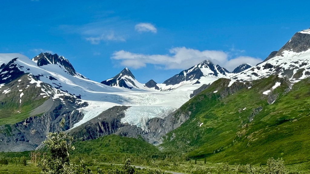
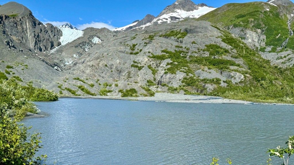
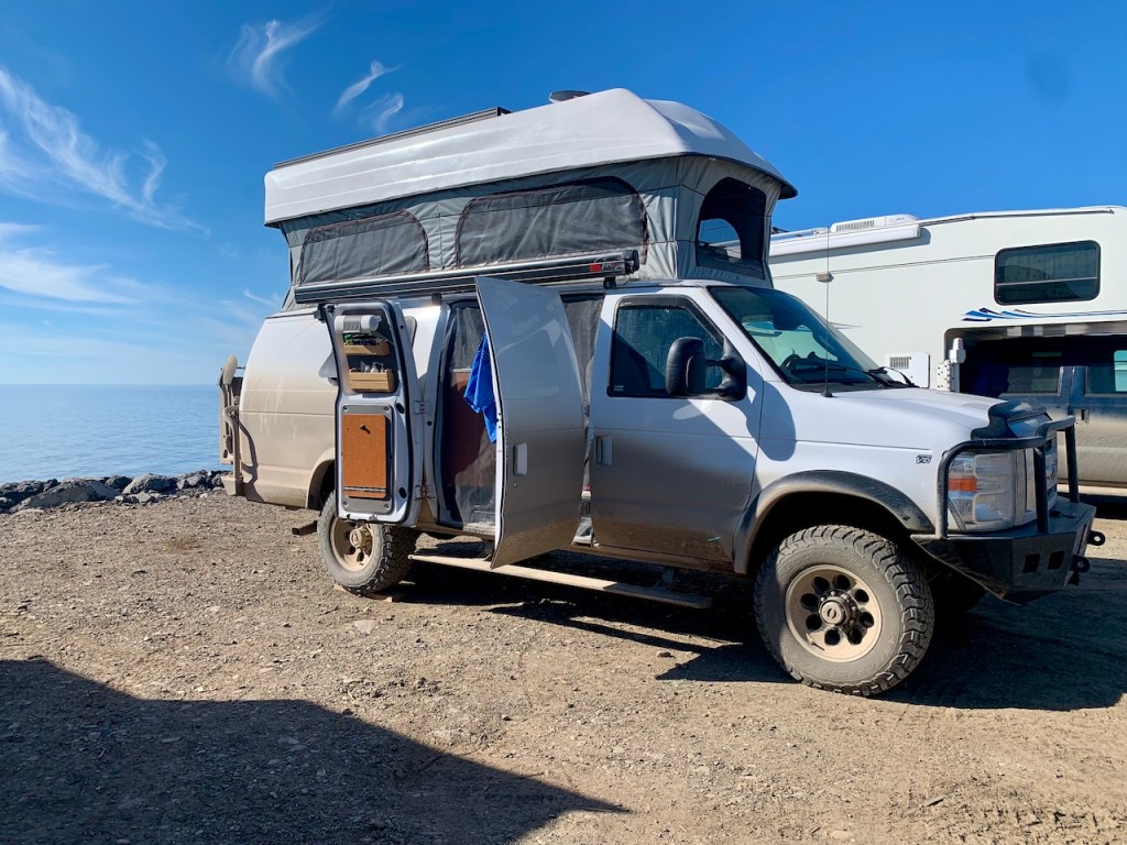
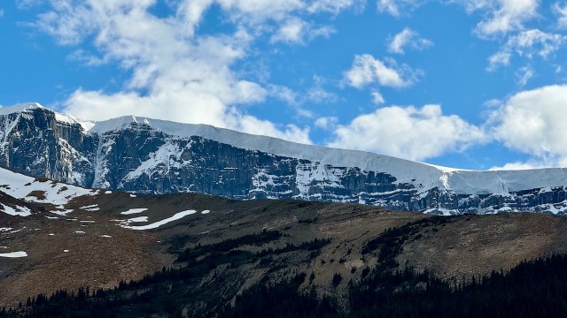
We left camp around 9 am and our first stop was for a hike at Worthington Glacier. However, it was not much of a hike, but a walk around a paved trail, quite a way from the glacier. The glacier has receded so much that you cannot hike to it and walk on the ice.
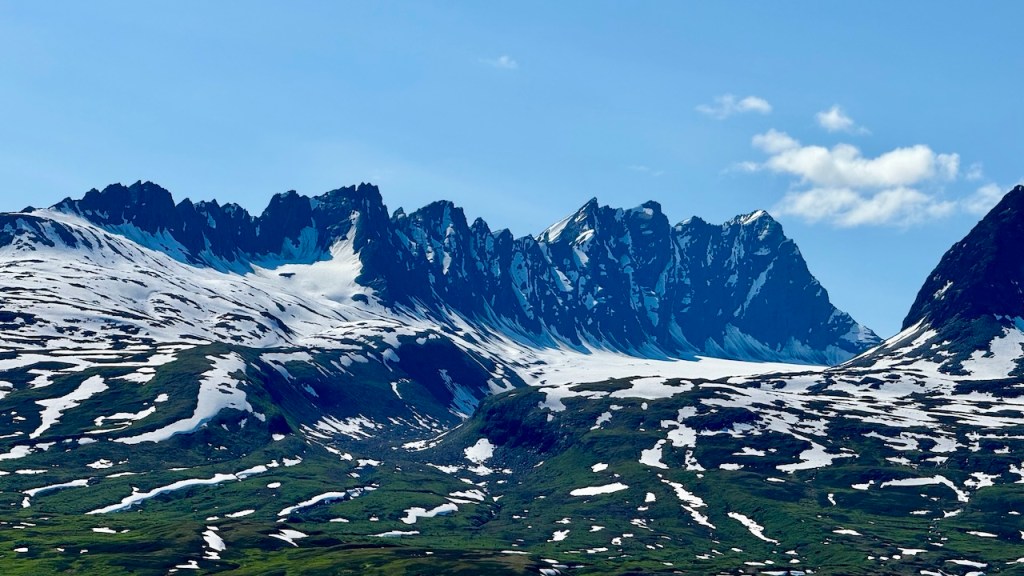
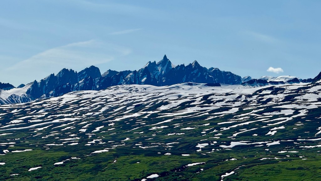
Worthington Glacier
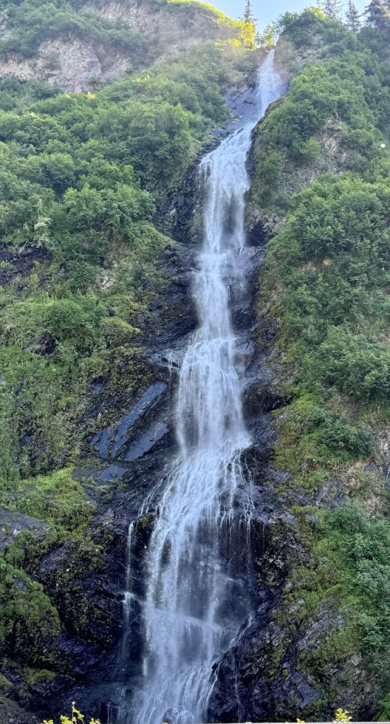
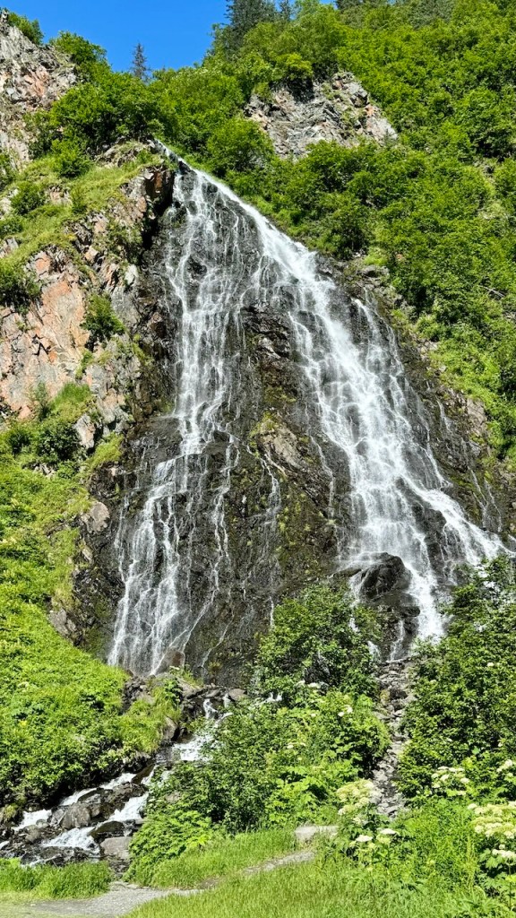
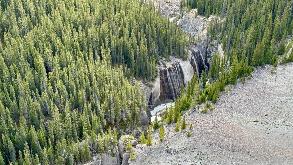
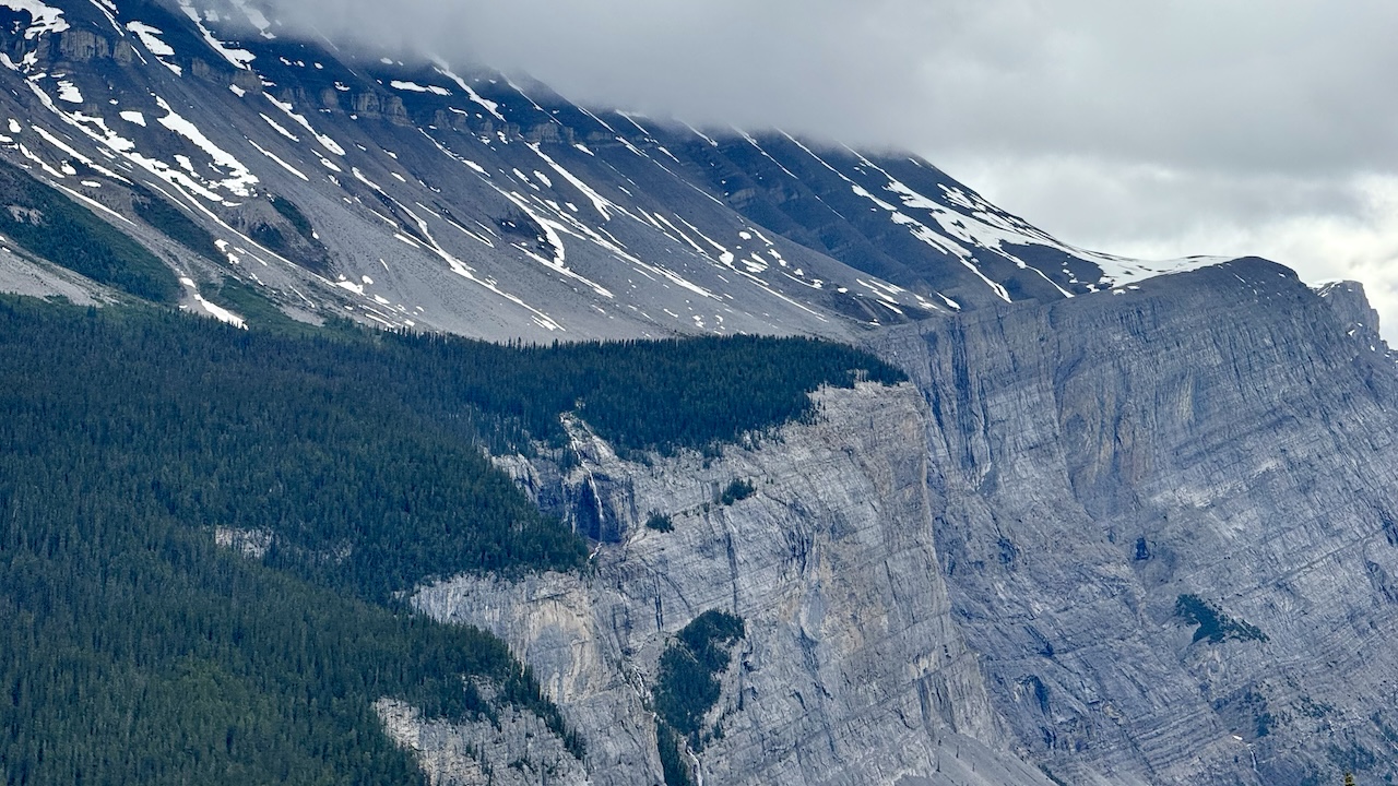
We continued towards Valdez but stopped at a couple of waterfalls along the way.
Rudleston Waterfall
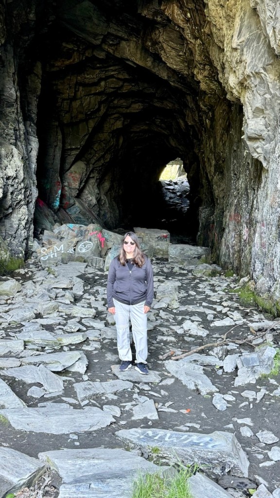
Keystone Canyon Railroad Tunnel
Bridal Veil Falls
Horsetail Falls
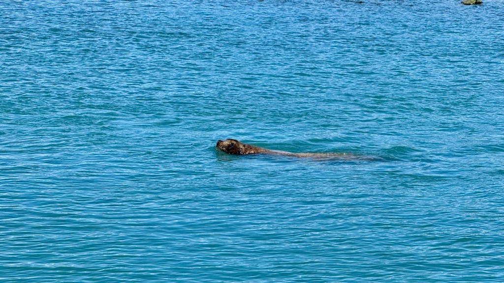
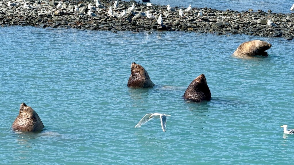
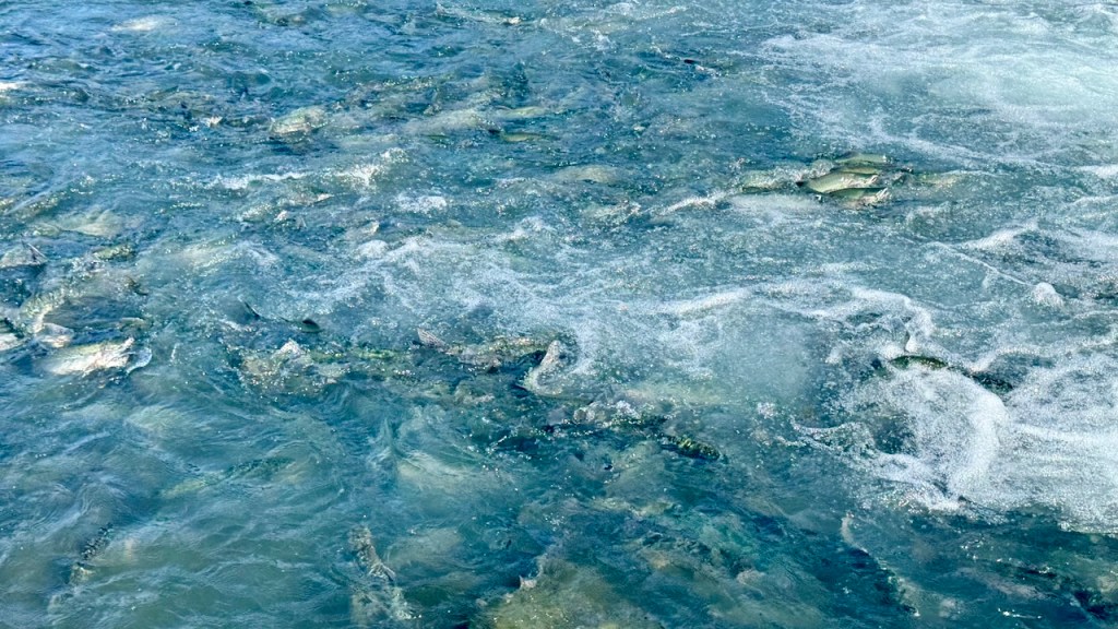
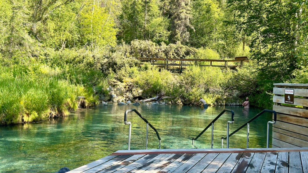
We spent much of the day at the Solomon Gulch Fish Hatchery. This is a salmon fish hatchery ran by the local fisherman organization. It is a great place to watch for wildlife such as bears, sea lions and other predators. We stayed for a few hours and saw a lot of fish, sea lions and bald eagles. We did not see any bears.
We ended up camping about 15 miles outside of Valdez. It is hard to find free campsites in these small towns. Tomorrow we are staying at a campground in the town.
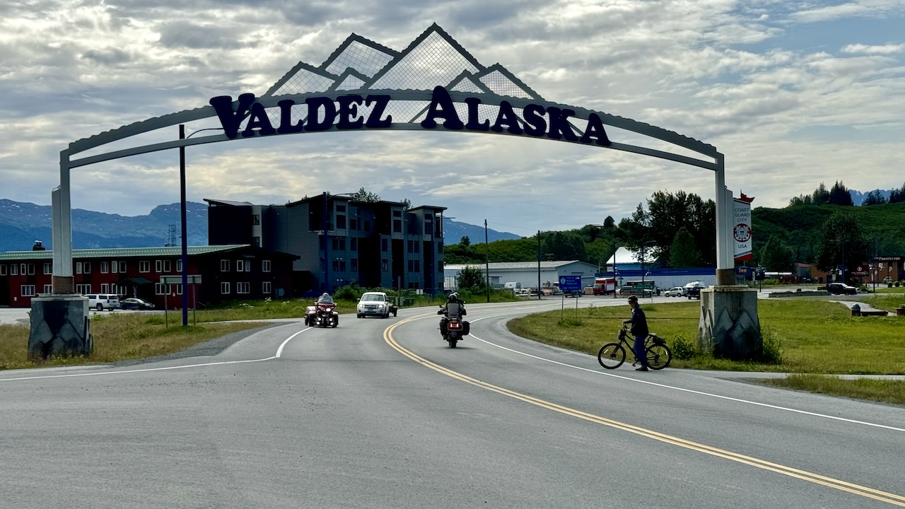
July 20, 2024 – Saturday – Day 27
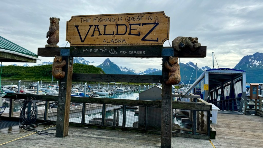
We had a nice quiet night outside of Valdez, except for kids on 4-wheelers driving on the road. We drove into Valdez and visited the local museum. In the museum they had the stories of two major disasters associated with Valdez. First was the Exxon Valdez oil spill. I learned that Valdez was not affected by the oil spill. The affected area was miles from the town, but because of the ship’s name and the clean-up efforts were headquartered in Valdez, it’s easy to think the damage was closer to the town.
The second disaster was the March 27, 1964, Good Friday Earthquake. The largest earthquake in the US was centered near Valdez. The earthquake damaged many buildings and a large area of the coastline fell into the ocean causing a tsunami that damaged much of the town. The ground where the town was situated sunk by 3-6 feet. This caused flooding during the higher tides. So the town was effectively destroyed. The land where the town sat was so unstable that they decided to move the entire town 4 miles west onto more stable ground. So the new Valdez was designed and built from the ground up and everyone moved to the new town in 1967. The old town was emptied then burnt to the ground.
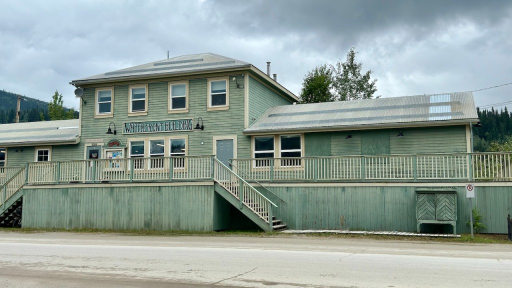
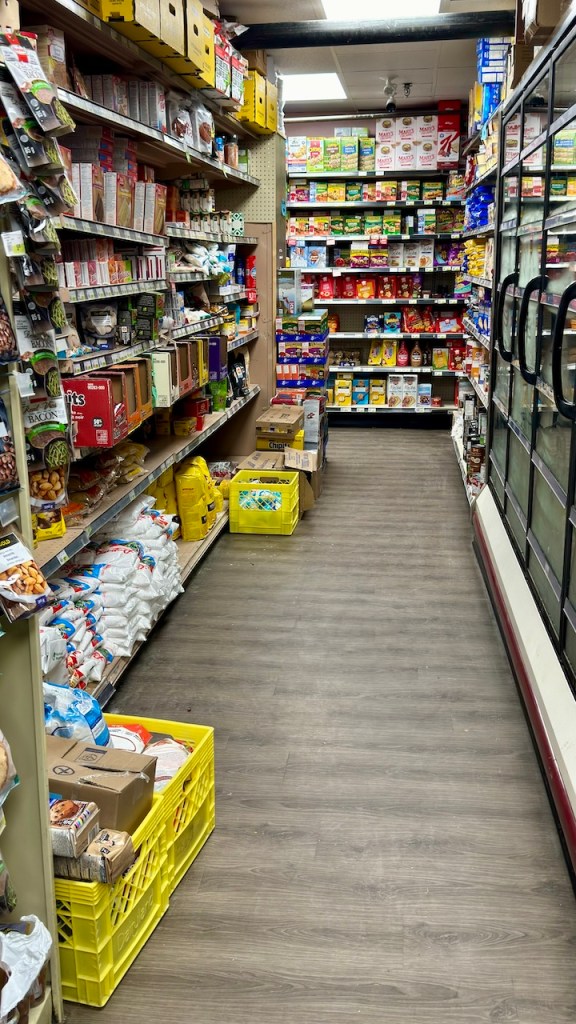
After the museum we washed the van again and also did some grocery shopping. Valdez is an isolated town, so everything was 30-40% higher in cost, so we only bought what we needed.
We then went to our campsite at Valdez RV Campground. It is basically a parking lot for RV, but we stayed in the tent area and there was a strip of grass behind our camping spot. We spent a few hours cleaning the van. 1200 miles of dirt road put a lot of dust and mud everywhere and this was our first opportunity to do a good cleaning. It was also warm and sunny and no rain.
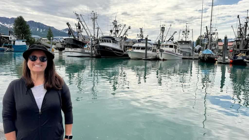
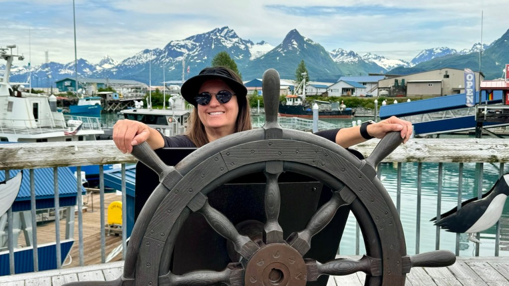
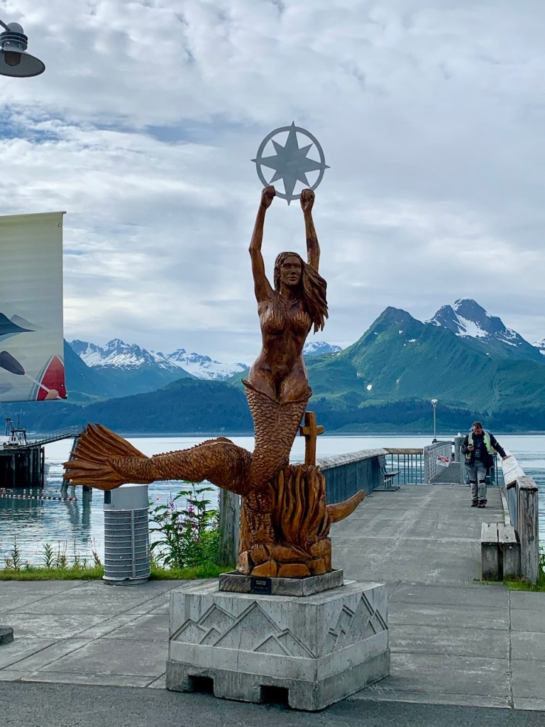
Later in the afternoon we walked to the waterfront and watched the fishing boats come in and clean their catch. The campground is within walking distance of the entire town, so as long as the weather stays good, we can explore the town on foot for the next few days.
July 14, 2024 – Sunday – Day 21 – Off the Dempster Hwy
It was a bright and noisy night. However, things did quiet down at some point in the night. We took a picture of the sun at 12:30 am and it was still up in the sky. It will be 1-1/2 weeks until the sun sets again.
We slept late but we were on the road around 9:30 am on our way south. Tuktoyaktuk is an interesting place, but like many places in the world, there are not much of the old cultural left, it is very westernized. The restaurant had a sign that they only serve hamburgers, chicken and fries. “No Traditional Food”. I understand, because it is a much easier life for them. We could not find many souvenirs to buy, most of the shops were closed. I guess Covid had a big impact on their tourism. The road to Tuktoyaktuk was built only 7 years ago, so their tourism was not very mature when Covid shut them down 4 years ago.
Pingos outside of Tuktoyaktuk (Ice domes covered by dirt and grass
The trip back to Inuvik was quick and we spent our time reviewing this week’s Sunday School lesson. In Inuvik we got some gas and then parked outside the visitor’s center to connect to the internet. I was able to update the blog and then we also Facetimed the kids to talk with them. Before leaving town we found a car wash and sprayed off most of the mud. We probably lost 100 lbs. of mud.
Rock Creek
We drove south for about 4 hours and found a campsite at Rock Creek. It was still a warm day, but it will cool down later tonight.
July 15, 2024 – Monday – Day 22
It was a rainy morning, but we left about 9 am. Today was a day of driving. We planned to drive to within a couple of hours drive of Dawson City. We filled up with gas at Eagle Plains (the gas is $6.88/gal, but it is the only place to get gas). We then continued south.
Red River
Our plan was to drive until 3 pm and then find a camping spot. We started looking for spots and they were either taken or too exposed to the highway. We finally found a place on the river after stopping at 5 other spots. Each campsite was 10-15 minutes apart, so it was 4:30 pm before we finally set up camp.
July 16, 2024 – Tuesday – Day 23
It rained all night, but it stopped before we left camp. It took us about 1 hr 45 min to finish the Dempster Highway. It was a relief to end ~1200 miles of dirt road. I always have that concern that something may break, or we would have other problems, but we had no issues. When we made it to Dawson City, I noticed that some wires had pulled loose back by the receiver hitch. I don’t remember rubbing the back end of the van anywhere, or driving through weeds or sticks, but something caught them and pulled the wires loose. They are the wires for the trailer plug and the rear aux lights, so nothing important. I quickly used a couple of wire ties to hold them up. I will fix it more permanent when the rain stops.
We decided to spend the night at the Bonanza Gold campground, just outside of Dawson City. We spent the afternoon washing more mud off the van ($6), did our laundry ($10) and took showers ($2). It was raining the entire time we were at the camp.
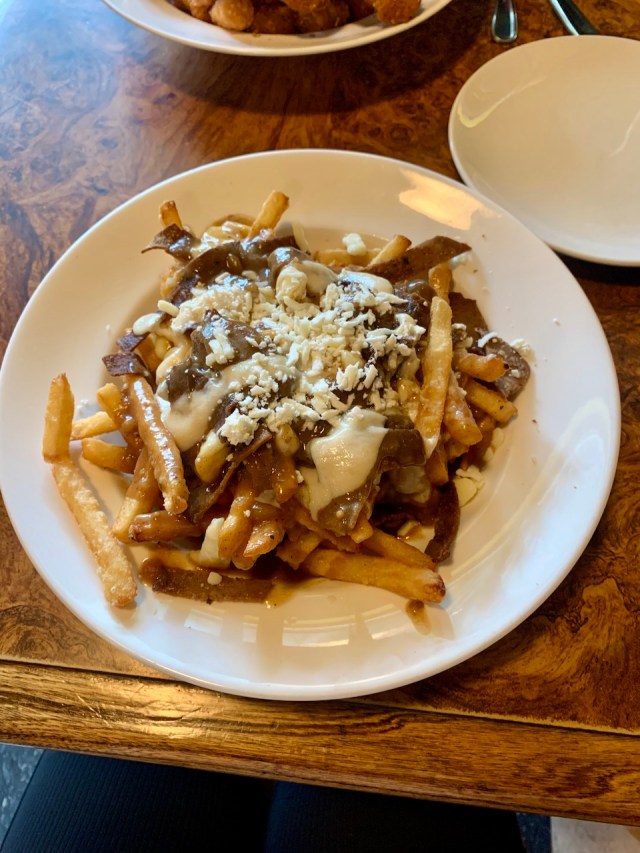
Later in the evening we went into town to eat dinner at the Gold Pan Restaurant. I had chicken strips and Eva wanted to try poutine again. This time it had some tender beef and good cheese on it. It was much better than the Costco poutine we had a few weeks ago.
Donair Beef Poutine
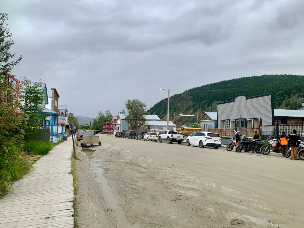
After dinner we walked around town a while, but it started raining again so we went back to camp. We need to find somewhere that has sunshine.
Streets of Dawson City, Yukon
Streets of Dawson City, Yukon
Streets of Dawson City, Yukon
Streets of Dawson City, Yukon
July 17, 2024 – Wednesday – Day 24 – Into Alaska
It was another rainy night and morning, but the rain had mostly stopped by the time we got up. We took a shower and then parked by the laundry to wash our towels, sheets and a few other things. We also called Alyssa and Kayla.
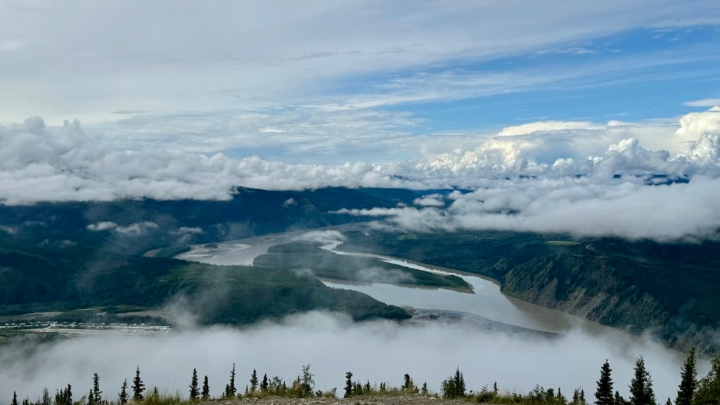
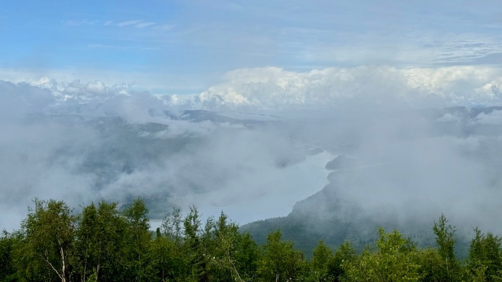
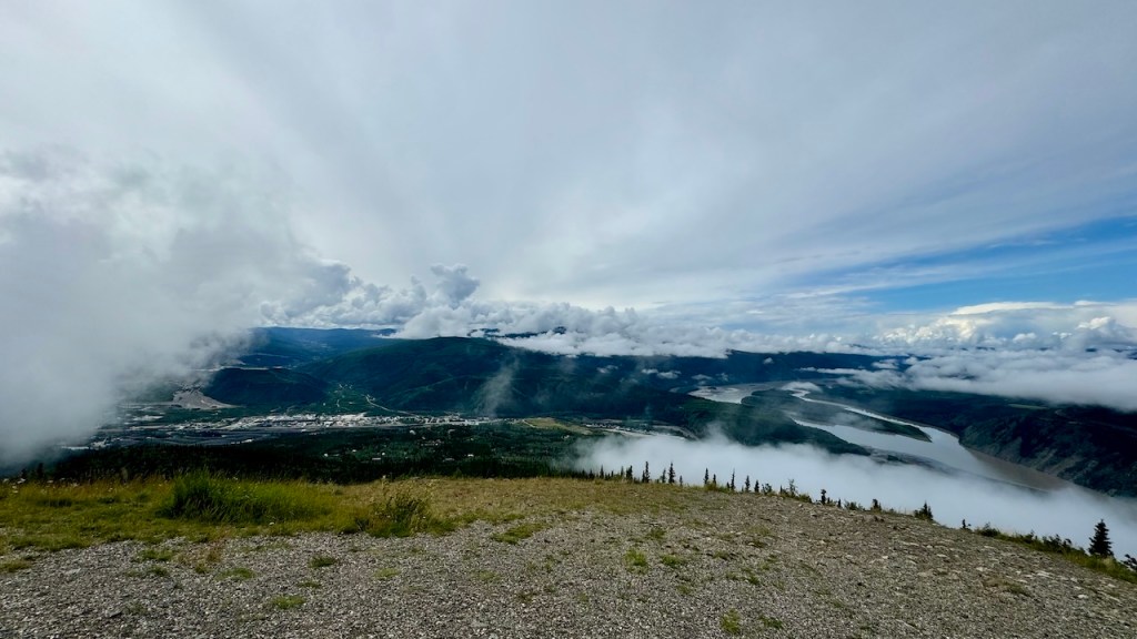
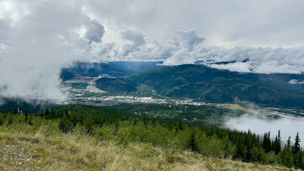
We didn’t leave the campground until around noon. After getting gas we drove to the top of Midnight Dome, a high mount above the Yukon River and Dawson City. We ended up above the clouds so we could not get a good view of the valley, but it was nice up there and we were able to see the sun.
The Yukon River from the Midnight Dome
The Yukon River from the Midnight Dome
Dawson City from the Midnight Dome
Dawson City from the Midnight Dome
Next, we ate lunch at Sourdough Joes and filled up our water at the visitor’s center. We then took the ferry across the Yukon River and continued towards the US border.
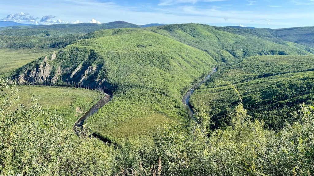
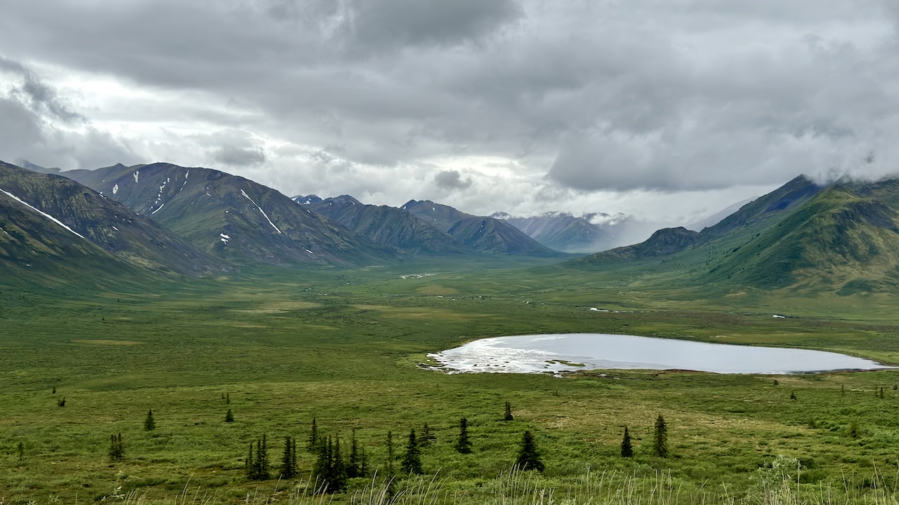
The highway into Alaska is called the Top of the World highway. From the Yukon River the road climbs high into the mountains and continues on top of the mountains for 40 to 50 miles. The mountain tops are rounded, so the road stays on top and weaves between the mountain tops. There are a lot of forest and meadows, and everything is green. Unfortunately, the rain and overcast skies continued as we drove towards Alaska, so it was hard to get a good picture, but it was a very beautiful drive.
The Top of the World Highway
The US/Canada Border
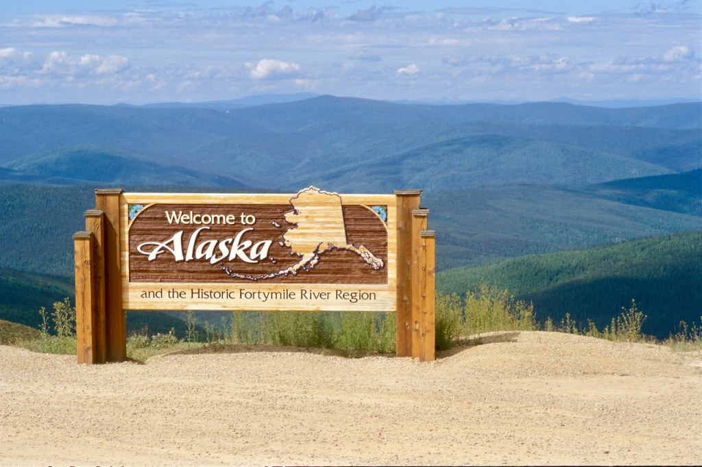
The US/Canada border is on top of the mountains and the border patrol people have two little cabins they live in on the mountain top. We crossed into the US, so after 24 days of our Alaska trip, we finally entered Alaska.
Entering Alaska, finally
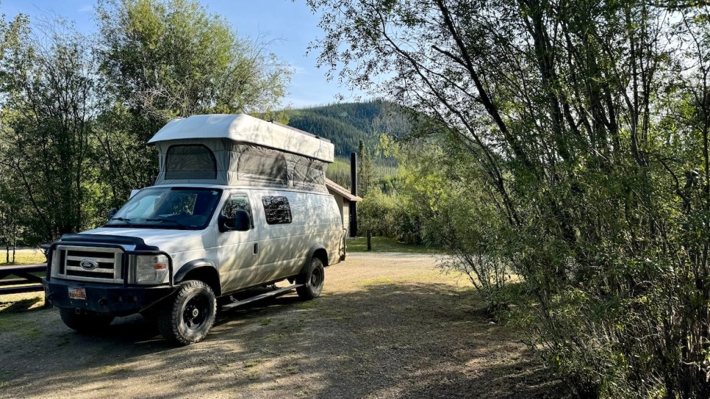
The highway stayed on top of the mountains for another 20 miles until it finally descended into the valley. We found a campsite at Walker Fort Bridge campground. This is the nicest BLM campground we have ever stayed at. There are only a few campsites, but they are large, flat and well-spaced. The bathrooms are clean and there were no mosquitos. The rain stopped and the sun came out, so we spent the evening outside eating dinner and playing games. We are still at a higher elevation, so the night got pretty cold, but there was no rain.
The Top of the World Highway
July 18, 2024 – Thursday – Day 25
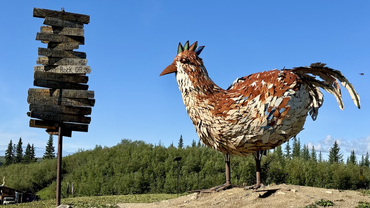
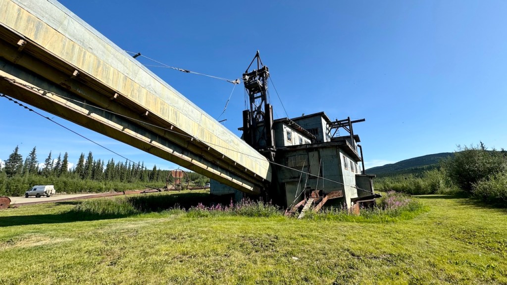
It was a good night and morning. We continued on the Top of the World highway to Chicken, Alaska. This was an old mining town. We took a picture at the chicken and the gold dredge.
Eva and the Chicken of Chicken, Alaska
The Pedro Dredge – Chicken, Alaska
We arrived at Tok around noon. After getting gas, I spent another $5 to spray more mud off the van. We also stopped at a gift shop and bought some shirts for the grandkids. After we ate lunch we spent some time planning our next few days, so it was around 4 pm before we left.
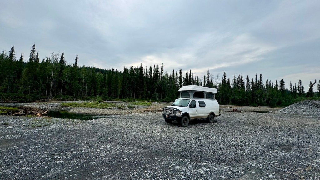
From Tok we turned south and drove about 3 hours until we camped at an old campsite about 60 mile north of Valdez.
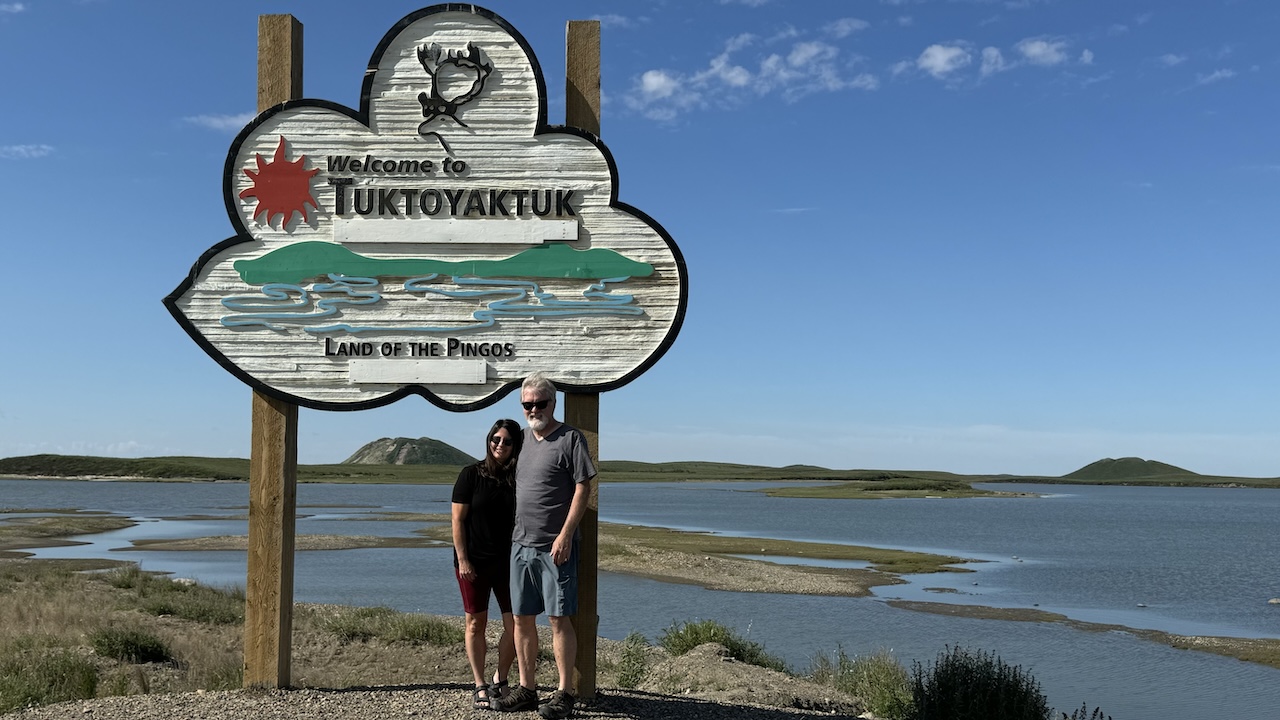
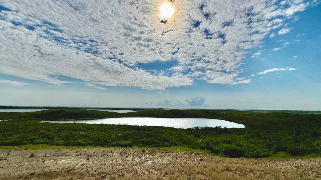
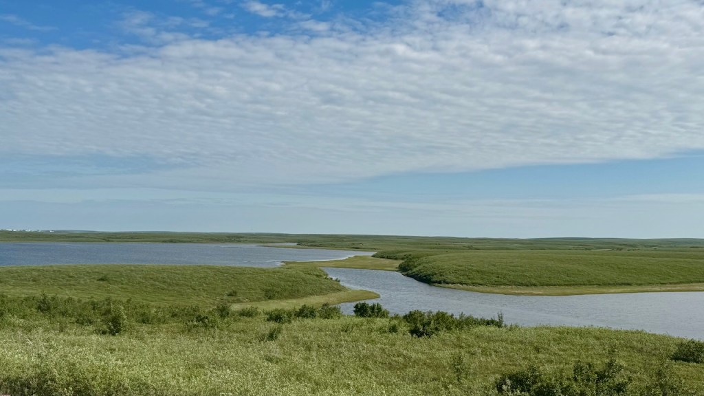
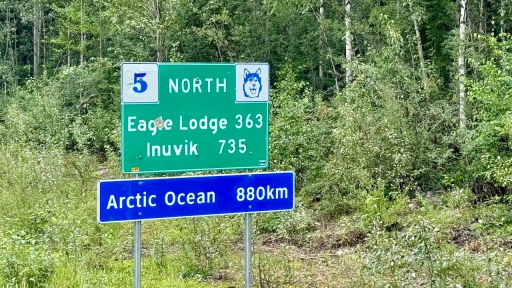
We left camp at 9 am and after getting more gas, we drove north on the Inuvik/Tuktoyaktuk Highway. This is the last 90 miles to the Arctic Ocean at Tuktoyaktuk (Tuk). This hamlet was founded in 1928 and is mostly inhabited by the Inuvialuit people. The sun does not set here between May 19th and July 24th.
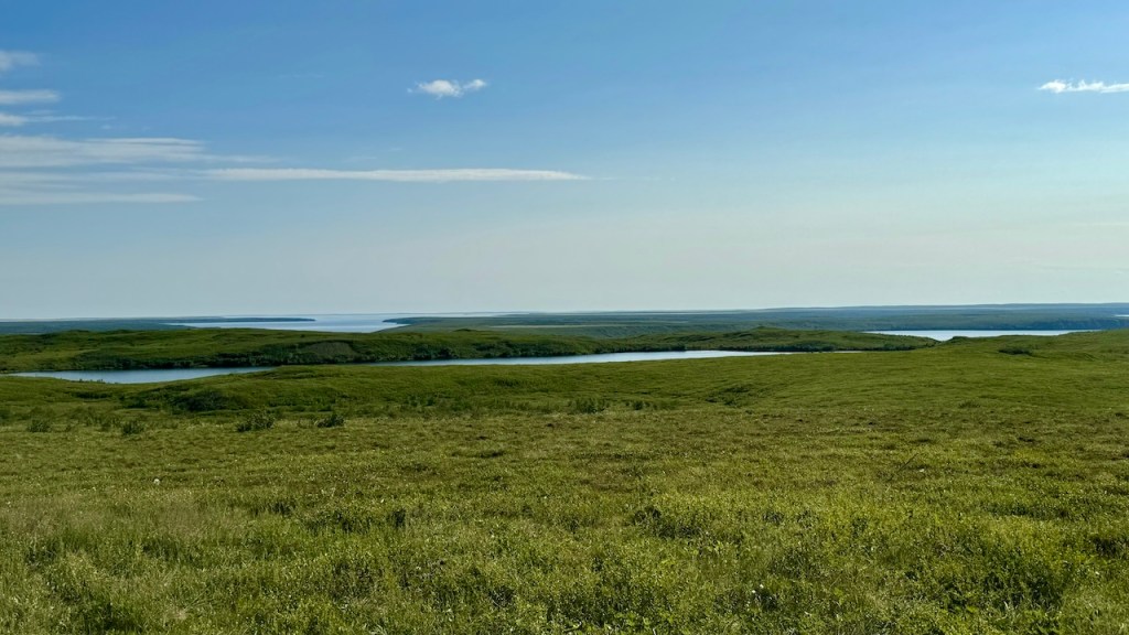
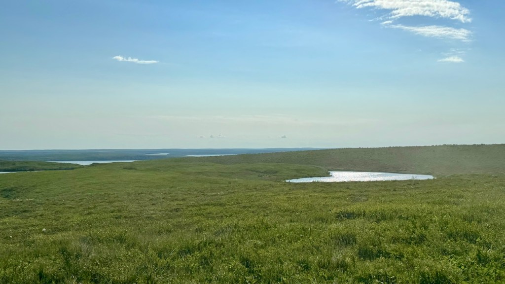
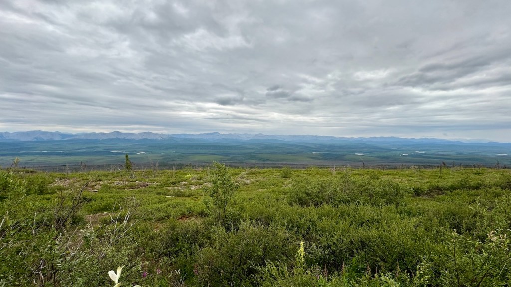
The road north was gravel, but not in bad condition, except where there is a lot of washboard on the road. North of Inuvik the terrain turns into a true tundra. Everywhere is green with a lot of water. As we got closer to Tuk the trees disappeared and then it was just grass and pools of water.
The Northern TundraThe Northern TundraThe Northern TundraThe Northern Tundra
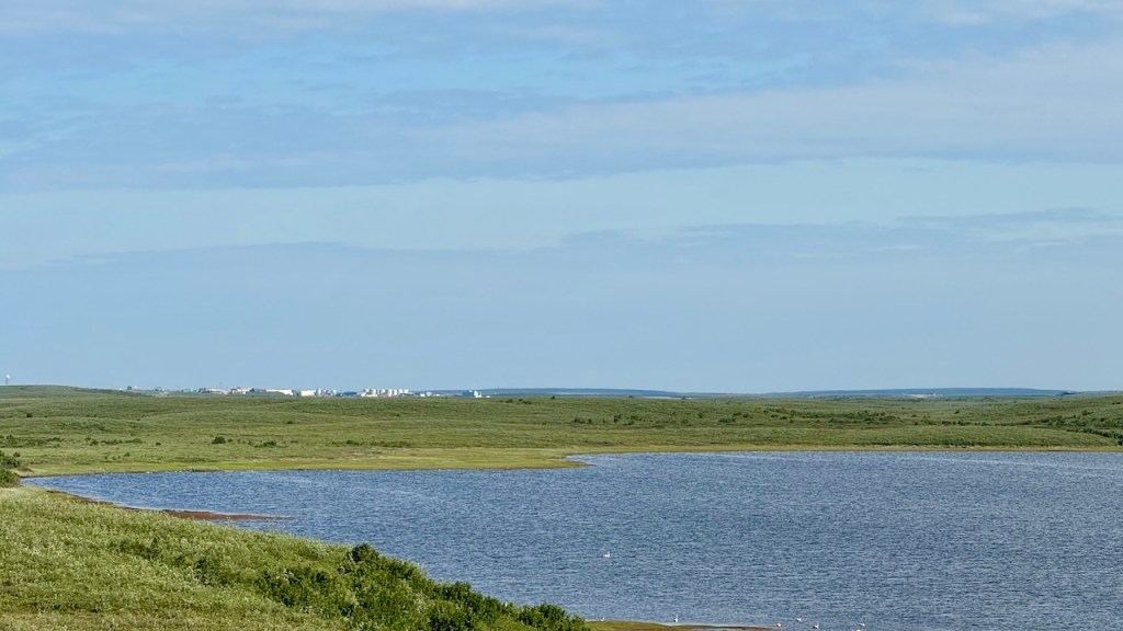
Our first view of Tuktoyaktuk
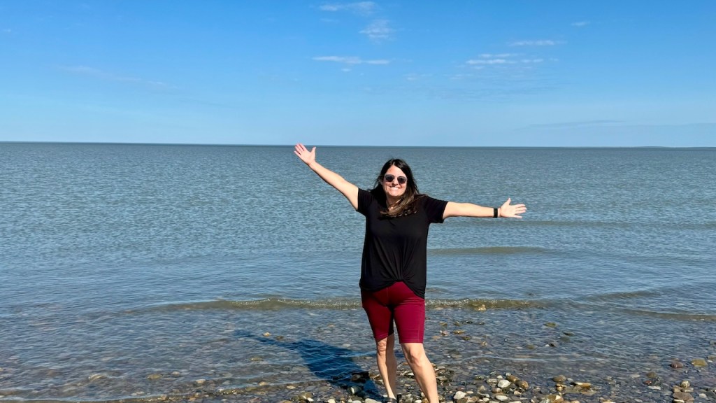
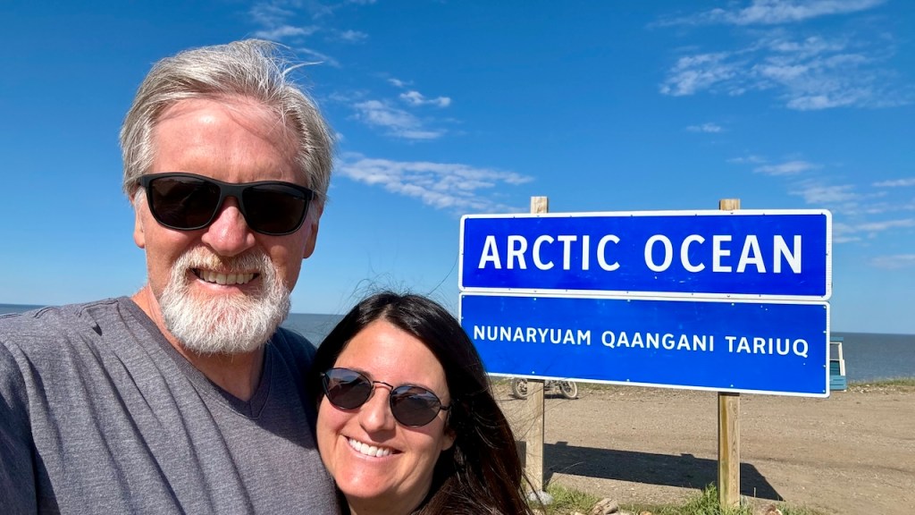
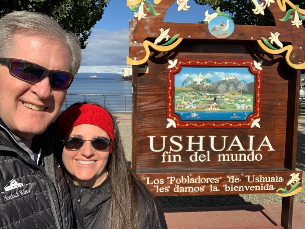
After arriving in town we drove to the end of the road at the Arctic Ocean. We have now been to the El Fin del Mundo (The End of the World) in Ushuaia, Argentina and to the top of the world in Tuktoyaktuk, Canada. But we have only driven about ½ of the distance in-between.
The Top of the World – Tuktoyaktuk, Canada – July 13, 2024
The End of the World – Ushuaia, Argentina – Feb 16, 2023
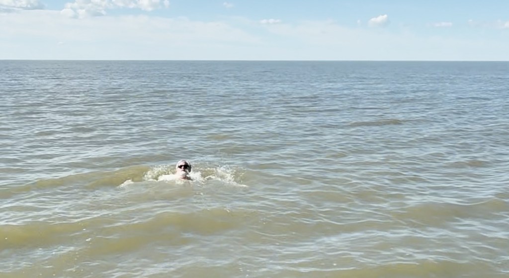
We ate lunch at Grandma’s Kitchen, the only open restaurant in town and then took dip in the Arctic Ocean. We were lucky it was a warm and sunny day. The water was cold, but the sun was warm. Some local people told us there was ice on the ocean until the end of June. They also mentioned that they had a family of polar bears on the beach just a few days ago. Too bad we missed that.
Dip in the Arctic Ocean
Dip in Arctic Ocean
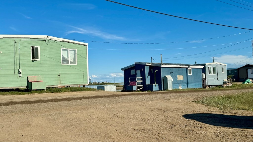
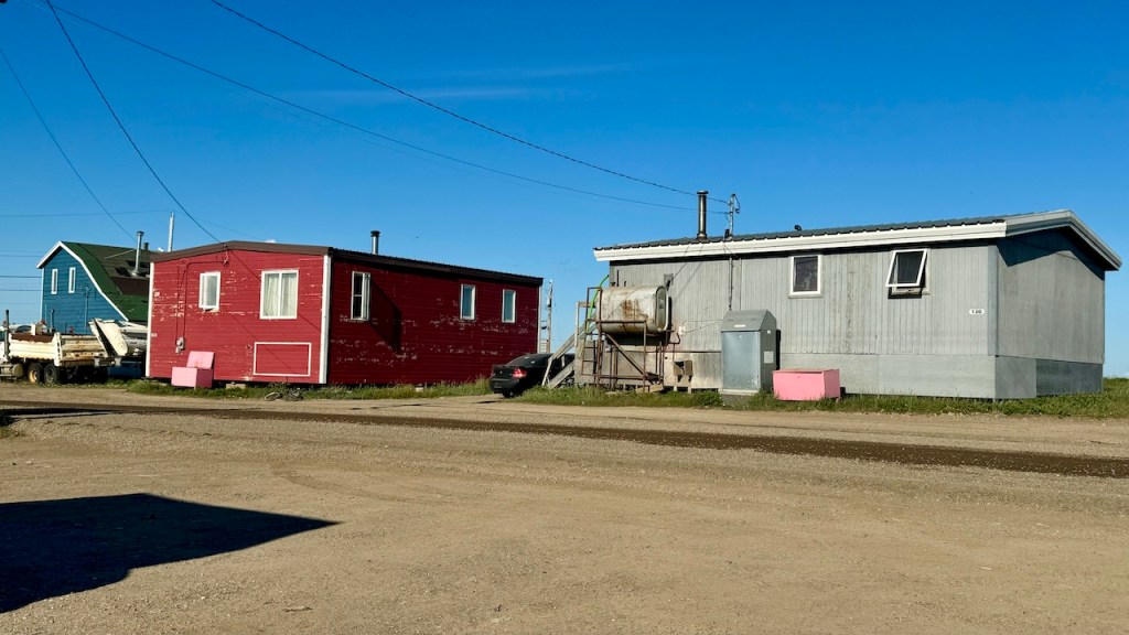
Houses in Tuktoyaktuk
Houses in Tuktoyaktuk
We decided to stay at the city campground on the shores of the Arctic Ocean. The campground was almost full, but we found one of the last spots. The campground is just parking spots along the northern shoreline. It was a nice evening, except the campground is on the main road and I think the locals like to drive back-and-forth on the road looking at the tourist, so it was a little noisy. Hopefully it will calm down before it is too late.
It sprinkled most of the night and was raining a little when we left camp. The mosquitoes were terrible at this camp and everywhere on the Dempster Highway. We had not had any issues with bugs for the past 3 weeks, but they are making up for it now.
We continued to drive north on the Dempster Highway, stopping for gas at Eagle Plains. This was the most expensive gas we have paid for so far.
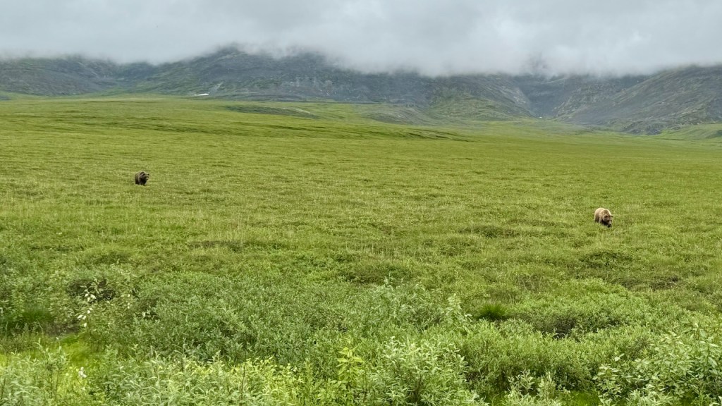
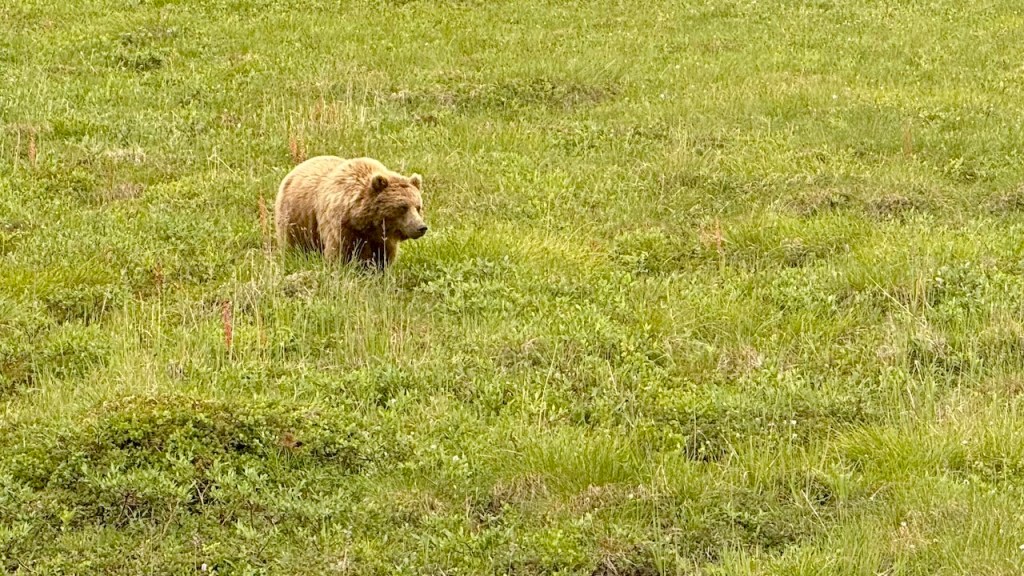
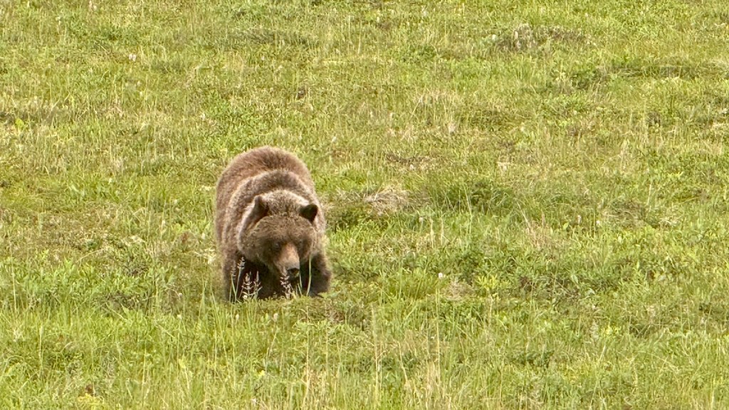
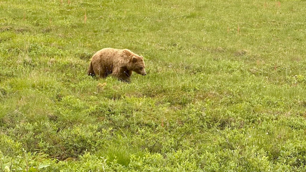
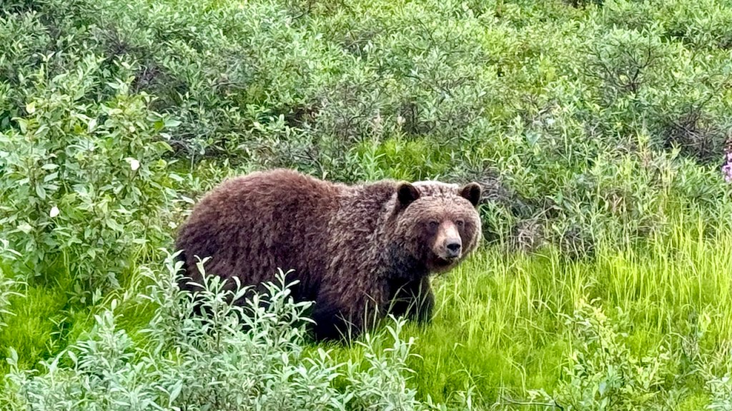
About 30 mile north of Eagle Plains we crossed the Arctic Circle and a few miles past that we came across two grizzly bears foraging just off the road. They were only 20-30 feet away and they just ignored us as we took videos and pictures. These are the first grizzlies we have seen after seeing 5-6 black bears.
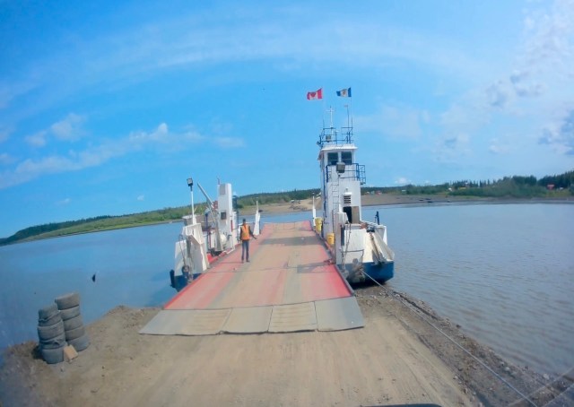
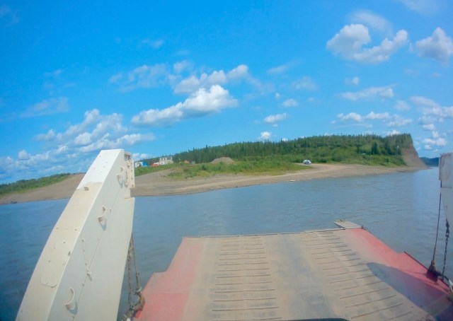
In this section of the highway we crossed two rivers using ferries. The ferries are run by the government and are free to cross. The first ferry crosses the Peel River and we were the only ones on the ferry. The second ferry crosses the Mackenzie River and the ferry is much larger. Our ferry had 4 vehicles and a semi-truck on it. The Mackenzie River is quite wide and it took 5-10 minutes to cross it.
Peel River Ferry
MacKenzie River Ferry
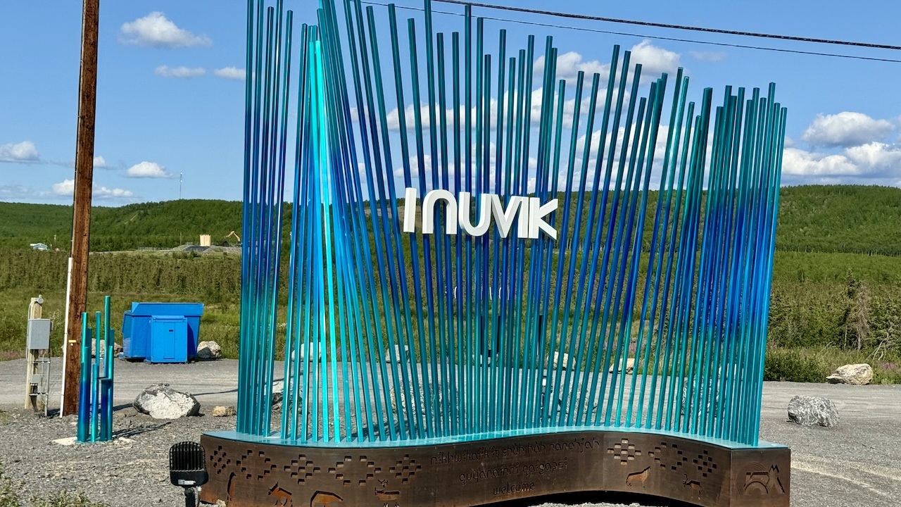
From the last ferry we only had 1-1/2 hours of driving to reach Inuvik. This is the biggest city in northern Canada and is 90 miles from the Arctic Ocean.
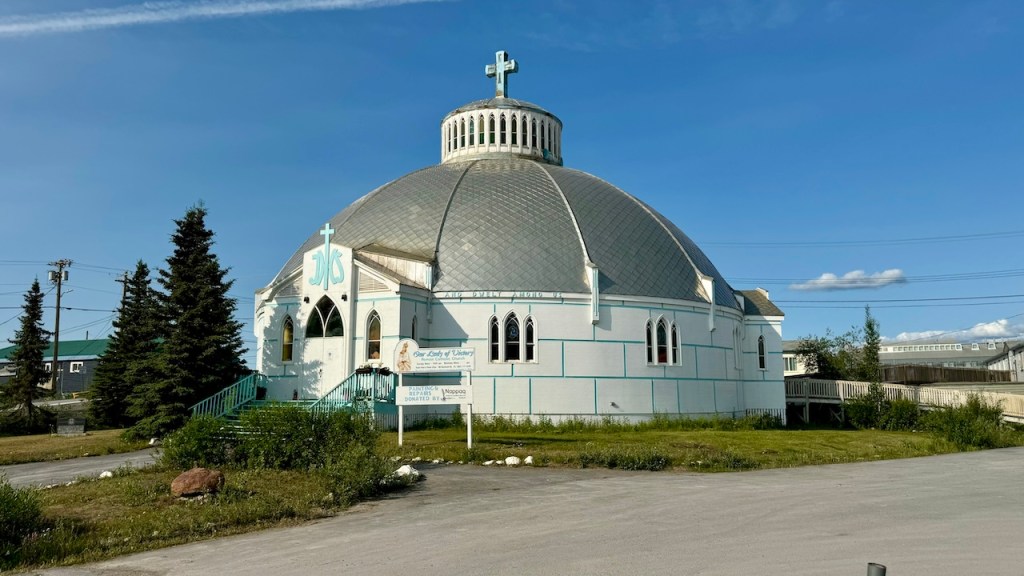
The Igloo Church
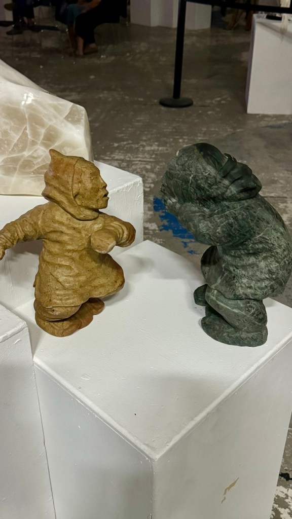
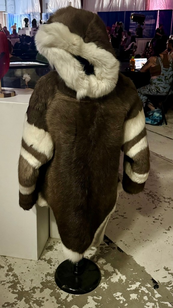
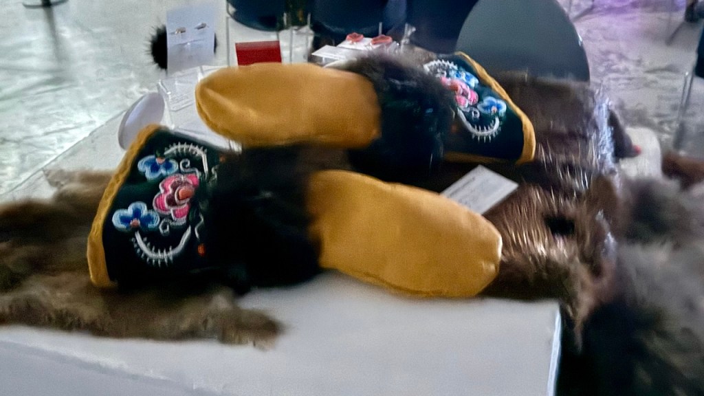
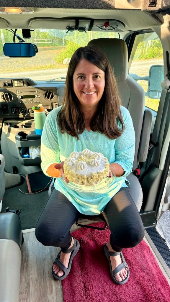
They were holding the Great Northern Arts Festival this week, so we stopped by to look at the exhibits. Also, while in Inuvik we ate dinner at one of the two restaurants to celebrate Eva’s birthday.
While walking back to the van we stopped by the only grocery store and bought a small cake so she could have her birthday cake.
Eva turns 32 again
There are not many places to camp for free this far north, so we got a campsite at a territorial park at the edge of town. It was nice because they had showers.
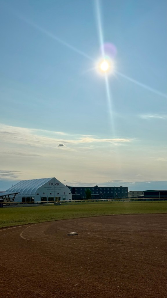
It has surprised us how warm it is up in the north. It was close to 80 deg today and right now it is 10 pm and the sun is high in the sky. We are hoping it will cool down in the evening.
The sun at 9 pm
The sun was up in the sky long after midnight. The camper next to us pulled into camp around 11 pm and was using a chainsaw to cut wood at about 11:30 pm. It was too light (and noisy) to sleep so we took a picture from camp of the sun at midnight.
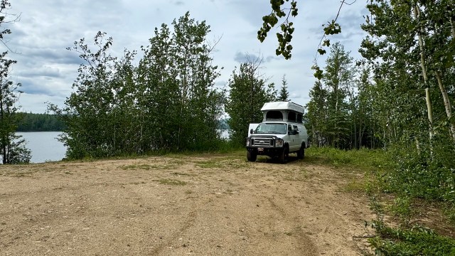
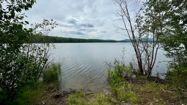
We decided to take is slow today. We left camp after 10:30 am and only drove until 1:30 pm. We found a nice spot for lunch on the shore of a lake. It was far from the highway and nice a quiet, so we decided to spend the night. Tomorrow we will arrive in Dawson City.
July 11, 2024 – Thursday – Day 18
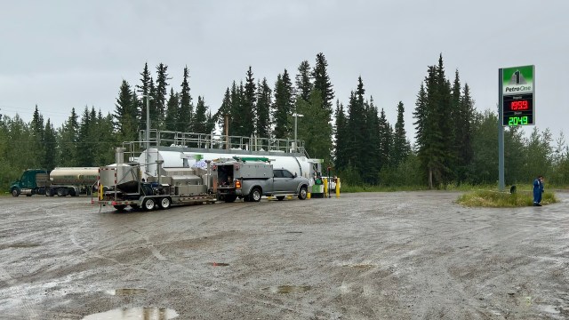
It rained most of the night and was raining when we left camp and headed north on the Yukon Highway. In this part of Yukon the gas stations are big above-ground tanks with attached pumps. There are no employees around, you just use your credit card and then pump the gas. Also, there is no competition, so the prices are quite high. We paid $5.24/gal at the tank at Stewarts Landing.
Yukon Gas Station
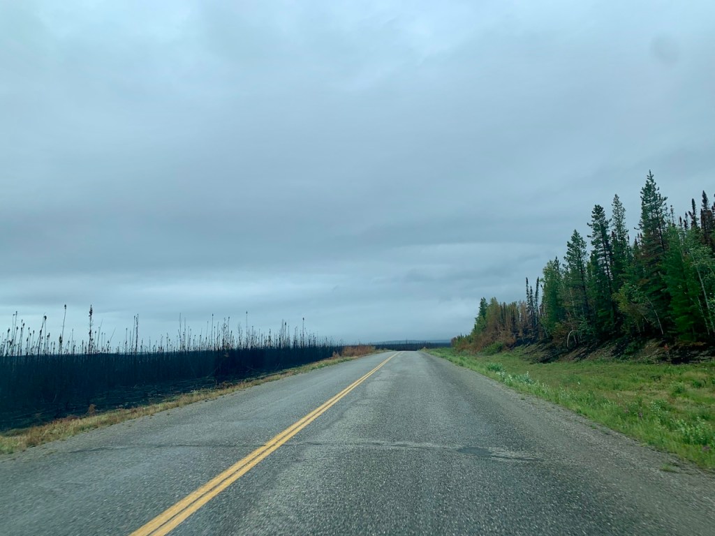
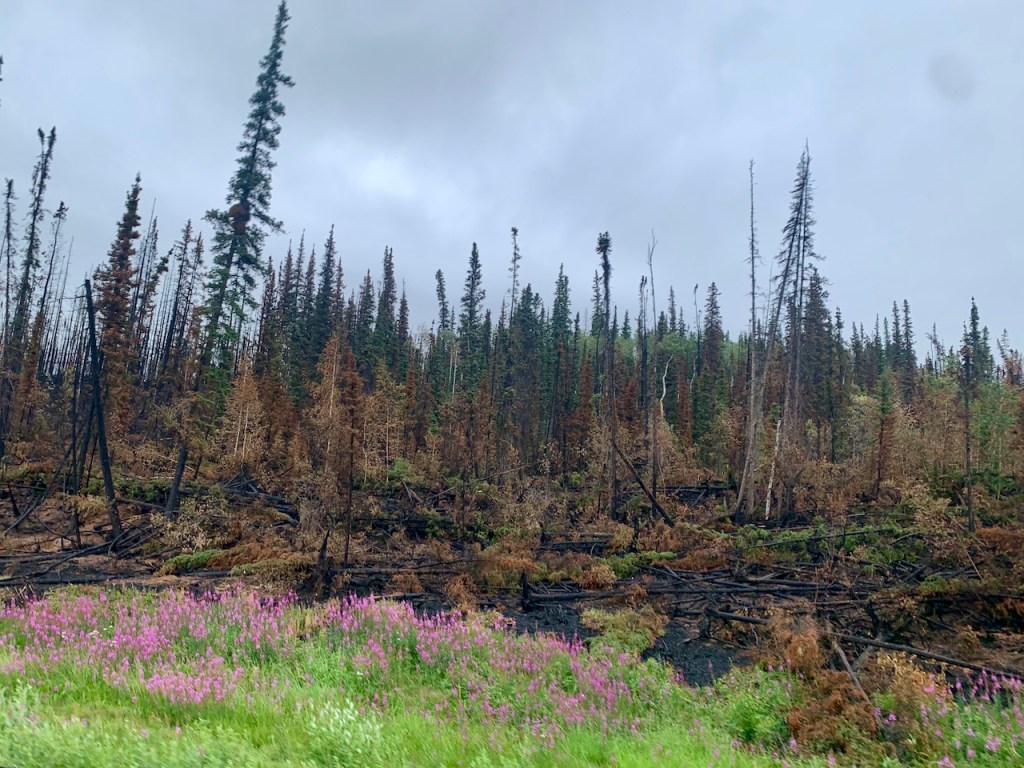
We drove through an area that had a recent wildfire. We were worried they would close the road, but with the recent rain the fire was mostly out. We did pass some areas that were still smoking.
Wildfire Area
Wildfire Area
Wildfire Area
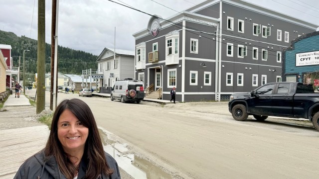
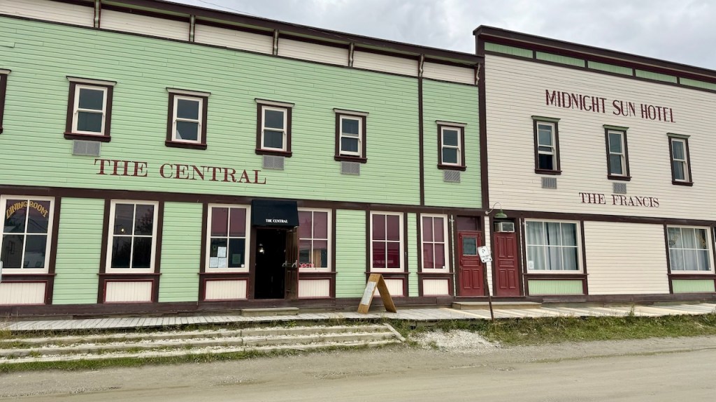
We arrived at Dawson City around noon and stopped at the visitor’s center to get fresh water and the general store to get some food. Dawson City is the heart of the Yukon gold rush. It is still a mining town, but they have restored some buildings from the gold rush period to focus on tourism. There are also many National Historic Sites in town.
Dawson City
Dawson City
Our original plan was to spend a couple of days in Dawson City before continuing north to the Arctic Ocean. However, we check the weather forecast and the forecast in the far north was warm and sunny for a few days. This type of weather is pretty rare, so we changed plans and quickly left Dawson City to drive north on the Dempster Highway. We will return to Dawson City in a few days to see more of the town.
The Start of the Dempster Highway
The Dempster Highway is known as the Road to the Arctic. The road goes from Dawson City to the town of Inuvik and then continues to the village of Tuktoyaktuk at shores of the Arctic Ocean. The total highway is 547 miles of dirt/gravel, one way. The road to Inuvik was finished in 1979, but the last 90 miles to Tuktoyaktuk and the ocean was not completed until 2017.
We left Dawson City at 2 pm with the goal to make it halfway to Inuvik before camping for the night. It is funny that the time does not matter much as the sun will go down, but not far enough for it to get dark. It makes it easy to drive for as long as you want and then still find camp in the light.
It was raining as we started our trek on the Dempster. We stopped at a provincial park at 40 miles in and the lower half of the van was covered in mud.
After another 60 miles the entire back was covered. We had heard that it takes $20-30 at the car wash to clean off the mud from the Dempster.
The highway starts in the mountains and forests following several rivers. We camped ~210 miles from the start and the terrain was rolling hills with short scrubby trees. It had stopped raining a few hours ago and it was a warm evening.
We left camp early and drove on to Whitehorse, Yukon. This is a gold mining town that was the gateway to the Klondike. Gold seeking travelers would land in Skagway, AK and climb up the pass to Whitehorse on their way to the Klondike.
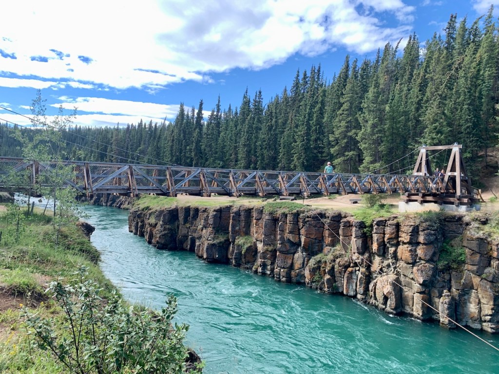
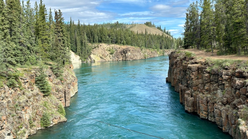
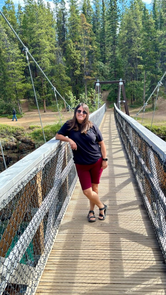
We stopped at the Miles Canyon Suspension Bridge on the way into Whitehorse. The Yukon River passes through a narrow basaltic canyon and the bridge was built at that point. It was very pretty.
Miles Canyon Bridge
Miles Canyon Bridge
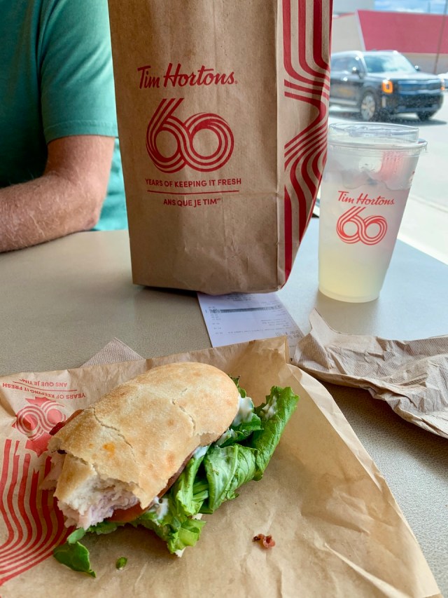
Once in Whitehorse we found a tire shop to replace the valve stem. This took longer than I thought it should, but they finally fixed it. We then went to the visitor’s center and later ate lunch at Tim Hortons. Tim Hortons is the McDonalds of Canada, even though they have McDonalds also.
After lunch we walked to the MacBride Museum of Yukon History. It is in a large museum, and it was interesting to visit.
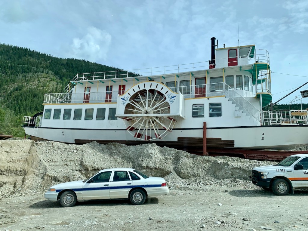
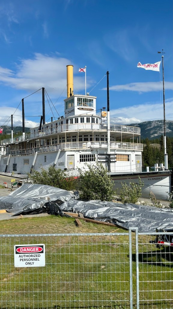
After the museum we walked around town a little before going to the SS Klondike, an old stern wheel paddle boat that is also a National Historic Site. However, it was closed for renovations, so we could only see it from the outside.
SS Klondike
We ended up eating dinner at McDonalds inside of Walmart before leaving town. I was able to get internet there and update the blog. We left town at 7 pm and found a campsite on a river north of Whitehorse. We are far enough north that it never seems to get dark. The sun goes down after 11 pm, but it never gets completely dark. We usually stay up late because we lose track of time with it being light so late at night.
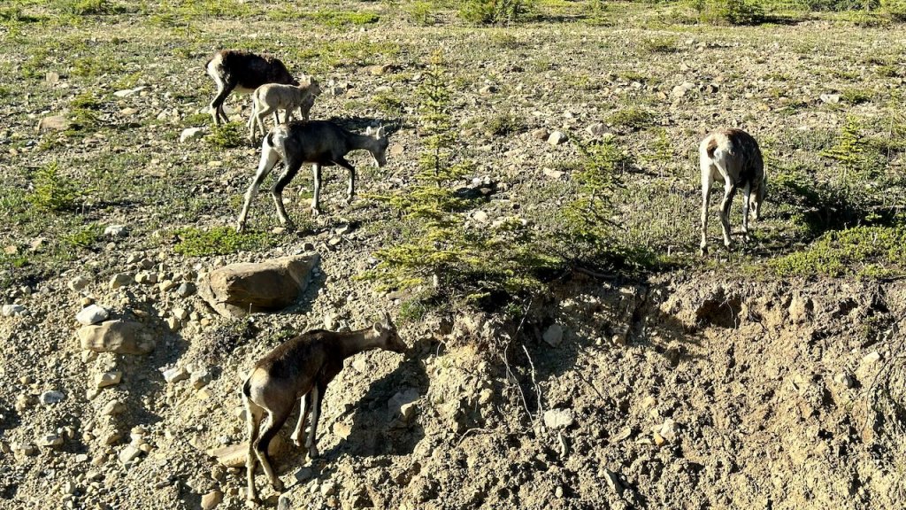
We left Jasper before 8:30 am and drove north through the rest of Jasper National Park. We saw a few big horn sheep, a herd of elk and a moose along the road. It took about 4 hours to reach Grande Prairie, Alberta. About 60 miles from town we hit the smoke from the wildfires. The smoke lasted for 30-40 miles past Grande Prairie.
Saffron Fields in Alberta
Big horn Sheep
In Grande Prairie we gassed up at Costco and while we were there, we had a couple of Polish dogs and our first taste of poutine, a Canadian favorite. Poutine is French fries mixed with cheese curds and covered in hot brown gravy. It was nice to have Polish dogs at Costco again, but we will pass on any more poutine. It was not our favorite.
Costco Poutine
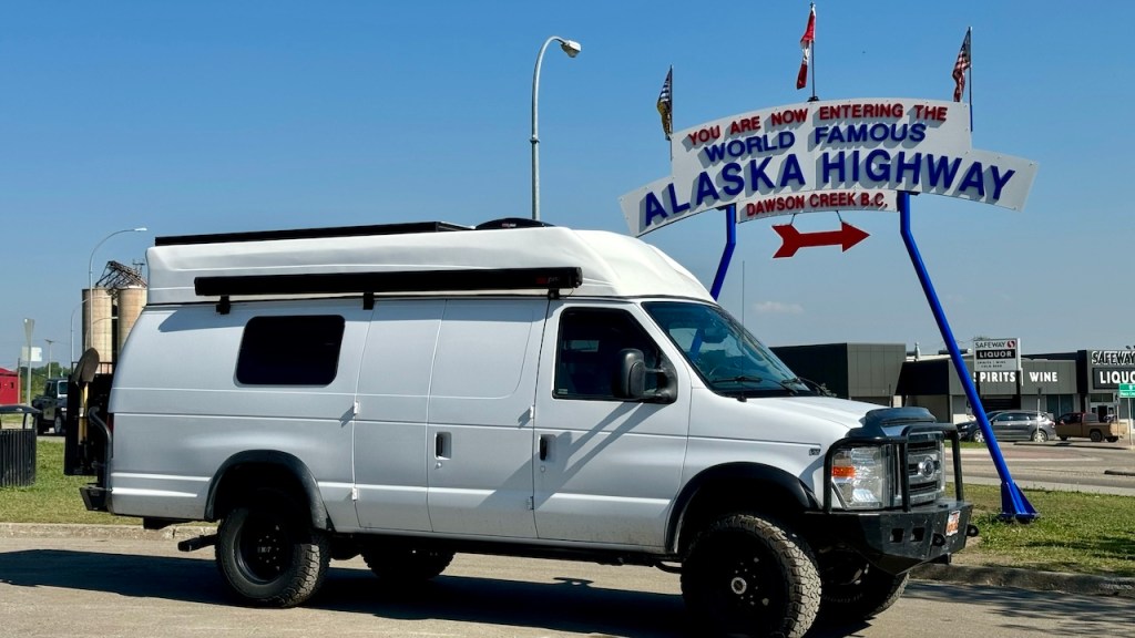
The next major town was Dawson Creek. This is the official start of the Alaskan Highway. There were several other travelers that stopped to take pictures of the start of the highway. The Alaskan Highway is 2480 km long and was built in 8 months in 1942 to provide a transportation link to the northwest of North America during World War 2.
This part of north Canada is mostly rolling hills and lots of farms. This is a big change from the Rocky Mountains we had been in for the past week.
Our final stop for the night was in Fort St. John. We are spending the night in the parking lot of Canadian Tire, it is a store like Cal Ranch, but a lot bigger.
July 7, 2024 – Sunday – Day 14
We had a good night in the parking lot. It was quiet all night long, but it was pretty light. The sun didn’t set until after 10 pm and I’m not sure it ever got truly dark.
We went to church at the Fort St John ward in a building about 5 minutes away. After church Eva was able to help an older sister who only spoke Spanish. She is from Ecuador and had lived in Canada for 2-1/2 years. She lives with her son, but he works in the oil camps and is gone all the time. She has been attending church for 2-1/2 years, but not understanding anything. There is a Philippian family in the ward and they try to talk with her, but they mostly have to use Google translate. The sister does not read or write, so they have difficulties. She was very happy to talk to Eva in her native language and she was telling Eva her life story.
We ate lunch in the church parking lot and then continued our way to the Yukon. It was a long day of driving, with not much to see. The terrain was rolling hills covered with pines and aspens for as far as you could see, with a swath cut out for the highway. It was that way for about 5 hours of driving and then we hit some mountains. It was very pretty with the trees and several large rivers and lakes. We drove until about 8:45 pm, but the sun was still up when we arrived at camp.
We ended up camping at Mineral Lick trailhead. There was another truck/camper there, but we just parked on the other side of the lot. It was a quiet night.
Two thousand miles of bugs
July 8, 2024 – Monday – Day 15
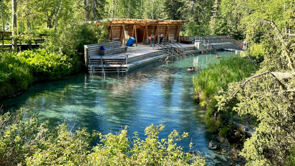
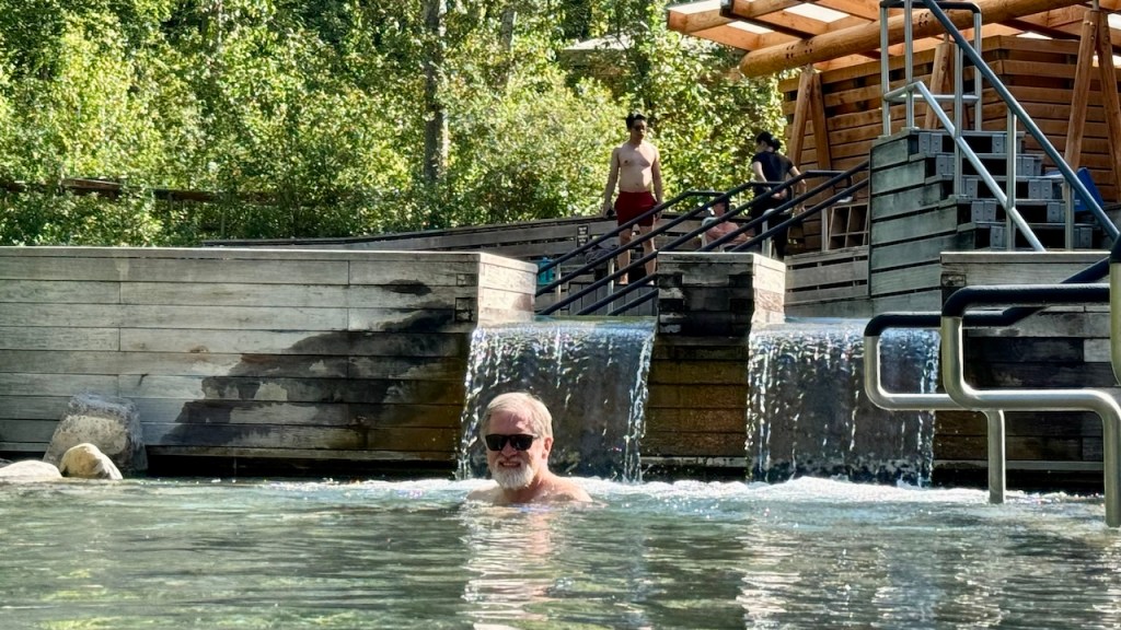
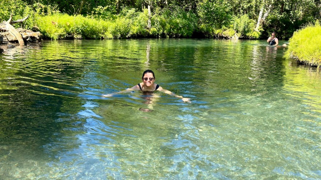
Today was a driving day as we wanted to get closer to Whitehorse, in the Yukon Territory. However, just 25 minutes from our camp was the Liard River Hot Springs. This is a provincial park that has beautiful hot springs. It cost CA$5 each for a day pass. The hot springs are at the end of a ½ mile boardwalk. We arrived around 9 am and there were only a few people there. I have seen pictures where the pools were pack, so we felt lucky to be there so early.
Liard Hot Springs
Liard Hot Springs
Liard Hot Springs
Liard Hot Springs
We spent about 1-1/2 hours in the hot spring and then walked back to the van. The water was a perfect temperature and it felt good to soak in the water.
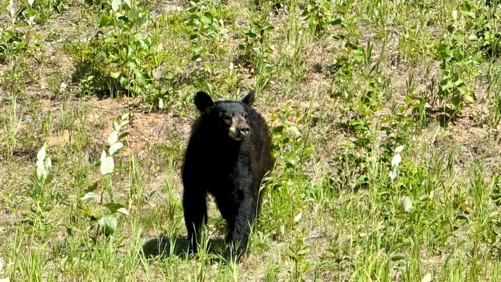
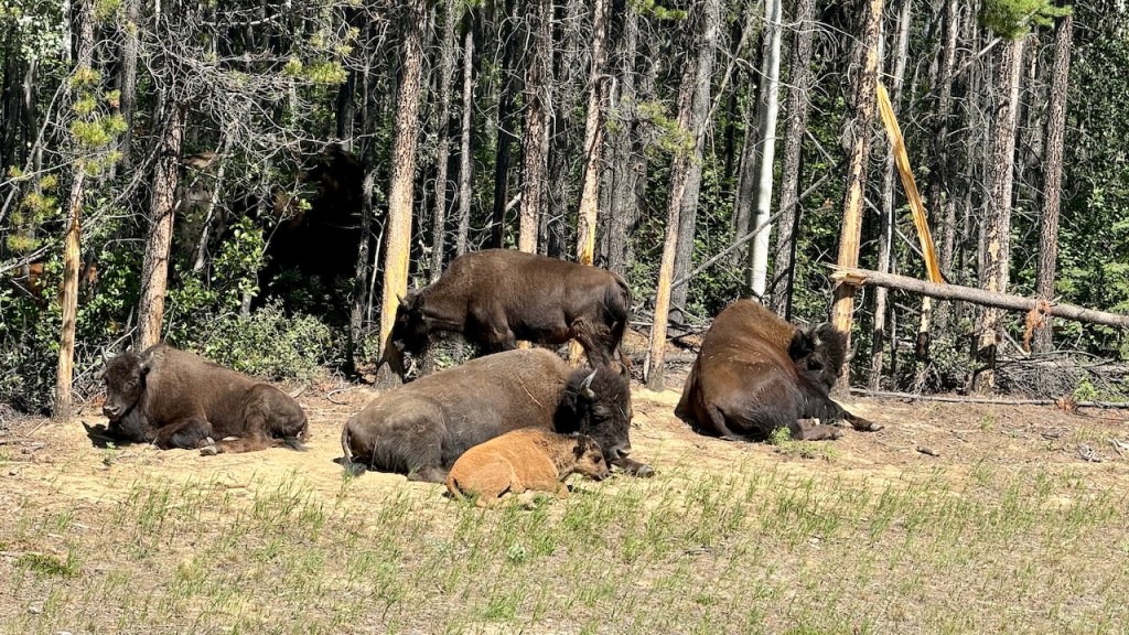
The rest of the day we drive northwest on the Alaskan Highway. Today was also a wildlife day as we saw 3 black bears, bison and mosquitoes. We got pictures of the bears and bison, but not the mosquitoes.
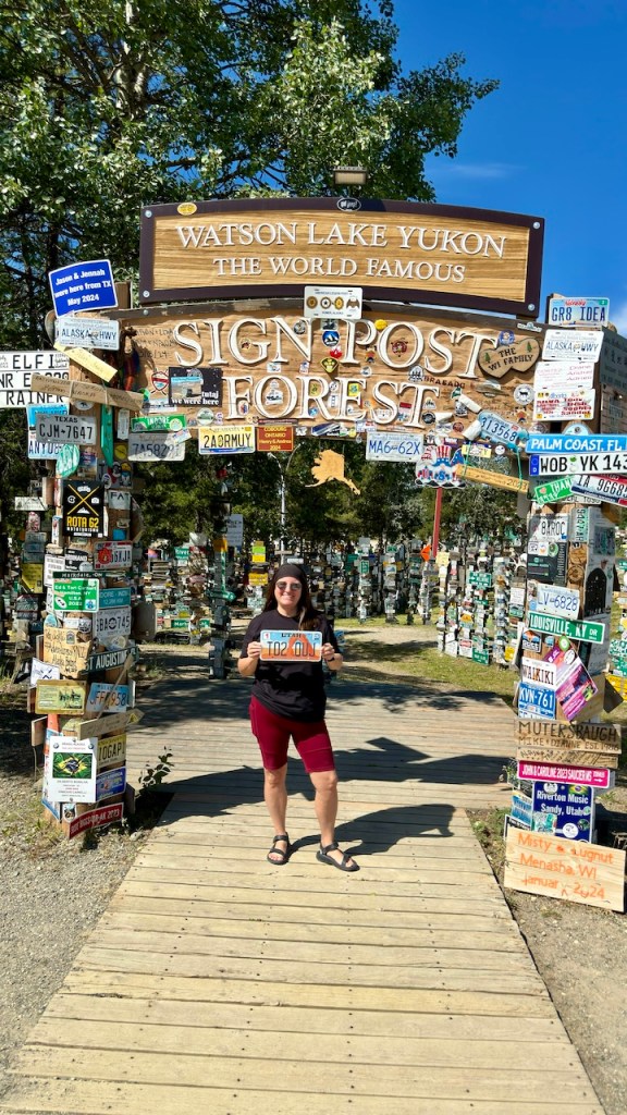
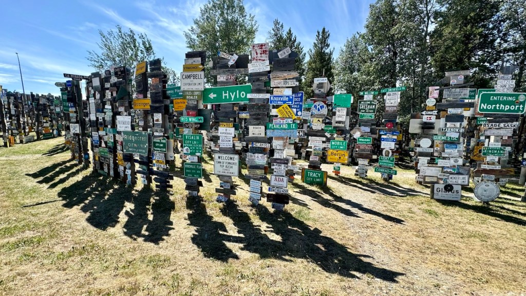
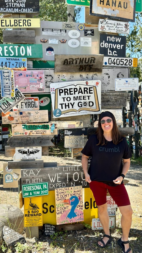
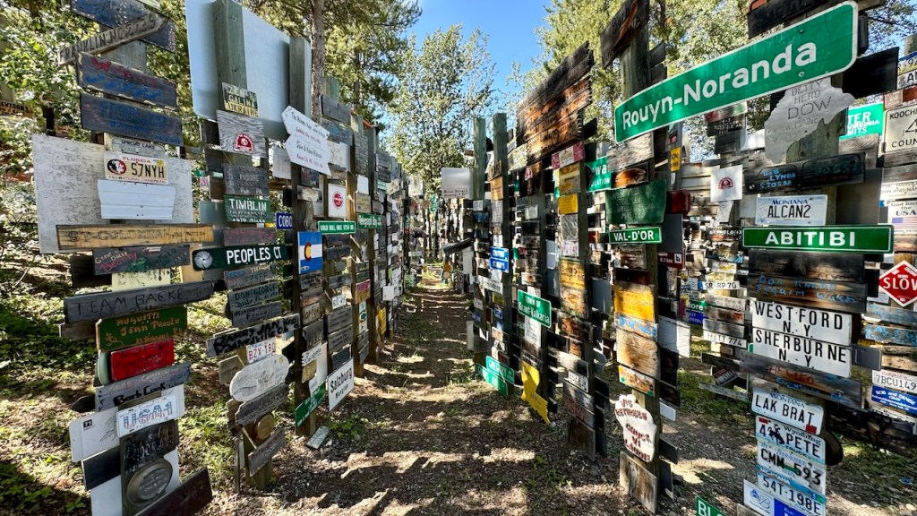
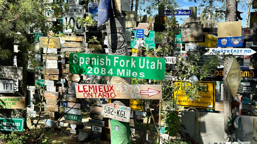
Later in the day we entered the Yukon Territory and stopped in Watson Lake to view the Sign Post Forest. Soldiers based here during World War 2 started putting signs up, point to their hometown. It just grew from there. Today the estimate over 100,000 signs, license plates or other messages are posted here.
Sign Post Forest
Sign Post Forest
Sign Post Forest
Sign Post Forest
Sign Post Forest
Sign Post Forest
We drove another 2-3 hours past Watson Lake, until we found a camping spot in the woods and spent a quiet evening at camp.
We haven’t taken a lot of videos, but here are a few from the trip so far.
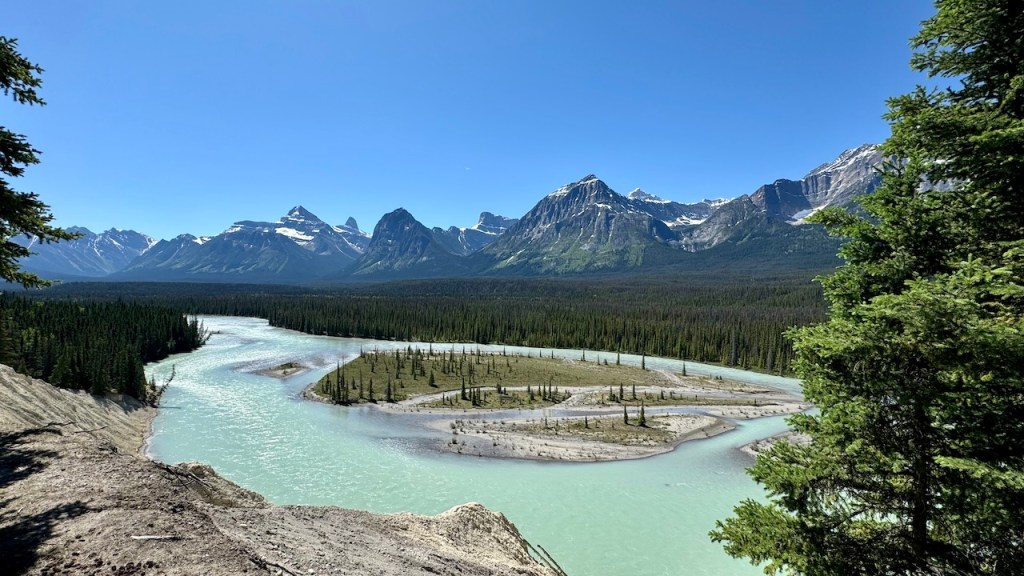
We started the morning driving to the Columbia Icefield Center to use their WIFI and update the blog. After that we continued to drive north towards the city of Jasper. We first stopped at the Sunwapta Falls.
Sunwapta Falls
Sunwapta Falls
Sunwapta Falls
Sunwapta Falls
Sunwapta Falls
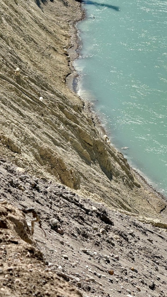
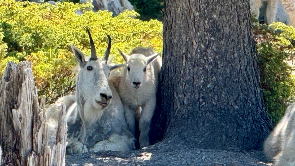
Next we stopped at an area where the mountain goats come down from the cliffs to eat dirt. The dirt gives them the minerals that the need and cannot get on the cliffs. We were surprised how many mountain goats were there.
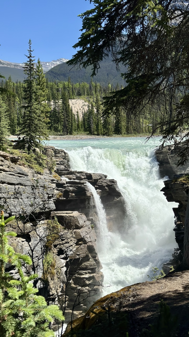
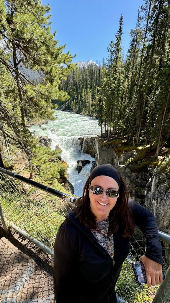
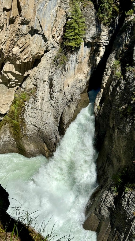
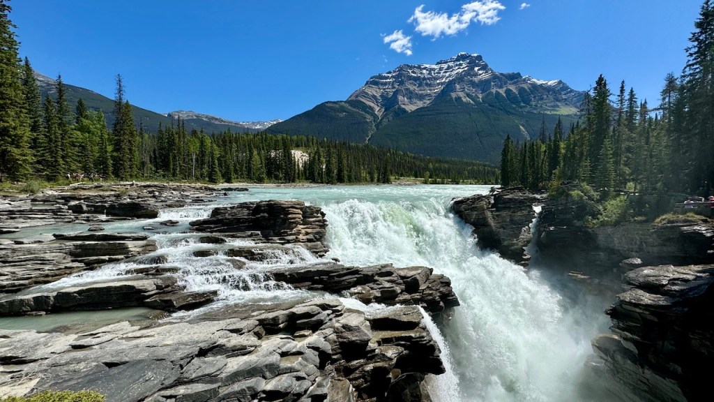
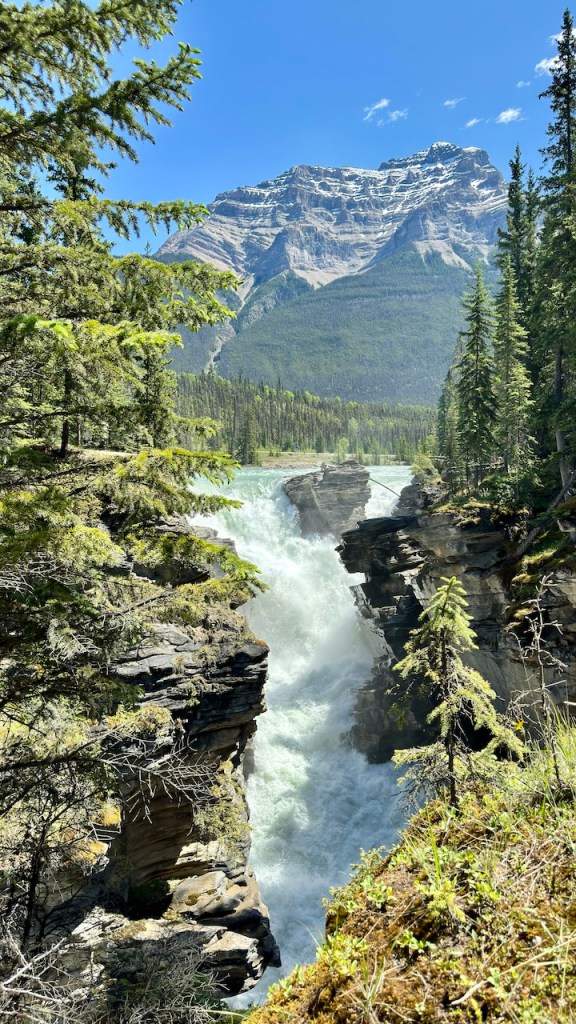
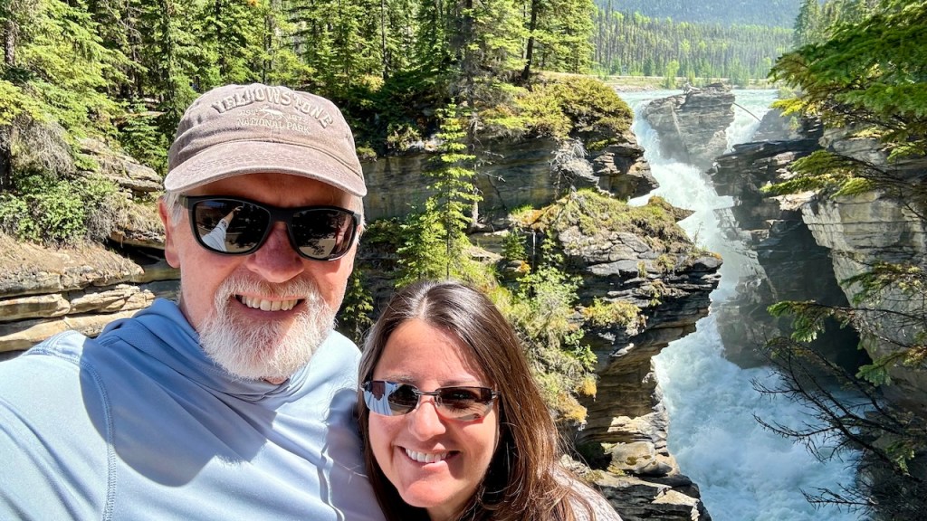
We next drove to Athabasca Falls. This was an amazing water fall that carved a short but steep and narrow canyon. It was amazing to see the entire river passing through a narrow slot.
Athabasca Falls
Athabasca Falls
Athabasca Falls
We arrived in the town of Jasper at 2 pm. Our main priority was to find a laundromat and get our laundry done. It took a few hours to complete our laundry and then we drove to the Whistler Campground where we had reservations for the night. It was a nice evening. Jasper is about 3000 ft lower than where we camped last night, so it was a lot warmer.
The next few days will be a lot of driving. We will be driving from Jasper to Dawson City, Yukon, a distance of 1600 miles.
Today we finally had a day with no rain and sunny blue skies. Eva made French toast for breakfast, and we had an enjoyable morning in the sun.
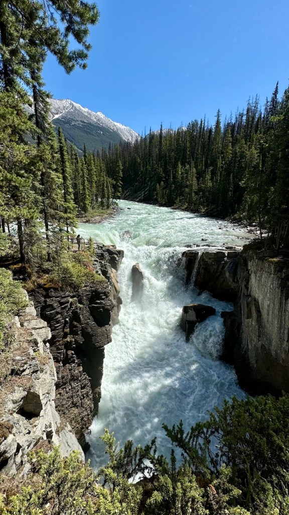
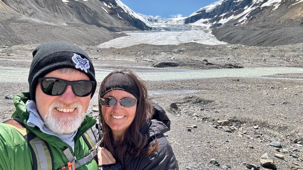
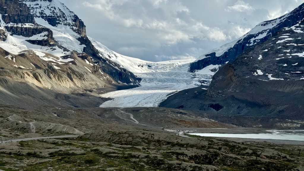
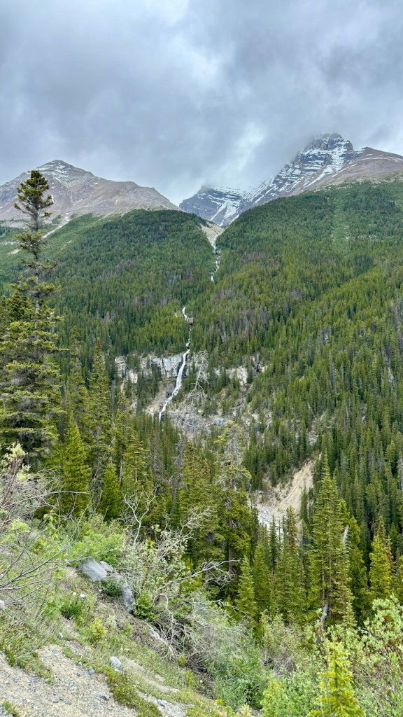
Later we left camp and drove to Tangle Falls and took a few pictures. We then took a short hike to the Toe of the Athabaska Glacier. Well, they didn’t let you get too close to the snow and ice.
View from Campsite
Tangle Falls
Hiking to Athabasca Glacier
Athabasca Glacier
Athabasca Glacier
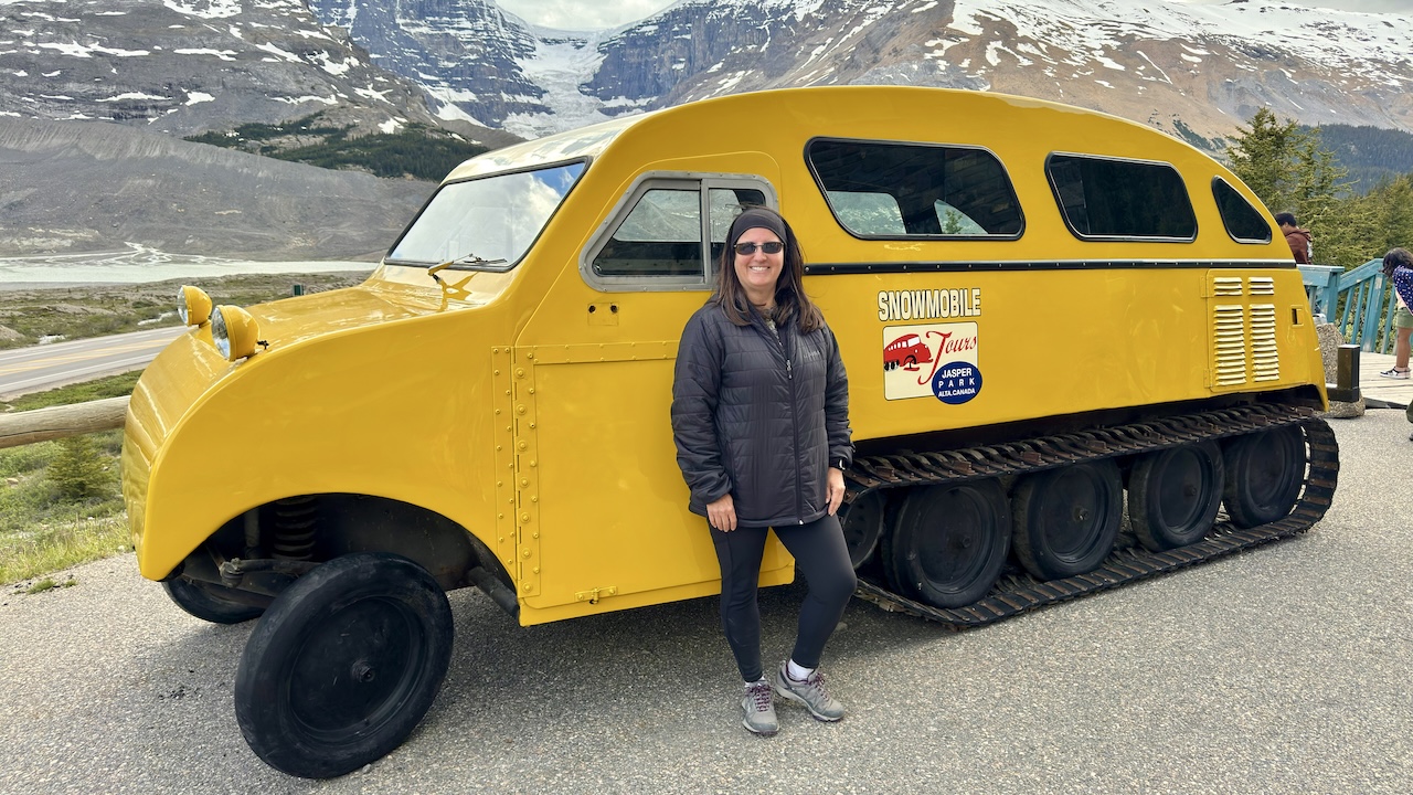
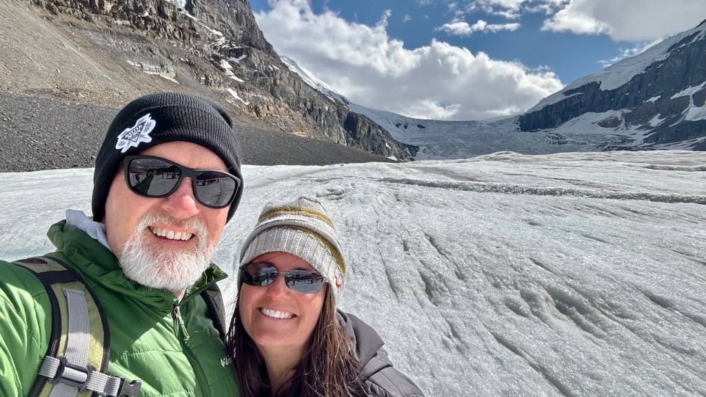
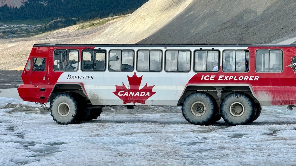
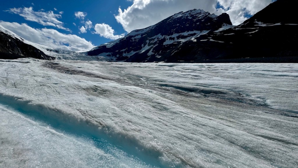
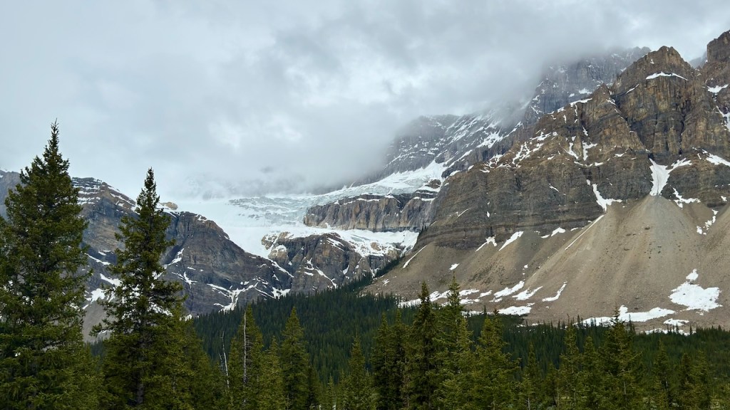
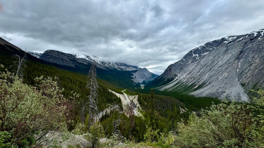
In the afternoon we took a tour that took us onto the Athabasca Glacier that is just below the Columbia Icefield. The Columbia Icefield is the largest icefield outside of the Arctic. The icefield is like a frozen lake on top of the mountains and then there are 6 glaciers that are pushed over the mountains like frozen rivers from the frozen lake. The Athabasca Glacier is the 2nd largest glacier and the easiest to get to.
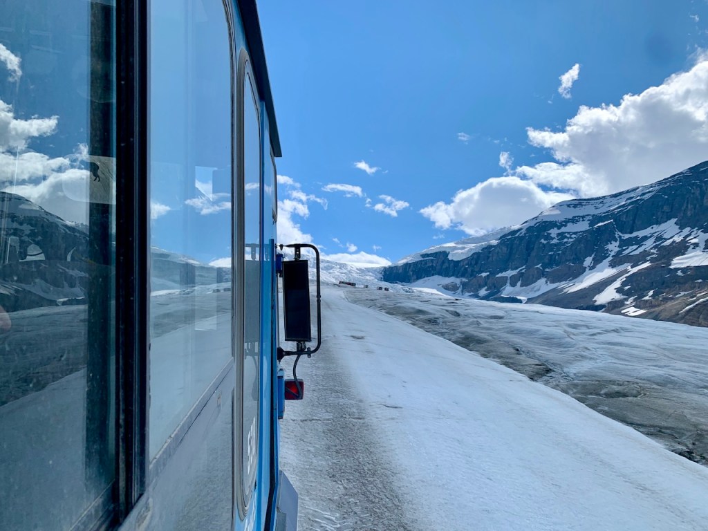
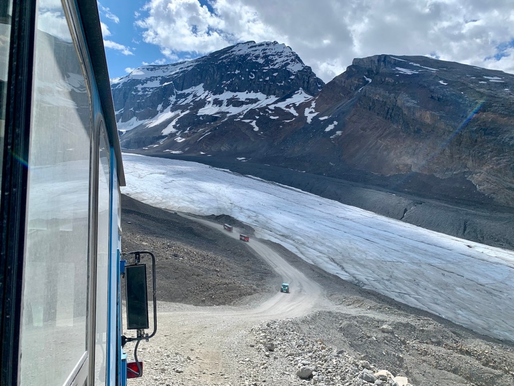
Driving to Athabasca Glacier
Driving to Athabasca Glacier
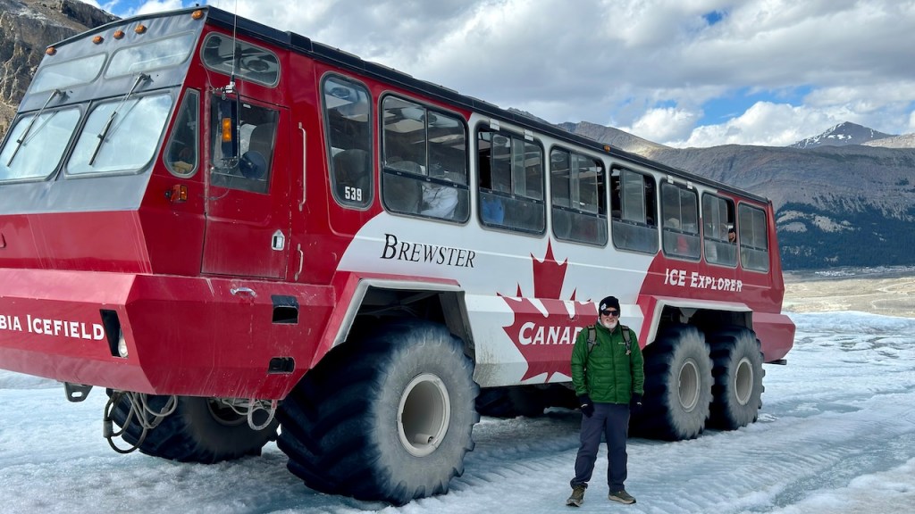
We rode to the middle of the glacier on the large ice explorer buses. These 6-wheel drive buses have huge tires to drive over the rock rubble leading up to the glacier and then float on the snow and ice of the glacier. It was an interesting drive in these huge buses.
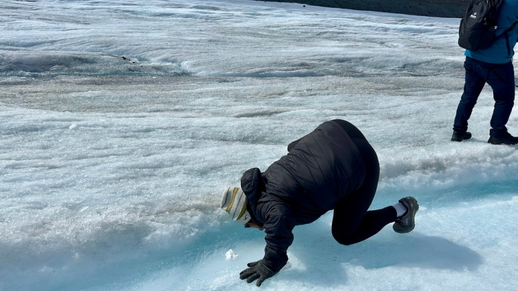
We spend some time on the glacier. We both took a sip of the ice-cold glacier water, straight from the ice.
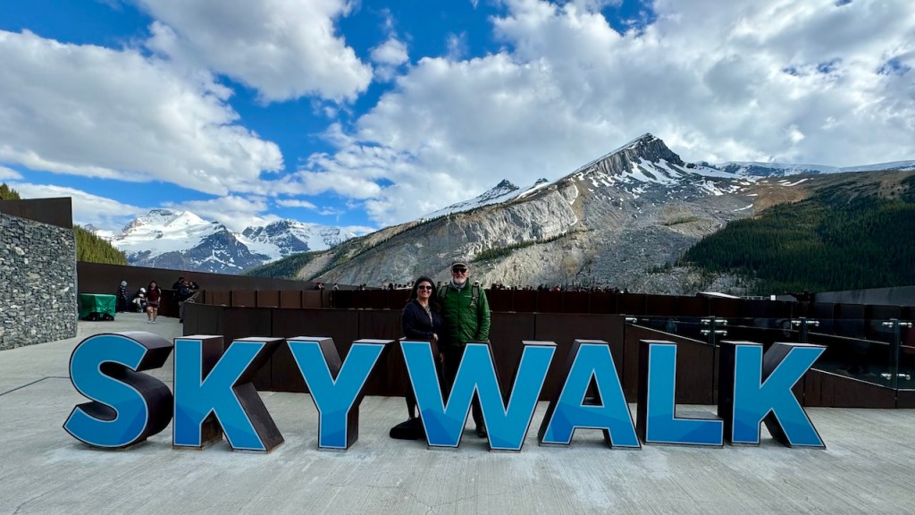
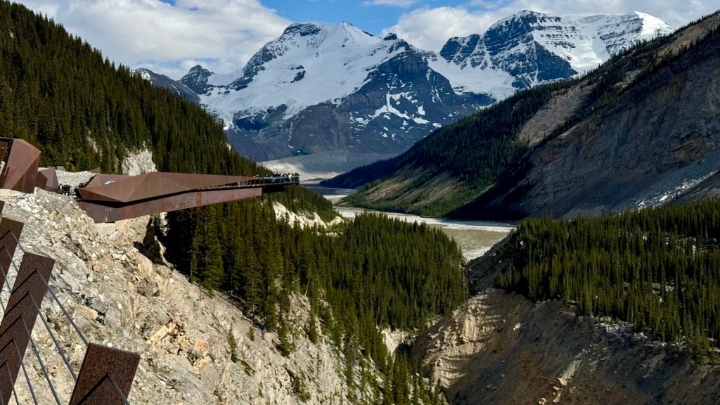
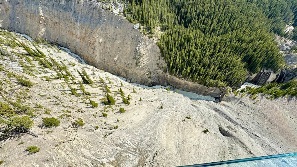
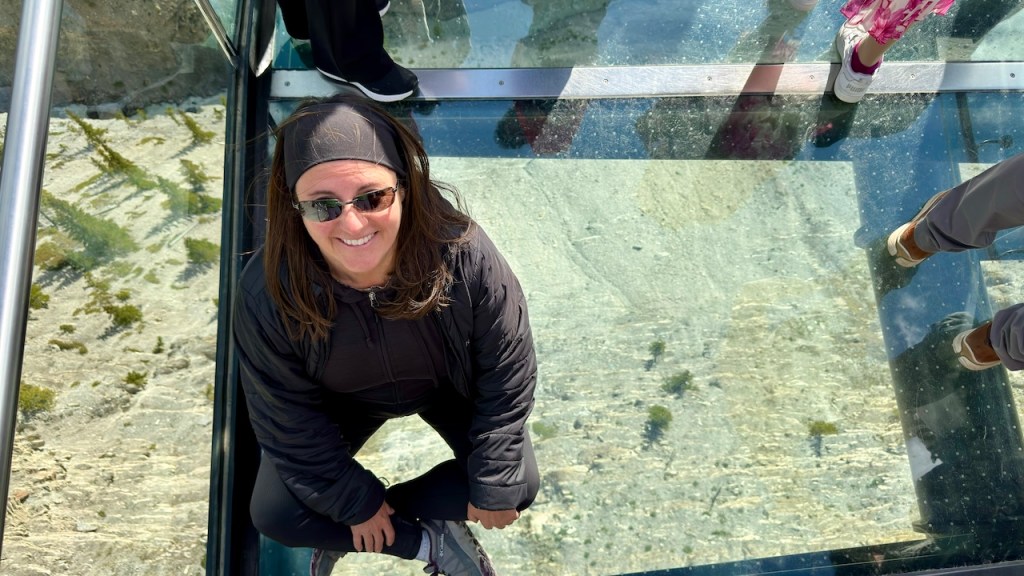
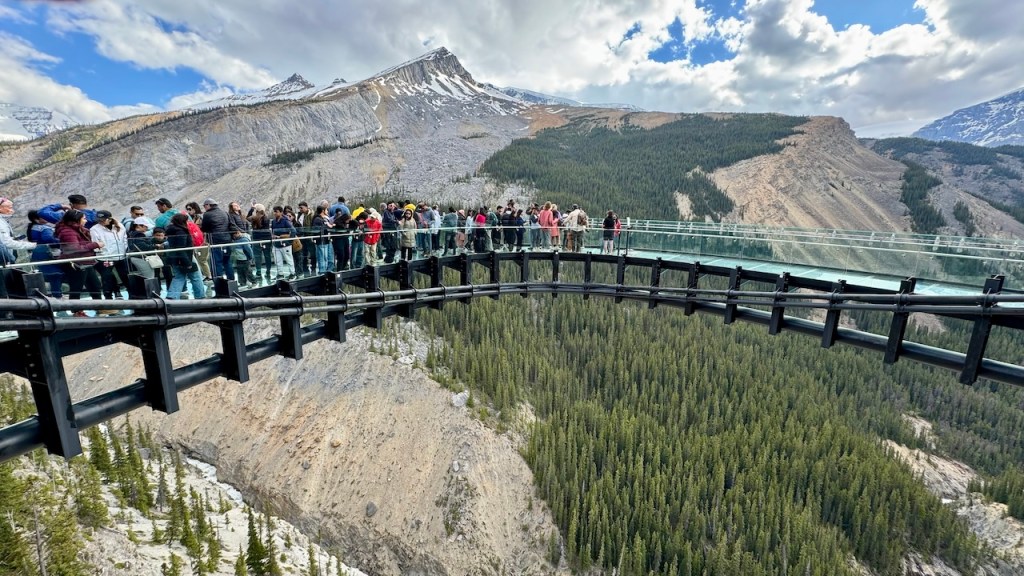
After the glacier we went to the Glacier Skywalk. This is a glass bottom arch that stretches out over a glacier fed river in the bottom of a 1000 ft canyon. It was interesting, but way over-crowded. They had ½ of the arch closed as they had replaced a few sections of glass.
Edge of Columbia Icefield Coming Over Top of Mountains
We made it back to camp in Wilcox campground just before 8 pm and ate leftovers for dinner. It was a long tiring day.
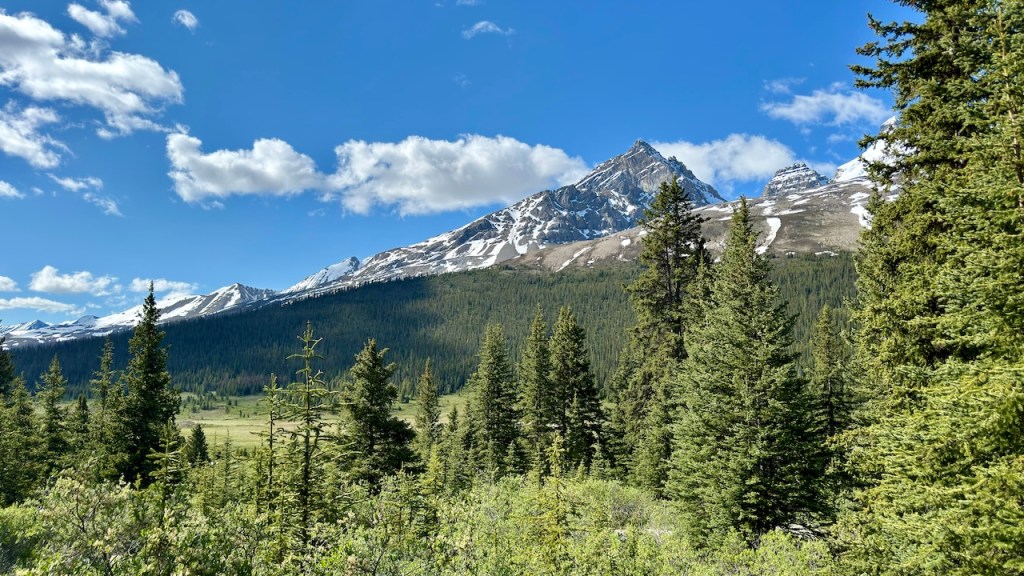
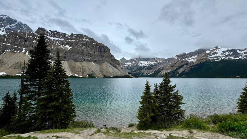
We left Lake Louise at 8:30 am and drove north to Jasper National Park and onto to the Icefield Parkway. They claim this is the prettiest mountain drive in the world. Unfortunately, it started raining not long after we left camp. It was a nice drive, but the tops of the peaks were in the clouds and there was not much sun to brighten the day. We made a few stops at the viewpoints and took a short hike in the rain to Peyto Lake. The shape of this lake looks like the head of a dog.
Crowfoot Glacier
Crowfoot Glacier
Bow Lake
Peyto Lake – Shaped like a dog head
Bridal Veil Falls
Today was a slow day. We had been moving non-stop for 9 days, so we found a campsite at Wilcox Creek campground early and relaxed the rest of the day. It was a little cool outside, so we spent some time in the van, but it was a nice rest.


You must be logged in to post a comment.