March 10, 2024
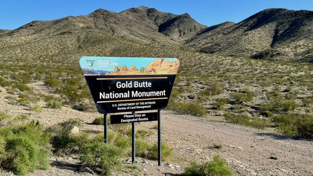
We took a short trip south this week looking for warmer weather and somewhere new to hike. We had never been to Gold Butte National Monument that is just southwest of Mesquite, Nevada. We left home a little after 9:00 am and didn’t stop until we stopped in Cedar City for gas and lunch.
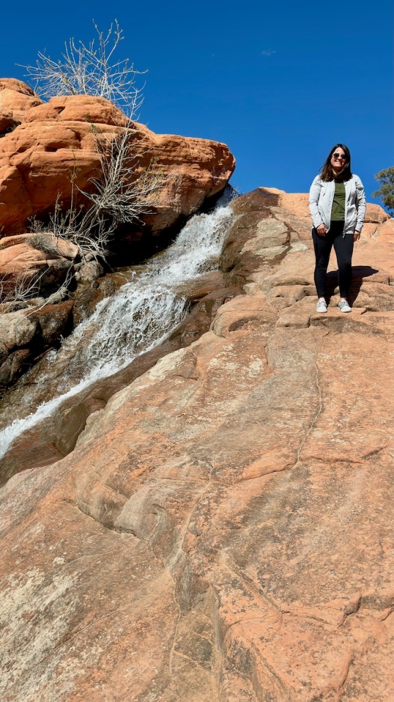
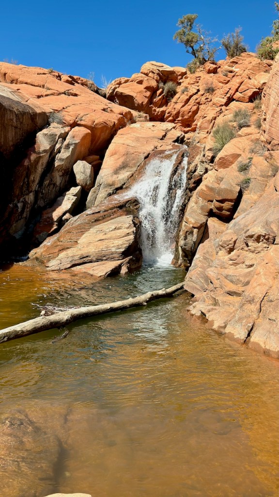
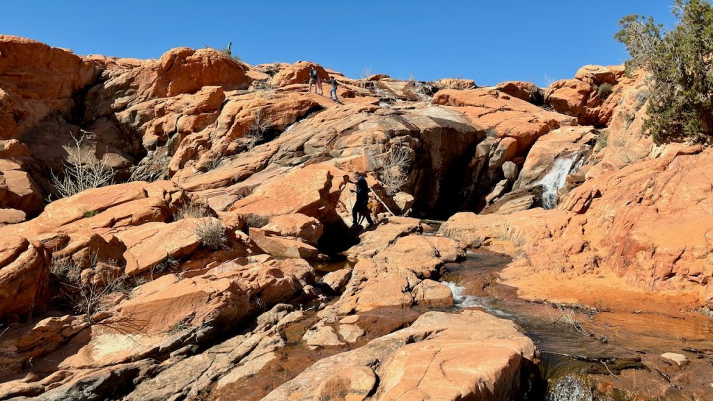
We drove west from Cedar City through the mountains to Gunlock to see the waterfalls at Gunlock Reservoir. These falls only appear when there is enough water to breach the spillway at the south end of the lake. The water runs over and around the red sandstone cliffs and rocks. This only happens when the lake is full, which has been rare during the recent drought in Utah. However, this is the second wet year in a row, so the falls were active this year. Mid-March is early in the year, so the falls were not that great. It will only get better as the water flow from the snowmelt increases. I was here in April of 2019 and the volume of water was much greater. But it was still nice to see and hike around the falls.


After visiting the falls, we continued the backway through the desert and mountains to Mesquite. After filling the gas tank we continued to Bunkerville, which is the start of the road to Gold Butte National Monument.
The road was quite rough and hard to drive. It had been paved and repaired many times and that made the road very rough. We had 22 miles of this type road until we arrived at the monument lands. There was a bit of smooth pavement at the beginning of the monument, but then turned to dirt roads. This was much better than broken pavement just out of Bunkerville
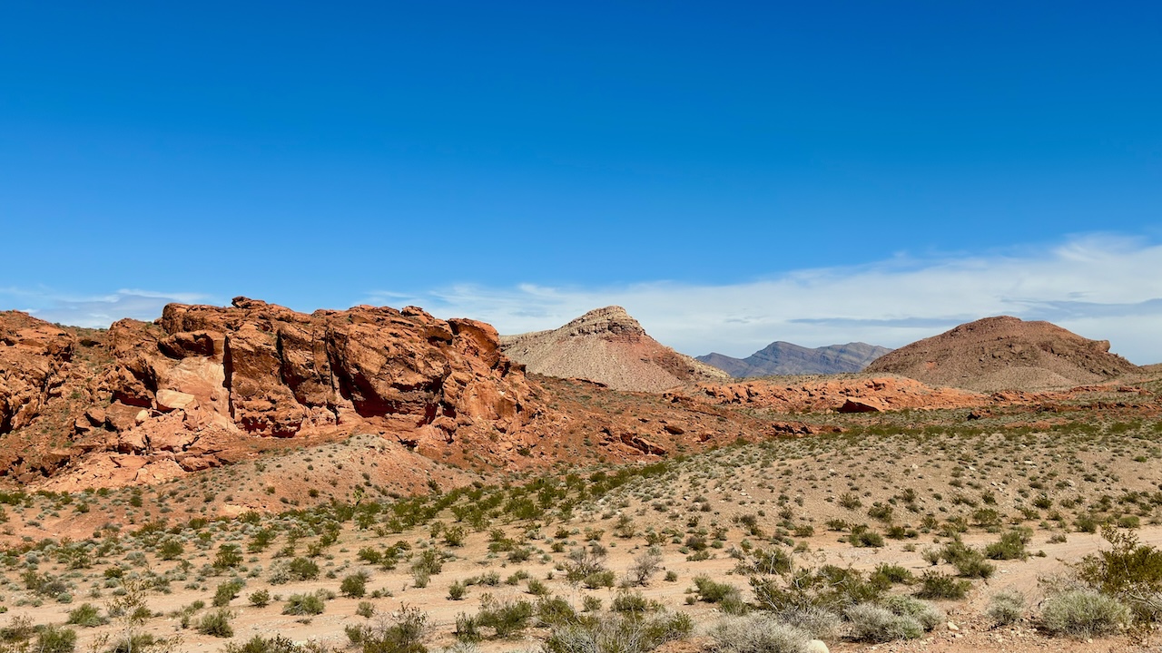
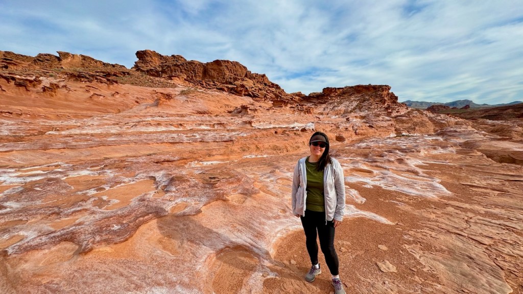
We camped the night at the former CCC camp at Whitney Pockets. We were surrounded by a lot of interesting rock formations. A lot of Gold Butte NM has red rocks similar to the Moab area, but not as concentrated and spread throughout the park.
Just across from our camp was the CCC dam that was built in the 1930s to capture runoff from the rocks and then use the water for cattle. It was a nice calm and warm evening.
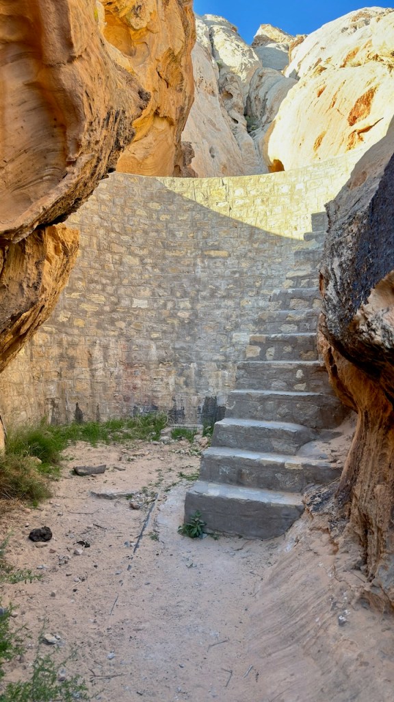
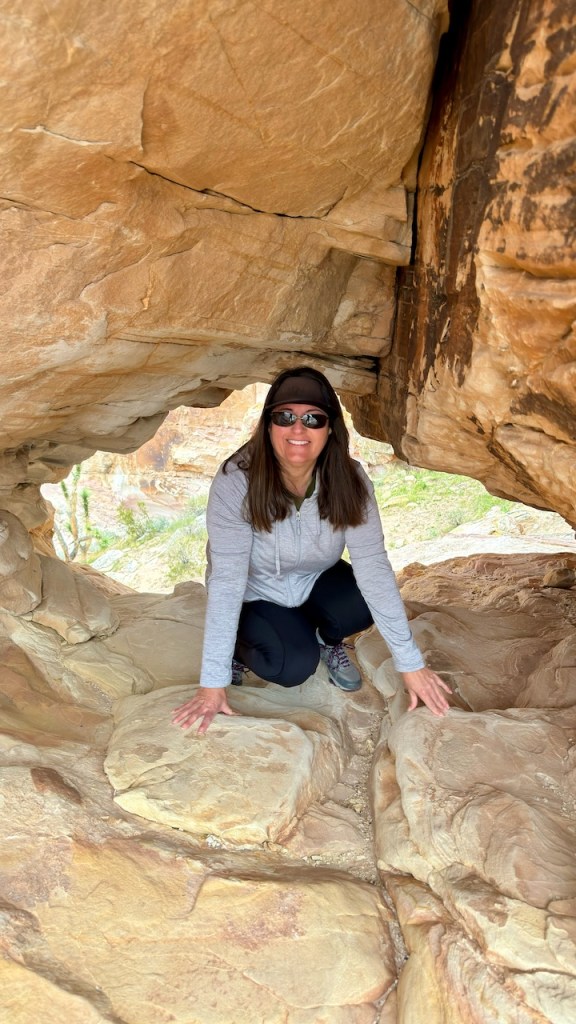
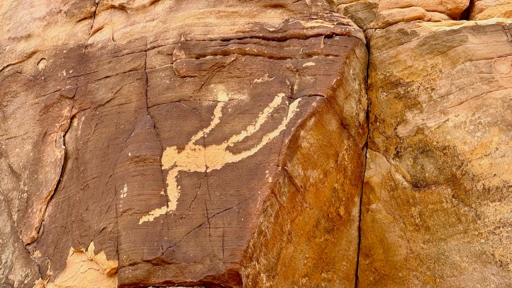
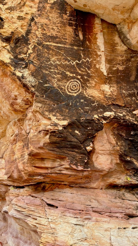
The next day we hiked the Falling Man trail. This is a short trail where you need to crawl through a short tunnel in the rocks to see the petroglyph of the falling man. There are many other petroglyphs in the area around the trail. You have to just climb and wander between the rocks, cliffs and washes to see the rock art. I had the GPS coordinates to many of the petroglyphs and that helped us find them.
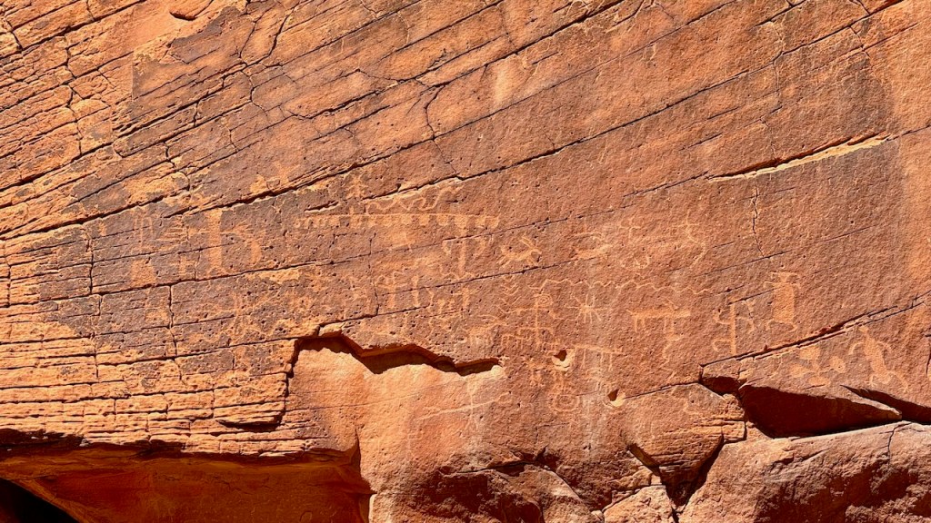
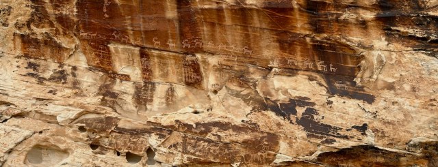
The next trail was to the 21 Goat Panel. This was a short hike through a wash to a large petroglyph panel with many goats chipped into the rocks. We didn’t count them all, but there were more than 21 goats. It was an impressive display of ancient rock art.
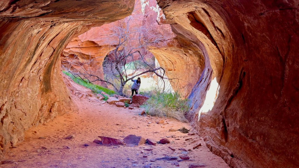
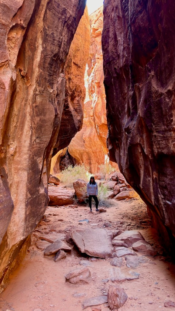
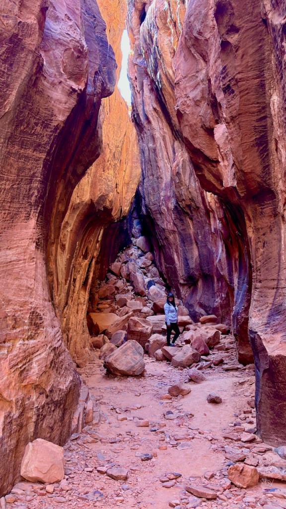
Next we drove 20 miles south, deeper into the park. Our next hike was in 7 Keyhole canyon. This is a slot canyon where you pass through 7 openings that are shaped like upside down keyholes. It was quite beautiful and interesting. There is also more rock art spread through the slot canyon.


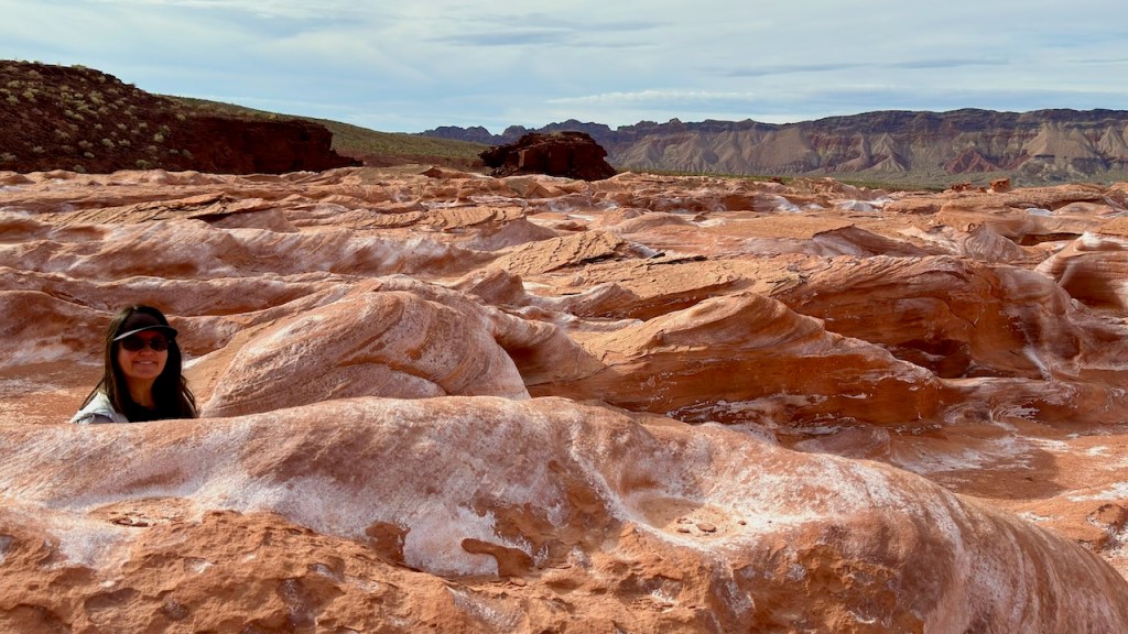
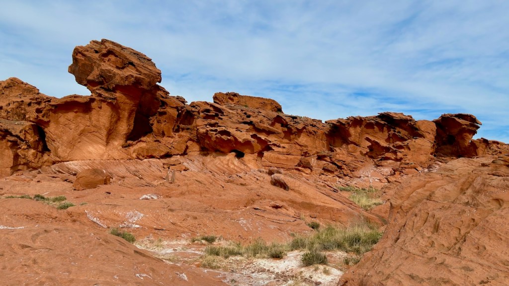
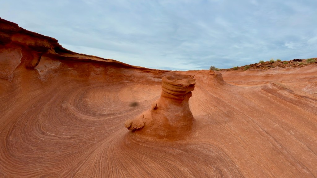
Our final hike for the day was at Little Finland, named for the red sandstone fins that filled the area. It was interesting to wander and hike through the continuous rock formations.
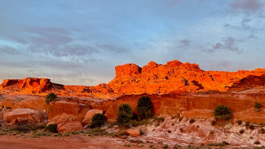
After finishing the hike, it was getting late, so we camped just below the red-rock fins. Later as the sun set, the clouds cleared and the sun really lit up the red cliffs.
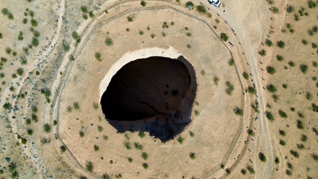
The next morning we drove through the dry washes further south to the Devil’s Throat, a huge sinkhole that appear in the early 1900s. Some cowboys working in the area saw a big cloud of dust appear in the desert and after investigating found the huge sinkhole that had just formed. It is now over 120 feet wide and slowly getting bigger.

This was our last stop before we headed north. The area is quite remote, and we only occasionally saw other people. 80% of the roads were gravel/dirt and not too bad. But 10-20% of what we drove were through the washes and sometimes it was rough. There were a few spots that high clearance was really needed, but we never had to put the van in 4X4.
On this trip I was testing taking videos with the drone. This is a video of the shot that I put into a quick YouTube video.
It took several hours to drive back to Bunkerville. On Monday we had lowered the air on our tires for a smoother ride on the rough roads, so we had lunch and aired up the tires before hitting I-15 and turning north. We wanted one more day in the sun and warmth, so we found a camp in Cedar Pocket, 15 miles south of St. George. The next morning we continued north on I-15 to our home. It was a fun trip to a new place for us.
